|
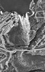
A rare opportunity to examine a natural phenomena the class of SE6023 and SE4083-2000
|
 |
|
|
A rare opportunity to examine a natural phenomena the class of SE6023 and SE4083-2000
|
|
 |
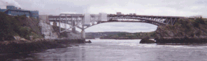
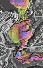
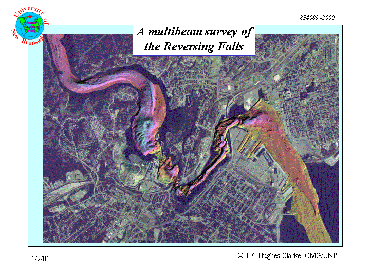
Whilst the CHS survey launch Plover was in transit through the Reversing
Falls in April and May 2000, the opportunity was taken to conduct a multibeam
survey of the submerged topography.
When this data were combined with a prior survey of the gorge above the falls (conducted by Mike Collins and Carmen Reid of the CHS in 1996 whilst waiting for the tide) and a survey of the harbour (by Daryl Beaver and Carmen Reid in April 2000), it represents the first comprehensive view of the complex bedrock and coarse sediment morphology that underlies one of the natural wonders of the world. The CSL Plover is equipped with a Simrad EM3000S multibeam sonar integrated with an Applanix POS/MV 320. The data were processed using the OMG/UNB SwathEd software. |
 |