 |
SE4083 - Hydrographic Field Operations 1999 the class of SE4083-1999
|
|
|
SE4083 - Hydrographic Field Operations 1999 the class of SE4083-1999
|
A hydrographic survey was executed in May 1999 as part of SE4083 - Hydrographic Field Operations. SE4083 is a 4th year undergraduate course offered within the Dept. of Geodesy and Geomatics Engineering at UNB as part of the specialisation in Ocean Mapping. The aim of the course is to expose the students to the practical issues involved in the planning, execution and processing involved in a coastal marine survey.
The area chosen for the 1999 course was the St. Croix Estuary,
which extends from St. Stephen to St Andrews, New Brunswick, where the
estuary merges with Passamaquoddy Bay.
 |
 |
 |
The field program was done in partnership with the Hydrographic
Cooperative (HyCoop) program of the U.S. Naval Oceanographic Office. The
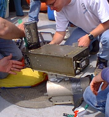
HyCoop program provided a RESON Seabat 9001 multibeam sonar together with
peripheral hardware (TSS-335B, and gyro-compass). By working with the HyCoop
personnel we were able to gain access y working with the HyCoop
personnel we were able to gain access both to their advanced hardware and
the practical experience of their staff. This proved to be particularily
valuable for our students.
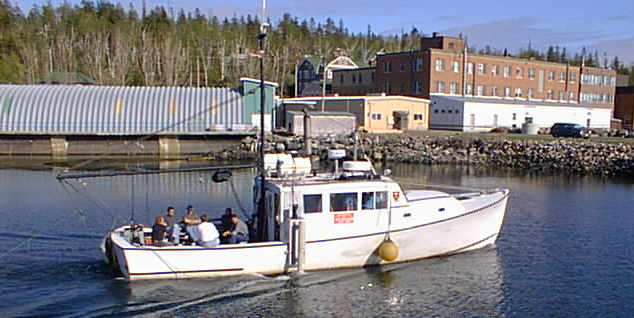
| The main survey platform is the RV Mary-O, a 41ft coastal research and teaching platform, owned and operated by UNBSJ. The vessel has a dedicated 110V generator with an uninterruptable power supply. It can comfortably take 4 personnel inside during survey operations. For teaching purposes, up to 10 can be accomodated internally. The Mary-O is based at Deer Island, New Brunswick and is available year-round for undergraduate and graduate research and training. | 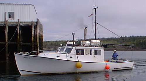 |
 |
On the starboard side of the Mary-O a custom swinging mount has been
built (to a RESON design) which is capable of deploying a variety of sonar
instrumentation at a depth of ~1m. The mount has been successfully used
at speeds up to ~ 8 knots, although 5-6 knots is a typical operational
speed.
All survey operations were conducted from the St.Andrews Biological Station dock in Brandy Cove. |
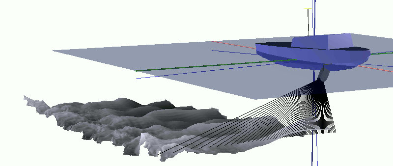 |
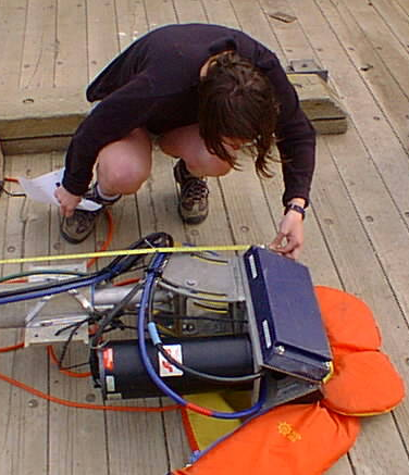
For the first two weeks of operation, a RESON Seabat 9001 sonar was installed. For the deep water operational area, it was mounted symetrically to provide coverage for a +/- 45 degree sector. The 9001 uses amplitude detection only for all 60 beams . Each beam is 1.5 by 15 degrees. The ping rate depends on the operator range setting, and for the water depths encountered was always at least 10Hz. |  |
 |
For the intertidal operations, the 2x WD coverage would have been prohibitively expensive in ship time (requiring line spacings of a few metres. Therefore, the sonar head was mounted to mimic one half of a RESON Seabat 9002 configuration, in which each head is tilted 30 degrees. In this case we now had only 15 degree coverage to port, but 75 degree coverage to starboard. This provided a more than twice as wide swath. However, because the sonar only performs amplitude detection, the quality of the bathymetry at low grazing angles was notably degraded. |
| The RESON Seabat 9001 was integrated with a TSS-335B motion sensor and a gyro compass provided by HyCoop. UNB provided the Ashtech Z12 DGPS receivers. Line running was performed using HyPack and data collection used the RESON 6042 V.5 software. All post processing was done using the OMG/UNB SwathEd software. | 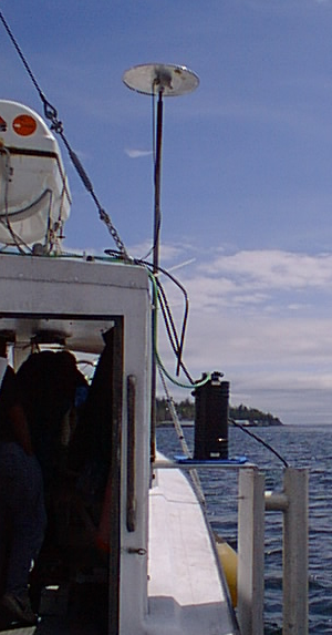 |
 |
For the last week of the survey, a Submetrix 2000 was kindly loaned by Submetrix U.K. Is was being used as a demonstration for the USGS and a U.S. NRL lab. The students had the opportunity to install, align and operate this system although no significant processing of the data was done for time reasons. |
| Horizontal and Vertical control was established from New Brunswick and Canadian Hydrographic Service monumentation | 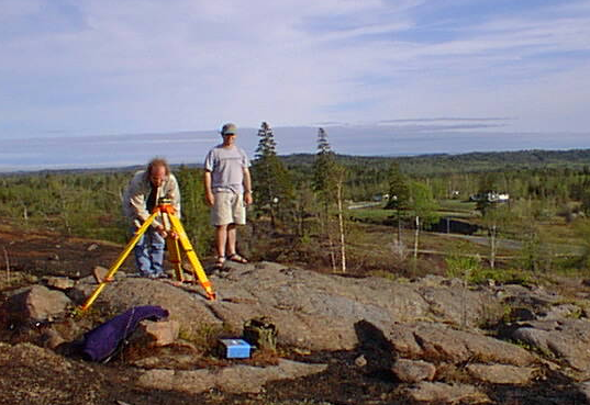 |
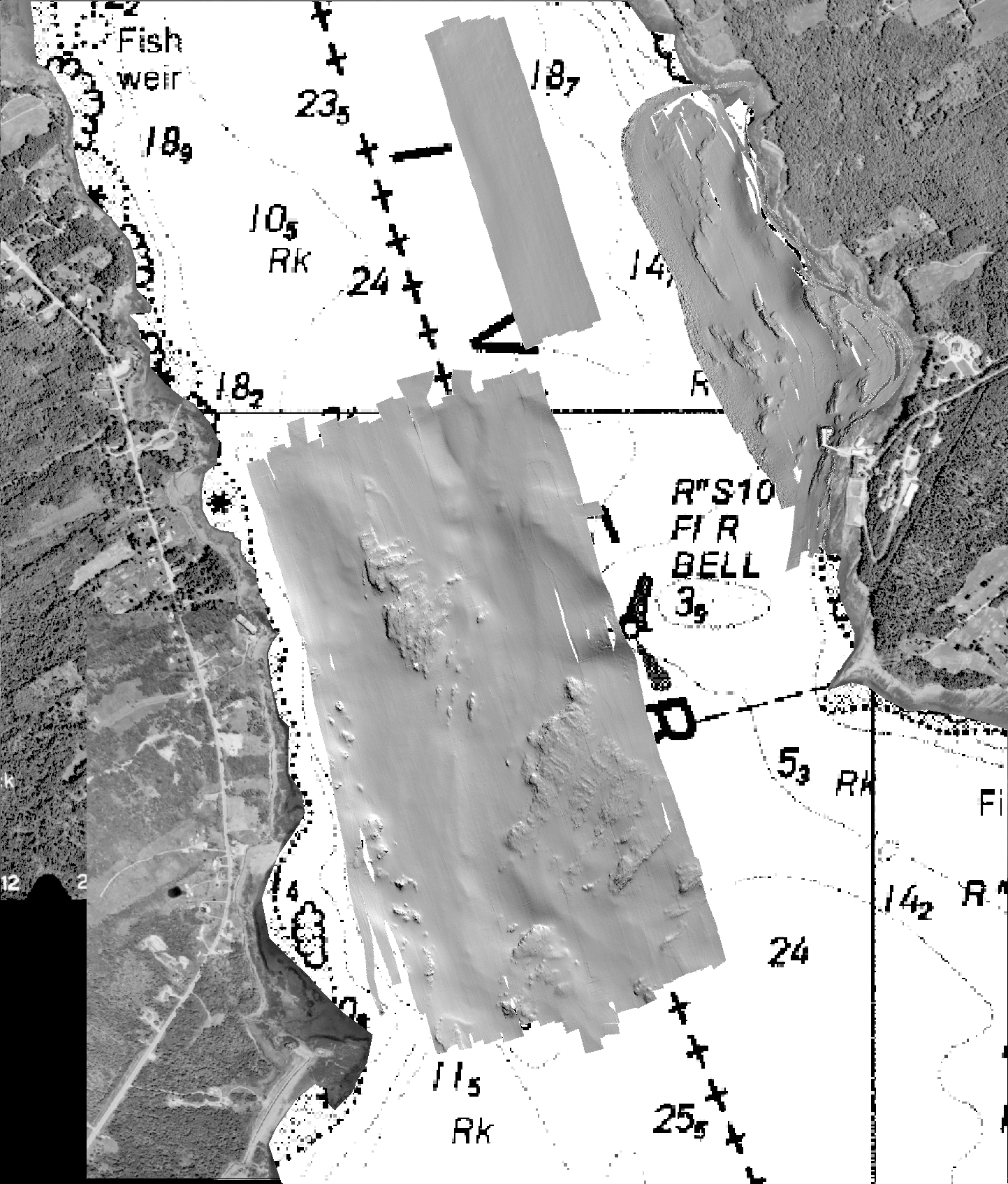 |
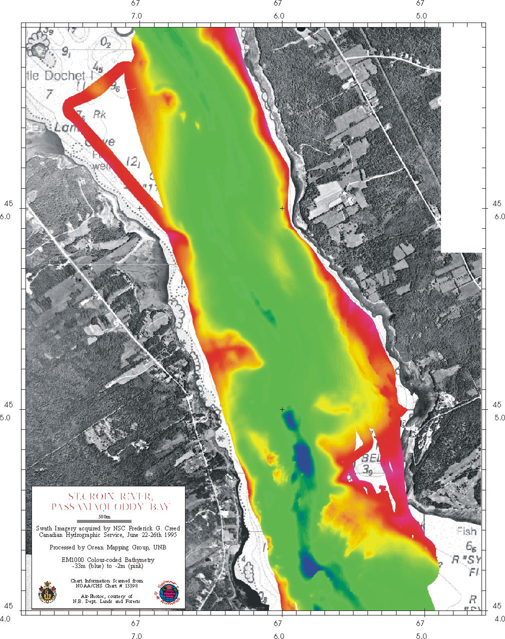
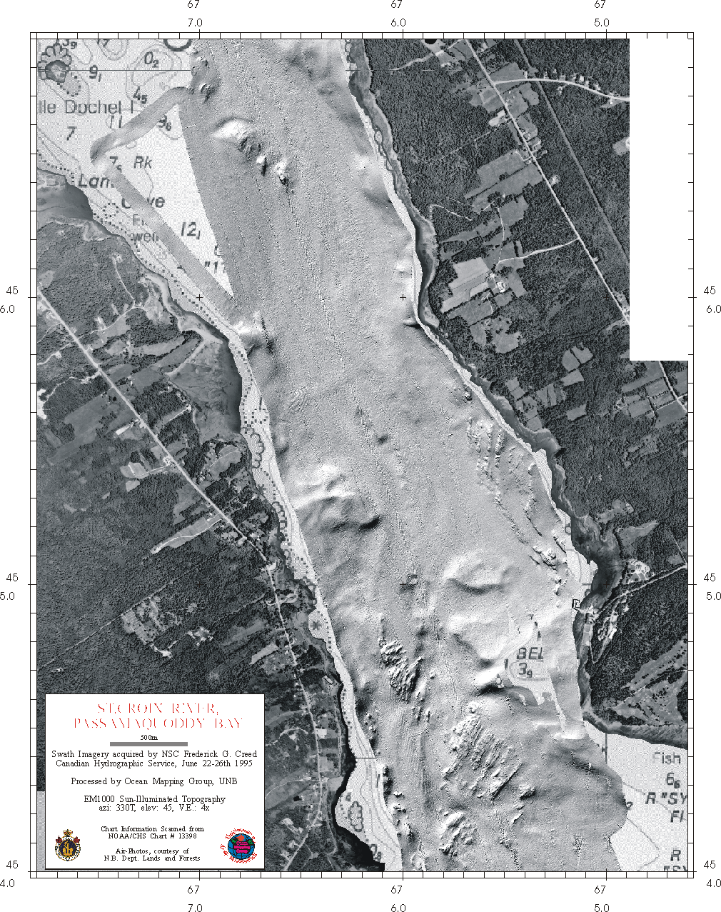
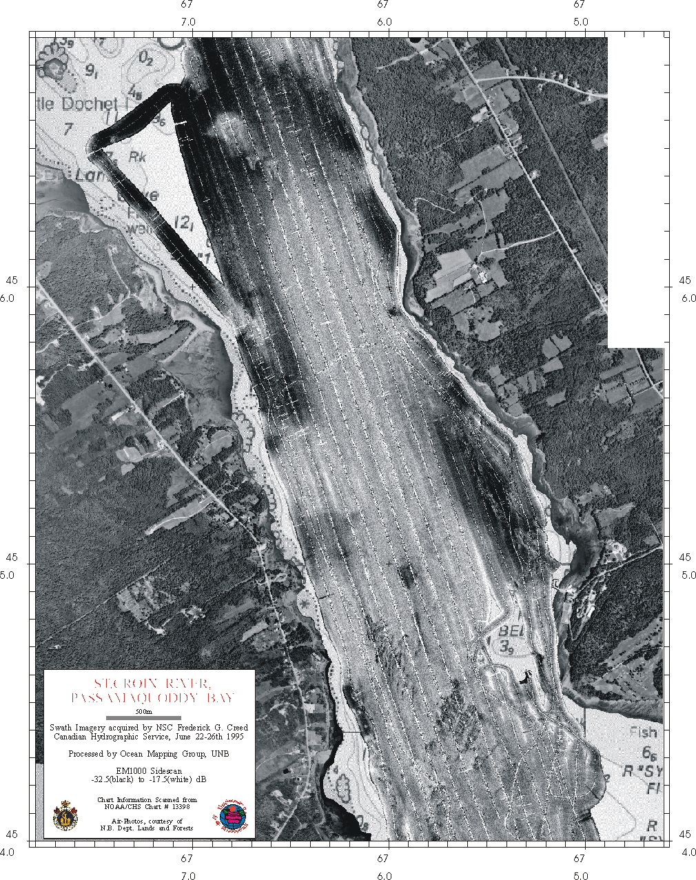
Area of Interest
The area of interest was the seabed in the vicof interest was the seabed in the vicinity of the St. Andrews
Biological Station dock. The area was chosen based on practical considerations
such as:
|
Oceanographic Framework of the St. Croix Estuary
The St. Croix Estuary extends from the Hydroelectric dam just
upstream of St. Stephen, 15 miles south to St. Andrews where it flowiles south to St. Andrews where it flows into
Western Bay and Passamquoddy Bay. The region is one of high (6-8m) tides.
The St. Croix River drains southern Maine. Whilst it does input fresh water,
no noticeable stratification was observed from any of the TS profiling
performed as part of this operation.
For almost all profiles collected in May 1999, the sound speed varied less than 1m/s from top to bottom. Inital profiles were made using the UNBSJ manual sensor. Later measurements were made using the CHS AML SVP-16.
Prior Surveys
1992 HYGRO 92 Creed EM1000 transits
1995 Creed EM1000 Dochet to St. Andrews and Western Bay
1996 EM3000 St. Andrews Harbour
1997 EM3000 Huntsman foreshore
1996 and 1997 USCHC comparison systems
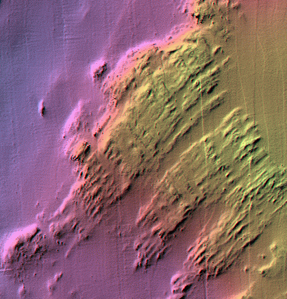
Deep Water Survey Area
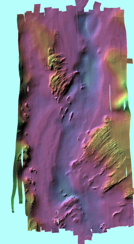 |
The main survey area chosen was that covered as part of the USCHC multibeam
sonar comparisons. These experiments were performed in 1995/6/7 using various
survey platforms and swath sonars provided by the manufacturers for demonstration
purposes. Although a RESON 9001 had been used in 1994 and 1995, no useful
data had been collected in the area of inter-comparisons.
The data were reduced using the tide gauge mounted on the SABS dock.
|
 |
Intertidal Survey Area
| A survey was conducted ranging from 15 depth below chart datum to ~5m elevation above chart datum. The survey demonstrated the complications of trying to maintain 100% coverage in variable and declining water depths. The area coveraged included the shallow subtidal area investigated in 1997. | 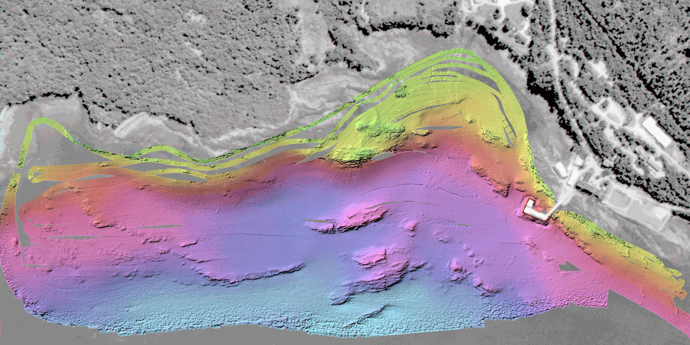 |
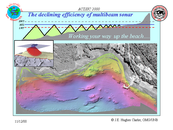 |
In order to demonstrate the declining efficiency of multibeam sonar in shallow water, an attempt was made to utilise the RESON multibeam in two differing mount configurations in the intertidal zone. By using the tides, one could operate the system with 6-7m of water over chart datum. | 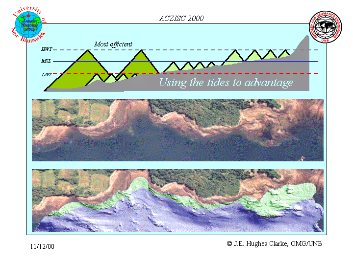 |
 |
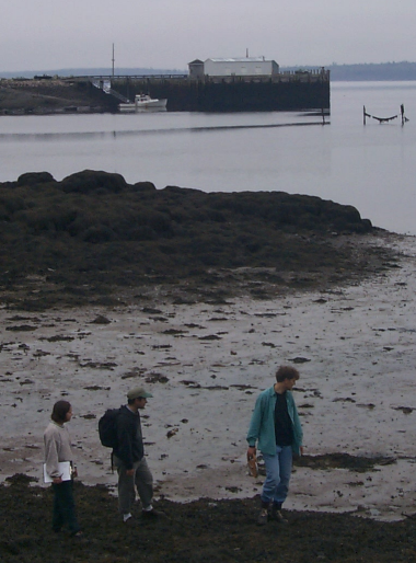
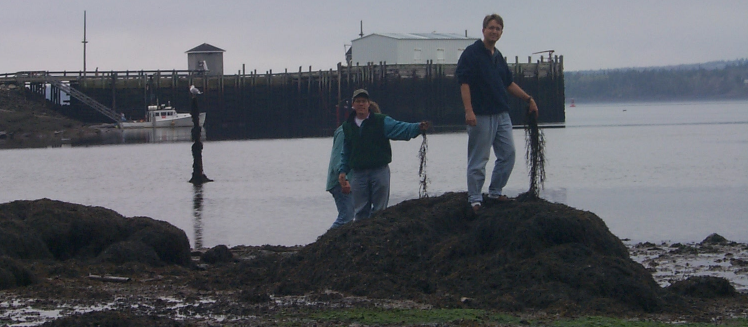
In this manner, swath data could be collected in areas where the students could subsequently walk and exami could subsequently walk and examine and compare the visible seabed features with the representation obtained by multibeam sonar. The elevation of floating algae and the height of proud features were surveyed using conventional and RTK GPS methods. | 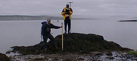 |
SABS aquarium seawater intake pipe (and associated concrete blocks)
A serendipitous find as part of this survey, was the presence of a line
of concrete blocks that hold down the intake pipe, delivering seawter to
the research aquariums at the St. Andrews Biological Station. The target
detection capability of the RESON 9001 is +/-45 degree and -15+75 degree
mode was compared. THe results from the Submetric 2000 were also examined.
Later that year a RESON Seaabt 8101 (loaned courtesy of Fugro Jacques Geosurveys)
was also deployed on those targets.
Personnel
Instructors:
Other Visitors
USGS; Bill Danforth and Tommy O'Brien.
Submetrix: Paul Byham
CHS -Quebec: Andre Godin and Louis Maltais
NRL Arctic Lab:.