 |
|
(click on image to view full resolution) |
 |
|
(click on image to view full resolution) |
John E. Hughes Clarke
Ocean Mapping Group, Dept. Geodesy and Geomatics Engineering
University of New Brunswick, CANADA
506-453-4568 (ph.), 506-453-4943 (fax.), jhc@omg.unb.ca
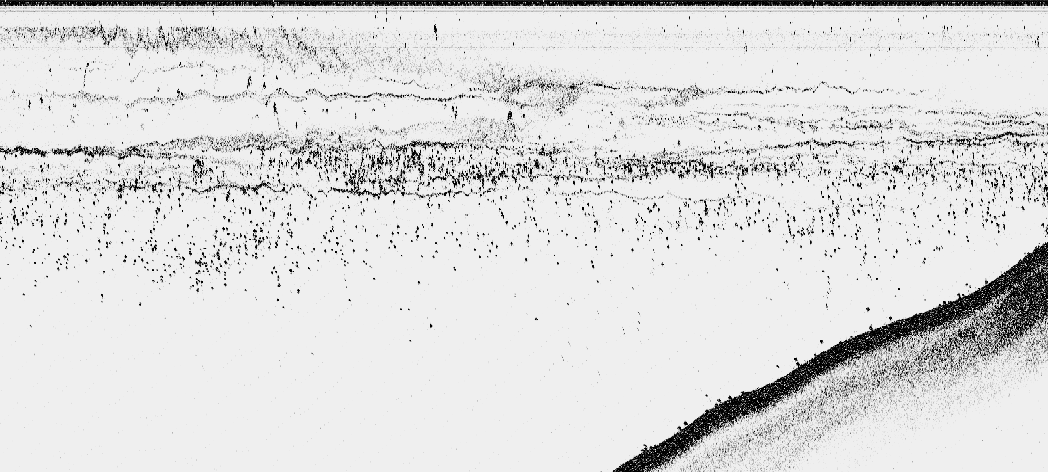
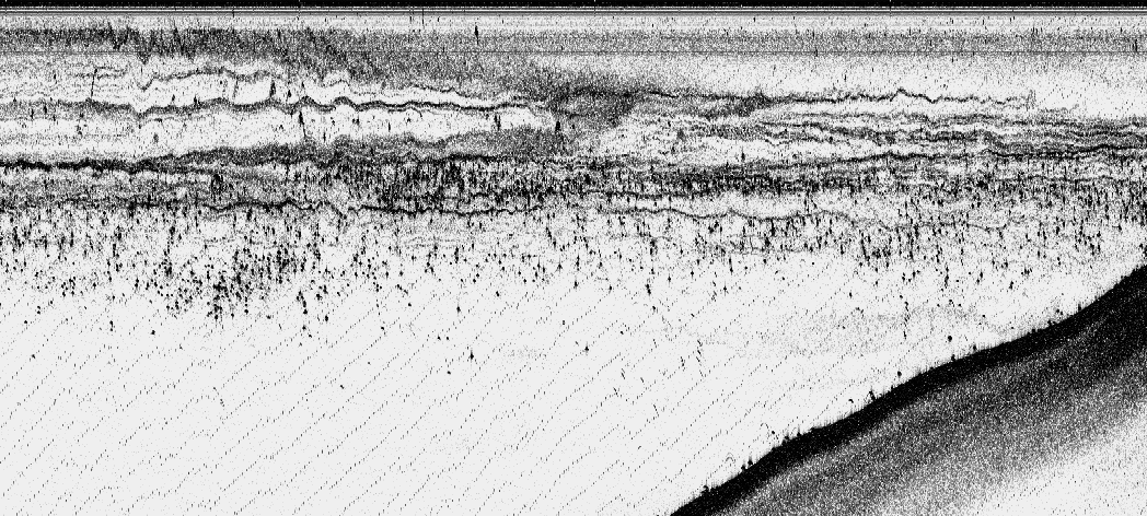
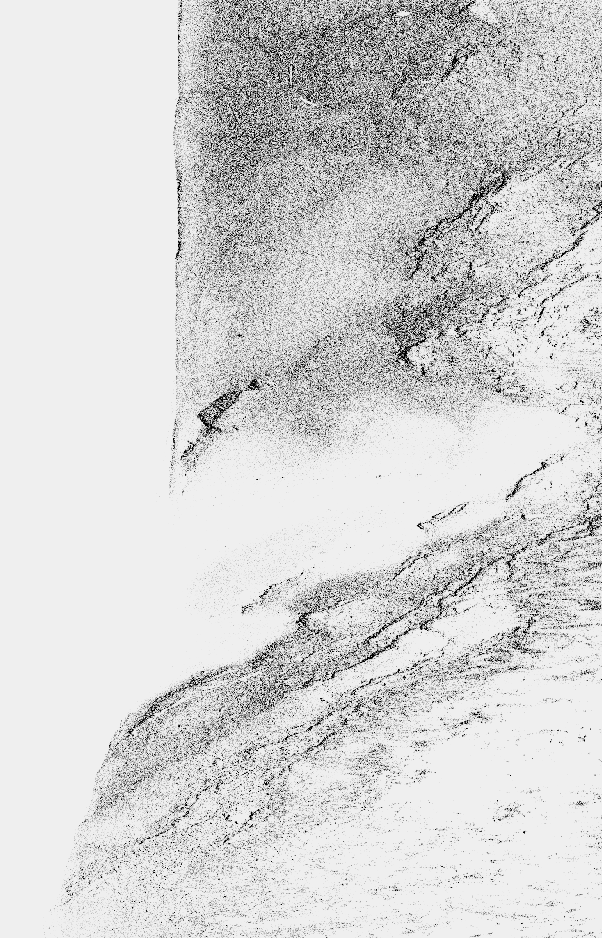
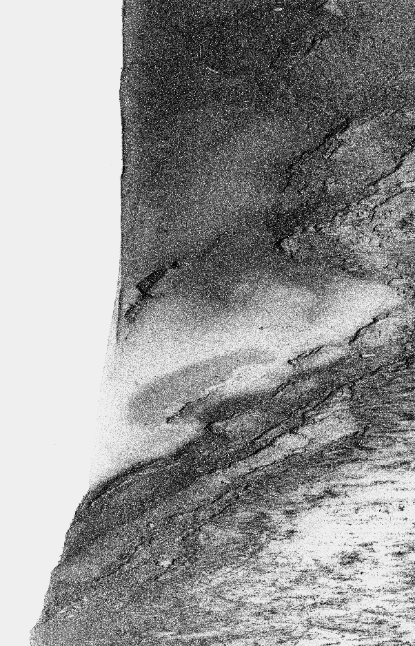
The following three examples show the amount of information that is stored within the 8bit data range preserved. In each case the top image shows a linear representation of that data, whereas the bottom image shows a logarithmic representation of the same data. The linear representation is that which one would view as played to a greyscale recorder, or equivalently viewed through the current Knudsen display software (contrast enhancement is essentially a linear function and does not add to the detail).
Note that, although the data is better viewed in the logarithmic mode, the retained information content is not actually increased (only its visibility). Increasing the information content would only be possible if the original 16? bit data were logarithmically compressed into the 8bit range (or the data retained at the original higher dynamic range).
The example used here shows the abrupt nature and detailed structure
of the halocline developed in Kennebecasis Bay. The upper layer is hot
fresh water from the St. John River. The lower layer is a plug of cold
salt water from the Bay of Fundy, trapped upstream of the Reversing
Falls.
The base of the layer occurs at about 10m depth. The oblique
zigzag
lines seen in the lower image are just interference with another
(unspecified)
source. Both images are derived using a 200kHz source with the
gain/power
level set to total saturation on the seafloor echo.
|
|
|
(click on image to view full resolution) |
|
|
|
(click on image to view full resolution) |
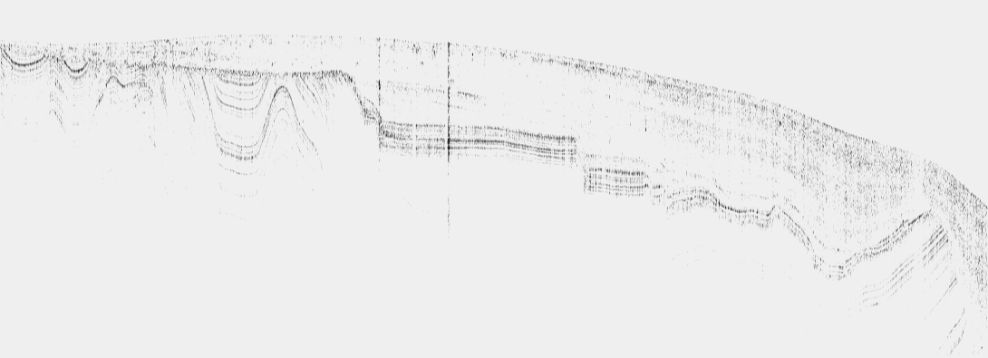
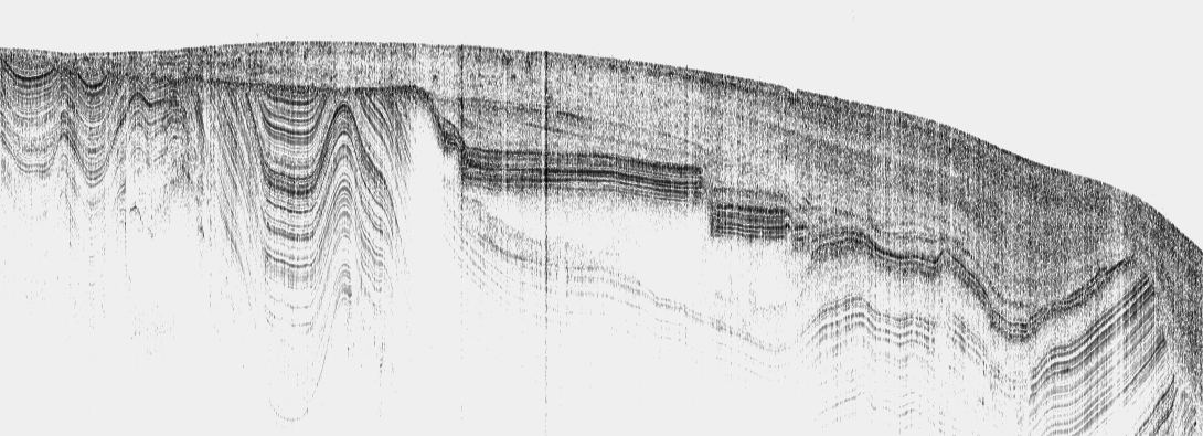
The second example used here shows the subbottom structure developed
in the approaches to the Royal Kennebecasis Yacht Club. Little is
actually known about the details of the subbottom in the area. What one
can see is a partially stratified conformal drape over an abruptly
faulted
and folded layered strata. The contact betwen the two layer is an
erosional
unconformity. We are looking at between 10-15m subbottom
(depending
on the sound speed in the sediment). Both images are derived using a
28kHz
source with normal gain/power level settings (I'd like to tell you what
they were but I currently can't read those fields in the data
telegram!).
 |
|
(click on image to view full resolution) |
 |
|
(click on image to view full resolution) |
For the case of the default prime role of Knudsen echosounders (robust first-arrival bottom detection), there is no need to go to this effort. But because these systems provide a digital file with full sonar parameters retained (hopefully), it represents a powerful scientific tool.
And here is a sample of the 200kHz sidescan data that you provided
showing
the advantage for logarithmic (or other equivalent) packing, in
bringing
out the textural information:
 |
 |
|
of 200 kHz sidescan image (click on image to view full resolution) |
of 200 kHz sidescan image (click on image to view full resolution) |
In this case, first arrival detection (for fish altitude) is of secondary importance. It is the spatial variations in the backscatter strength, after the first arrival which contain the useful information. More particularily, many of the apparent cast shadows in the left image turn out, not to be shadows.