Upper Slope - Seaward of Hudson Strait
John E. Hughes Clarke
Ocean Mapping Group
University of New Brunswick

| MVP-300 Oceanographic Sections Upper Slope - Seaward of Hudson Strait John E. Hughes Clarke Ocean Mapping Group University of New Brunswick |
|
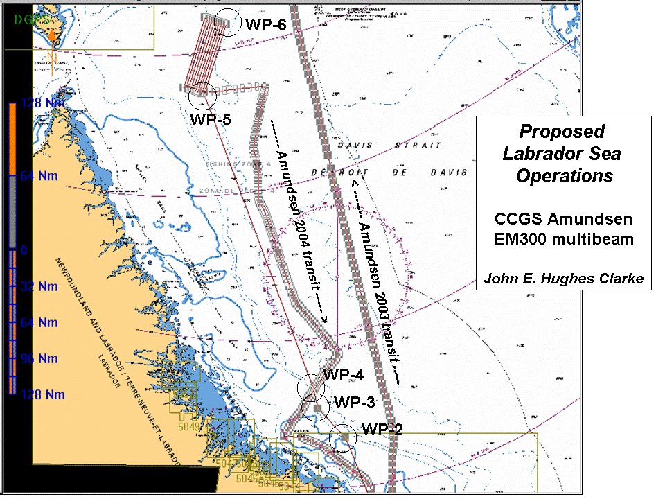 |
Whilst the main aim of the CCGS
Amundsen program in 2005 is ArcticNet science in the high Canadian
Arctic, the vessel has to perform two transits through the Labrador
Sea. As an extension of the transits, a 3 day NSERC-funded mapping
project is being carried out on the upper continental slope off the
mouth of Hudson Strait. As part of that project, there was a requirement for precise sound speed field to support multibeam operations, As a result, ~ 60 MVP casts were performed on August 10th and 11th (JD's 222 and 223). This page presents preliminary oceanographic results from those casts. |
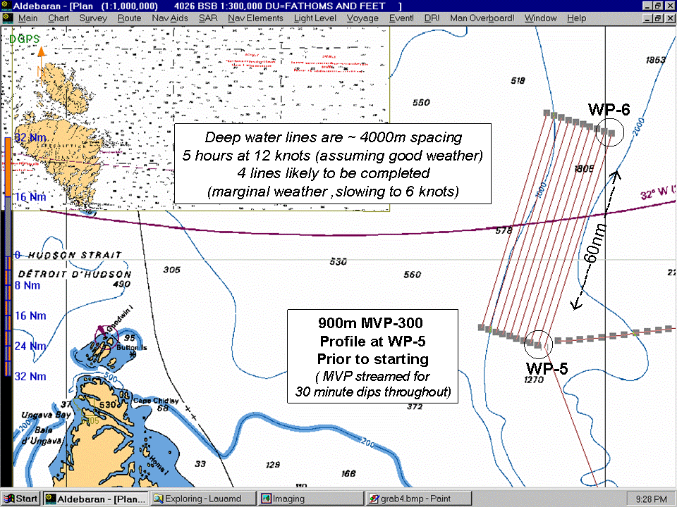 |
The mapping project will
ultimately consist of about 12 contour-parallel lines. These lines are
approximately 110km long and will extend from the 2000m contour,
westward about 35 km to the shelfbreak. To date (on Leg 1), 5 lines
have been completed. To ensure precise beam steering and refraction modelling, a complete knowledge of the temporal and spatial variability in sound speed is required. The deeper (> 500m) watermasses in the area are reasonably predictable on a seasonable basis. Thus the requirement was primarily for the shallower structure. Therefore the MVP-300 was deployed at 12 knots and used for 30 minute (~10km spacing) dips to 300m. |
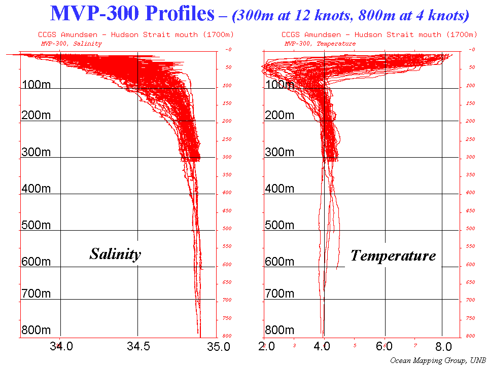 |
The MVP performance was
generally excellent, right up to the point when we lost it. The
adjacent figures illustrates the typical structure and variability. At
the end of each survey line a deeper (500-800m) dip was performed at 4
knots to ascertain whether there was any significant variability in the
deeper water mass. All profiles were extended to full ocean depths using the World Ocean Atlas database, interpolated locally. |
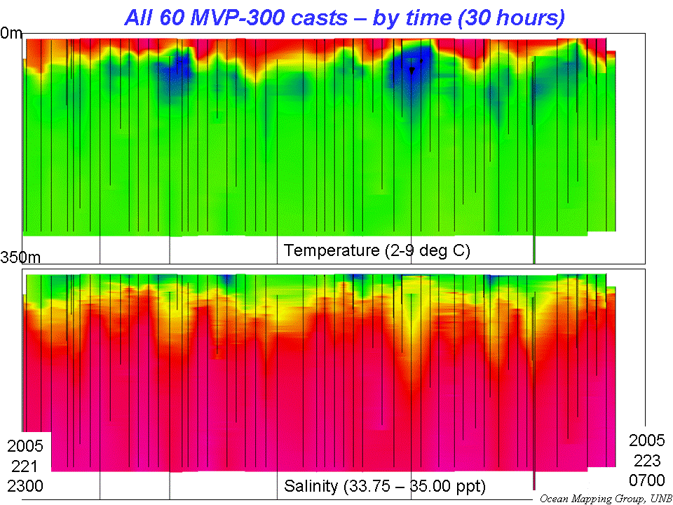 |
The adjacent figure illustrates
a purely time-sequential interpolation of the ~ 60 profiles. As one can
see there is most variability in the temperature minimum at ~50m. Also
the main thermocline above that fluctuates over 40m. Strongly
correlated with, but not identical too, are similar variations in
salinity. Below we present the data geographically line by line progressing from the easternmost section to the west. |
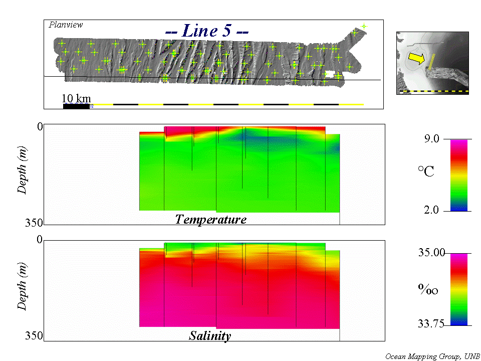
| The adjacent section shows the
MVP dips along the eastern most line. The top figure illustrates the
dip location and density. The lower two figures show the
interpolated temperature and salinity fields. The thin black lines
indicate the precise locations of the observations. As can be seen there is a strong temperature (and thus sound speed) minima at the northern end of the line. There are lesser secondary minima in the centre and at the southern ends also. The other main visible structure is the vertical fluctuations of the main thermocline. |
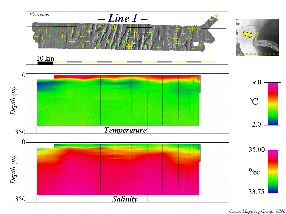 |
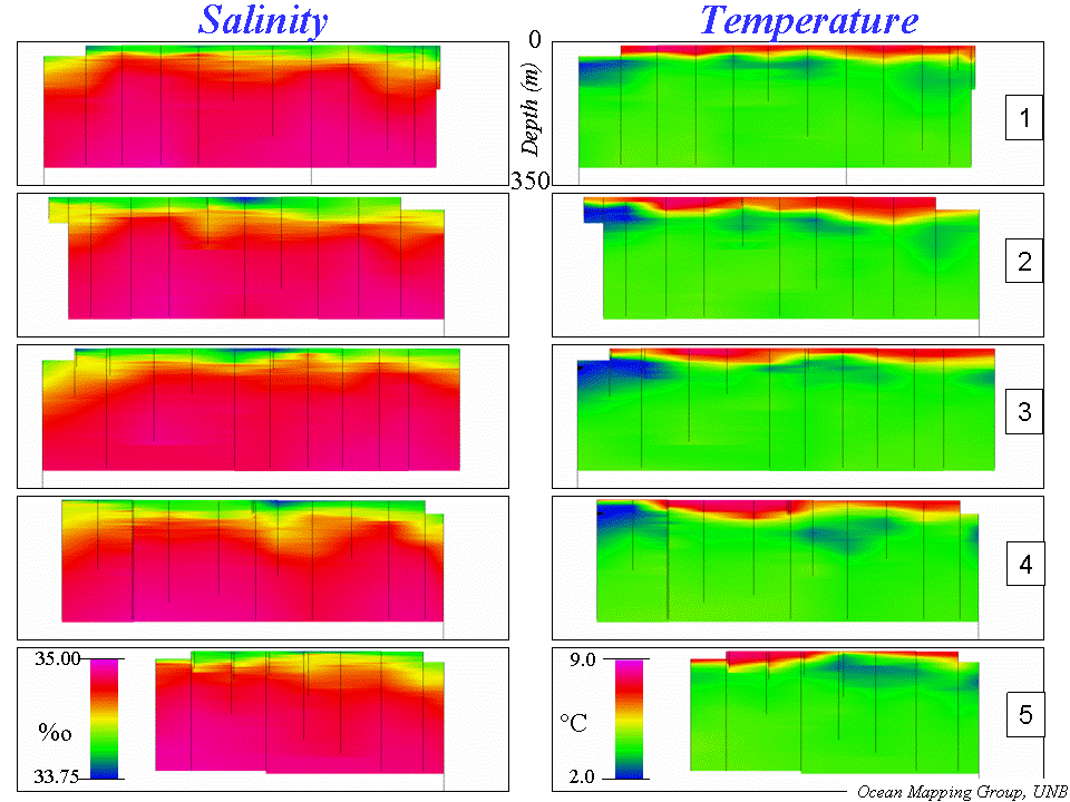
| Proceeding to the next line to
the west, one sees an intensitification of the northern minima. Also
the location of the other minima has migrated. Additionally the highs and lows in the thermocline have grown and migrated. |
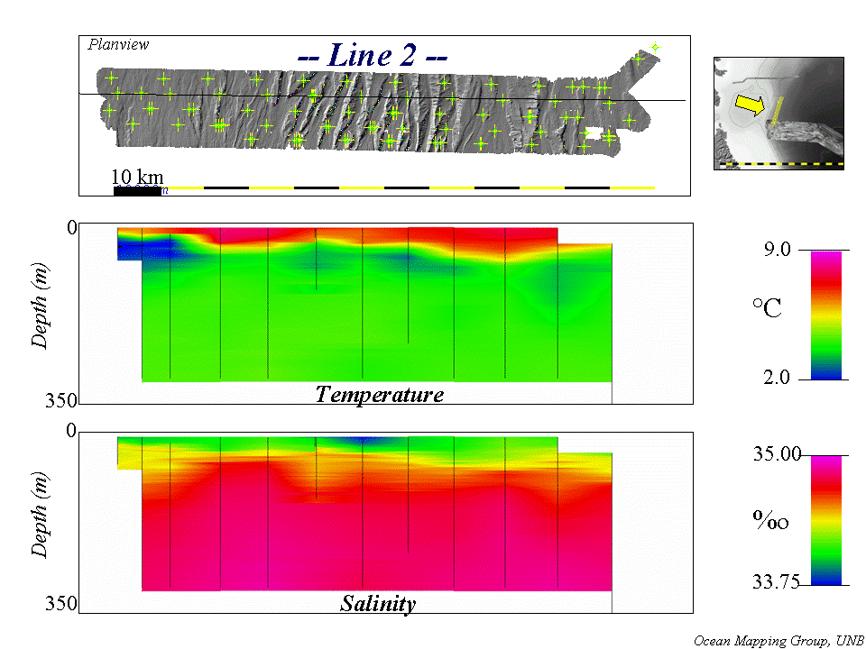 |
| Next line to west. Note shifting thermocline highs, possibly indicating a succession of slices through a lens-like body of cold water. Note a near surface local salinity minima also. |
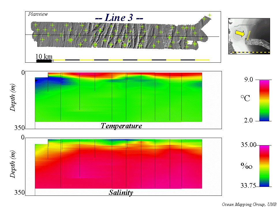 |
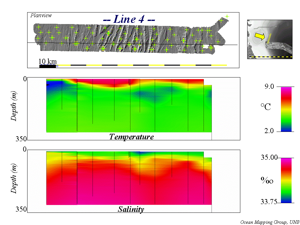
| Further migration or offset of
the thermocline lows and highs. |
 |
| Last profile (truncated as the
MVP was lost on the last (leftmost) dip). Further migration of
the thermocline undulations. |
 |
|
Putting the 5 lines together,
one sees a progressive spatial variation in the location and intensity
of the temperature minima and the thermoclines. Obviously there is much more to be learnt fromn this data, but these preliminary results are available now (day after acquisition). |
 |