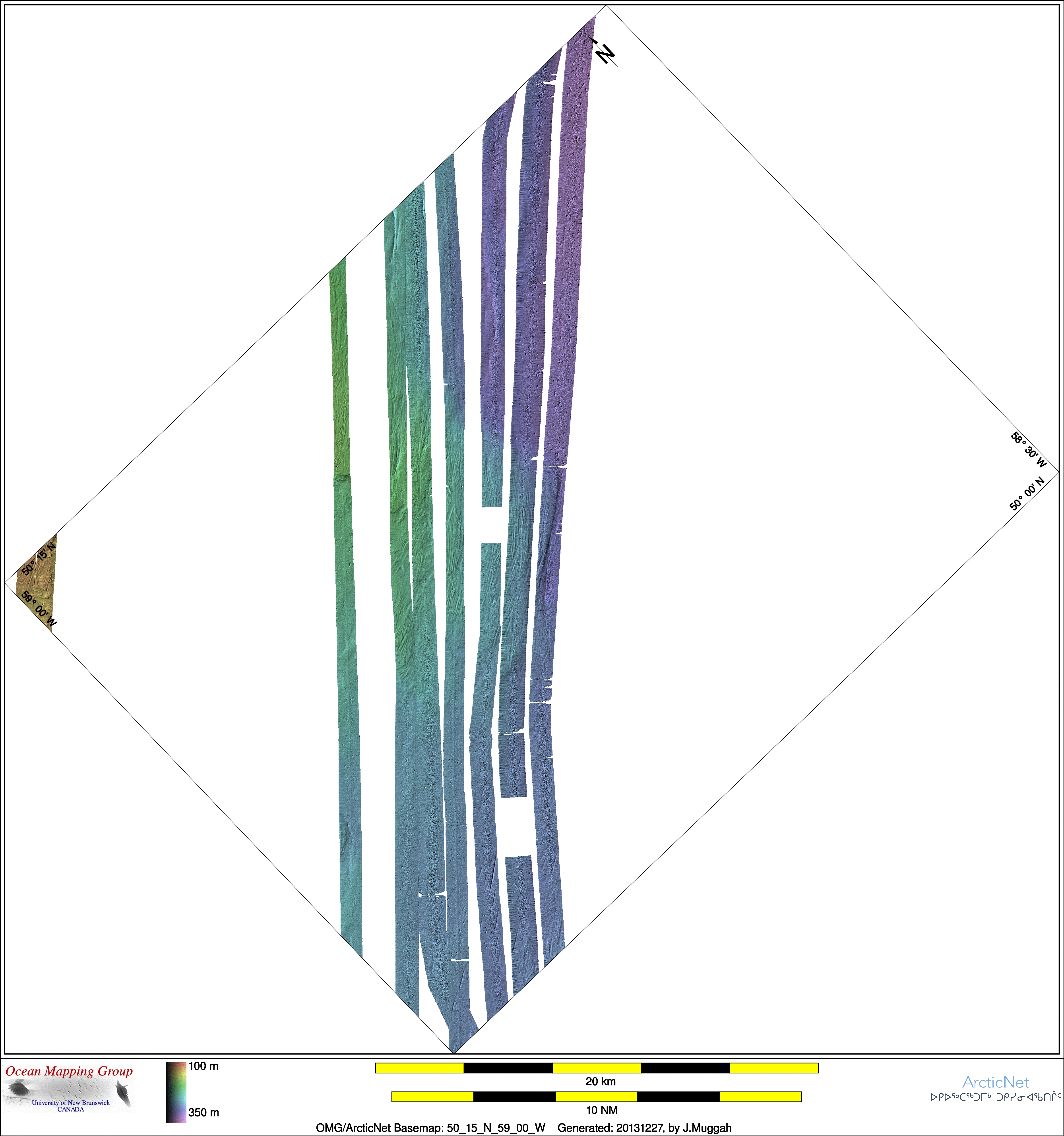
ArcticNet Basemap Series: 50_15_N_59_00_W
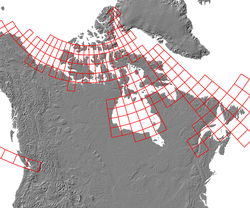
Overview Map
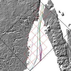
Index Map
52_00_N_60_00_W
Downloads
ESRI grid files for:
This basemap
|
|
|
|
Source data
2003_Amundsen

| 2004_Amundsen

| 2005_Amundsen

| 2006_Amundsen

|
2007_Amundsen

| 2009_Amundsen

| 2010_Amundsen
| 2011_Amundsen

|
2013_Amundsen

|
Survey Lines for each area
Mon Dec 23 10:47:28 AST 2013 Making combo map
Data from source: 2003_Amundsen
LINE - /drives/hudson/disk1/data/2003_Amundsen/Transit_GulfStLawrence/EM300/merged/JD258/0217_20030915_161333.merged - 180 pings included
LINE - /drives/hudson/disk1/data/2003_Amundsen/Transit_GulfStLawrence/EM300/merged/JD258/0218_20030915_171333.merged - 1834 pings included
LINE - /drives/hudson/disk1/data/2003_Amundsen/Transit_GulfStLawrence/EM300/merged/JD258/0220_20030915_180309.merged - 1701 pings included
LINE - /drives/hudson/disk1/data/2003_Amundsen/Transit_GulfStLawrence/EM300/merged/JD258/0221_20030915_190309.merged - 1701 pings included


Data from source: 2004_Amundsen
LINE - /drives/hudson/disk1/data/2004_Amundsen/Labrador_Transit/EM300/merged/JD280/2034_20041006_173430.merged - 4767 pings included
LINE - /drives/hudson/disk1/data/2004_Amundsen/Labrador_Transit/EM300/merged/JD280/2035_20041006_183430.merged - 2501 pings included


Data from source: 2005_Amundsen
LINE - /drives/hudson/disk1/data/2005_Amundsen/001_Gulf_St_Lawrence_Transit_out/EM300/merged/JD219/0042_20050807_105612.merged - 492 pings included
LINE - /drives/hudson/disk1/data/2005_Amundsen/001_Gulf_St_Lawrence_Transit_out/EM300/merged/JD219/0043_20050807_112612.merged - 170 pings included
LINE - /drives/hudson/disk1/data/2005_Amundsen/001_Gulf_St_Lawrence_Transit_out/EM300/merged/JD219/0044_20050807_113458.merged - 13 pings included
LINE - /drives/hudson/disk1/data/2005_Amundsen/001_Gulf_St_Lawrence_Transit_out/EM300/merged/JD219/0045_20050807_113709.merged - 996 pings included
LINE - /drives/hudson/disk1/data/2005_Amundsen/001_Gulf_St_Lawrence_Transit_out/EM300/merged/JD219/0046_20050807_120709.merged - 962 pings included
LINE - /drives/hudson/disk1/data/2005_Amundsen/001_Gulf_St_Lawrence_Transit_out/EM300/merged/JD219/0047_20050807_123709.merged - 601 pings included
LINE - /drives/hudson/disk1/data/2005_Amundsen/001_Gulf_St_Lawrence_Transit_out/EM300/merged/JD219/0048_20050807_130709.merged - 601 pings included
LINE - /drives/hudson/disk1/data/2005_Amundsen/001_Gulf_St_Lawrence_Transit_out/EM300/merged/JD219/0049_20050807_133709.merged - 601 pings included
LINE - /drives/hudson/disk1/data/2005_Amundsen/030_StLaw/EM300/merged/JD297/0016_20051024_194507.merged - 500 pings included
LINE - /drives/hudson/disk1/data/2005_Amundsen/030_StLaw/EM300/merged/JD297/0017_20051024_201507.merged - 1932 pings included
LINE - /drives/hudson/disk1/data/2005_Amundsen/030_StLaw/EM300/merged/JD297/0018_20051024_204508.merged - 1864 pings included
LINE - /drives/hudson/disk1/data/2005_Amundsen/030_StLaw/EM300/merged/JD297/0019_20051024_211508.merged - 901 pings included


Data from source: 2006_Amundsen
LINE - /drives/hudson/disk1/data/2006_Amundsen/003_St_Lawrence/EM300/merged/JD238/0103_20060826_002210.merged - 448 pings included
LINE - /drives/hudson/disk1/data/2006_Amundsen/003_St_Lawrence/EM300/merged/JD238/0104_20060826_005210.merged - 1113 pings included
LINE - /drives/hudson/disk1/data/2006_Amundsen/003_St_Lawrence/EM300/merged/JD238/0105_20060826_012210.merged - 1087 pings included
LINE - /drives/hudson/disk1/data/2006_Amundsen/003_St_Lawrence/EM300/merged/JD238/0106_20060826_015210.merged - 993 pings included
LINE - /drives/hudson/disk1/data/2006_Amundsen/003_St_Lawrence/EM300/merged/JD238/0107_20060826_022210.merged - 301 pings included
LINE - /drives/hudson/disk1/data/2006_Amundsen/003_St_Lawrence/EM300/merged/JD238/0108_20060826_025210.merged - 301 pings included
LINE - /drives/hudson/disk1/data/2006_Amundsen/003_St_Lawrence/EM300/merged/JD238/0109_20060826_032210.merged - 301 pings included


Data from source: 2007_Amundsen
LINE - /drives/hudson/disk1/data/2007_Amundsen/000_StLawrence/EM300/merged/JD209/0091_20070728_133133.merged - 970 pings included
LINE - /drives/hudson/disk1/data/2007_Amundsen/000_StLawrence/EM300/merged/JD209/0092_20070728_140133.merged - 1111 pings included
LINE - /drives/hudson/disk1/data/2007_Amundsen/000_StLawrence/EM300/merged/JD209/0093_20070728_143133.merged - 1151 pings included
LINE - /drives/hudson/disk1/data/2007_Amundsen/000_StLawrence/EM300/merged/JD209/0094_20070728_150133.merged - 801 pings included
LINE - /drives/hudson/disk1/data/2007_Amundsen/000_StLawrence/EM300/merged/JD209/0095_20070728_153133.merged - 801 pings included
LINE - /drives/hudson/disk1/data/2007_Amundsen/000_StLawrence/EM300/merged/JD209/0096_20070728_160133.merged - 801 pings included


Data from source: 2009_Amundsen
LINE - /drives/viscount/disk1/data/2009_Amundsen/022_Transit/EM302/merged/JD319/0026_20091115_160152.merged - 1984 pings included
LINE - /drives/viscount/disk1/data/2009_Amundsen/022_Transit/EM302/merged/JD319/0027_20091115_163152.merged - 3162 pings included
LINE - /drives/viscount/disk1/data/2009_Amundsen/022_Transit/EM302/merged/JD319/0028_20091115_170151.merged - 3454 pings included
LINE - /drives/viscount/disk1/data/2009_Amundsen/022_Transit/EM302/merged/JD319/0029_20091115_173151.merged - 301 pings included


Data from source: 2010_Amundsen
LINE - /drives/viscount/disk1/data/2010_Amundsen/001_Quebec_City/EM302/merged/JD185/0046_20100704_164547.merged - 2750 pings included
LINE - /drives/viscount/disk1/data/2010_Amundsen/001_Quebec_City/EM302/merged/JD185/0047_20100704_174547.merged - 3657 pings included
LINE - /drives/viscount/disk1/data/2010_Amundsen/001_Quebec_City/EM302/merged/JD185/0048_20100704_184547.merged - 101 pings included
LINE - /drives/viscount/disk1/data/2010_Amundsen/024_Baffin_Bay/EM302/merged/JD292/0053_20101019_163835.merged - 101 pings included
LINE - /drives/viscount/disk1/data/2010_Amundsen/025_Labrador/EM302/merged/JD302/0253_20101029_214328.merged - 2594 pings included
LINE - /drives/viscount/disk1/data/2010_Amundsen/025_Labrador/EM302/merged/JD302/0254_20101029_221328.merged - 3379 pings included
LINE - /drives/viscount/disk1/data/2010_Amundsen/025_Labrador/EM302/merged/JD302/0255_20101029_224328.merged - 2001 pings included
LINE - /drives/viscount/disk1/data/2010_Amundsen/025_Labrador/EM302/merged/JD302/0256_20101029_231328.merged - 2001 pings included


Data from source: 2011_Amundsen
LINE - /drives/berg/disk1/data/2011_Amundsen/001_StLawrence/EM302/merged/JD202/0087_20110721_143401.merged - 2564 pings included
LINE - /drives/berg/disk1/data/2011_Amundsen/001_StLawrence/EM302/merged/JD202/0090_20110721_160401.merged - 2701 pings included
LINE - /drives/berg/disk1/data/2011_Amundsen/001_StLawrence/EM302/merged/JD202/0091_20110721_163401.merged - 2701 pings included
LINE - /drives/berg/disk1/data/2011_Amundsen/001_StLawrence/EM302/merged/JD202/0092_20110721_170400.merged - 2701 pings included
LINE - /drives/berg/disk1/data/2011_Amundsen/001_StLawrence/EM302/merged/JD202/0088_20110721_150401.merged - 3613 pings included
LINE - /drives/berg/disk1/data/2011_Amundsen/001_StLawrence/EM302/merged/JD202/0089_20110721_153401.merged - 3472 pings included
LINE - /drives/berg/disk1/data/2011_Amundsen/001_StLawrence/EM302/merged/JD202/0086_20110721_140401.merged - 3472 pings included
LINE - /drives/berg/disk1/data/2011_Amundsen/023_Baffin_Bay/EM302/merged/JD302/0303_20111029_020015.merged - 801 pings included
LINE - /drives/berg/disk1/data/2011_Amundsen/023_Baffin_Bay/EM302/merged/JD302/0305_20111029_030015.merged - 1501 pings included
LINE - /drives/berg/disk1/data/2011_Amundsen/023_Baffin_Bay/EM302/merged/JD302/0304_20111029_023015.merged - 1701 pings included
LINE - /drives/berg/disk1/data/2011_Amundsen/023_Baffin_Bay/EM302/merged/JD302/0306_20111029_033015.merged - 1701 pings included


Data from source: 2013_Amundsen
LINE - /drives/mamquam/disk1/data/2013_Amundsen/001_StLawrence/EM302/merged/JD209/0081_20130728_211713.merged - 2954 pings included
LINE - /drives/mamquam/disk1/data/2013_Amundsen/001_StLawrence/EM302/merged/JD209/0082_20130728_214713.merged - 3141 pings included
LINE - /drives/mamquam/disk1/data/2013_Amundsen/001_StLawrence/EM302/merged/JD209/0083_20130728_221713.merged - 3108 pings included
LINE - /drives/mamquam/disk1/data/2013_Amundsen/001_StLawrence/EM302/merged/JD209/0084_20130728_224718.merged - 2901 pings included
LINE - /drives/mamquam/disk1/data/2013_Amundsen/001_StLawrence/EM302/merged/JD209/0085_20130728_231713.merged - 2901 pings included
LINE - /drives/mamquam/disk1/data/2013_Amundsen/012_Lancaster/EM302/merged/JD277/0281_20131004_092736.merged - 1010 pings included
LINE - /drives/mamquam/disk1/data/2013_Amundsen/012_Lancaster/EM302/merged/JD277/0282_20131004_095736.merged - 1201 pings included
LINE - /drives/mamquam/disk1/data/2013_Amundsen/012_Lancaster/EM302/merged/JD277/0283_20131004_102736.merged - 1201 pings included
LINE - /drives/mamquam/disk1/data/2013_Amundsen/012_Lancaster/EM302/merged/JD277/0284_20131004_105736.merged - 1201 pings included
Created: 20140212 by J.Muggah