Grand Manan Survey
July 18-28, 2002


Location of Grand Manan Island in Bay of Fundy

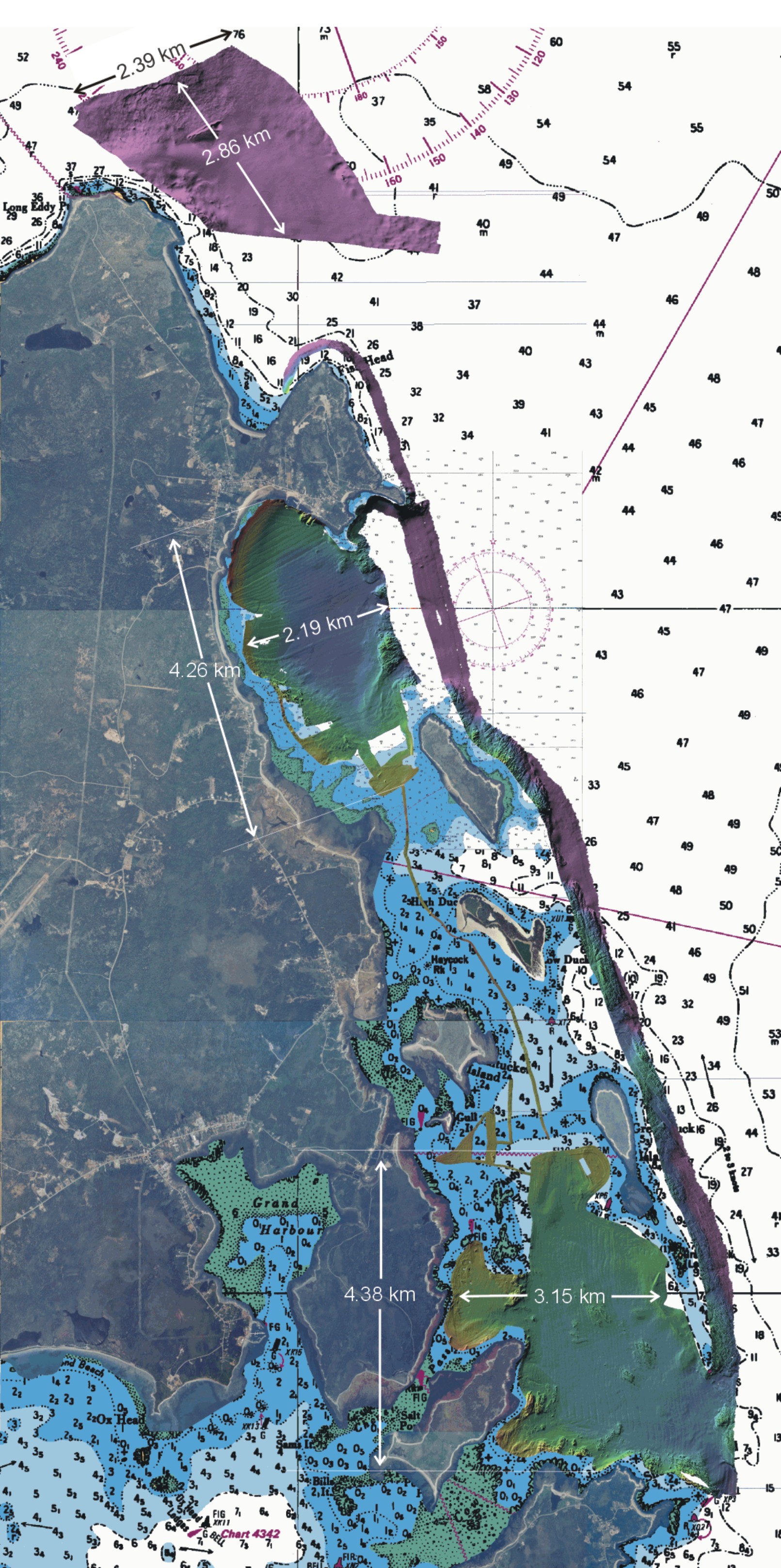
Grand Manan is a small island situated in the mouth of the Bay of Fundy.  The island's main industries are fishing and aquaculture, and tourism.  Aquaculture, namely salmon and scallop, occurs around the island, in and around Duck Island Sound, and on the western side of the idland.  The island is also a popular excursion for tourists, who, among other things, are attracted to the naturalness of the island, and the chance to view seabirds, porpoises, seals, and many species of endangered whales.

The survey was conduced from July 18-28, 2202 by the University of New Brunswick's Ocean Mapping Group (OMG).  The vessel used was the CSL Heron , a 34-foot long hydrographic survey launch on loan to OMG by the Canadian Hydrographic Service.


The objective of this survey was to collect Simrad EM3000 multibeam bathymetry and backscatter data.  Data was gathered in three different areas along the Eastern and Northern coasts of Grand Manan Island, for three different clients:

  1. Around the aquaculture sites of Duck Island Sound for Peter Lawton of the Department of Fisheries and Oceans, St. Andrews
  2. Offshore Northern Head for David Johnston, doctoral candidate at the Nicholas School of the Environment and Earth Sciences (Duke University) and The Grand Manan Seabird and Whale Association
  3. Within Long Island Bay for Russell Parrott of the Geological Survey of Canada (GSC)

Overview of Survey Areas

Each of these clients desired information on the surveyed areas for their different research interests:

  • The survey in Long Island Bay was a continuation of a previous survey conducted earlier in the summer by Russell Parrott.
  • Peter Lawton provided OMG with areas of interest for aquaculture, and possible lobster and scallop spawning sites.  Dr. Lawton used the resulting bathymetric and backscatter maps, in conjunction with seafloor imagery he collected that fall, to study the habitat usage of American lobster ( Homarus americanus).  Through his work, he seeks to define sensitive habitats (with respect to aquaculture development), as well as dealing with new area-specific fishery access issues (i.e. aboriginal fisheries).
  • David Johnston's research interests are in studying the abundance, distribution, and acoustic behavious of marine mammals in relation to the biological and physical characteristics of tidal-induced fronts.  The area surveyed for Mr. Johnston encompassed an area where an island wake, referred to as the "Long Eddy", forms on the flood tide.  This wake is likely one example of a location where harbour porpoises forage around Grand Manan.
The resulting products for the Grand Manan survey consisted of a series of maps for each client, depicting an overview of the entire survey area (5 metre resolution), and a high (2 metre) resolution image of their particular area of interest.  Each client was provided with a map illustrating bathymetric data, and a mpa illustrating backscatter.

The data presented here may be subjected to continual reprocessing as part of research within the Ocean Mapping Group.


Maintained by J. Coppola.  Last modified March 2004.