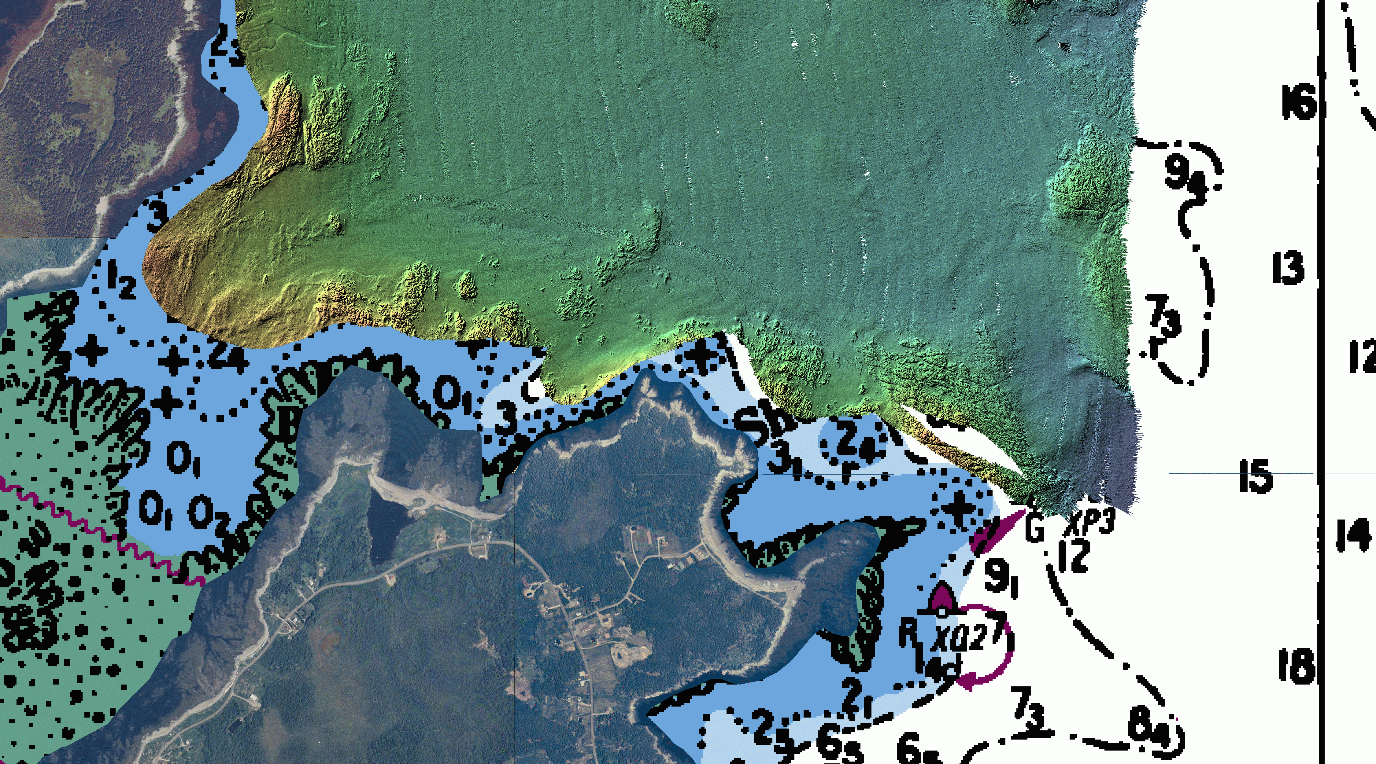
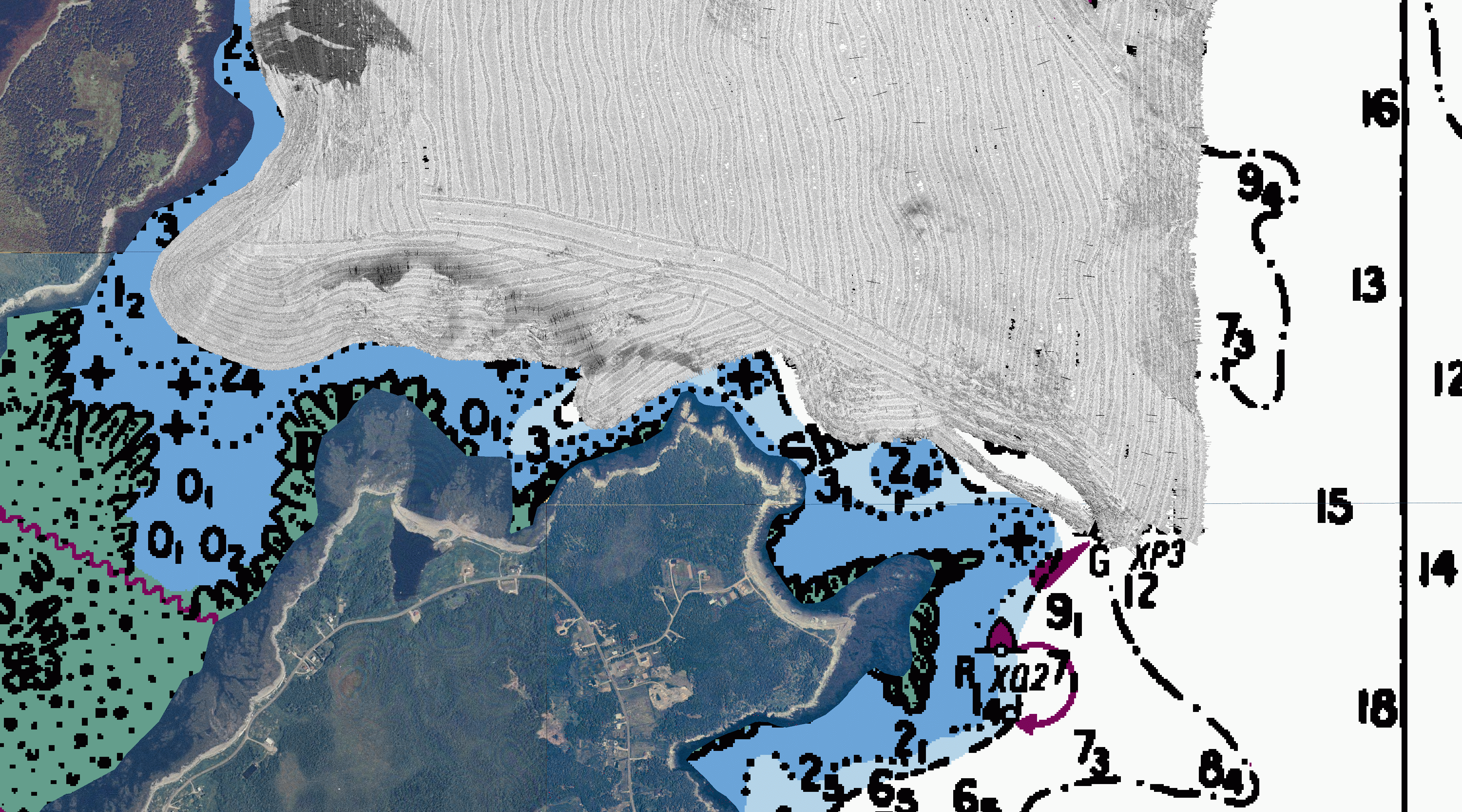
Grand Manan Survey 2002 - 1m data map sheets
AREA 8
Metadata
R4
5m Contours (ASCII)
Bathymetry (Geotif)
Bathymetry (Lat/Lon/Depth Ascii file)
Bathymetry (ESRI Binary Grid File)
Backscatter (Geotif)
Bathymetry
(~5.41MB)
Multibeam
Backscatter
(300 kHz)
(~5.56MB)
Collected by:
C.S.L. Heron
Ocean Mapping Group
University of New Brunswick
July 18-28, 2002
Created by Jennifer Coppola
April 2004
Modified by Steve Brucker, June 2005