ADCP investigations of
M2 circulation patterns at the mouth of the Musquash Estuary:
one approach to boundary delineation


John E. Hughes Clarke, Ted Byrne and Doug Cartwright
Ocean Mapping Group
University of New Brunswick


Background
As part of a Geoide funded project looking at marine boundaries, an ADCP study was conducted in September 2001 examining the M2 tidal circulation patterns at the mouth of the Musquash Estuary where it exchanges with the open Bay of Fundy.


The aim of the experiment was to better define the seaward boundary of the proposed Musquash Marine Protected Area (MPA). The Musquash Estuary is a macrotidal (6-8m tide range) bay lying ~ 20 km west of the port of Saint John.  As part of the MPA designation, legal boundaries have to be established, an approach that is relatively simple for terrestrial parks or reserves, but is far more difficult for submerged land areas.


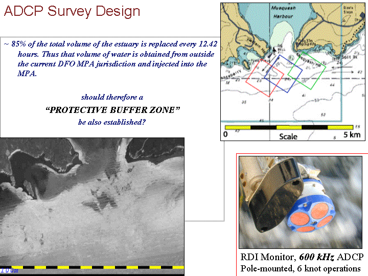
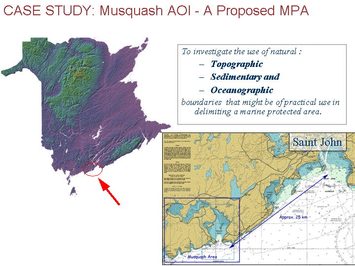
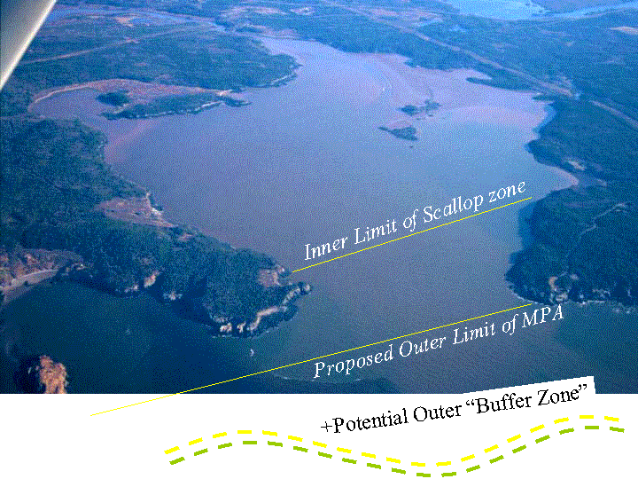
Two boundaries had already been provisionally defined, an inner one limiting the penetration of scallop dragging rights and an outer one defining the seaward limit of the MPA. Both of these had initially been defined using straight lines between terrestrial landmarks, making no account of the submerged topography or the oceanographic circulation in the area.  

In addition, it had been recognised that, due to the large tidal prism , the majority of the volume of the estuary was replaced twice daily through the tides and thus a potential "outer buffer zone" might need to be defined to allow for this exchange. The ADCP study described here attempted to address this issue.


Potential Seabed Boundary Indicators
Dense seabed topographic and surficial backscatter maps were created using the a multibeam sonar mapping system. From these, the bathymetric framework and indicators of the likely surficial sediment distribution could be ascertained.  Given that the aim of the MPA designation was to preserve critical species habitat, boundary delineation might reasonably be based on this information. A number of plausible approach might include:


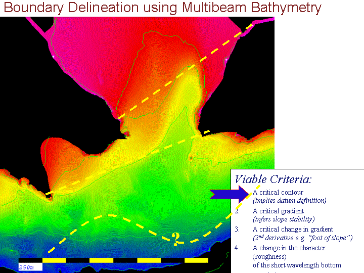
Boundary Based on Bathymetry

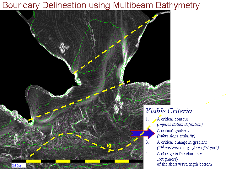
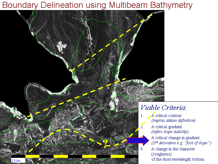
Boundary Based on Slope

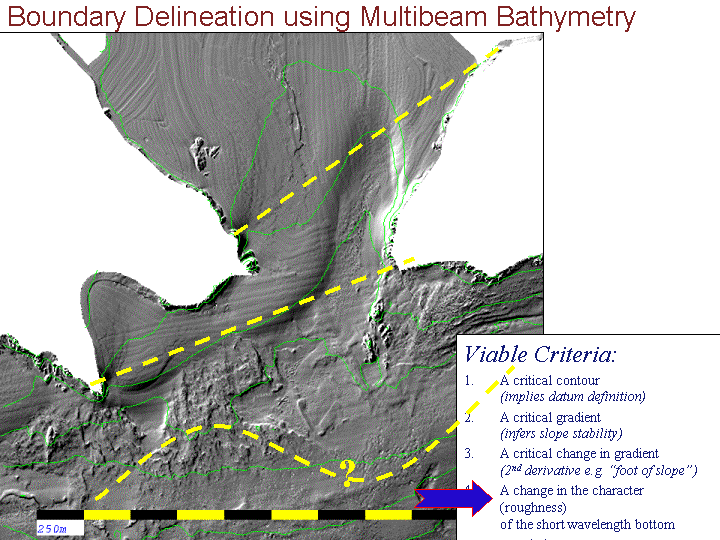
Boundary Based on Roughness

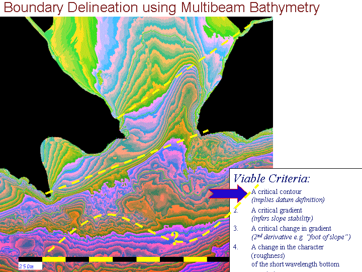
Boundary Based on Critical Contour

Boundary Based on 2nd Derivative

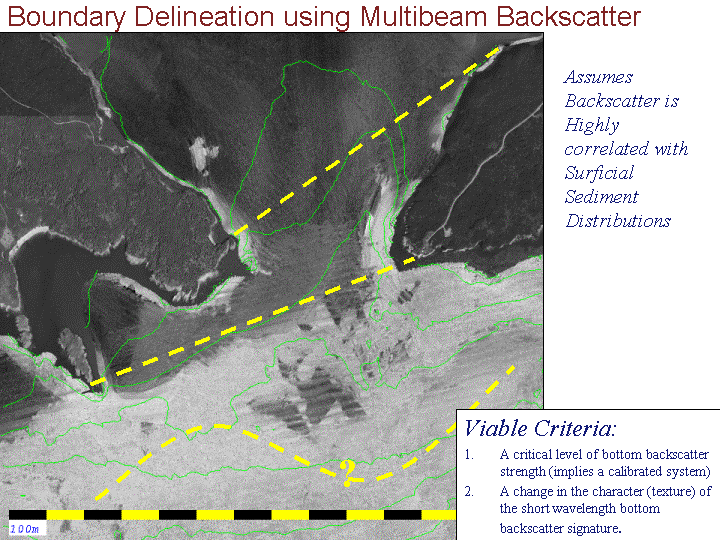
Boundary Based on Surficial Sedinments

:
Whilst a number of these potential critieria could be viable, one can't help wondering  what the principal controls on the sediment distribution at the mouth of the estuary were.
 
Two significant questions need to be answered:
  1. why was there such a pronounced change in sediment type along the line from Gooseberry Island to the eastern harbour mouth?
  2. what was the nature of the exchange of water between the estuary and the open bay?


Potential Oceanographic Boundary Indicators


  In order to answer these questions an ADCP experiment was designed that aimed to cover the likely region immediately seaward of the estuary mouth. The aim was to establish typical circulation patterns over an M2 tidal cycle. It should be noted that, whilst the Bay of Fundy is dominated by the M2 tidal forcing, significant external influences include:
  • wind forcing
  • river discharge (both the Musquash and the Saint John to the East)

The approach used, developed at the Ocean Mapping Group, was to pick sections that could be covered in less than 20 minutes and repeated for the duration of a tidal cycle (~12.42 hours). Such sections (in this case diamond track patterns were used approximately 600m on  a side) can only cover a finite region in any one tide. In order to build up a better picture, successive diamonds were run on successive tides, offset but overlapping.

The aim is to build up a complete spatial picture by combining succesive sections aligning each section by phase of tide. Limitations of this method include the fact that the tidal range changes slightly from section to section (as go from neaps to springs) and the overriding signature of wind forcing or river discharge can change.  The results and a brief interpretation of the results are presented below:


The following 18 images show sequential stages of the tide at ~ 40 minute intervals.


  FLOOD TIDE
EBB TIDE


FLOOD TIDE
EBB TIDE

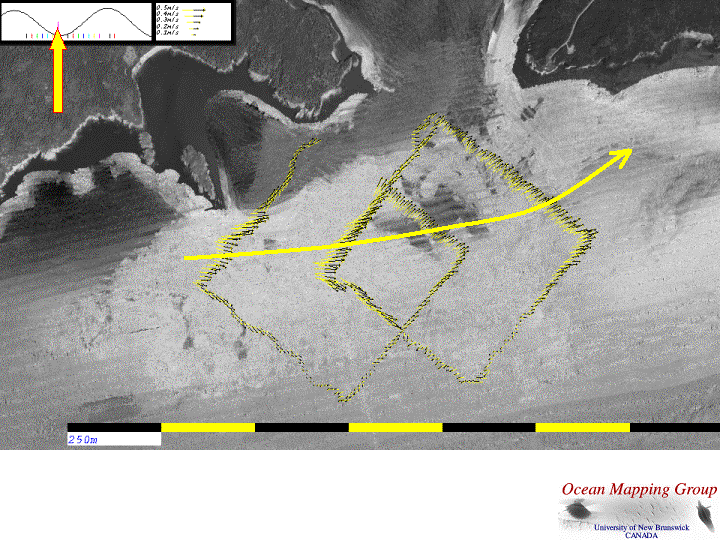
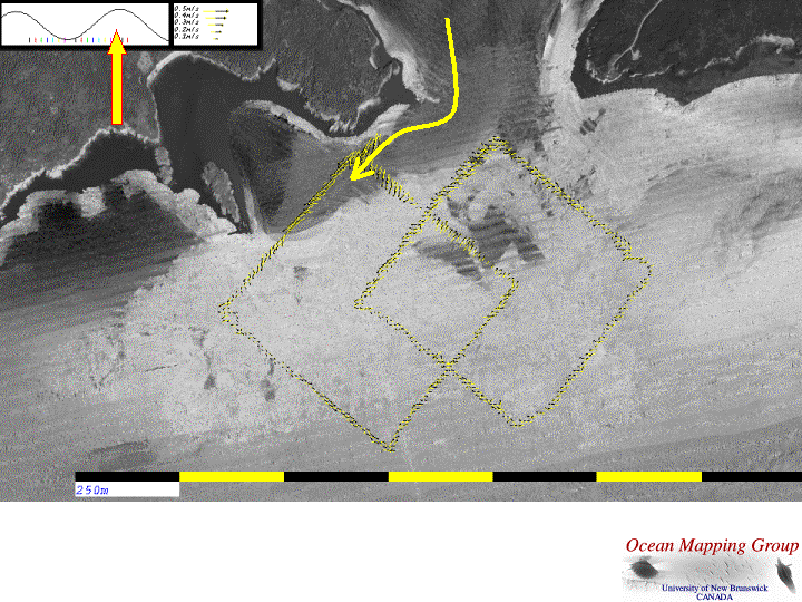
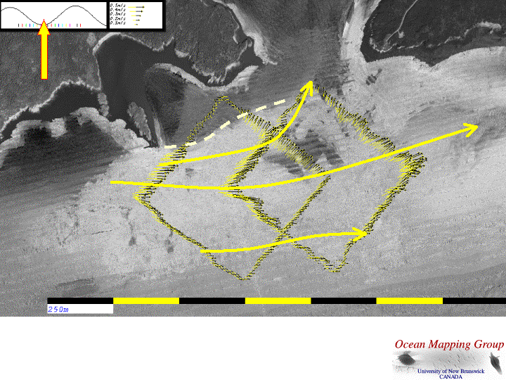
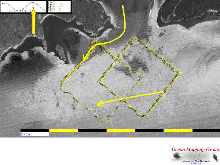
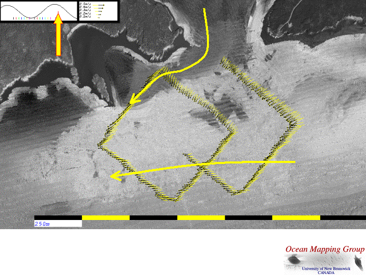
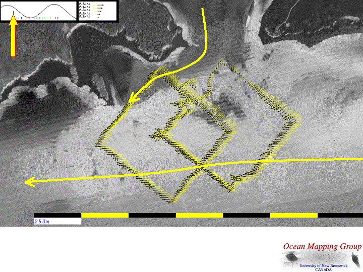
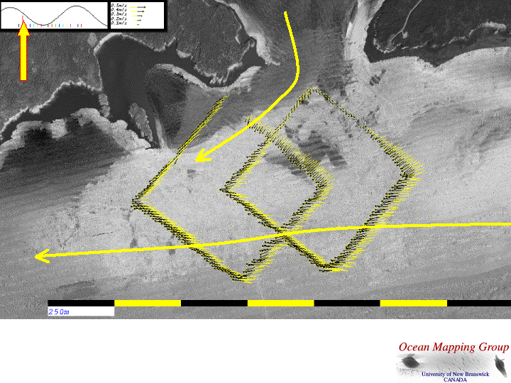
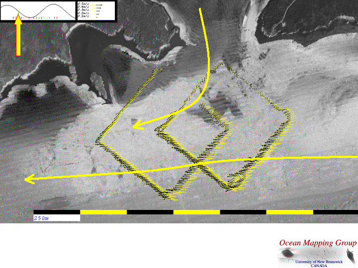
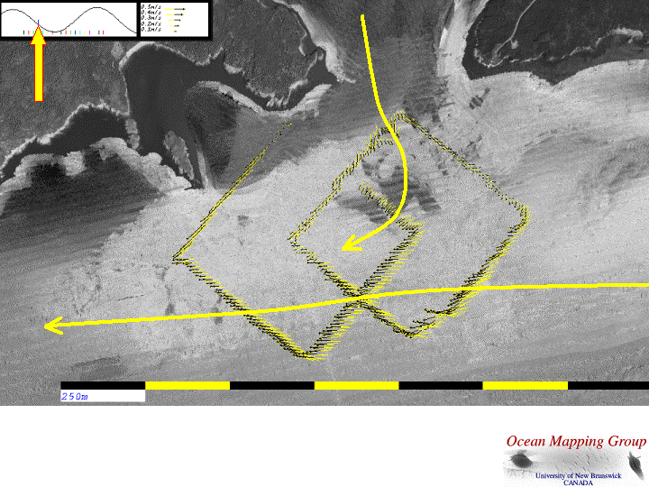
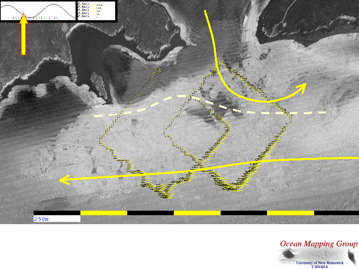
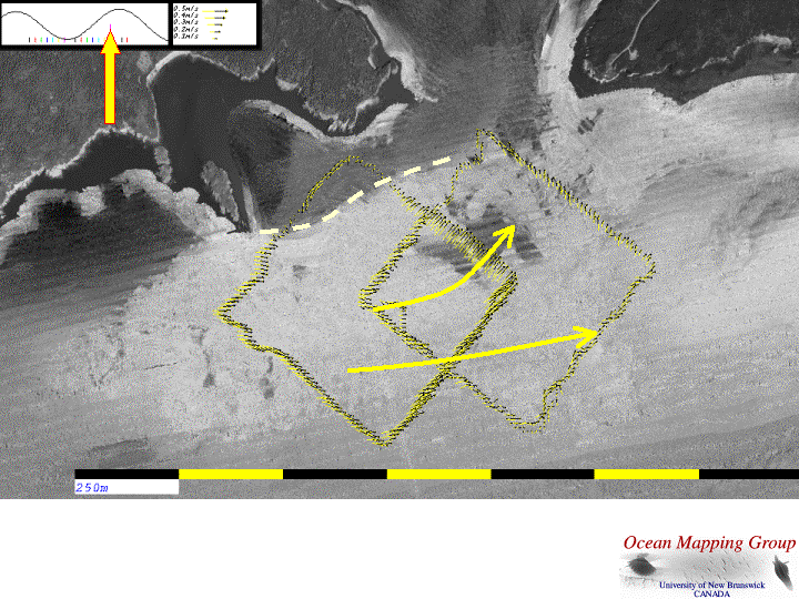
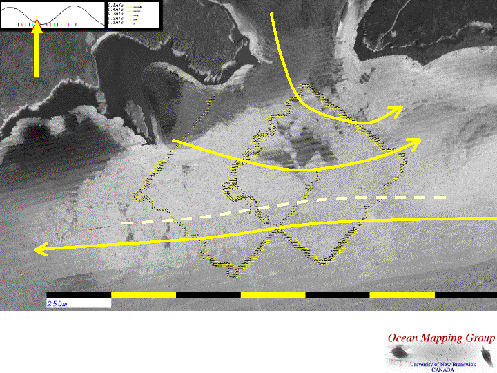
The most interesting feature is a clear flow separation of the ebb and flood plumes. On the flood, Gooseberry Island acts to block off the main alongshore flow resulting in a shadow zone in the lee of the island in which the flood tide stream is never developed. The southern edge of the shadow zone is defined by a line of heavy shear that exactly marks the edge of the low backscatter sediment boundary.  On the early ebb, the main discharge occurs hugging the west side of the estuary mouth. Thus the main flux of fine-grained sediment leaving the estuary is deposited in that region. The next flood tide, resuspends only the sediments dumped seaward of the shear line.

We can thus explain the presence and location of the sediment boundary that so closely aligns with the proposed outer boundary.  Because we now understand the mechanism for this sediment boundary (reflecting modern, not relict processes and thus significant to critical species habitat) we may justify using it (or a reasonable approximation of it) as a legal boundary.

The most important observation to make concerning the use of the outer boundary is that, if the current proposed line is used it has the following strange consequence:

  • if pollutants are released inside the line over the low backscatter area (i.e. within the park boundary), they are very unlikely to make it back into the estuary within a single M2 cycle. This is because, there is no flood stream at that location and the ebb jeb rapidly ejects the material out to the SW.

  • inversely, if pollutants are released just outside the line over the higher backscatter area (i.e. beyond the park boundary) they are almost certainly going to make it back into the estuary as this in the main corridor for the flood stream.
Thus, the current outer boundary is totally inadequate if the aim is to define an outer limit protecting the safe ecological habitat within the Park. We must thus seek a more seaward boundary or buffer zone that takes account of our new knowledge of the tidal circulation.


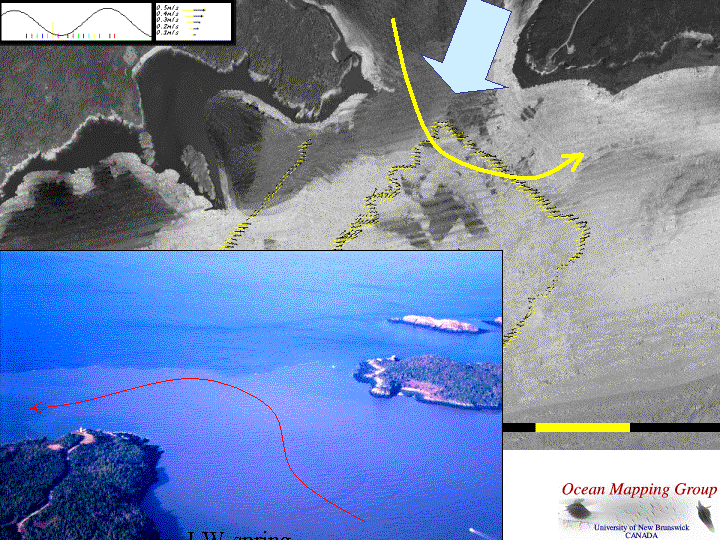
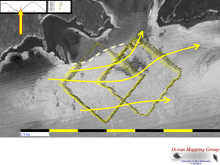
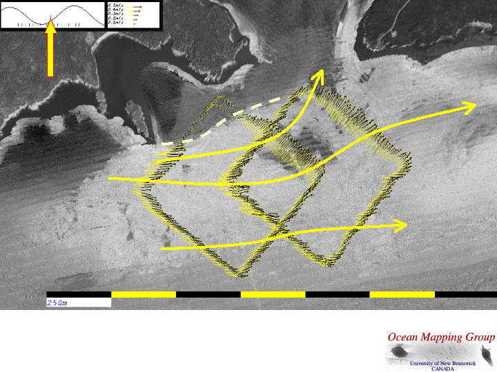
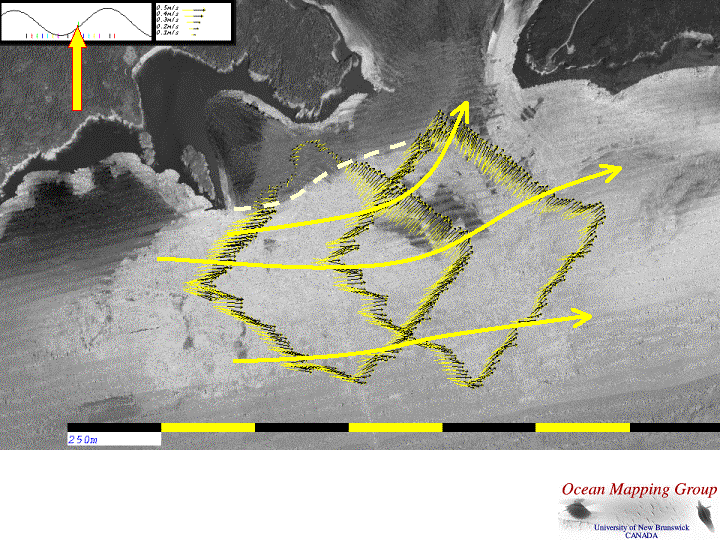
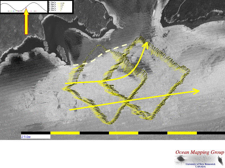
The most unexpected phenomena occurs on the last stages of the ebb when the ADCP flow suggest that the water exiting the estuary actually moves off to the east in a reverse direction to the main offshore ebb flow. This phenomena was confirmed using aerial photography at low water spring tide (see photo) showing a clear plume of high suspended sediment exiting the estuary and being advected to the east.


Summary

Putting the full tidal cycle together we can identify a number of notable characteristics of the M2 circulation, the principal of which are:
  • early ebb constrained to west
  • flood dominantly constrained to east
  • late ebb switching to east in trapped eddy
  • implicity a residual trapped eddy over dune body to east
  • offshore rectilinear flow developed south of a separation zone.


last modified     April 2003        by John E. Hughes Clarke


last modified     April 2003        by John E. Hughes Clarke