Nuliajuk in
                  Kangert
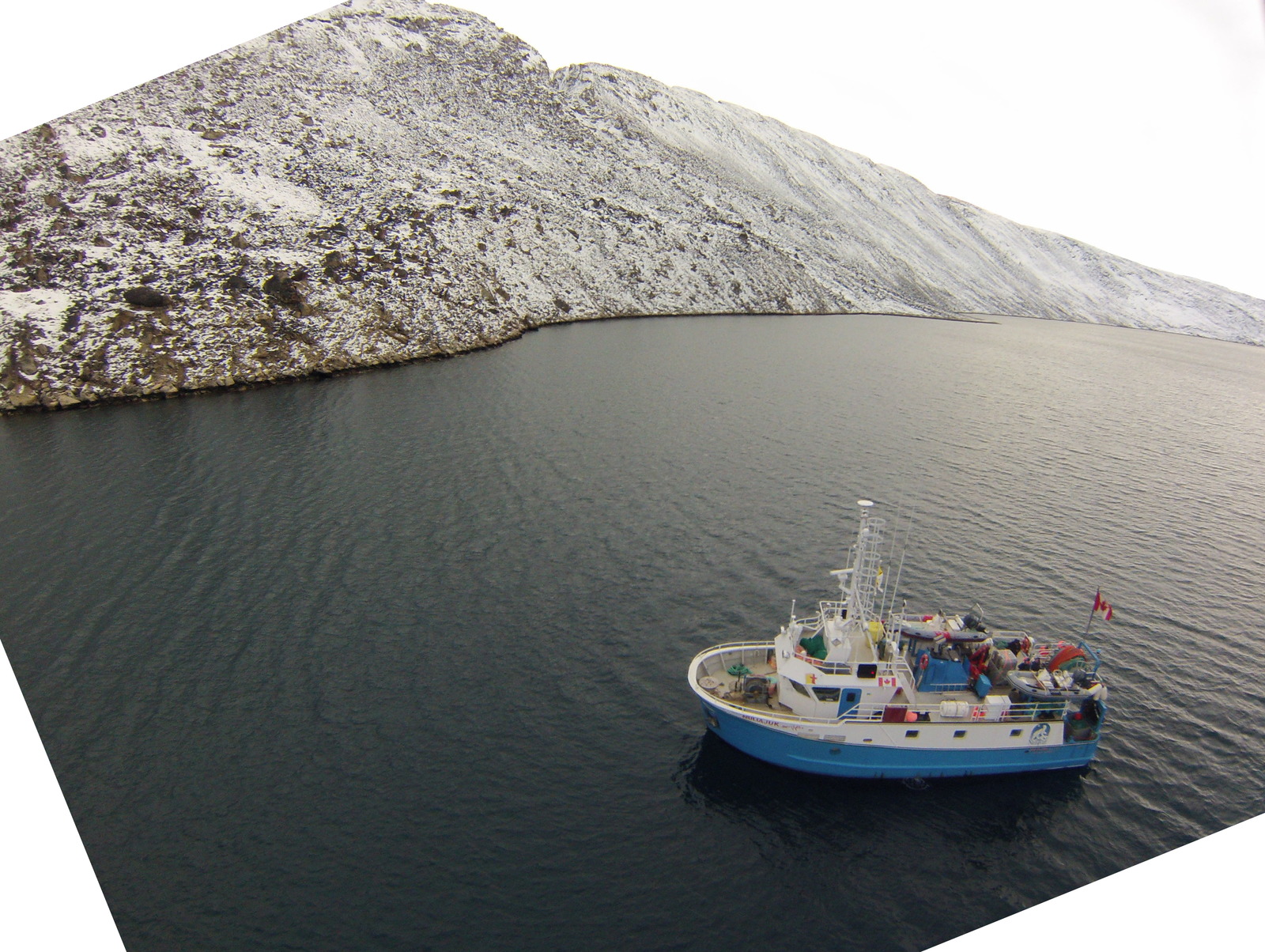
photo credit: James Muggah
Nuliajuk 2013 Lake Melville Mapping Operations - Preliminary Results

James Muggah1, Christine Legere2 and Weston Renoud1
1Ocean Mapping Group
Dept. Geodesy and Geomatics Engineering,
University of New Brunswick
2 Department of Geography,
Memorial University of Newfoundland
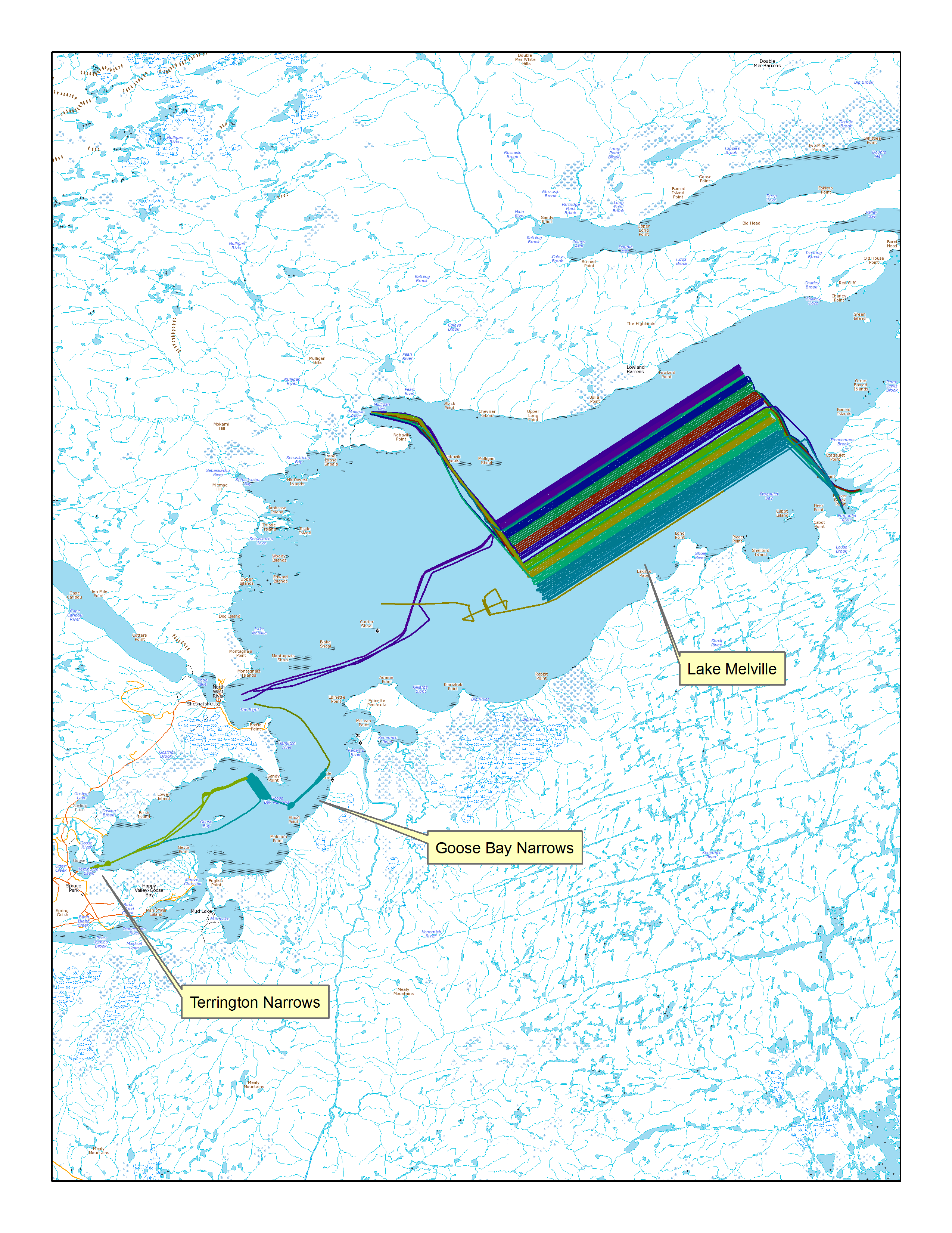
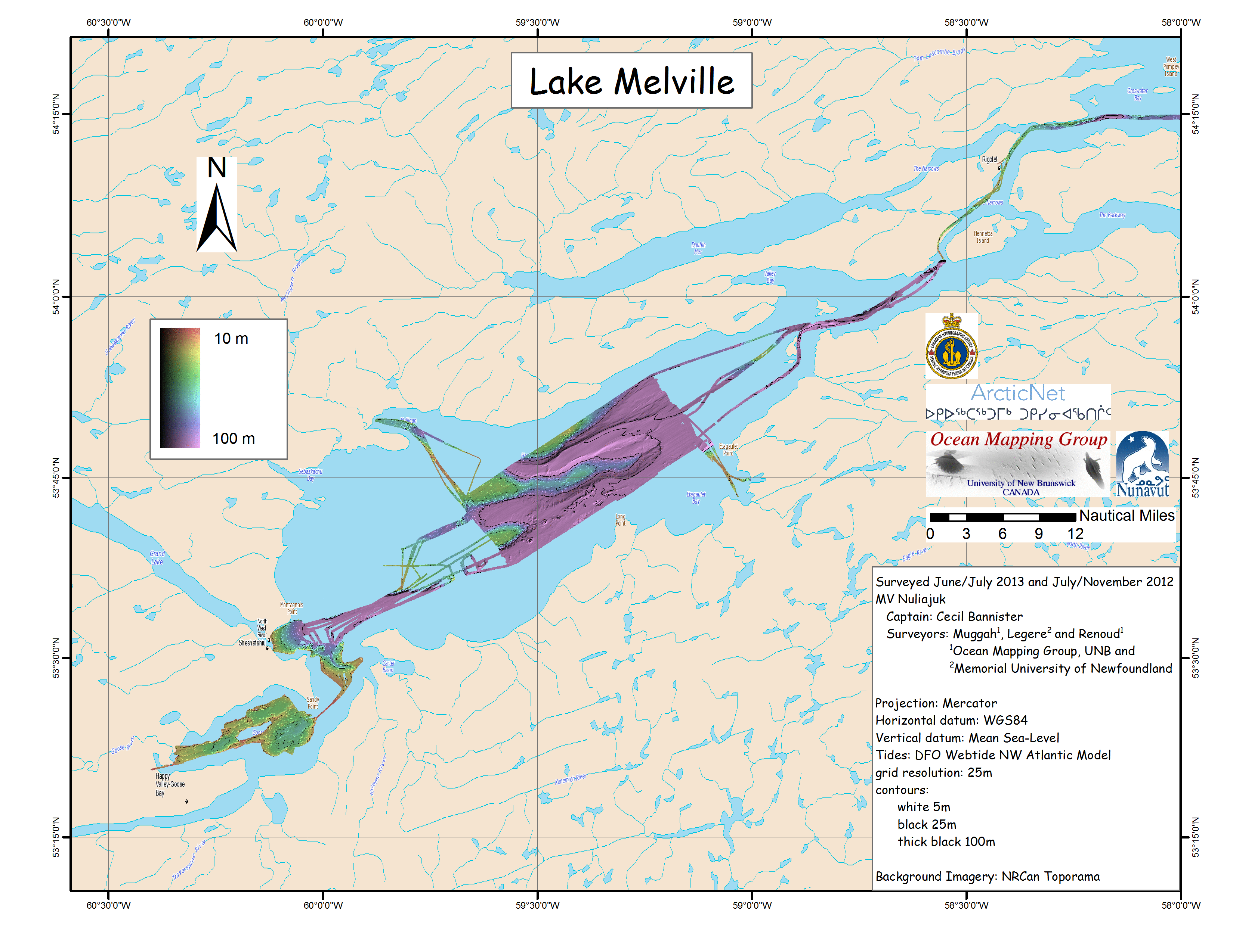
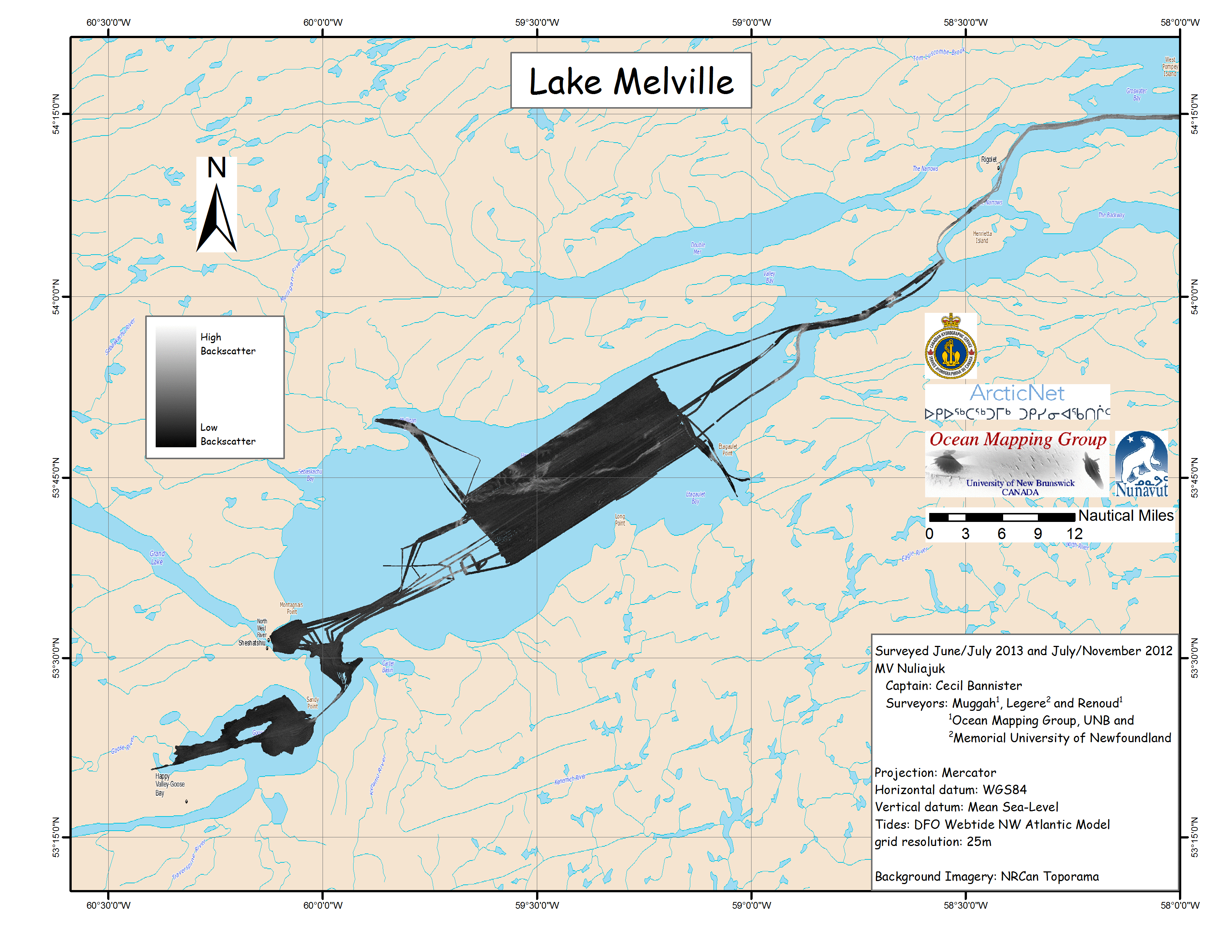
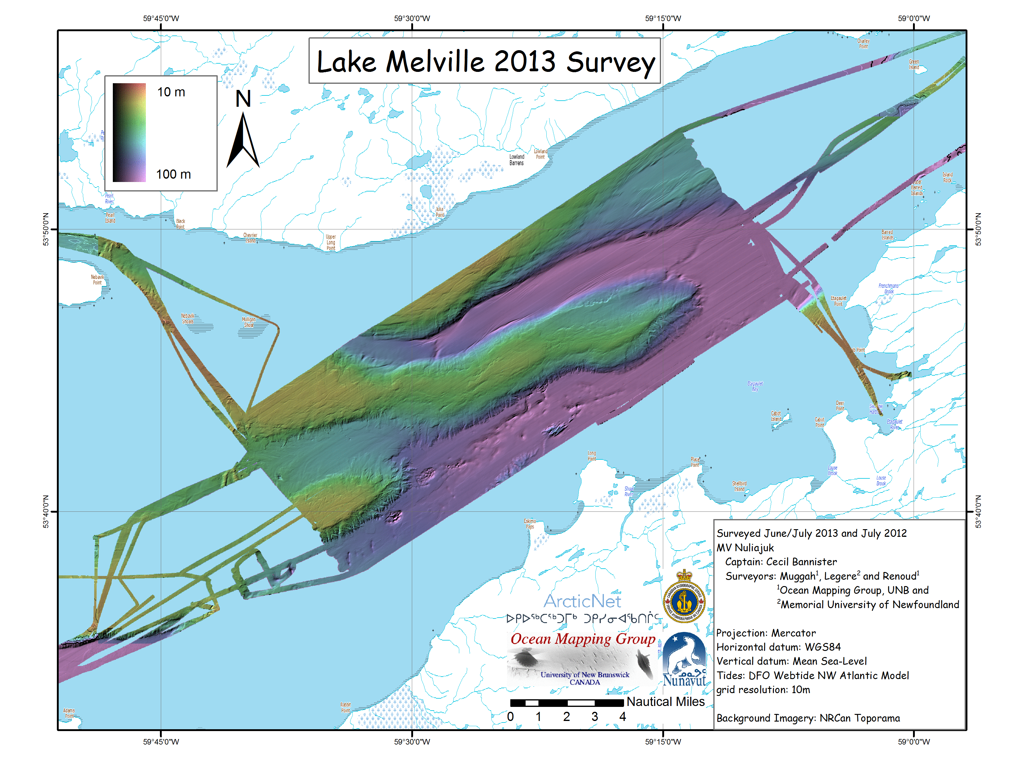
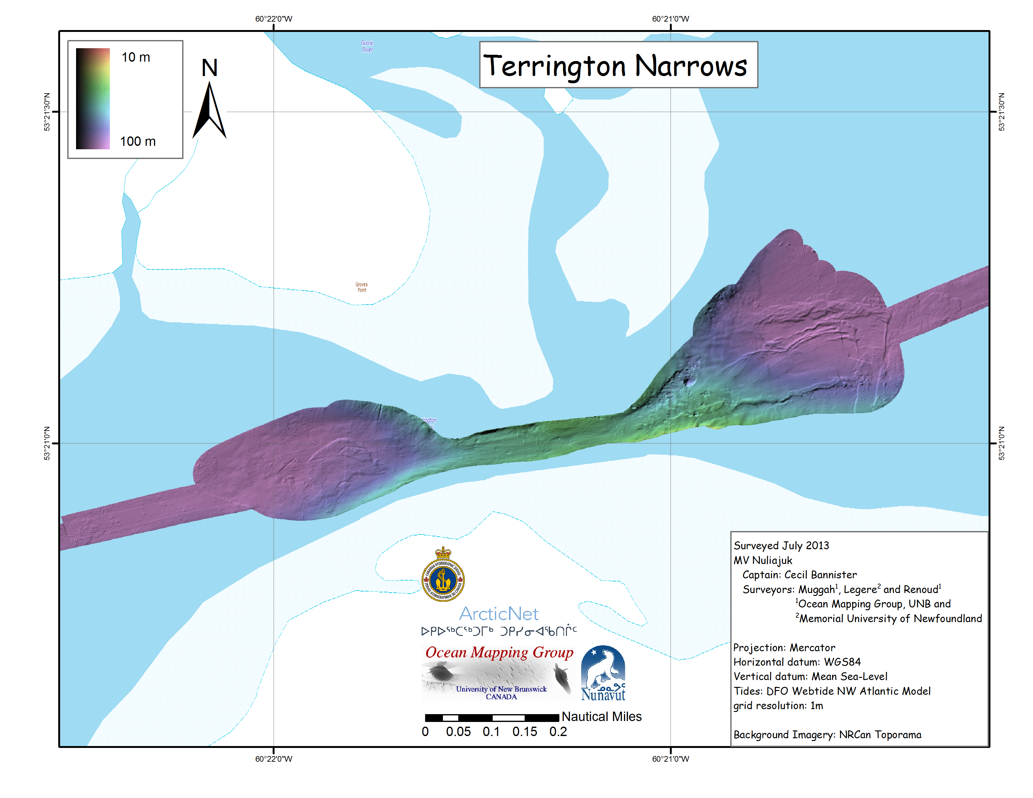
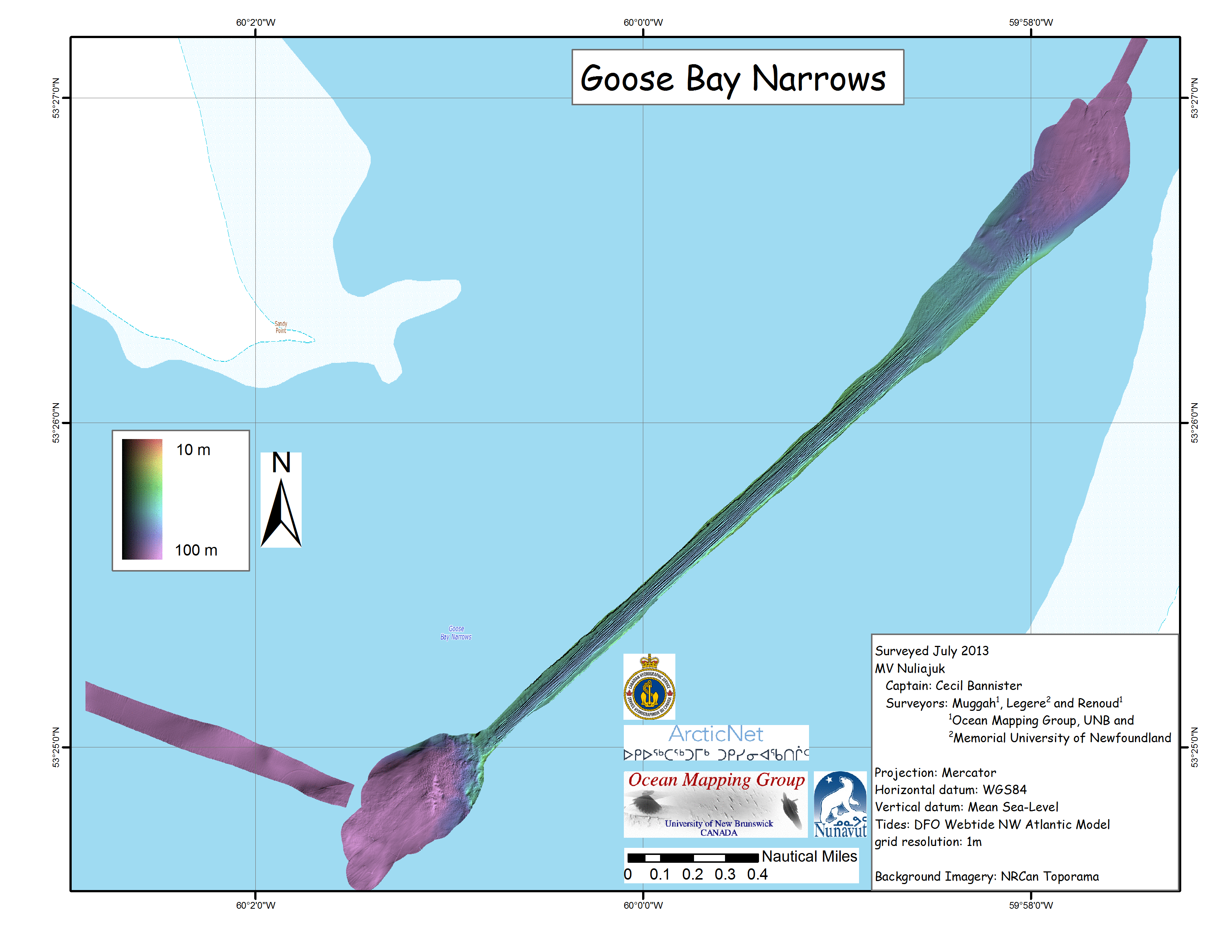
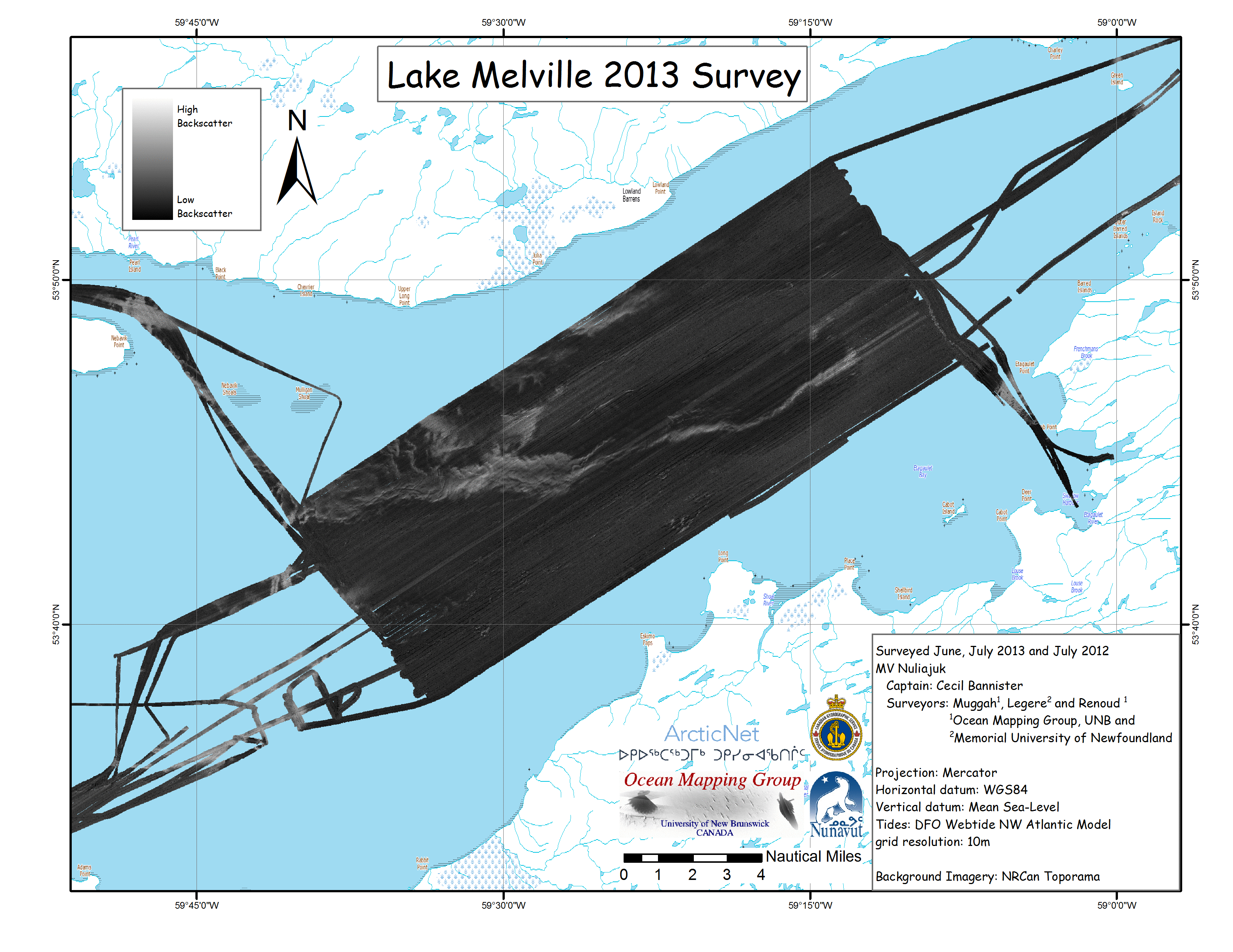
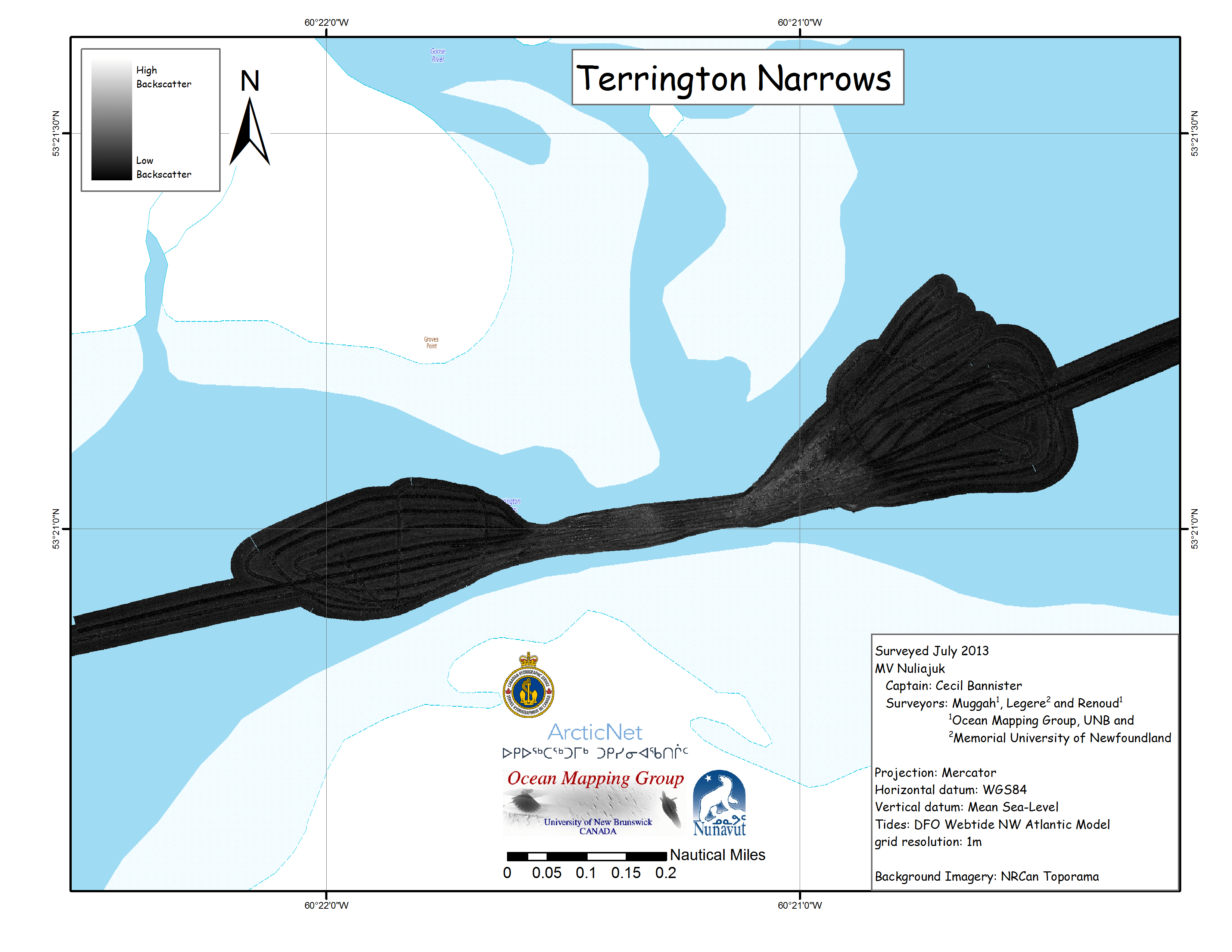
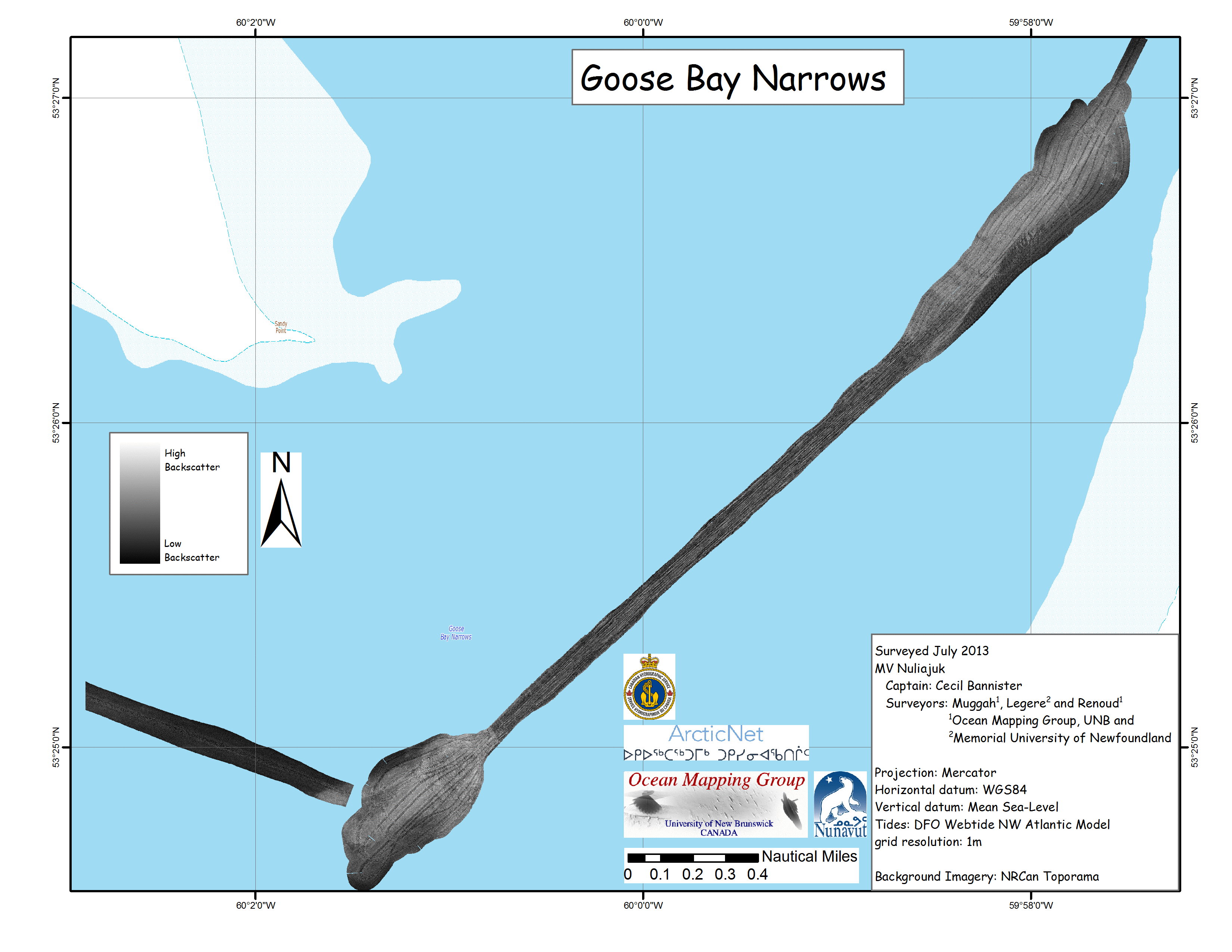
Nuliajuk 2013 Index

The web page presents an initial overview of the 2013 multibeam mapping program of the MV Nuliajuk. The Nuliajuk is a vessel owned and operated by the Government of Nunavut (GN), Dept. of the Environment, Fisheries and Sealing Division. This is the third year of Nuliajuk operations (second involving the Ocean Mapping Group), through a partnership between GN, ArcticNet (including the University of New Brunswick (UNB) and Memorial University (MUN)) and the Canadian Hydrographic Service (CHS). The vessel was equipped with a geoscience/hydrographic survey suite including multibeam and subbottom.

The instrumentation, owned and operated by the Ocean Mapping Group at UNB, includes:
The survey system complements the existing sonars suite on board including :
The instrumentation, loaned to the Ocean Mapping Group from the CHS, includes:
Details about the installation of survey equipment can be found here.
To view all multibeam bathymetry and backscatter the Ocean Mapping Group has collected up to 2012, click here.

Nuliajuk Track Overview
Lake Melville Track
Lake Melville


Lake Melville Coverage

For 20 days in June/July, the Nuliajuk operated in Lake Melville and the Goose Bay / Terrington Narrows.
The Lake Melville survey saw a significant portion of the central area of the lake mapped. The weather co-operated for almost the entire duration of the mapping, leading to high quality bathymetry and backscatter. On average, five lines (~20 Nm in length) were run per day allowing two corridors to be built into anchorages at Mulligan Bay (Northwest) and Etagaulet Bay (Southeast).
There were minor problems in Lake Melville with the F185 motion sensor, the initial calibration took more than the required time to complete. This is probably due to the baseline offset between the antennas. It was also noted that high speed maneuvers speed up the calibration. Near the end of the survey (~JD178), the F185 heading sensor began to drift, requiring a few figure eights to get it to lock on.
For the Narrows surveys a Trimble 5700 GPS base station was set up in Northwest River. The distance from the base station to Goose Bay narrows was ~15km and to the Terrington Narrows was ~25km. The base station will be used in post-processing to increase the horizontal and vertical accuracy allowing the surveys to be referenced to the ellipsoid, effectively removing the effects of the tide.

Melville Overview


Melville Whole MB
Melville Whole BS

Lake Melville
Terrington Narrows
Goose Bay Narrows
Lake
                Melville MB
Terrington MB
Goose Bay MB
Lake Melville BS
Terrington BS
Goose Bay BS


page created by JMuggah, October/November 2013