| Geology and Geomorphology
of the Passamaquoddy Bay Region. |
|
The Passamaquoddy Bay is an estuary in the northwest of the
Bay of Fundy along the New Brunswick - Maine border. Bay topography
is dominantly a gently rolling landscape with a drowned shoreline.
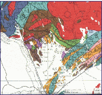
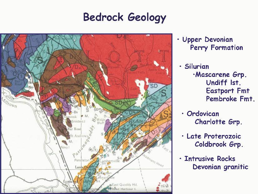
Geology.
The erosively resistant bedrock consists
mainly of Silurian and Devonian sedimentary and volcanic facies which
occurs between a Devonian granite to the north and a PreCambrian granite to
the south. Ordovician sedimentary and intrusive rocks occur in the north of
the area and PreCambrian volcanic rocks are present in the southern
part of the Bay region (Cummings. 1967).
|
|
|
Glaciation.
In the Pleistocene Passamaquoddy Bay was traversed by glaciers
moving to the south east. Subsequent to the loading by the ice sheets
the area has experienced isostatic depression, rebound, submergence and
emergence.
Surficial material now consists entirely of glacial and fluvioglacial
deposits which being unconsolidated deposits erode easily and provide a
rich and mobile source of sedimentary material.The classic stoss and lee
forms, and striated bedrock surfaces commonly occur. Amongst the larger
scale glacial deposits are a terminal moraine across the southern part of
Deer Island, outwash deposits near Pennefield Ridge and local amounts of
glacial and fluvioglacial sands and gravels.
The regions present drainage system is characterized by a southeasterly
flowing river system which cuts across the northeasterly trend of the bedrock.
The Didgequash and Magaguadavic Rivers may have had their courses changed
by glaciation (Cummings. 1967).
|
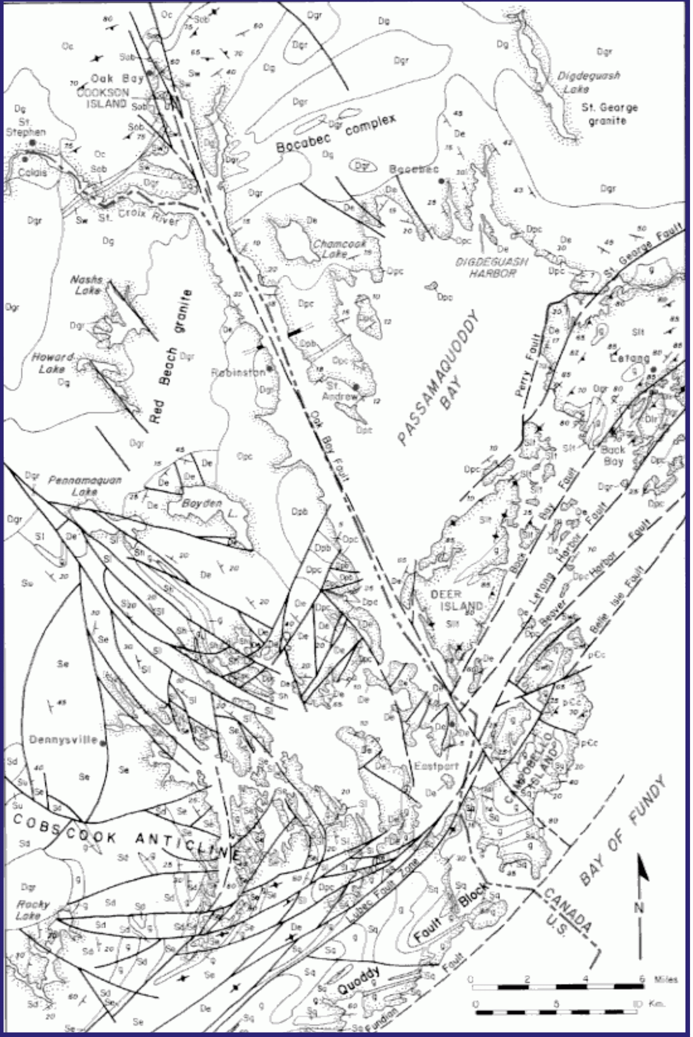
Structural Geology and Seismicity.
During the Mesozoic the Acadian Orogeny produced a gently folded asymmetric
syncline with a northeast trend, this major structure lies just to the
south of Passamaquoddy Bay. Within the region there are northeast trending
anticlines and minor synclines.
The Passamaquoddy Bay region has been identified by Barosh (1981) as a
seismically active area with some fifty seismic events since 1870.
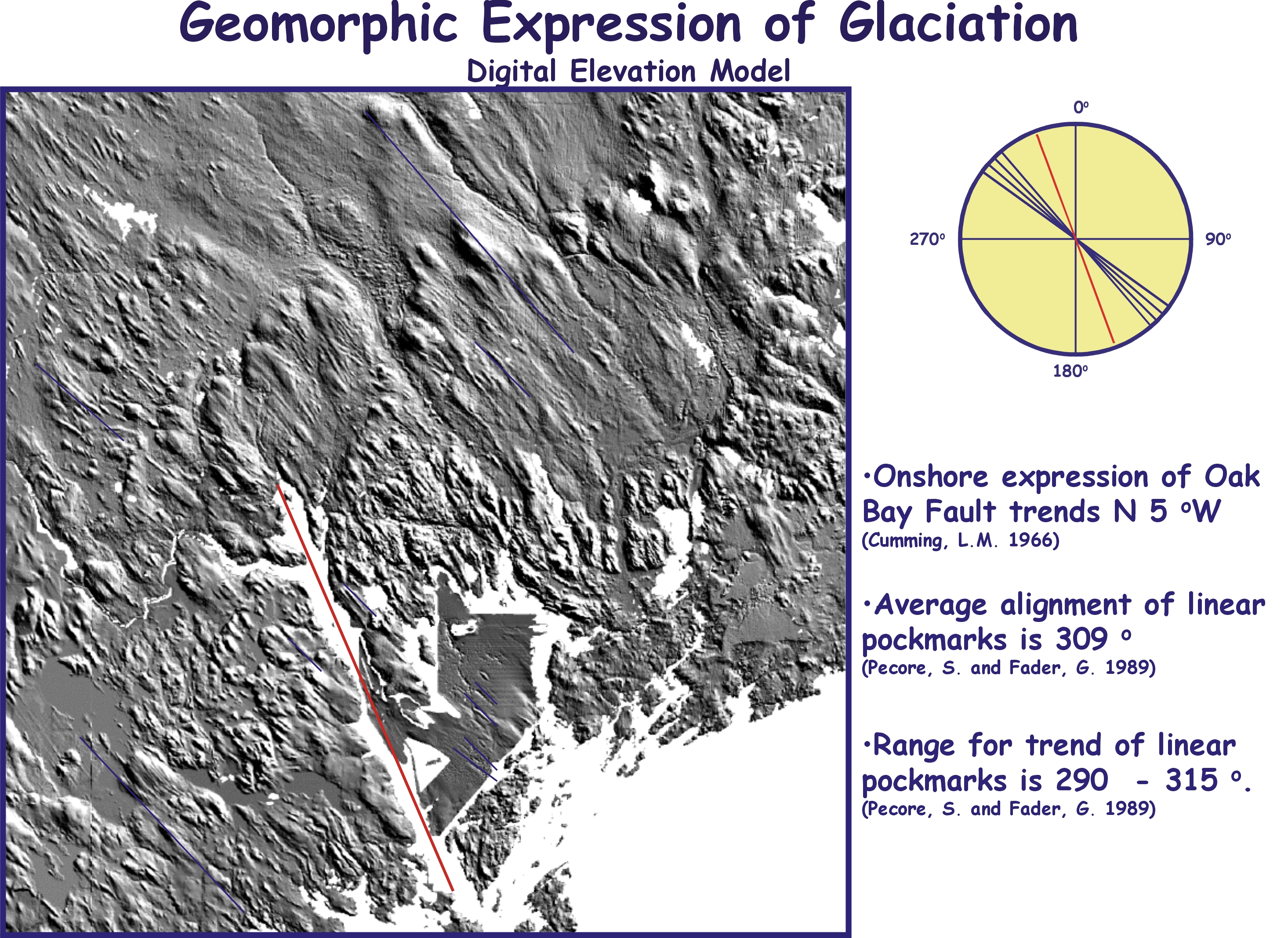
There are two major faults in the region both strike slip. The primary fault
is the Lubec Fault which trends northeast. This fault is offset by
the complementary north to northwest trending Oak Bay Fault which follows
the international boundary and the St. Croix River (Cummings, 1967). |
|
|
Plots of the epicentres of seismic events on a geological map of the region
suggested that earthquake activity might be related to movement on the Oak
Bay Fault (Rast et al.,1979). Other workers have related the earthquake
activity to a general subsidence of Bay, with accompanying minor movements
on the faults in the area (Barosh, 1981).
The Oak Bay Fault offsets Silurian and Devonian rock units. The fault is
transected by a Triassic dyke but there is no apparent offset, which would
tend to indicate that there had been no recent lateral movement along
this fault (Burke and Stringer, 1993). An examination of glacial striations
at twenty-four locations in the vicinity of the fault indicated no postglacial
displacement. Quaternary sediments found adjacent to the fault were
not displaced.
|
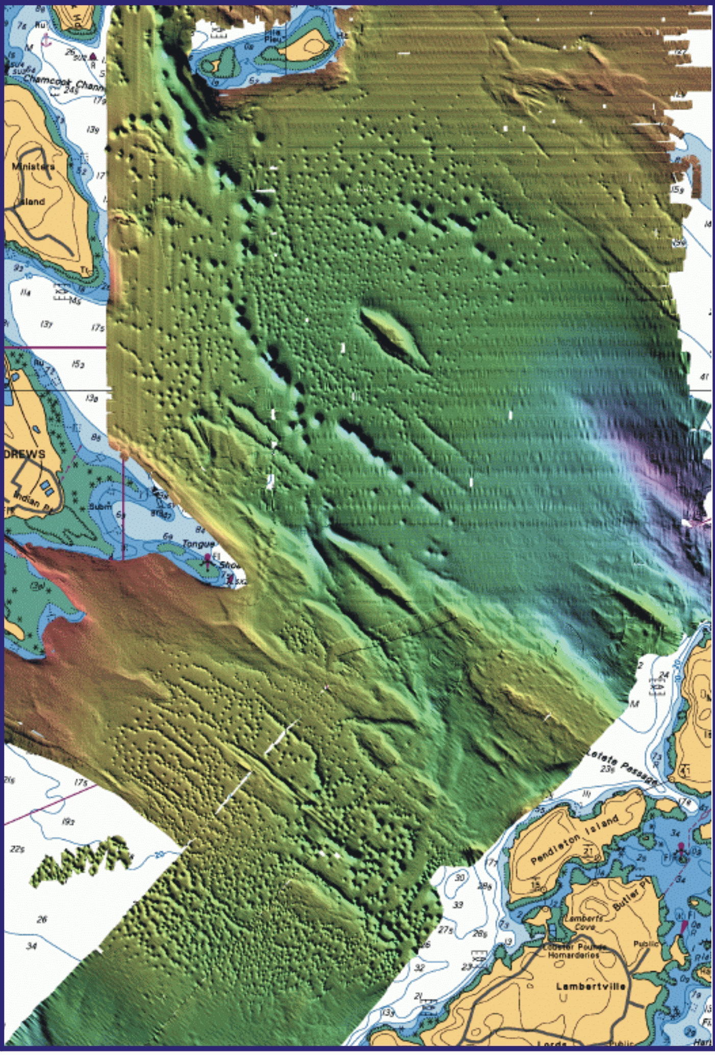
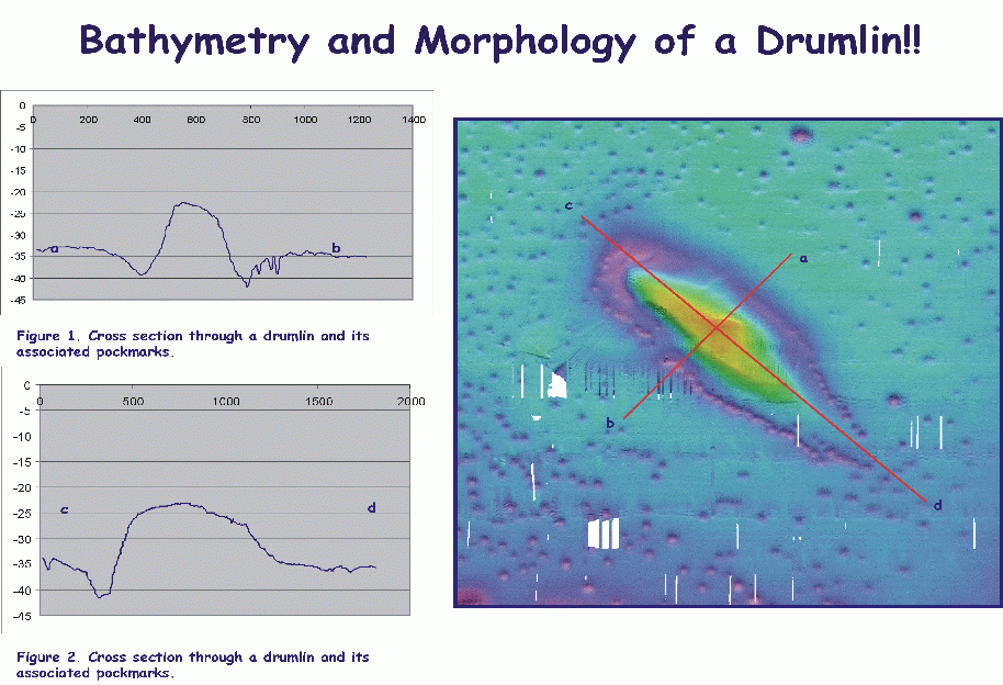
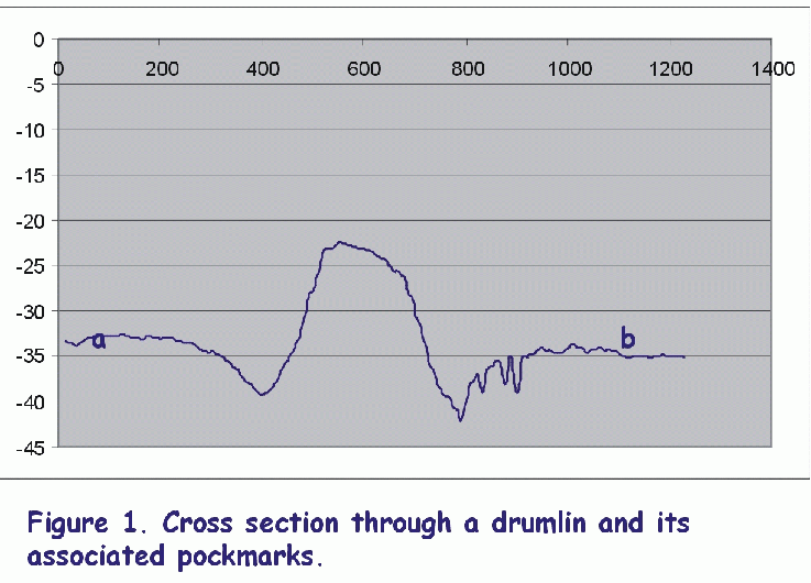
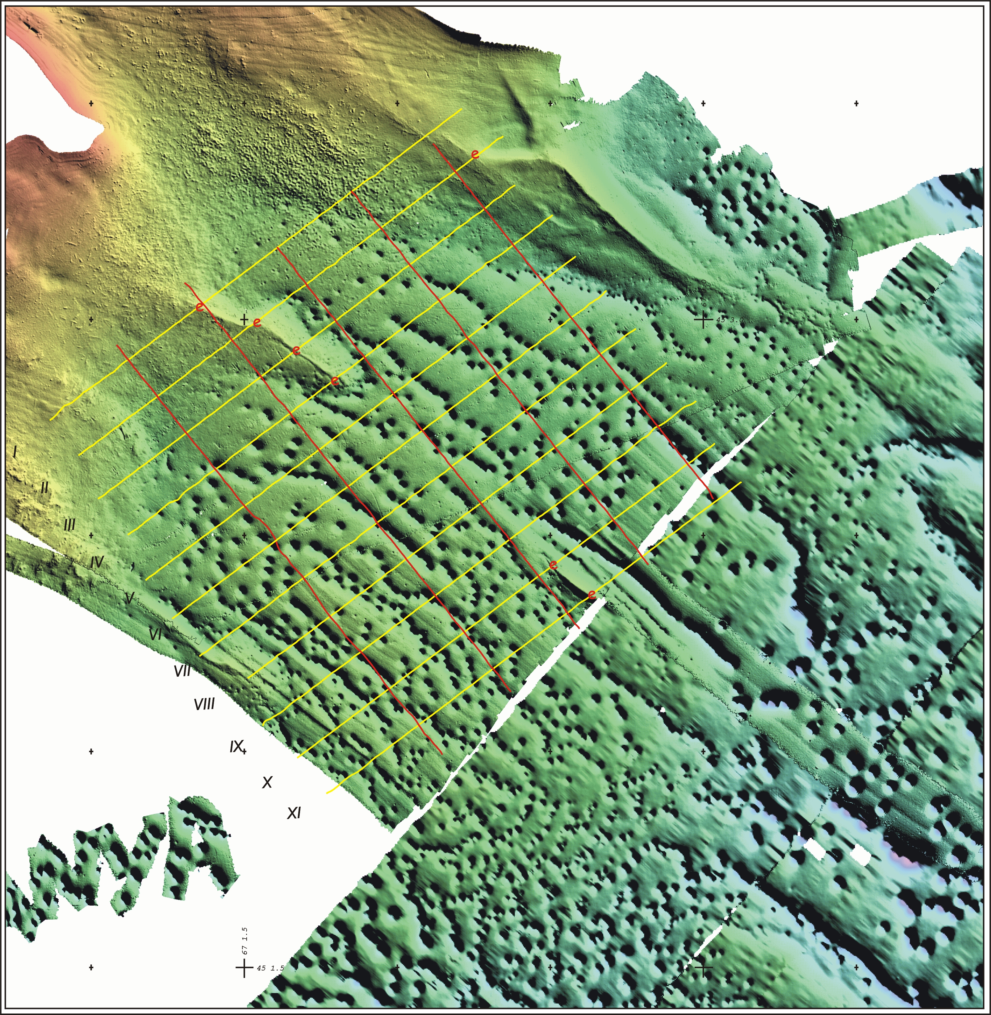
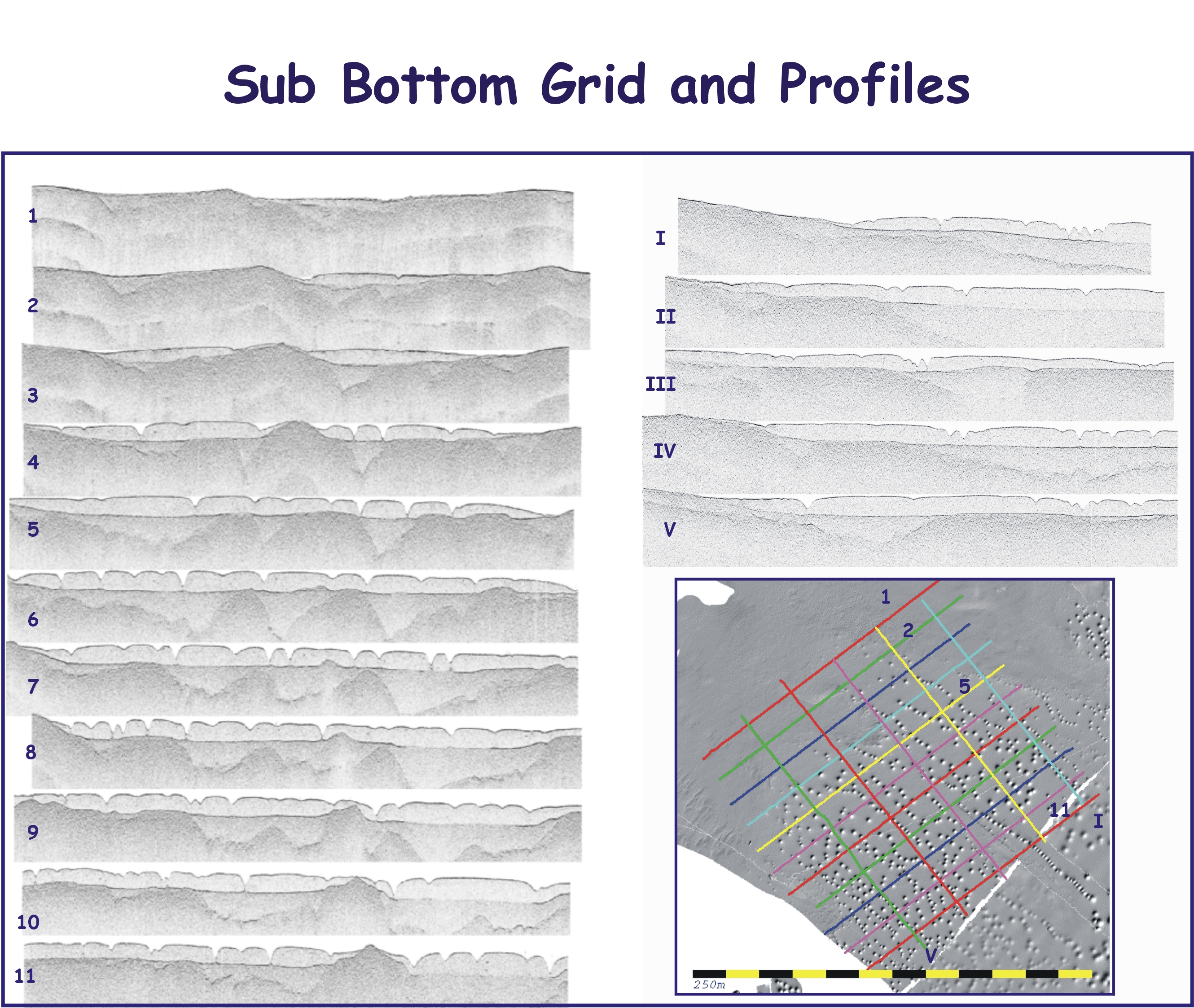
A marine
geophysical survey in 1988 partially mapped the bay seafloor making the discovery
of an abundance of pockmarks and plumose structures. In a report
by Pecore and Fader (1990), it was noted that there was a north western alignment
of some of these pock marks which they associated with northwest trending
faults. It was suggested that recent movement along the faults in Passamaquoddy
Bay may have allowed the release of gas or fluid creating the pock marks in
the overlying muddy unconsolidated sediments. This does not look to
be the case.
|
