 click for full res. animation |
Regional ADCP Current Measurements Shippagan Bay Survey 2003 John E. Hughes Clarke, Anya Duxfield and Beth-Anne Martin Ocean Mapping Group University of New Brunswick |
click for full res. animation |
Regional ADCP Current Measurements Shippagan Bay Survey 2003 John E. Hughes Clarke, Anya Duxfield and Beth-Anne Martin Ocean Mapping Group University of New Brunswick |
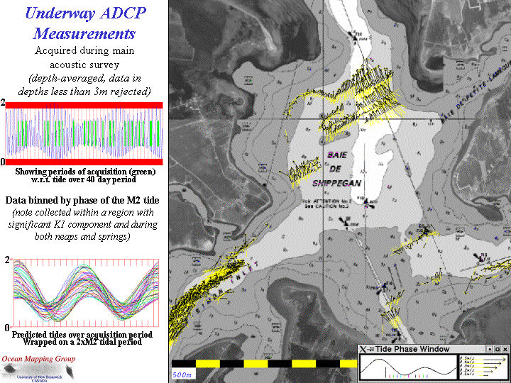
 Whilst
the regional multibeam/sidescan/subbottom survey was being conducted, a
pole-mounted 600kHz acoustic doppler current profiler (ADCP) was
deployed to measure instantaneous current profiles beneath the vessel
wherever she went. The aim was to make measurements of the currents
field through the bay as a function of the M2 and K1 tides.
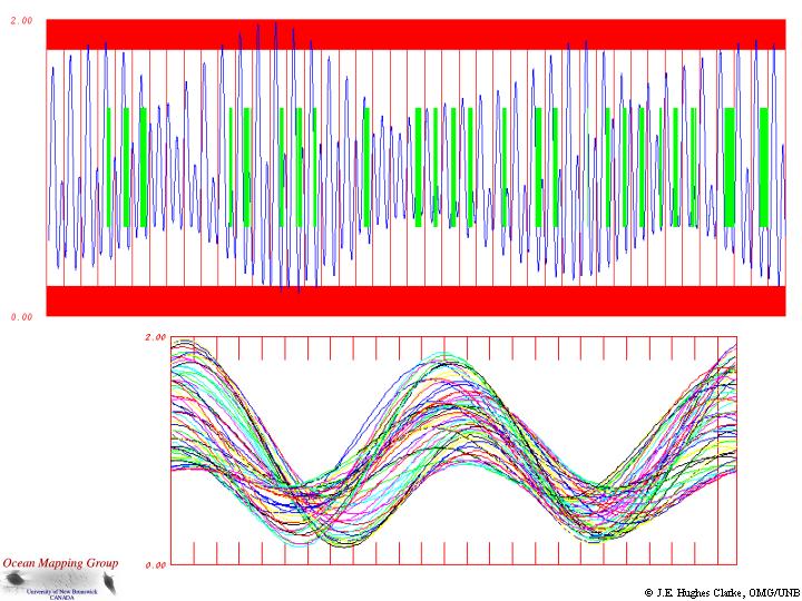
Nevertheless, it should be realised that during the ~ 40 day survey
window, the tides ranged from neaps to springs, from dominantly diurnal
to dominant semi-diurnal (see adjacent figure).
Whilst
the regional multibeam/sidescan/subbottom survey was being conducted, a
pole-mounted 600kHz acoustic doppler current profiler (ADCP) was
deployed to measure instantaneous current profiles beneath the vessel
wherever she went. The aim was to make measurements of the currents
field through the bay as a function of the M2 and K1 tides.
Nevertheless, it should be realised that during the ~ 40 day survey
window, the tides ranged from neaps to springs, from dominantly diurnal
to dominant semi-diurnal (see adjacent figure).