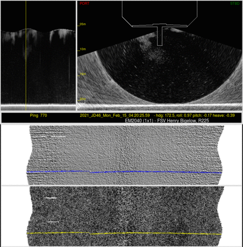
FRV Henry Bigelow R225
EM2040 install
issues.
John E. Hughes Clarke
Center for Coastal and Ocean Mapping
University of New Hampshire
Durham, NH
|
Harper Umfress LTJG/NOAA
Field Support Liaison - Pacific
Hydrographic Systems & Technologies Branch
7600 Sand Point Way NE, Seattle, WA 98115
|
This is based on data samples provided by Harper Umfress from the
February 2021 assessment of the performance of the new 0.5x1.0
EM2040 recently installed on the Dyson Class FRV, Henry Bigelow
(R225).
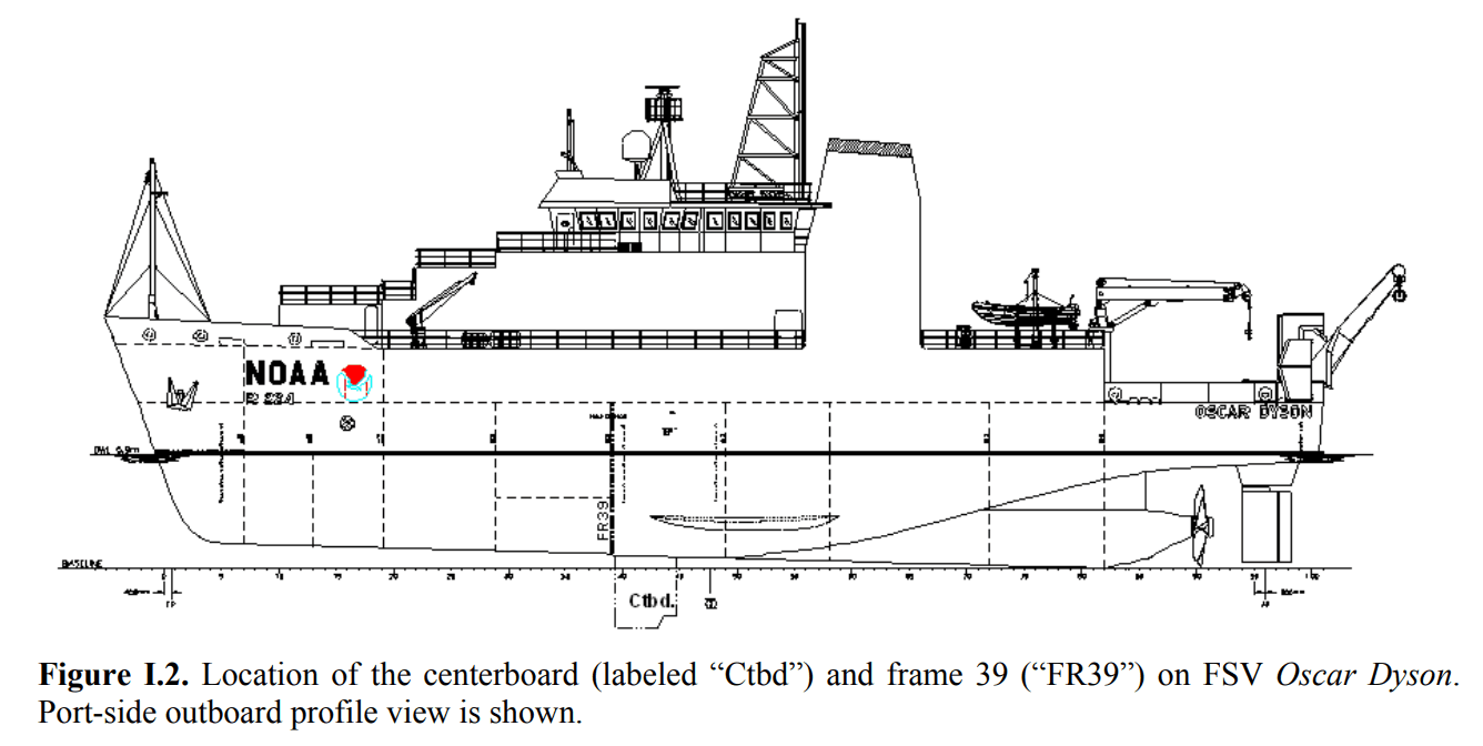
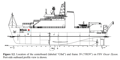
I've had to guess a bit on the dimensions of the Bigelow. From what
I could glean from other FRV reports/Wikipedia, the Oscar Dyson
Class are 64m long, with a beam of 15m. They have a draft of 5.9m,
growing to 9.2m with the centreboard down.
|
 |
from Cruise Report, Cutter and
Demer, 2008,
California Current Ecosystem Survey 2006 -
NOAA-TM-NMFS-SWFSC-415
|
"
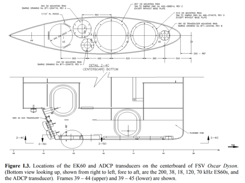
The keel could be used in retracted, intermediate, or
extended positions, placing the transducer faces at:
0m, 2m or 3.75m below the ship’s hull,
respectively
(5.4m, 7.4m or 9.15m below the sea surface). "
|
For the animations below, I've assumed the 2040 is 33m back from the
bow mounted ~ 2.2m to starboard of the centreline., and the
centerboard is on the centreline, is 1.0m wide and is fully (3.75m)
extended.
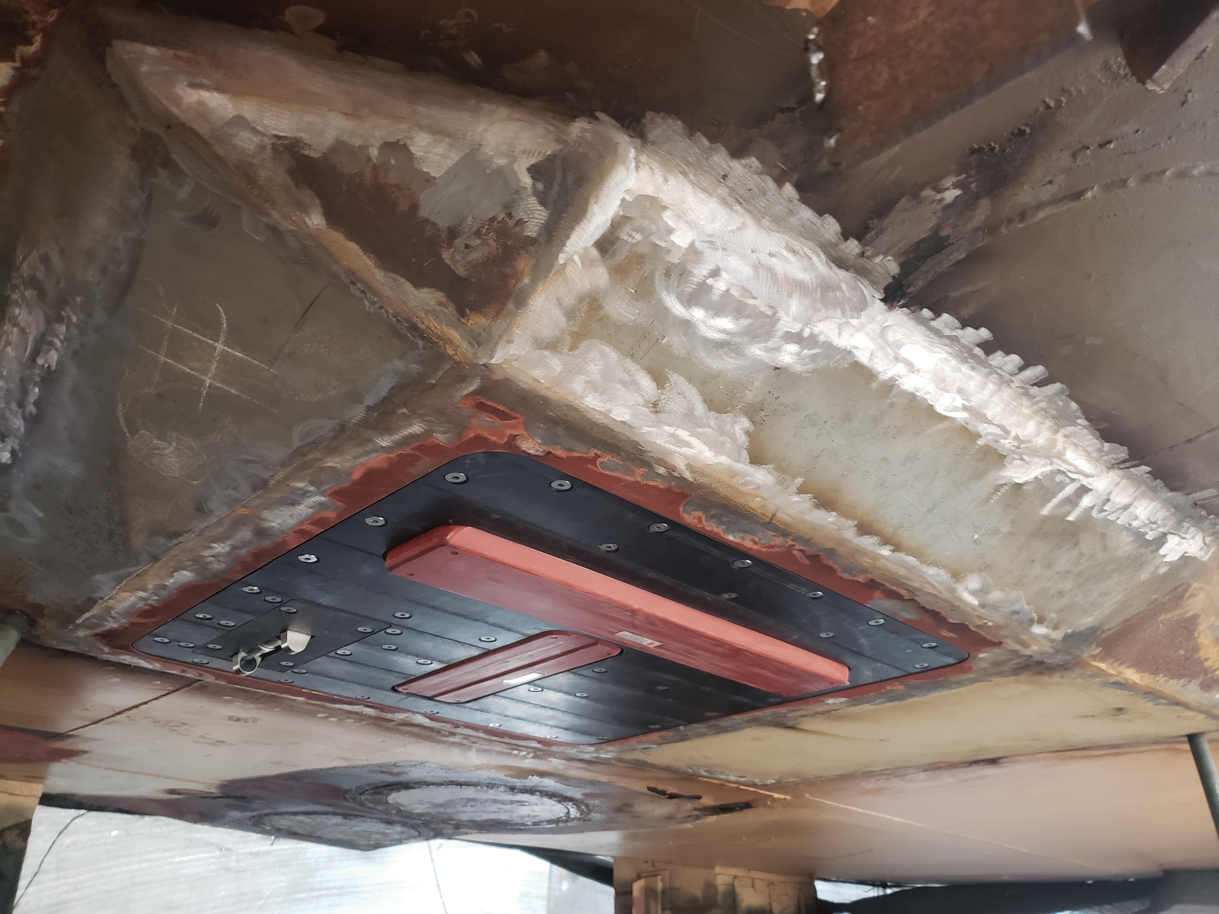
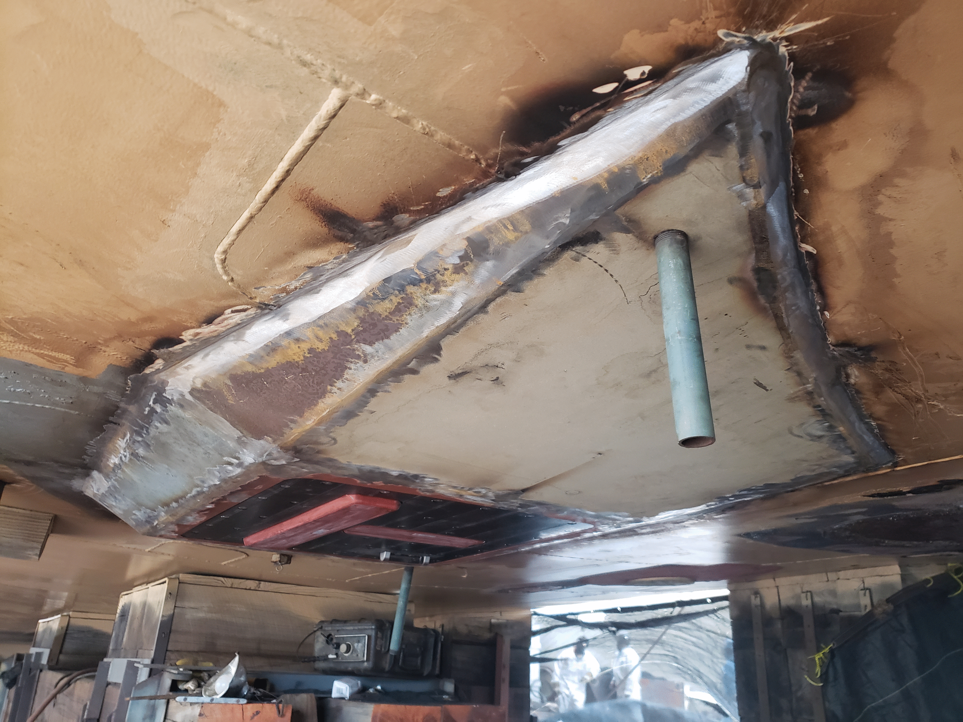
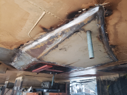
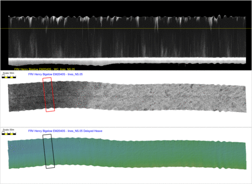
Details of the Hull Blister
Timothy Lichter of KUTI kindly provided the following photos of the
blister, acquiring during the install (before final painting). It
appears to be installed flush with the hull, just offset to
starboard and ahead of the centreboard.

|
 |
view of downstream edge (see
SV sensor abaft)
|
view of upstream edge
|
According to the parameter file in the .all files, the RP is truely
at the waterline (?), and the Tx and Rx are 5.6m below and ~ 2.2m to
starboard. Both are pitched up ~ 1.7 degrees.
- WLZ=0.000 (deliberate?)
- Transmitter:
- S1X=0.042
- S1Y=2.349
- S1Z=5.621
- Receiver:
- S2X=0.045
- S2Y=2.043
- S2Z=5.605
The Dynamic Integration (Wobble) Issue
A conspicuous motion-correlated residual is present in the real-time
data that needs to be better understood. Additionally the water
column imagery indicated extensive bubble fields. Fortunately,
however, masking or attenuation of the bottom tracking bathymetry or
backscatter was not particularly significant.

|
 |
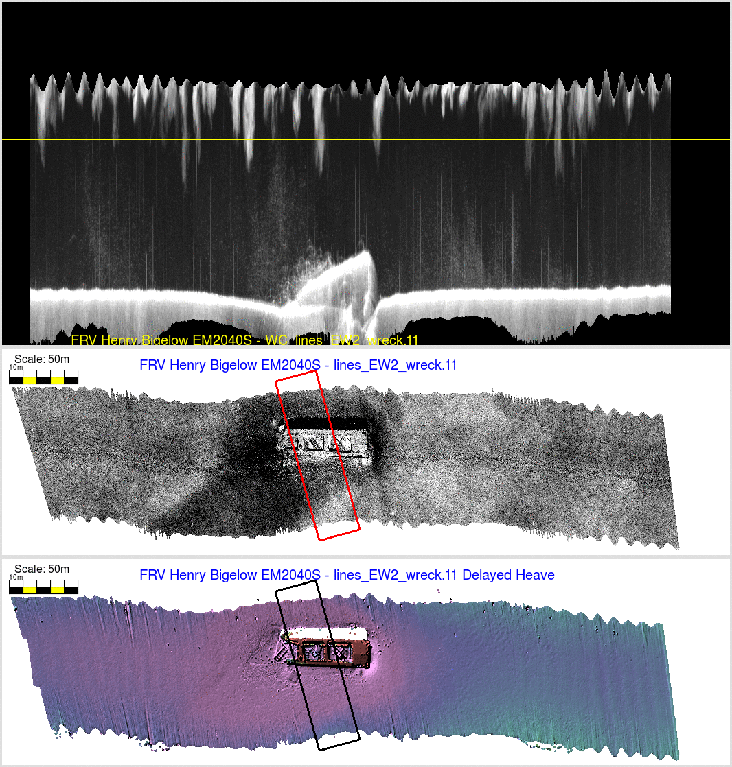
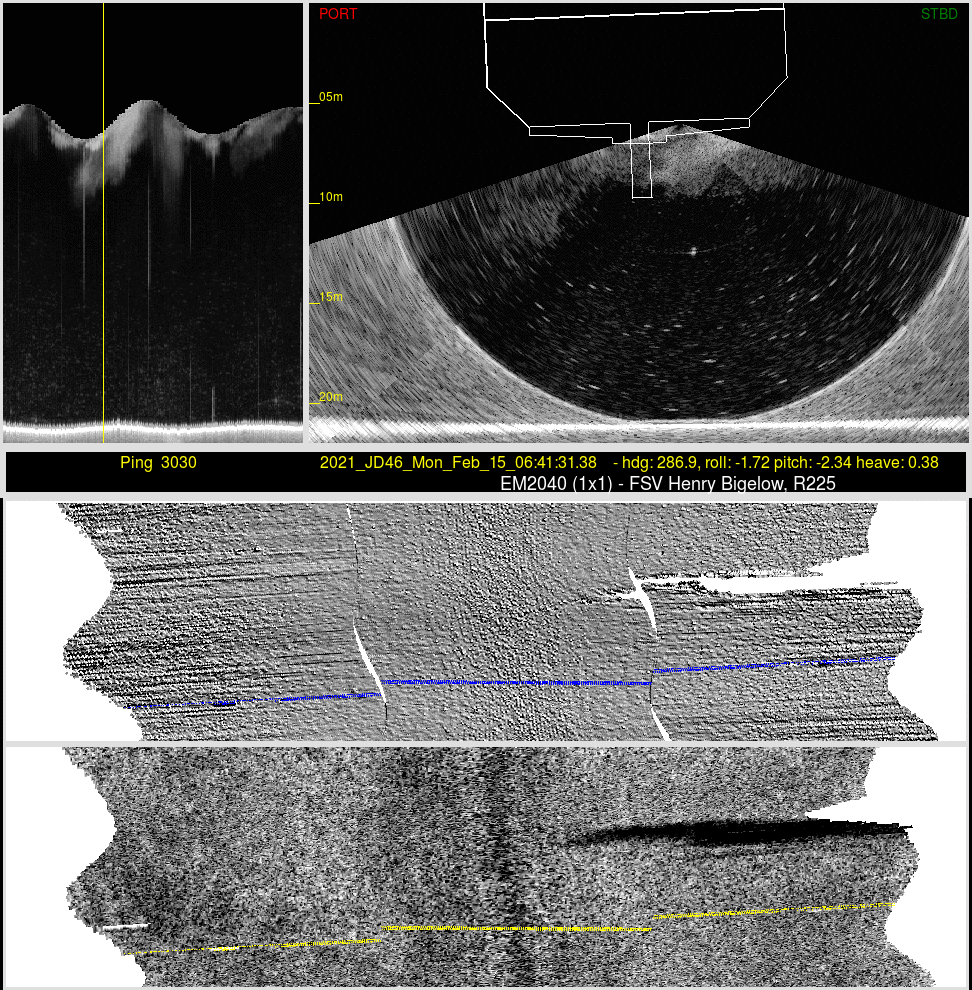
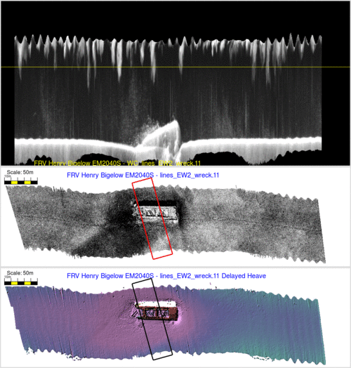
Patch Test Sample Data
As part of the patch test on the 14th February 2021, a
series of lines were collected in 21m of water. Apart from a
conspicuous wreck for timing and pitch, the surrounding area
was remarkable smooth and thus ideal for revealing dynamic
integration issues (wobbles).
- a pair of lines were run N-S,
- a pair were run NW-SE
- and several pairs were run E-W over the wreck.
These are presented below, with the associated water column
imaging that reveals the natural bubble plumes already
present in the ocean.
|
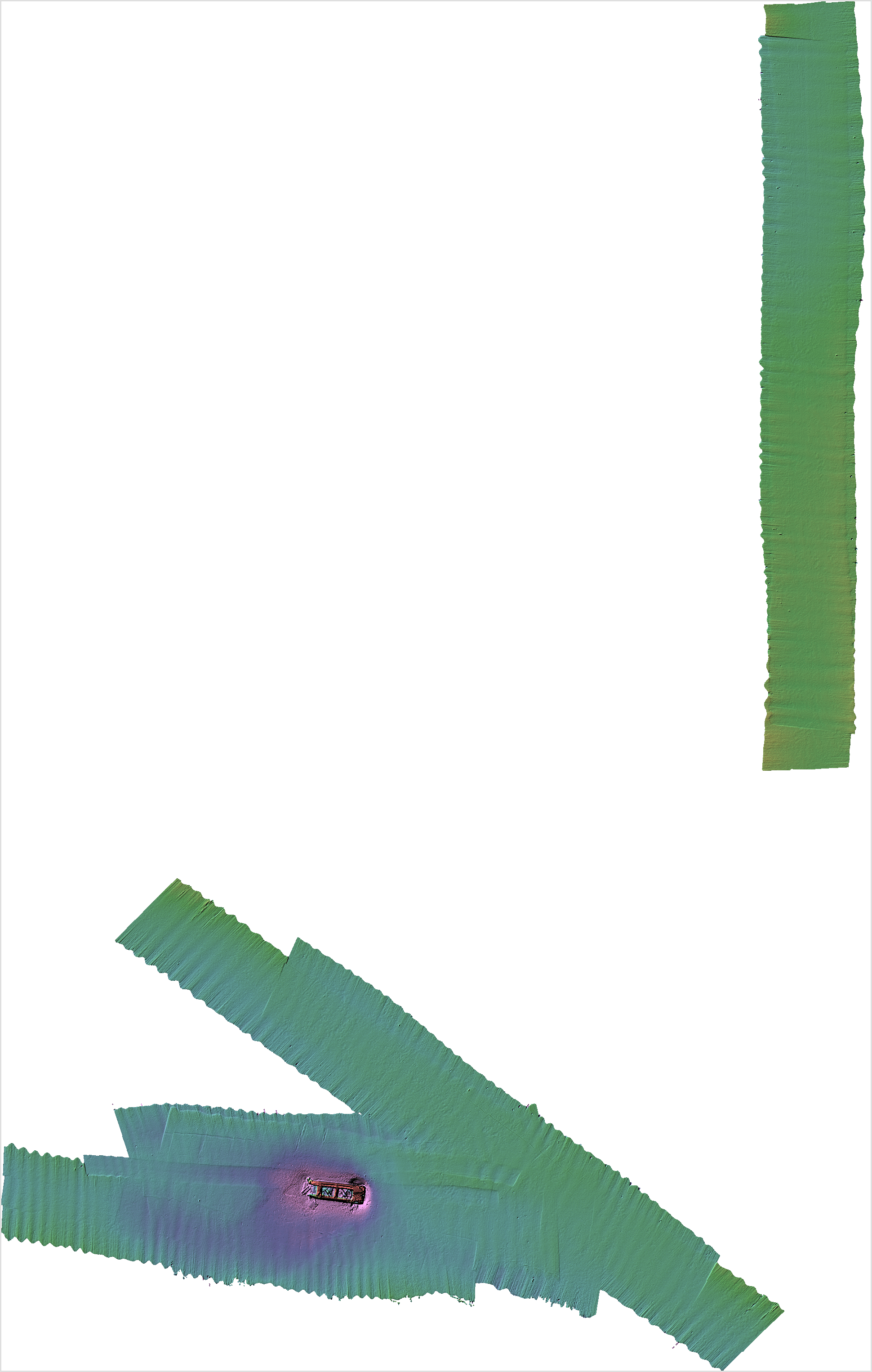
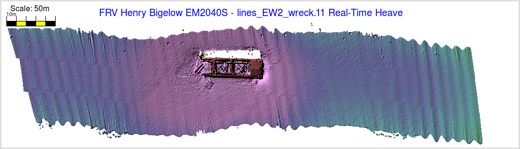
What is the across -track ribbing
(wobble) in the Bigelow 2040 data?
In the real time data (see map above), there is a very apparent
heave artefact running through all the data. What is causing that,
and how big is it?.
On the 15th of February, conditions were :
- 4-5 ft chop,
- 5-7 ft swell @ 340
- 30 kt winds at @ 340.
In all, not a nice day, but the FRV are designed to collect ICES
compliant acoustic data is such marginal seas. They of course have
the luxury of the centerboard 3+m below the main hull, which the
2040 does not.
How was the vessel responding to these seas? As the artefacts run
through nadir, they are believed to be some sort of heave residual
due to either a false lever arm or imperfections in the real time
heave. The second hypothesis proved to be the cause. To investigate
that the difference between the real-time and delayed heave is
presented.

|
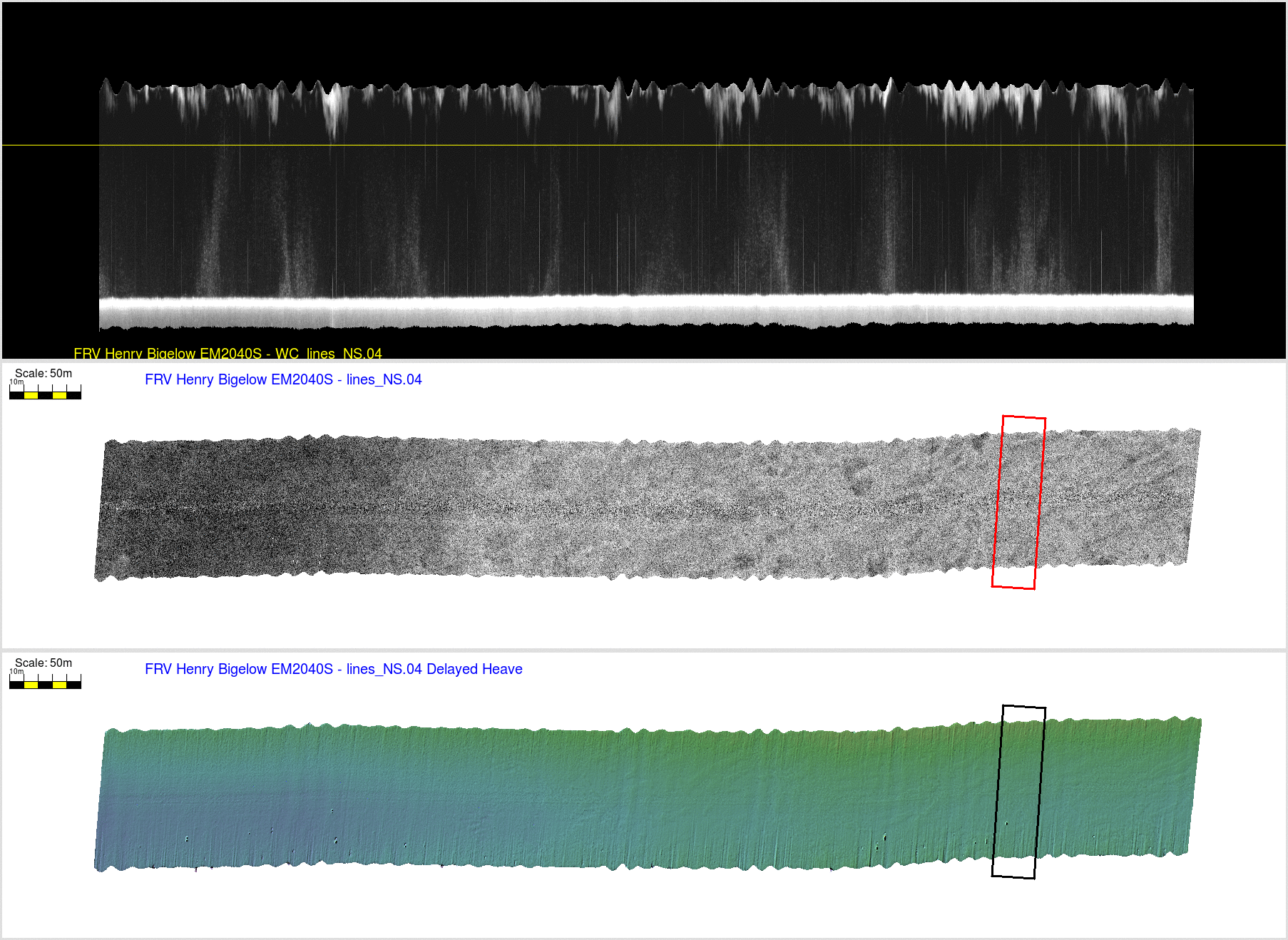
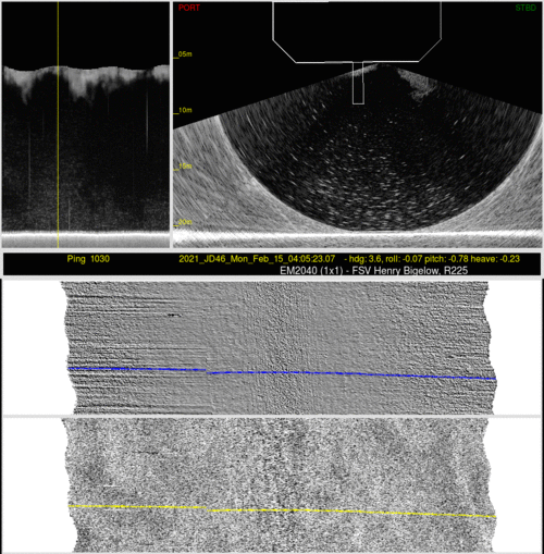
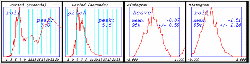
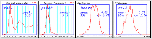
The data is always initially viewed through
SIS using the real-time data steam, From that, while the
full integration is done, it has to use the real-time heave
feed rather than the delayed heave (logged in the group 111
telegrams in the POS data stream ~ 200 seconds after
real-time).
Comparing the two heave outputs (figures to the left) over
the ~ 4 hour period of the patch test, one can see that
there was typically ~ +/- 0.5m of heave. Analysis of
the heave during the actual lines compared (see figures
below) show that it started at +/-0.4m for the NS
lines, increasing to +/-0.8m of heave for the E-W
wreck lines.
While the two heave signals look similar, it is important to
examine:
- their instantaneous differences.
- their long period drifting
1 - The instantaneous difference (center plot) shows that
there usually was ~ +/- 0.1m of difference that was changing
over the typical wave period. And it is that which is
subtracted in the figures below.
2 - The long period effects can be seen from the 30 second
low pass filtering of the two solutions (the overlain green
line). From those one can see that both data sets suffer
from long-period drifting (even though both are high pass
filtered).
The delayed heave uses an acausal filter and thus this is
minor, but will just reflect any slow speed changes. One can
see near-static offsets of a few centimeters as the lines
reversed.
The real-time heave is by necessity causal and thus one sees
larger impulse responses during the turns (when the vessel
speed changes and the squat adjusts).
The actual differences are a combination of the short period
(within wave period) and long period
differences. What shows up in the grids that the eye
notices, are the short period differences. Exactly why they
are there is not clear. Often a too short heave bandwidth
setting can be a problem, but the motion here was only ~ 6
seconds.
|
The difference in heave values peaks at about 15cm but is usually
within +- 10 cm, which may be within IHO specifications. But
on these, otherwise featureless, Gulf of Mexico seafloors they
show up clearly.
The noticeable difference between real and delayed heave coming out
of the POS has long been known and reported as part of the NAVOCEANO
open ocean TAGS testing (first noted in 2007, and still a problem in
the 2020 trials). Their operational solution is, of course, to apply
delayed heave. Interestingly in 2011 and 2012, NAVOCEANO tested a
competing sensor that also provided both a real-time and delayed
heave solution. Notably, that sensor did not exhibit nearly
the same level of difference between real-time and delayed have (and
all bandwidth settings were tested).
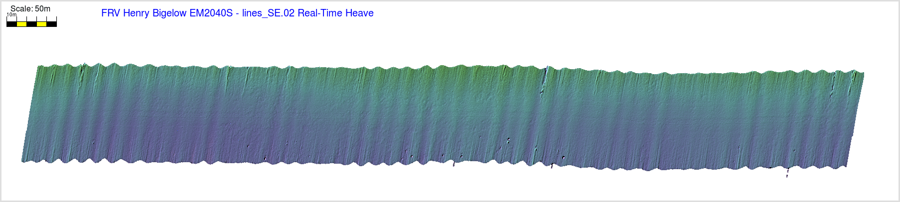
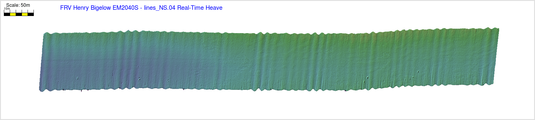
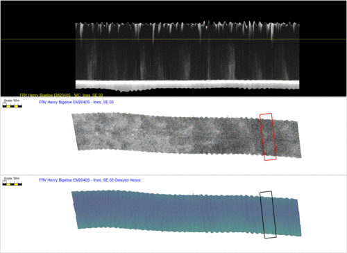
The figures below show three lines into the seas run at the
three headings, alternating between the real-time and delayed heave
solution. The improvement is very apparent and removes almost all
the wobble. This will, however, add an extra level of
necessary post-processing to FRV-acquired data which, while not an
issue for standard OCS operations (which do full PPP and
reprocessing through POS-Pac), is concerning for the reduced manning
being envisaged for the FRVs.
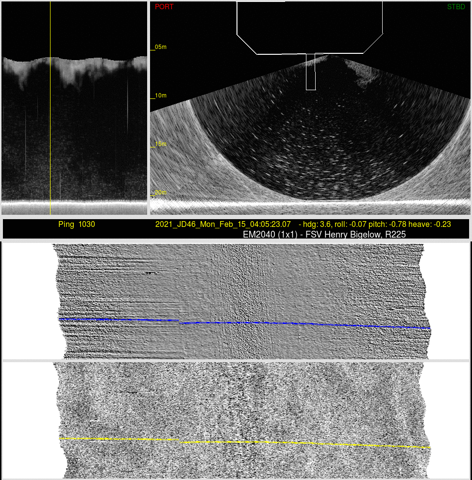
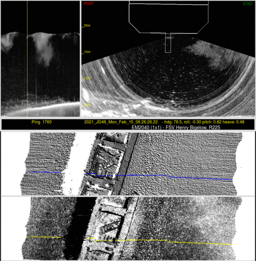
The Bubble Wash down or Wave Plume
Issue:
In addition to the real time wobble problem, it was apparent that
the marginal sea states were impacting the quality of the data. To a
first order these were suspected to be motion correlated, perhaps
related to wave-driven bubble sweep.
To investigate this suspected bubble sweep, three pairs of
reciprocal lines (N-S, E-W and NW-SE) are presented below to assess
the performance of system going into or against the seas. In
each case, a vertical section of the water column scattering under
the vessel is presented, geographically registered to the
corresponding seabed bathymetry and backscatter. And for
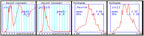
each, the spectrum of the roll and pitch is shown together with a
histogram of the roll and heave distribution.
To illustrate any correlation between vessel motion and bubble
generation, for a short 6 second window (~ one wave
period) 100 swath (50 dual ping cycles) are presented as an
animation.
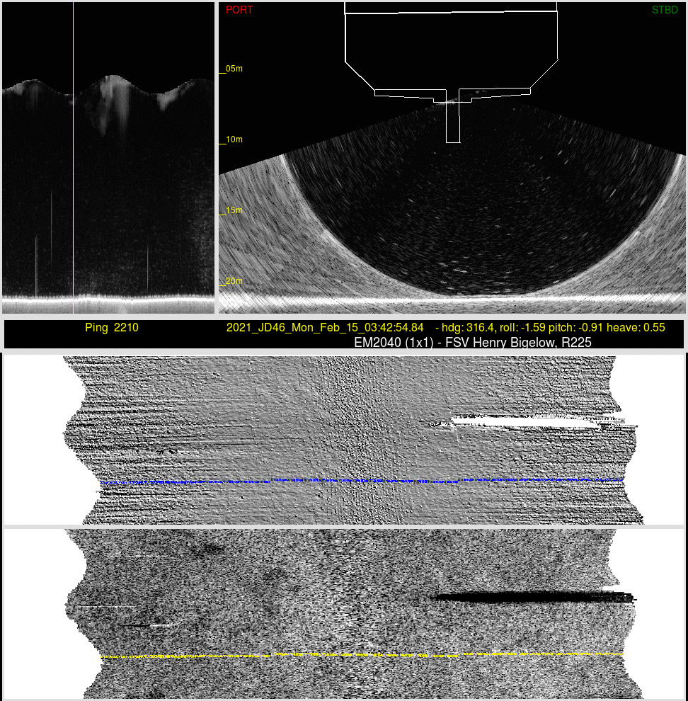
North South Lines:
There is a significantly higher bubble plume frequency
and intensity going into rather than with the seas.
Nevertheless, at either azimuth, the data was not
compromised.
heave is ~ +/-0.4 m.
line 04 -steaming North
|
line 05 -steaming South |
shorter period pitch, less rolling, same heave
|
longer period pitch, more rolling, same heave
|

note undisturbed BS and bathy.
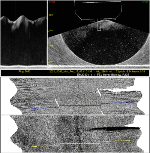
|
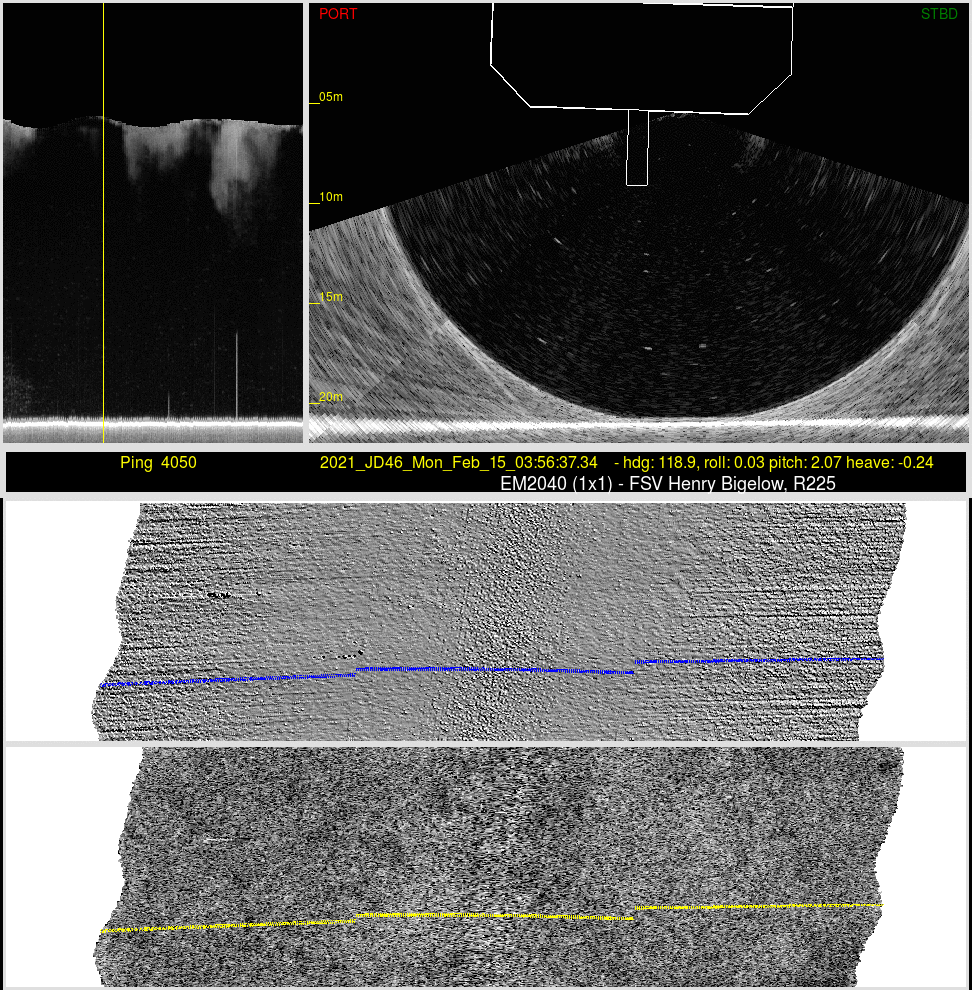
 |
this subset was chosen to be where the water column
scattering was the highest. Nevertheless, there is no
apparent impact on the seabed bathymetry or backscatter.
|
this was chosen where interference from another sonar was
suspected. But again no masking of the seabed backscatter
intensities, nor modulation of the bathymetric tracking was
apparent.
|
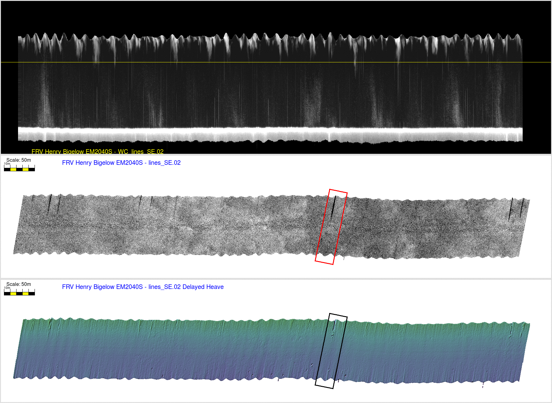
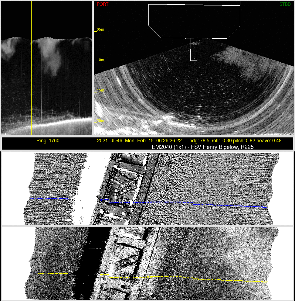
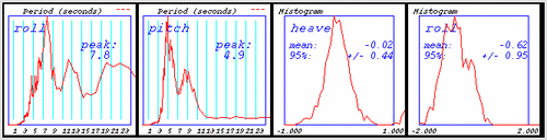
SE-NW Lines
This second pair of lines were run SE-NW. The pitch period
wasn't significantly different on the reciprocal, suggesting the
waves were on the beam?. Nevertheless, bubble masking was now
seen, but only steaming to the NW.
Heave now increased to ~+/-0.55 m
line 02 -steaming NorthWest
|
line 03 -steaming SouthEast |
1 deg roll bias to port
longer period roll, more heave, more roll
|
1 deg roll bias to stbd
shorter period roll - less heave
|

note bubble masking stripes in BS
|
 |
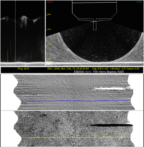
complete masking due to intense cloud over to starboard
(extending from hull to 4m below). It never appears to
actually reach the transducer.
|
period of almost no motion - ye the deepest local cloud
seen. But not intense enough to impact either the bathy or
backscatter modulation.
|
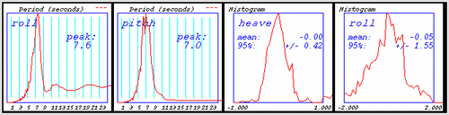
E-W Wreck Lines
The third pair of lines, conducted slightly later, were all
roughly E-W crossing the wreck site. Pitch period was shorter
going east suggesting into the seas. Interestingly though, the
bubble masking only occurred when going to the west.?
Heave now increased to a local maximum of ~+/-0.75 m
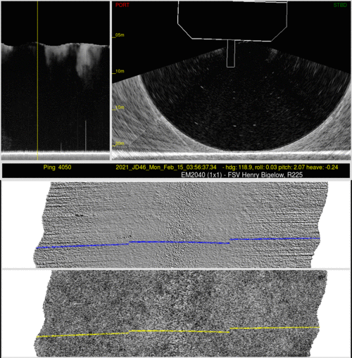
line 11 -steaming East
|
line 12 -steaming West |
1 deg roll bias to stbd
shorter period pitch, less roll - same heave
|
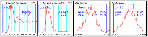
2 deg roll bias to port
longer period pitch, more roll, same heave
|
|
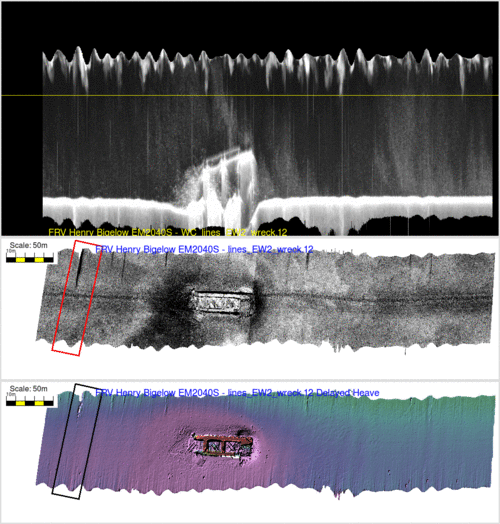
note bubble masking stripes in BS |
much deeper bubble cloud, but no high intensity regions and
thus absolutely no impact on bathy tracking or backscatter
modulation.
(nice view of wreck) |
The most intense masking seen. Note that it is a result of a
very intense cloud over to starboard that never actually
reaches the transducer. But it is still 2-3 below the hull
(7-8m below the surface).
|
What is very apparent is that the centerboard avoids almost all the
bubble cloud issues. The masking is seen for the 2040 data, but only
when the heave gets above about +/-0.6m. also the masking is
never directly below, the transducer, only offset at lower grazing
angles. And it also seems to be preferentially on the
starboard side (recall the array is offset to starboard)..
While pulsed bubble clouds are very apparent, it seems that they are
not related to the vessel motion. Rather they may be due to waves
breaking well forward of the vessel. Fortunately, most of the
time, while very clear in the water column scattering, the bubble
clouds are not intense enough to have a detrimental effect on the
2040 seabed backscatter intensity or the bathymetric bottom
tracking. The motion observed for this limited trial, however,
is unusually short (5-7 second periods more typical of inner shelf),
and thus probably wouldn't reflect a deeper outer shelf environment
where the FRV's more commonly operate.
The few times you do get intense masking, it seem triggered by
a "clump" of much denser bubble that are passing by. Notably, those
clumps are not necessarily right up against underside of the hull,
rather they are usually offset of the side and extend several
meters below.
It would be fascinating to temporarily add a forward-looking
multibeam to the front of the centreboard to see what is coming- and
from where...
page created by JEHC, June 2021