Celtic Sea Surface and Subsurface Morphology
from CE surveys 2016-2018


John E. Hughes Clarke
CCOM-UNH


Hi Sara and Fabio.

This shows you the three main surveys that I've cranked through the subbottom for.  For each I made a combined plot of each of the E-W profiles together with its plan-view association with the bathymetry and backscatter at the surface.

I should really go back through all these and provide a common output....

Subbbottom Structure :


location
CE1601

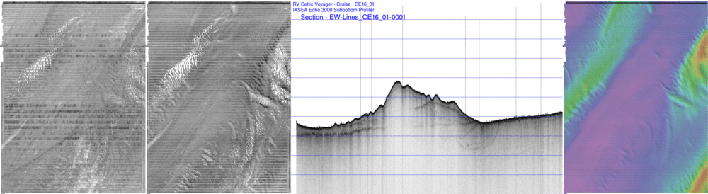
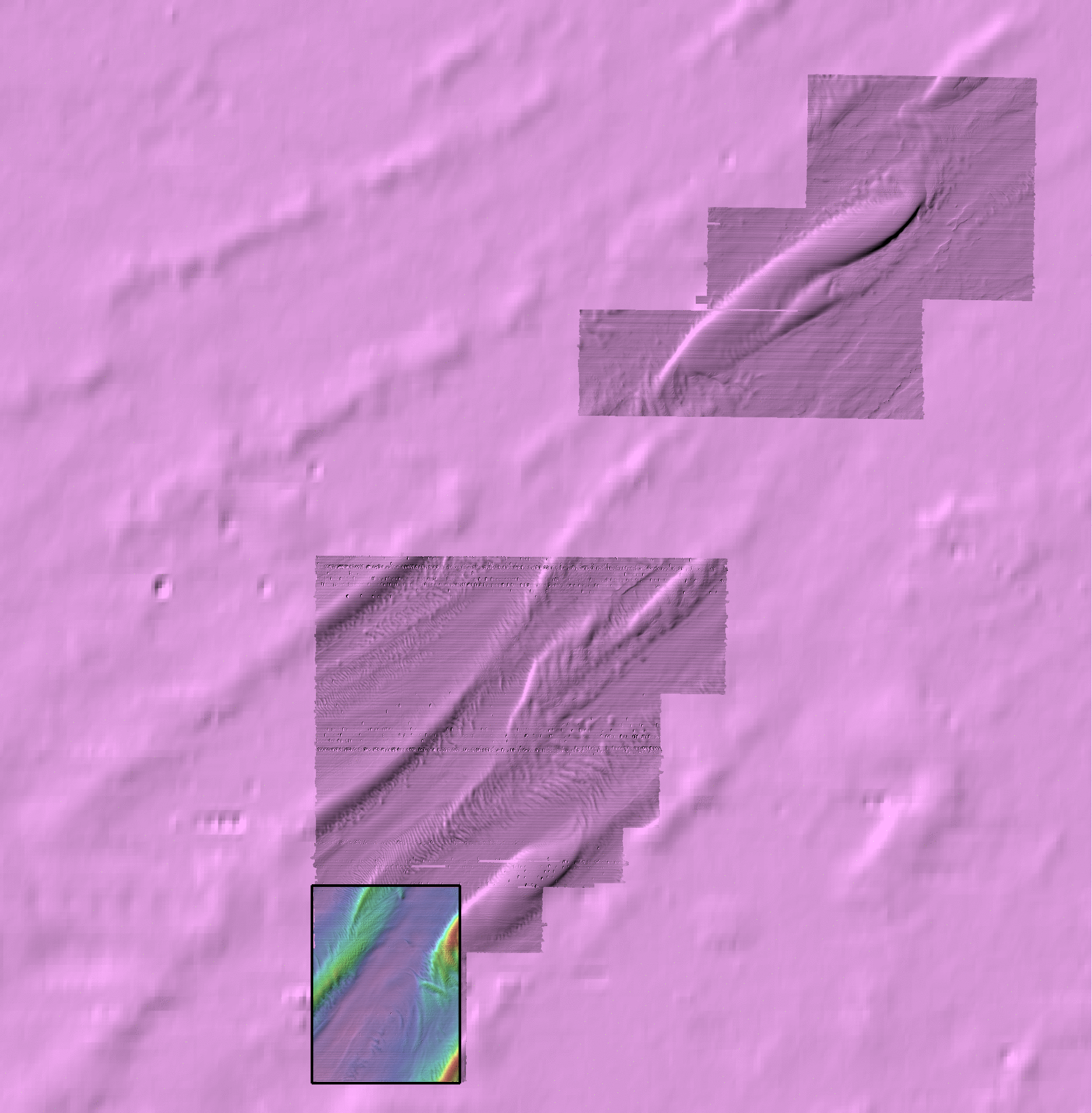
The 2016 survey was the most distal:

It clearly has that channel structure - it is almost entirely developed between the ridges though.  Notably, absolutely no surface expression of it.

It starts ~1/3 of the way down the map,  in the centre of the lowland areas, and tracks obliquely across the lowlands, slowly converging with te eastern flank of the western ridge.

At the very northern end, there is a glimpse of a few channels under the western ridge, but they disappear (whether due to masked by ridge or not present anymore isn't clear).

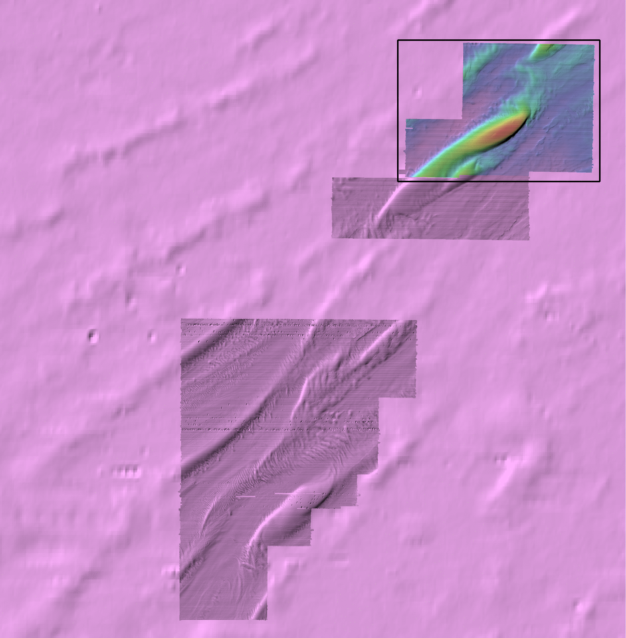
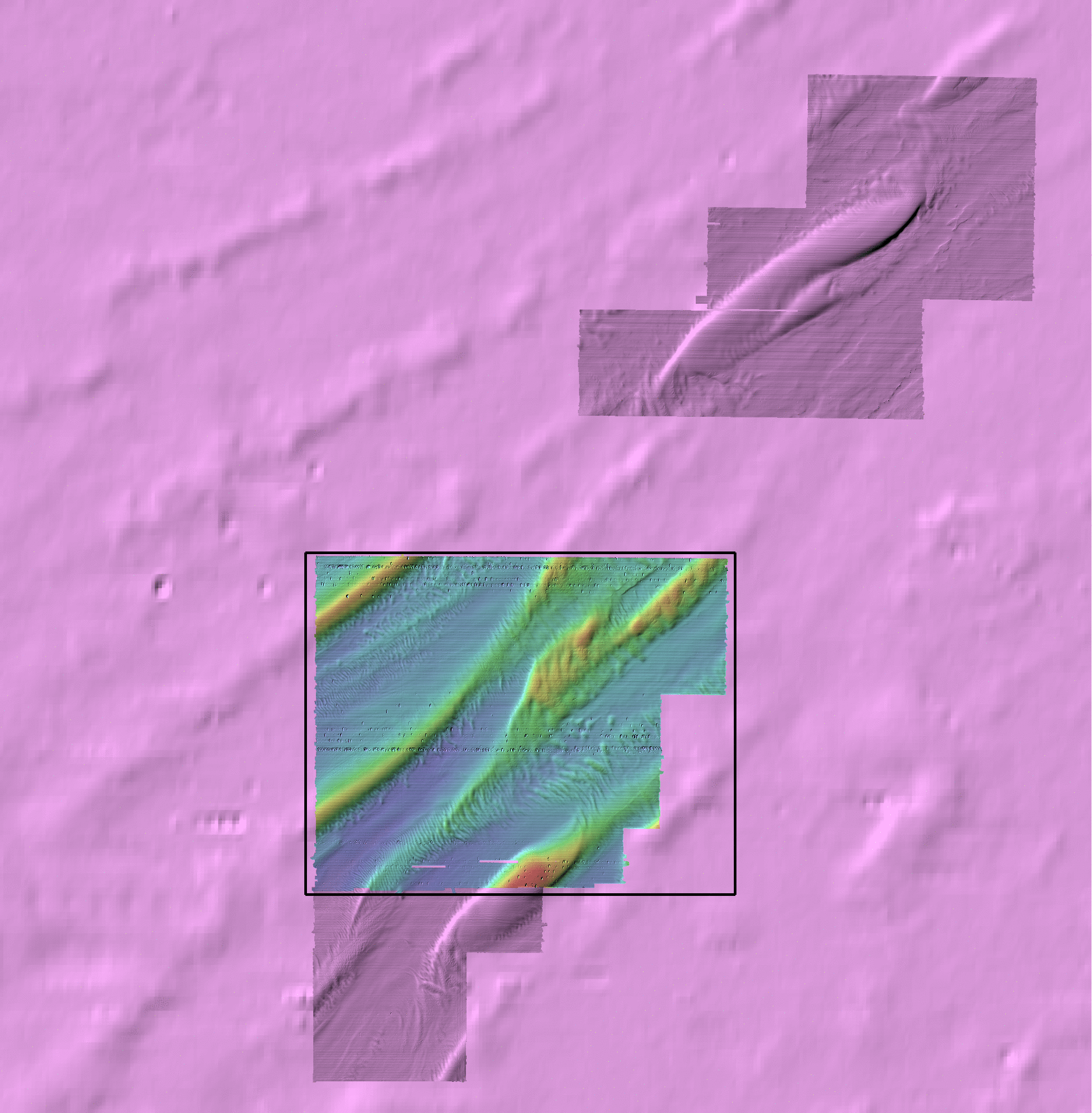
The question is, whether we can trace this character up into the 2018 data to the north.


animation of all sections in the CE1601 survey.
ce1601 subbottom

For each of these - here is a tarball of all the 2016 georeferenced subbottom sections with the individual frames so that you can scan through them successively at your own pace.

Note these images are ~3600 pixels wide  ~ 3.5 x the resolution of the animation so you can see much more detail (0.1m vertical, 15m horizontal).


location
CE1701


The 2017 survey was the most proximal - although I'm assuming the more-inshore CV surveys also have subbottom - has it been processed?

This was the July August survey... I need to add the 1702 October extension.

You can see channels, but their continuity is a little tricky to assess. Looking at you CV surveys to the east, they are actually coming in almost E-W so these E-W lines may not be the best to image them.

And there are excavated depressions along the western flank of the main Labadie bank - whether these are contemporaneous with the tunnel valleys or older is hard/impossible to infer.

I think the big point here is that  there is lots of evidence for significant paleo-channel relief, none of which is reflected in the modern surface.

I think it is best to unpack all the full resolution lines (tarball below) and slowly skip from line to line yourself and see what you believe - it is important to see each one in context with the local surface morphology in the MBES.

For any paper, you can't show all the lines (I think the animations - as well as being wheeeee! - help you recognize continuity of structure). We would have to pick a few representative ones and have plan view line drawings of where we think they stop and start.

animation of all sections in the CE1701 survey.
ce1701 subbottom


For each of these - here is a tarball of all the 2017 georeferenced subbottom sections with the individual frames so that you can scan through them successively at your own pace.

Note these images are ~5000 pixels wide  ~ 5 x the resolution of the animation so you can see much more detail (0.1m vertical, 10m horizontal).


location
CE1801

The 2018 survey was the most extensive and almost... fills the gap...

I don't see any obvious shallow channels.  What I do see though is that main ridge that starts on the left hand edge, sits over a broad depression, not a relict positive feature. Of course how old that depression is, is not clear at all.

What is interesting to me is that the transverse ribbing on the central ridge (which Dan thought might  be deGeers), is, I think very active today - there are clear strong surfical backscatter variations across these bedforms - they are smooth - not jagged relict morianal). I think they are modern and comparable to what we are seeing from Reynaud and co. down in the French sector.


animation of all sections in the CE1801 survey.
ce1801 subbottom

For each of these - here is a tarball of all the 2018 georeferenced subbottom sections with the individual frames so that you can scan through them successively at your own pace.

Note these images are ~3000 pixels wide  ~ 3 x the resolution of the animation so you can see much more detail (0.1m vertical, 20m horizontal).


page developed by JEHC - CCOM/UNH - March 2019