dunes

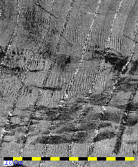
Archived Multibeam data from the Minas Passage

CSS Frederick G. Creed , Simrad EM1000, 1992 and 1993
HYGRO 92/93 - the Hydrographic Ground-Truthing Experiment

John E. Hughes Clarke
Ocean Mapping Group, Dept. Geodesy and Geomatics Engineering, UNB
May 2007
Background
With the increasing maturity of "in-stream" tidal power technology, there has been a resurgence of interest in the morphology and substrate of the Minas Passage. The Minas Passage is a constricted waterway that closes off the mouth of the Minas Basin. In the vicinity of the passage, the average tidal ranges are typically 13m.  In order to accomodate the massive tidal prism in the Minas Basin to the east, there are local tidal streams in excess of 8 knots close to Cape Split.  The site is thus naturally being considered for tidal power development (http://www.epri.com/oceanenergy/streamenergy.html).

As part of this, CCGS Matthew (EM710) and her two launches CSL Plover and Pipit (EM3002) have just completed (early May 2007) surveying the passage to provide the most up-to-date image of this dynamic seabed. The critical question however is, given the high tidal current regime, how stable is the seabed in the region? To in part, address this question, older survey data has been sought. Herein, archived multibeam data, collected by the Ocean Mapping Group at UNB in 1992 and 1993, are reprocessed to act as a long term comparison.

The data are presented here as grids and mosaics in geotiff and ESRI grid formats.  All data are presented at 5m pixel resolution in a UTM Zone 19 (63W) WGS84 projection.
Bathymetry is reduced to mean sea-level using the DFO WebTide "Upper Fundy" model.  Backscatter grey level represents a range from -27.5dB (black) to -12.5 dB (white).
1992 along channel - bathymetry
1992 along channel - backscatter
1992 - Along Channel Bathymetry
bathy_geotiff --- tfw --- gzipped_tar_of_ESRI_grid_and_geotiffs
1992 - Along Channel Backscatter
mosaic_geotiff --- tfw
1992 across channel - bathymetry 1992 across channel - backscatter
1992 - Across Channel Bathymetry
bathy_geotiff --- tfw --- gzipped_tar_of_ESRI_grid_and_geotiff
1992 - Across Channel Backscatter
mosaic_geotiff --- tfw
1993 - bathymetry 1993 - backscatter
1993 - All Bathymetry
bathy_geotiff --- tfw --- gzipped_tar_of_ESRI_grid_and_geotiff
1993 - All Backscatter
mosaic_geotiff --- tfw

Two multibeam surveys of the Minas Passage were conducted in 1992 and 1993 as a byproduct of the NSERC strategic grant funded "HYGRO - Hydrographic Ground Truthing" Project. This project was led by David Wells at the then Dept. of Surveying Engineering at the University of New Brunswick. The field program was performed collaboratively between the Canadian Hydrographic Service (Quebec Region - HIC, Andre Godin) and the Ocean Mapping Group at UNB. The original data processing (and this reprocessing) was performed by John Hughes Clarke of the OMG.

The main aim of the HYGRO-92/93 program was to collect multibeam backscatter data from the intertidal mud flats of the approaches to Parrsboro Harbour. The intertidal acquisition, was of course, only possible at high water. The vessel used, CSS Frederick G. Creed, is not capable of taking the ground and thus had to wait offshore during the low water (and night time) period.  During the daylight and low water periods the vessel was used to collect opportunistic data in the Minas Passage area. These datasets represent those periods of acquisition.

In 1992, the original survey was run along the axis of the channel. It was subsequently noted that backscatter definition of the large gravel dunes was far better when steaming across the channel. As a result, a subset of the Channel was resurveyed using across-channel line orientation. These two surveys are presented separately as each has its own postioning problems and averaging the two surveys serves only to defocus the resolvable features.

In 1993, further across and along channel lines were run. The along channel lines were designed to extend the areal coverage of the 1992 data. The across channel  surveys were run to try to reimage the dune fields to see if there had been significant migration over the one year period. The results of this comparison were published in Hughes Clarke et al. (1996,Marine Geophysical Researches, v.18, p.607-629).
 
Data Quality Issues

Whilst these data represent a unique opportunity to examine seabed change over a 15 year period. It should be borne in mind that the data quality are not compartable to the 2007 surveys (which use an EM710 (0.5x1.0 degree beams - achieving ~ IHO Special Order target detection (1m cubes to 40m)), a POS/MV v.4 motion sensor (0.02 deg accuracy in roll, pitch and heading) and Fugro OmniStar positioning (20-40cm horizontal and vertical).


Instrumentation

Sonar
The survey was conducted using an EM1000. This system has beam widths of 2.4x3.3 degrees. Beam spacing was equidistant producing a tight spacing at nadir but compromising the across track resolution in the outer part of the swath.  At best, the sonar can achieve 2m target detection at nadir at 40m, but generally features with a horizontal dimension smaller than 5m cannot be reliably detected.

Motion Sensing
The heading sensor was an Anschutz gyro which performed adequately (0.75 degree accuracy). The roll, pitch and heave output, however, was derived from a TSS-335B.  At the time, the 335B was considered state-of-the-art, comparable to the industry standard Datawell Hippy-120C.  Its stated accuracy is, however, only 0.25 degrees and this level of angular accuracy was only achieved when there were no periods of sustained lateral accelerations (corners).  0.25 degrees was adequate for the old  narrow swath multibeams such as the EM100 (+/-40 deg), but the <0.05 degree accuracy required for an EM1000 (+/-75 degrees) was not achievable.  Also, as the Creed was operating at 14-16 knots during these surveys, the residual angular errors and heave drifting due to cornering corrupt much of the data (data acquired within about 1-3 minutes after each turn). The nature of these errors include artificial across track slopes of up to 1 degree during the corner (dying out within a few minutes of the corner though) and long period heave drifting of over one metre during the corner which attenuated with a similar time constant. Thus data collected during corners (included in the compilation here to expand the available coveage) should be treated with suspicion.

Another problem, in addition to the inherent performance limitations of the old 335B, was that for the 1992 surveys, the motion data was not properly applied in the real time output. The motion time series has had to applied in post-processing and as it was only retained at the ping interval (~2-4 Hz, rather than the original 50Hz), the motion cannot be perfectly compensated for.  A faint, but significant ship-track orthogonal ribbing is thus apparent in the 1992 data. For the 1993 survey, this was not an issue.

Horizontal Positioning

One should realise that in 1992/93, single point GPS was intentionally degraded to a horizontal accuracy of typically 50-100m due to Selective Availability (SA). All transit data in these two years (excluded from the current compilation), had this level of horizontal uncertainty. To try to cope with this, differential GPS was attempted for these surveys using a local base station set up on the beach in Parrsboro. The corrections were transmitted on VHF using a directional antenna. There were significant radio-link problems encountered, mainly as the vessel moved to the west and the line-of-sight was masked by Partridge Island. Most of the data presented here is differential, but the data quality is hard to assess as the navigation was only logged through the old Simrad 90 telegram which does not preserve quality flags. It is assumed that a 5m horizontal accuracy is achievable for most of the survey.

Vertical Positioning

The Minas Passage area is very dynamic tidal regime with rapid changes in phase and amplitude of the tide. There are no non-drying wharves in the region. In 1992 and 1993 a  tide board was installed on the Parrsboro wharf and read manually for a period ~ 2 hours before high water to 1 hour after (during which the intertidal experiments were performed). There are no observed tides for the rest of the tidal range (during which these Minas Passage surveys took place).

In the absence of measured tides, the DFO WebTide model has been used to reduce the data presented here. This model provides local sea-surface elevations relative to mean sea level (MSL). Thus all data herein, is presented to MSL rather than Chart Datum. Note that there is a shift of about 7 metres between the two datums at this location. For the WebTide program (implemented using the tidecor program), there are two models that cover the Bay of Fundy, the Scotian Shelf model and the Upper Fundy model. The Upper Fundy model was utilized at it is supposed to better account for the large intertidal areas in the Minas Basin.

This model should account for the rapidly changing phase and amplitude of the tide along the Minas Passage. Based on comparison to the OmiStar data just collected this May of the CCGS Matthew, however, it is clear that the Upper Fundy WebTide model, overestimates the tidal range by about 1.5 metres at either end of the tidal range. Also the same Omnistar data suggest that the alternate Scotian Shelf model underestimates the tidal range. Thus absolute vertical accuracy cannot be relied upon to much better than ~ +/- 2m.  Users should bear this limitation in mind when trying to difference this surface from that obtained by CCGS Matthew this May.

Apparent Change over 15 years.

Given the caveats listed above concerning the absolute horizontal and vertical accuracy of these data, the main value of the data lie in the definition and detection of change in short-wavelength seabed features indicative of erosion or deposition such as bedforms and scour depressions. The author was aboard the CCGS Matthew during the first 3 days of EM710 data collection in the Passage this year. These 1992/93 data were used on board to grossly assess the level of significant change over the intervening 15 years. Full results will have to await final processing of the Matthew 2007 data. However, it is apparent that all the dune fields images in 1992 and 1993 are active (the pattern of bedforms has significantly changed). The location and boundaries of the dune fields appear stable however. Furthermore, the edges of the erosional sections of the channel (which are defined by abrupt, step-like scour ledges) appear to not have changed over the 15 year period.


created by: John E. Hughes Clarke,  May 21st 2007