Disposal at Sea Site Monitoring in British Columbia
|
 |
Each of the disposal at sea sites were
examined for existing mulitbeam bathymetry and backscatter data which
could be used as baseline information. An overview of each site follows
with an image and grid of the existing data from the Ocean Mapping
Group archieves.
Malaspina Strait
Five Finger Island (not in cruise plan)
Porlier Pass (not in cruise plan)
Thornbrough Channel (not in cruise plan)
Watts Point (not in cruise plan)
Johnstone Strait - Hanson Island *
Johnstone Strait - Hickey Point *
Cape Mudge *
Comox *
* no data
Malaspina Strait
Five Finger Island (not in cruise plan)
Porlier Pass (not in cruise plan)
Thornbrough Channel (not in cruise plan)
Watts Point (not in cruise plan)
Johnstone Strait - Hanson Island *
Johnstone Strait - Hickey Point *
Cape Mudge *
Comox *
* no data
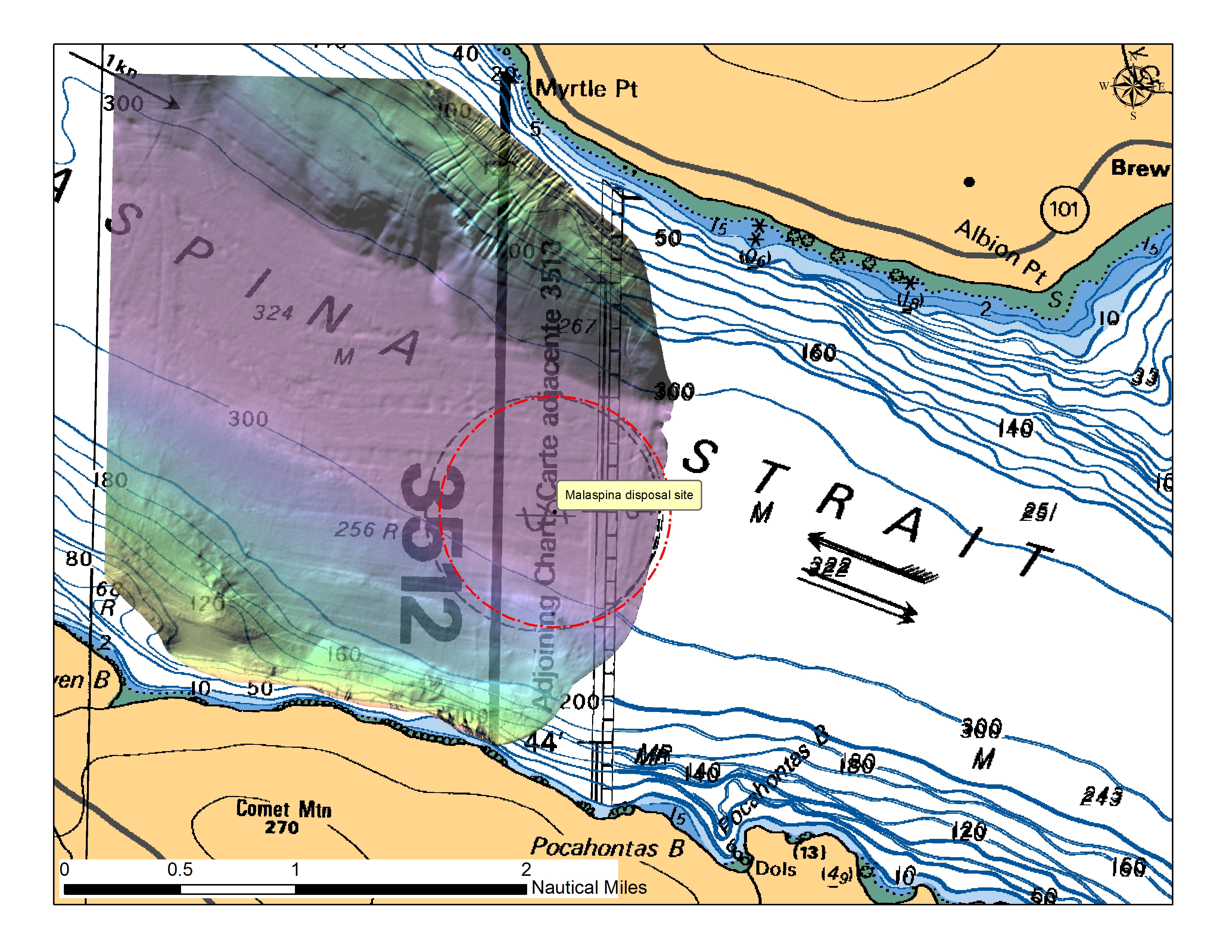
Site 6: Malaspina Strait |
|
| Bathymetry | Backscatter |
 |
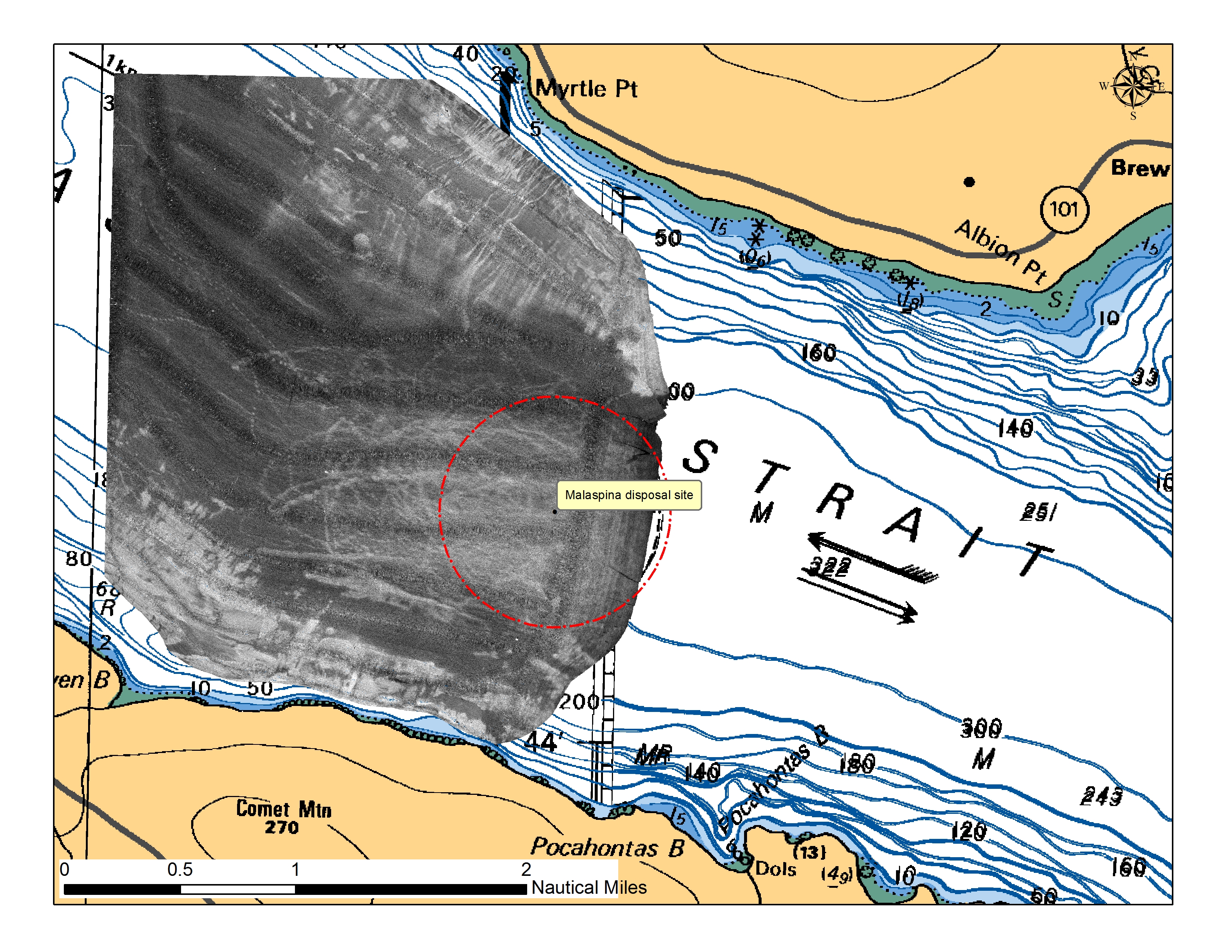 |
Sources:
|
|
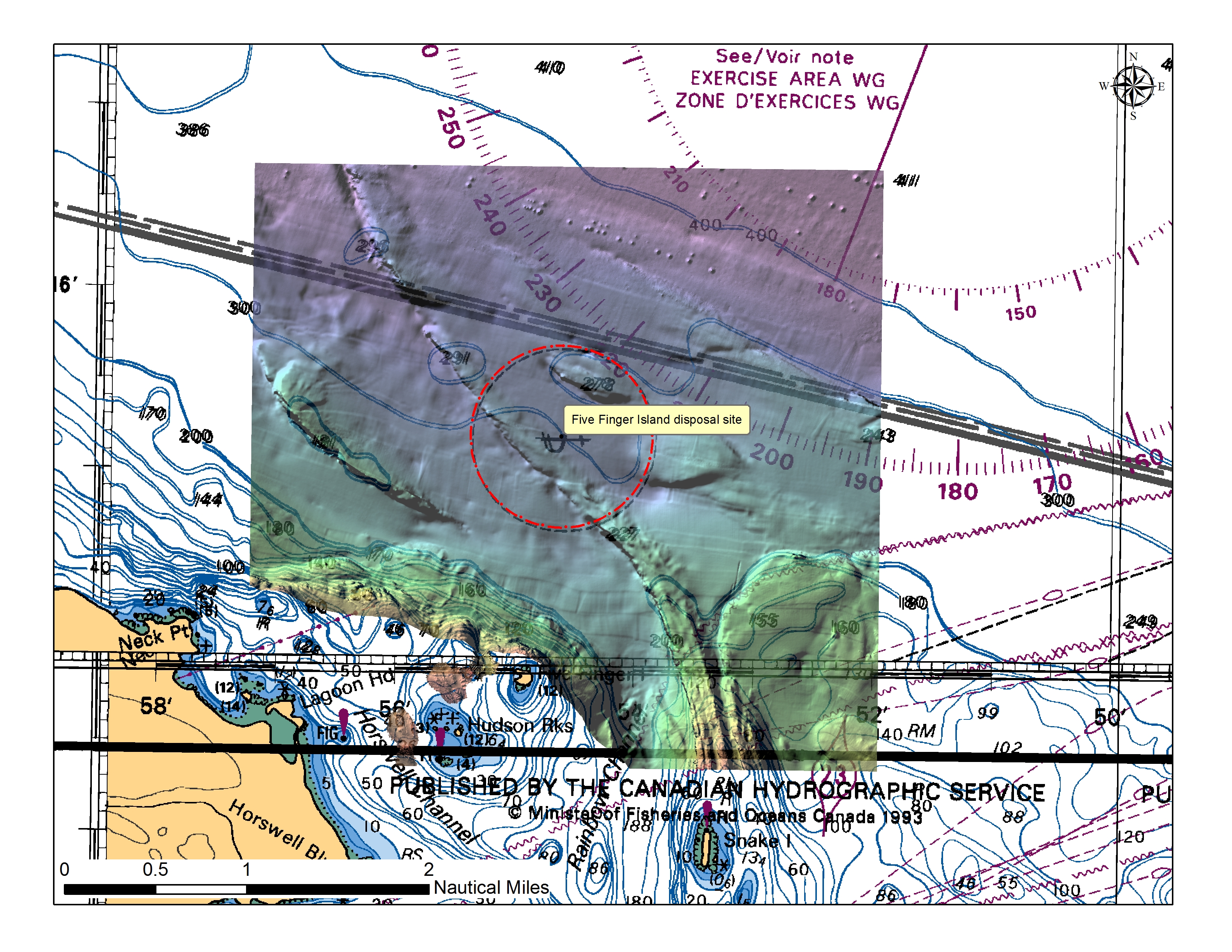
Site 7: Five Finger Island |
|
| Bathymetry | Backscatter |
 |
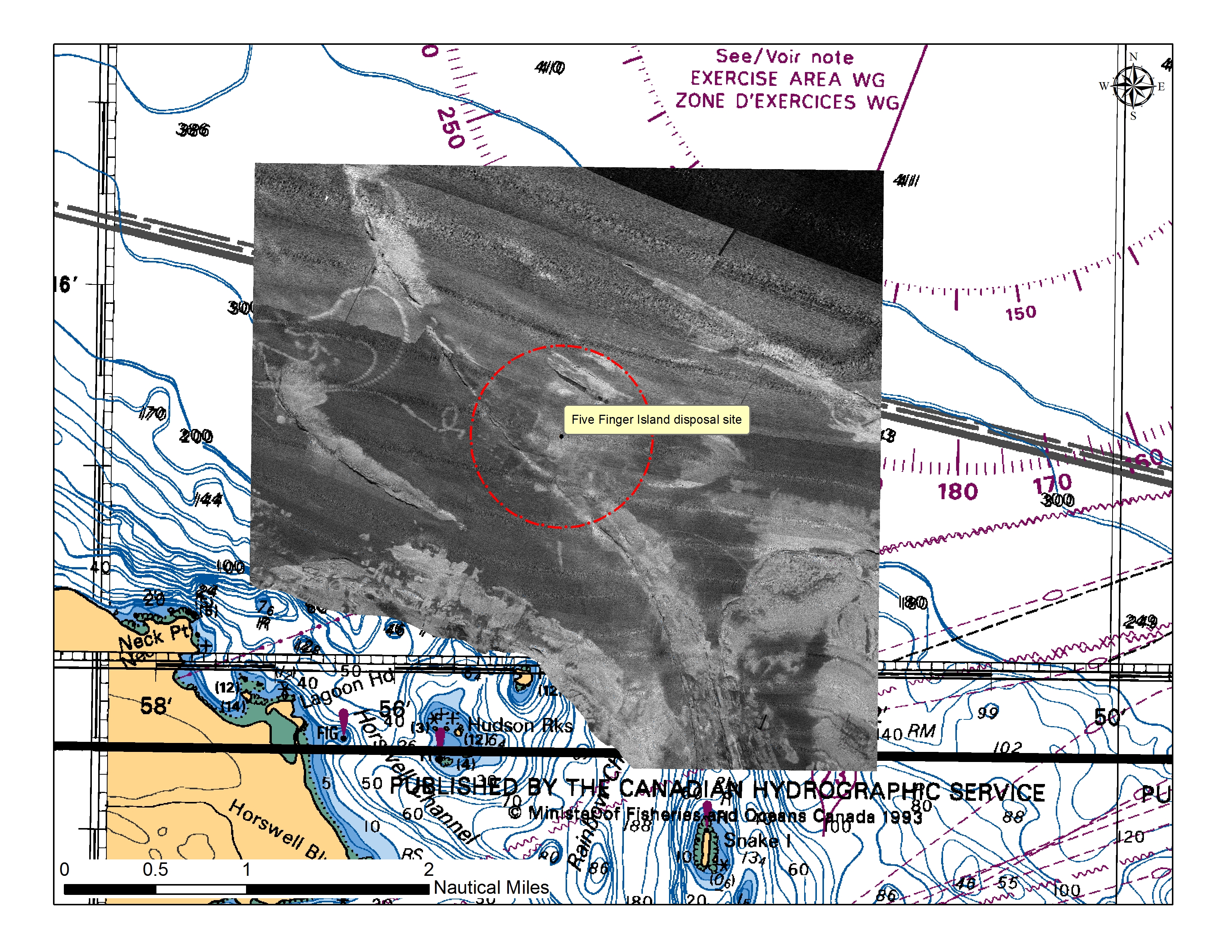 |
Sources:
|
|
Site 13: Porlier Pass |
|
| Bathymetry | Backscatter |
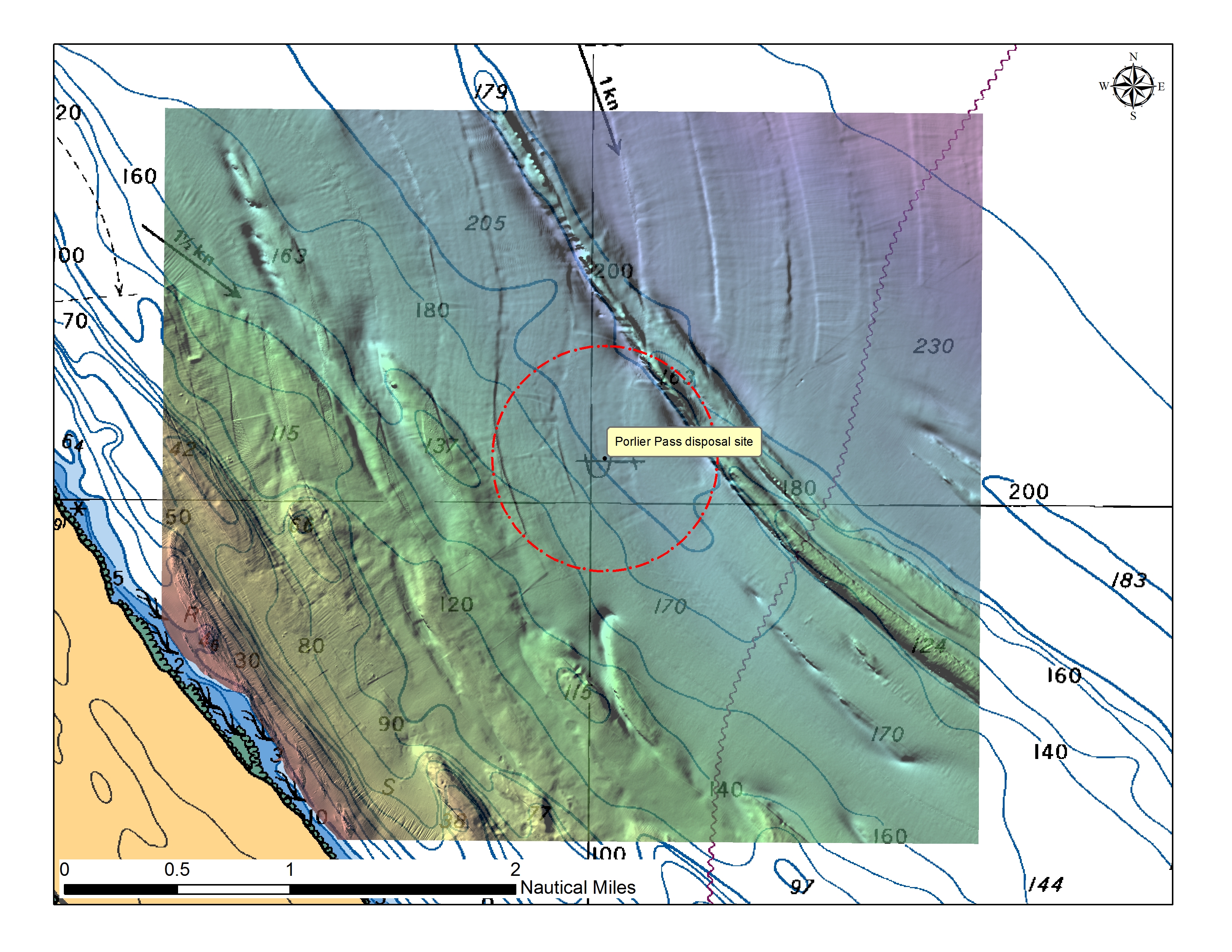 |
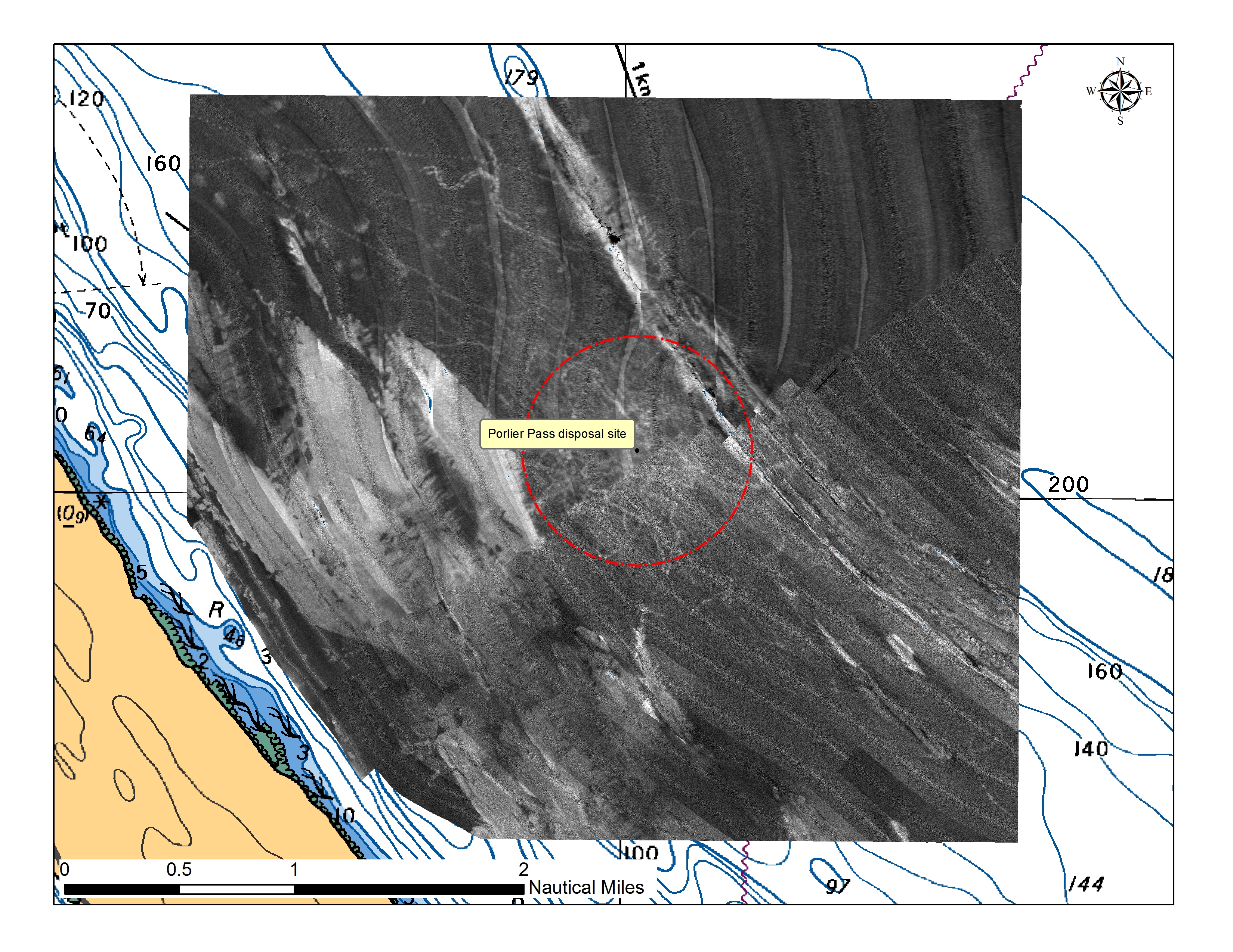 |
Sources:
|
|
Site 8: Thornbrough Channel |
|
| Bathymetry | Backscatter |
| Here |
Here |
Site 9: Watts Point |
|
| Bathymetry | Backscatter |
| Here | Here |
Site 2: Johnstone Strait - Hanson Island |
|
| Bathymetry |
Backscatter |
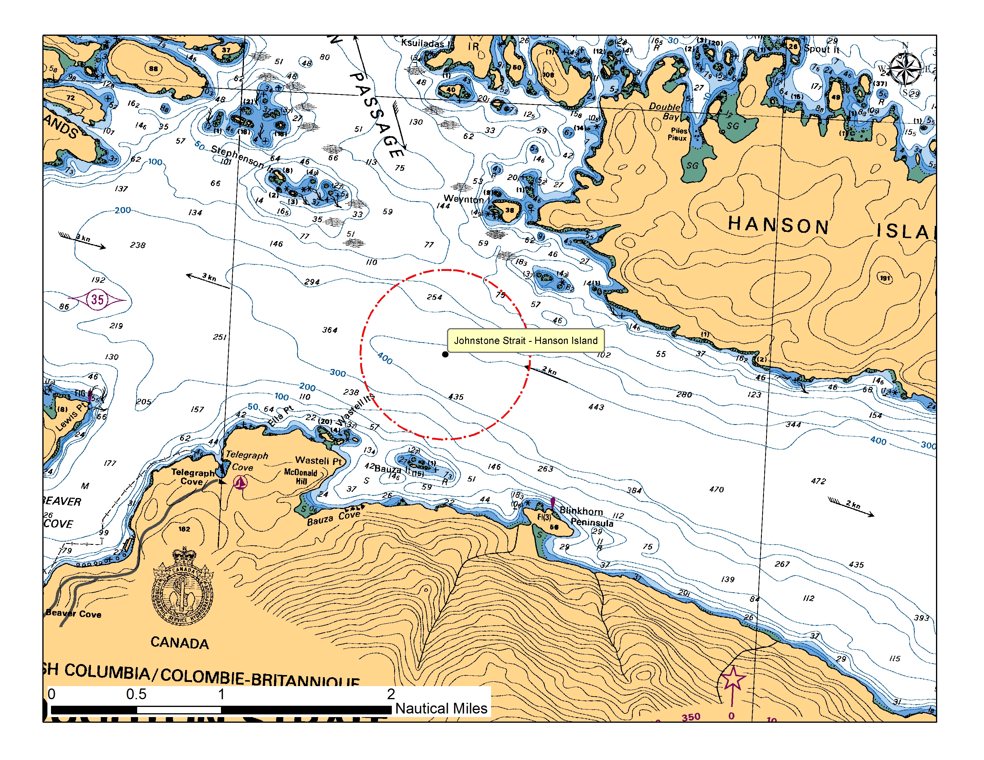 |
|
| Sources: None |
|
Site 3: Johnstone Strait - Hickey Point |
|
| Bathymetry | Backscatter |
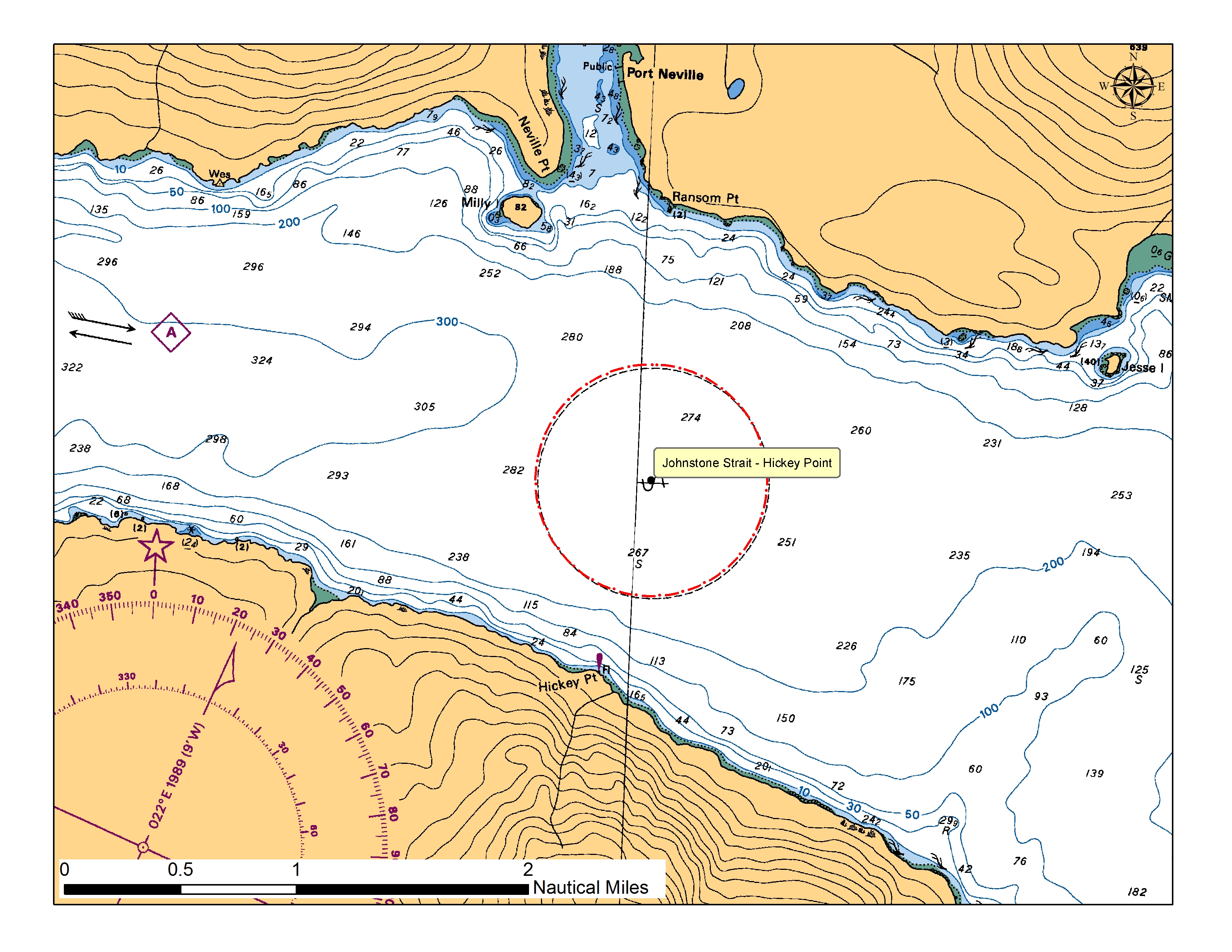 |
|
| Sources: None |
|
Site 4: Cape Mudge |
|
| Bathymetry | Backscatter |
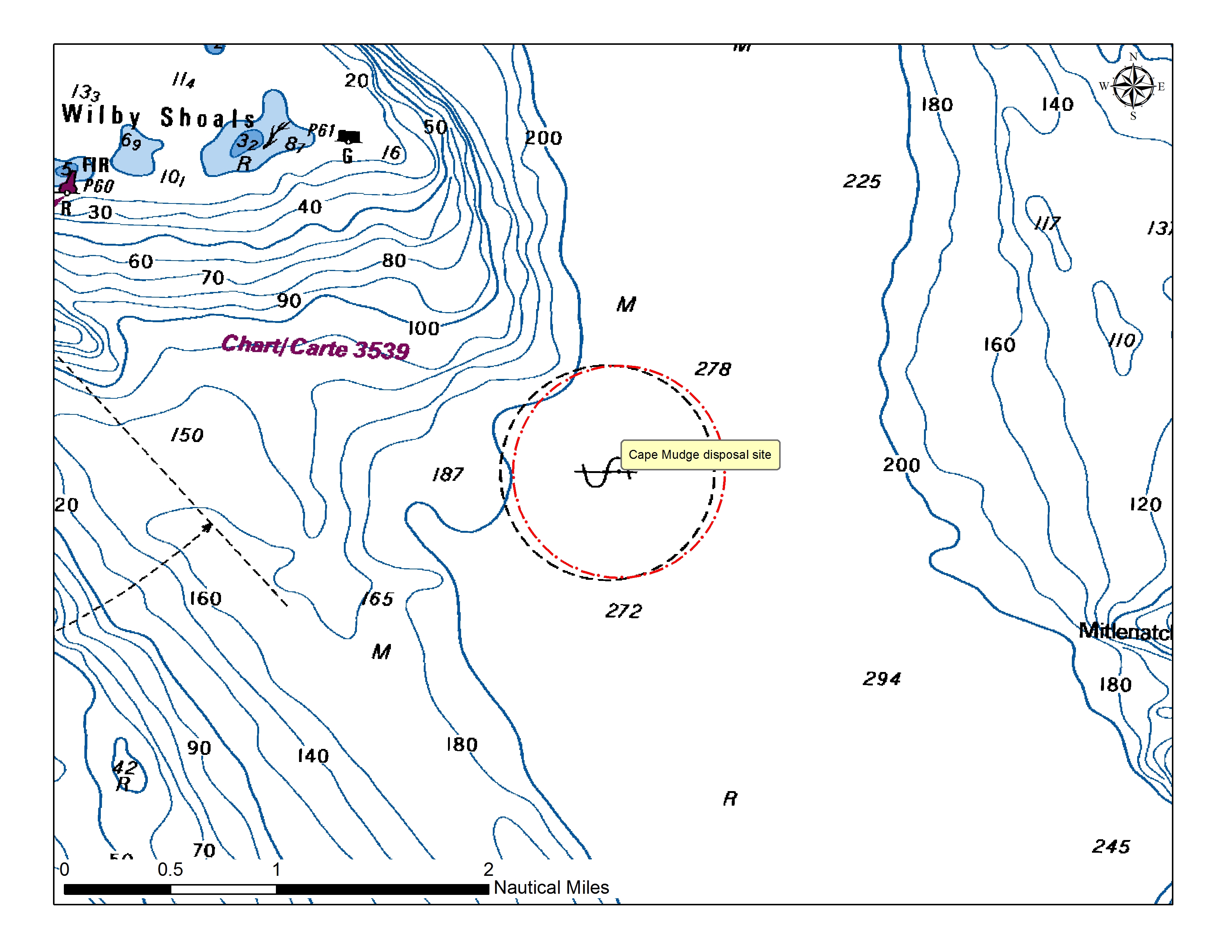 |
|
| Sources: None |
|
Site 5: Comox |
|
| Bathymetry | Backscatter |
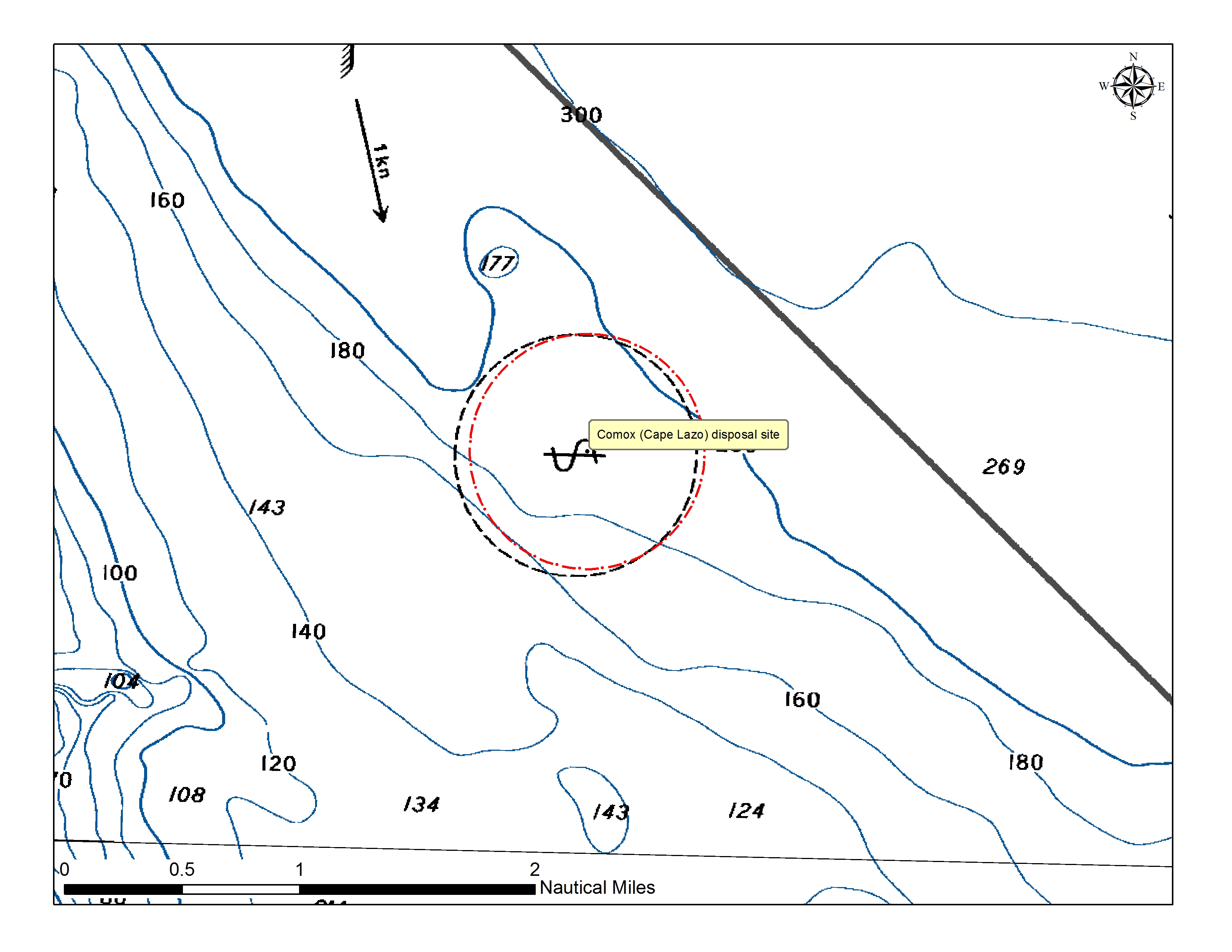 |
|
| Sources: None | |