Lake Melville Multibeam and Subbottom Mapping
Data Coverage and
Quality to date.
MV Nuliajuk, JD188 to JD 200 (July 6th to July 18th) 2012
(so far - doesn't include data
since Steve and Weston left)
Steve Brucker, Weston Renoud and Travis Hamilton (so far)
Ocean Mapping Group, UNB
This page is intended to
illustrate the EM3002 multibeam bathymetry and backscatter
and Knudsen 3.5 kHz subbottom data coverage and quality.
It is also a means of assessing what needs to be done with the
data before final delivery.
showing current recce. mapsheets for quality assessment.
As I see it the next major steps are:
- Multibeam :
- removal of periods when F185 went walkabout.
- Bathymetric cleaning (minor interference and > 250m
issues).
- Backscatter processing
- accounting for improper attenuation coefficients.
- decision on appropriate beam pattern corrections
- decision on whether to apply non flat -grazing angle
corrections.
- Vertical Positioning
- application of predicted tides (for now)
- processing of C-Nav PPP solution
- development on Ellipsoid-Geoid separation model (EGM-08?).
- decision whether to account for Geoid-CD
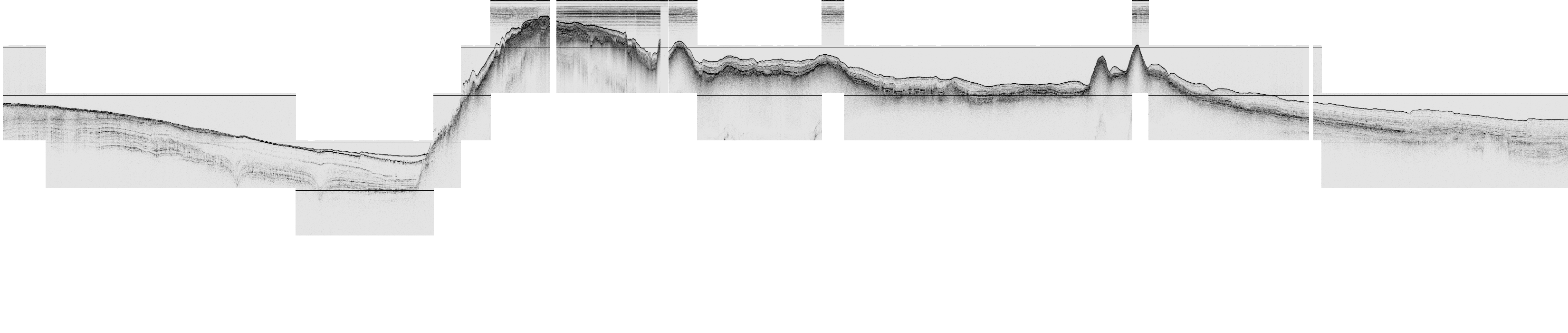
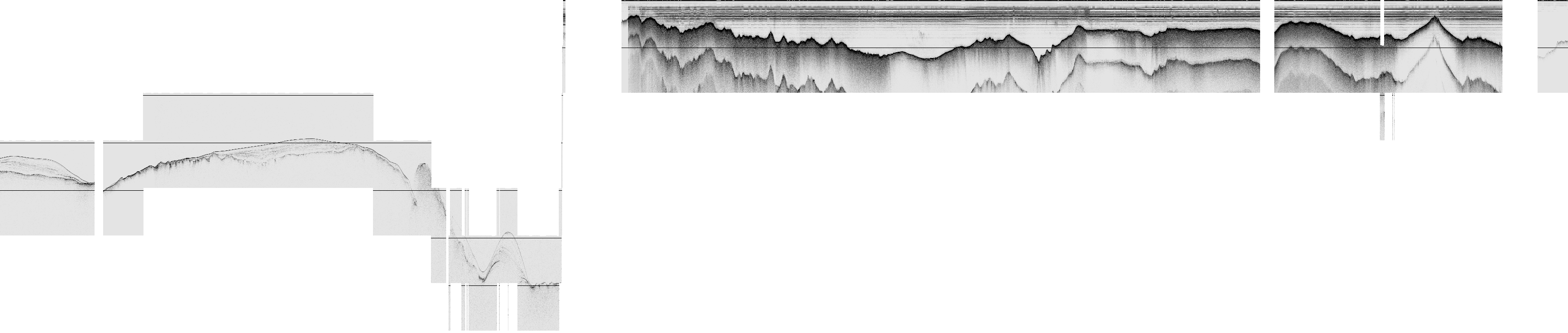
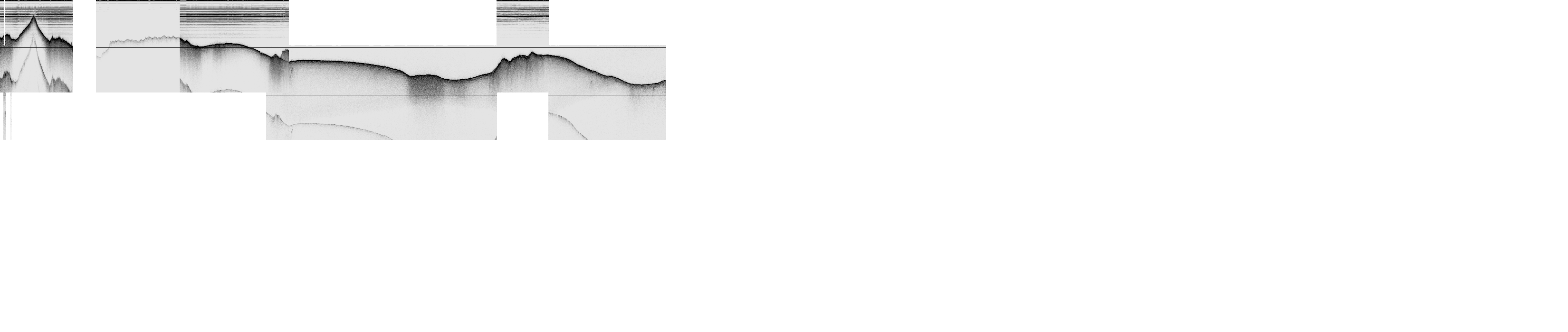
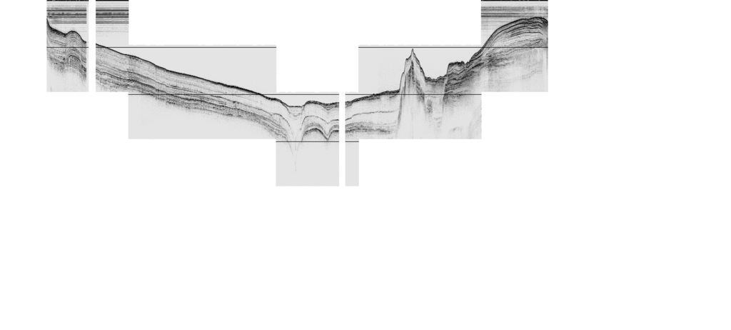
- Subbottom
- Unravel remaining data
- Assess data gaps (may be unravel script issues)
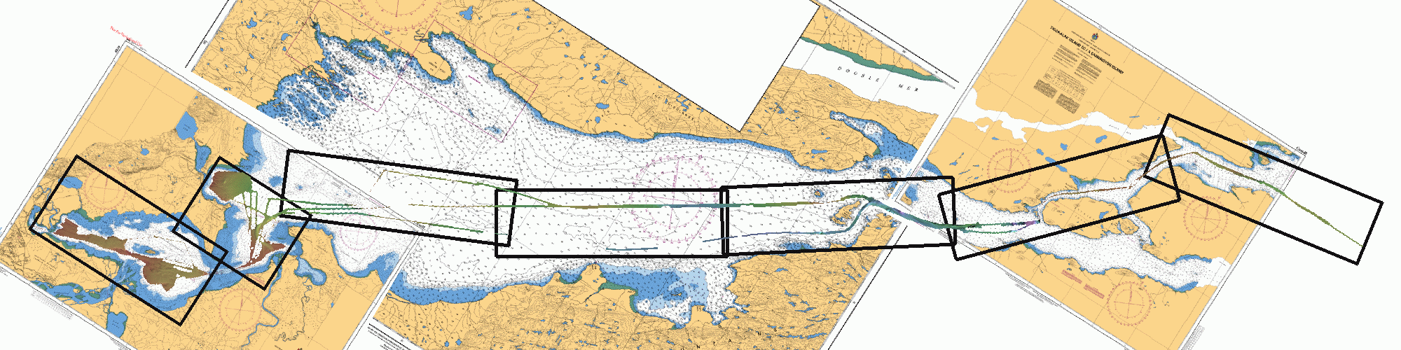
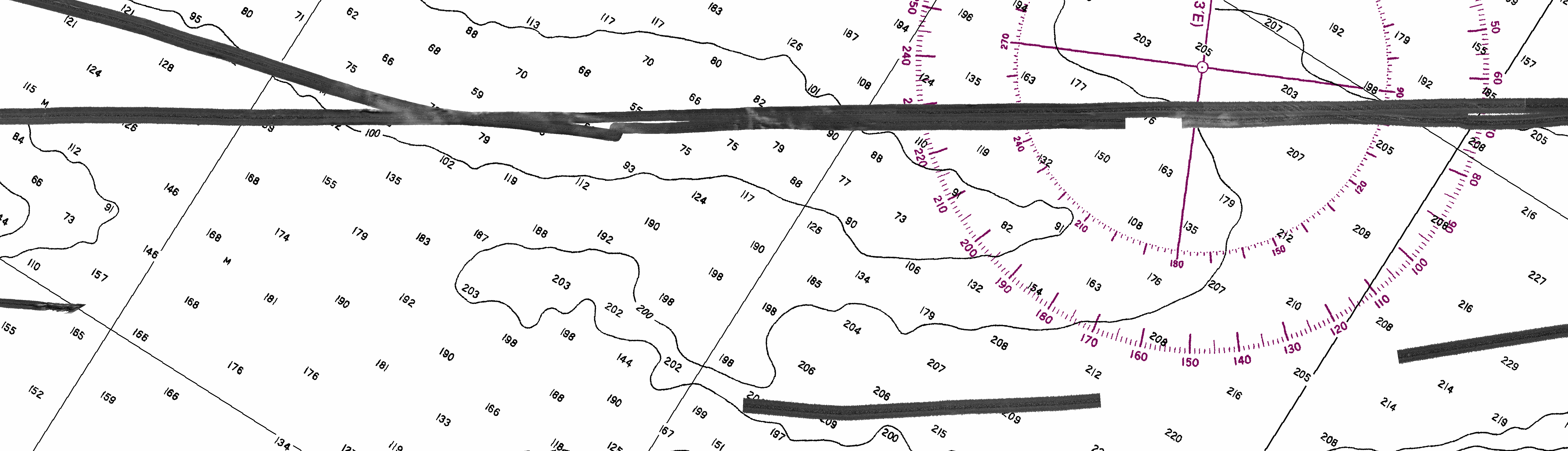
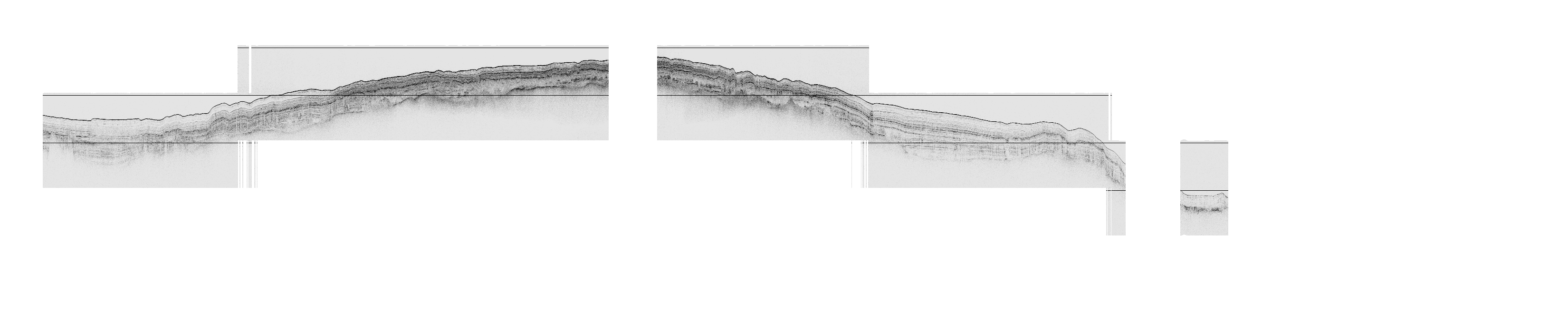
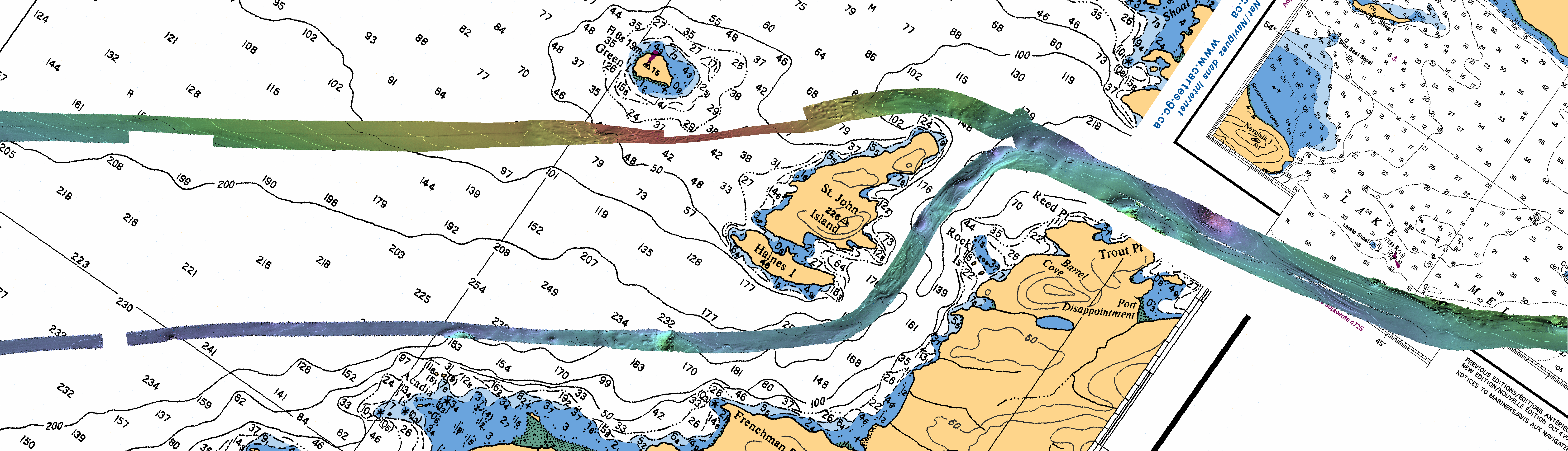
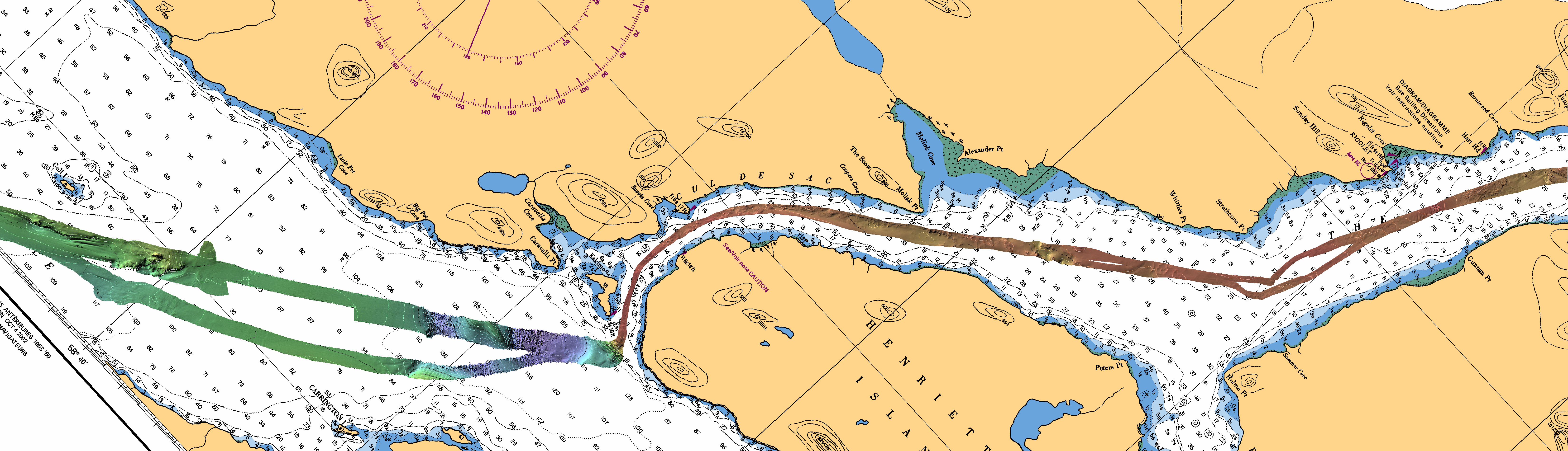
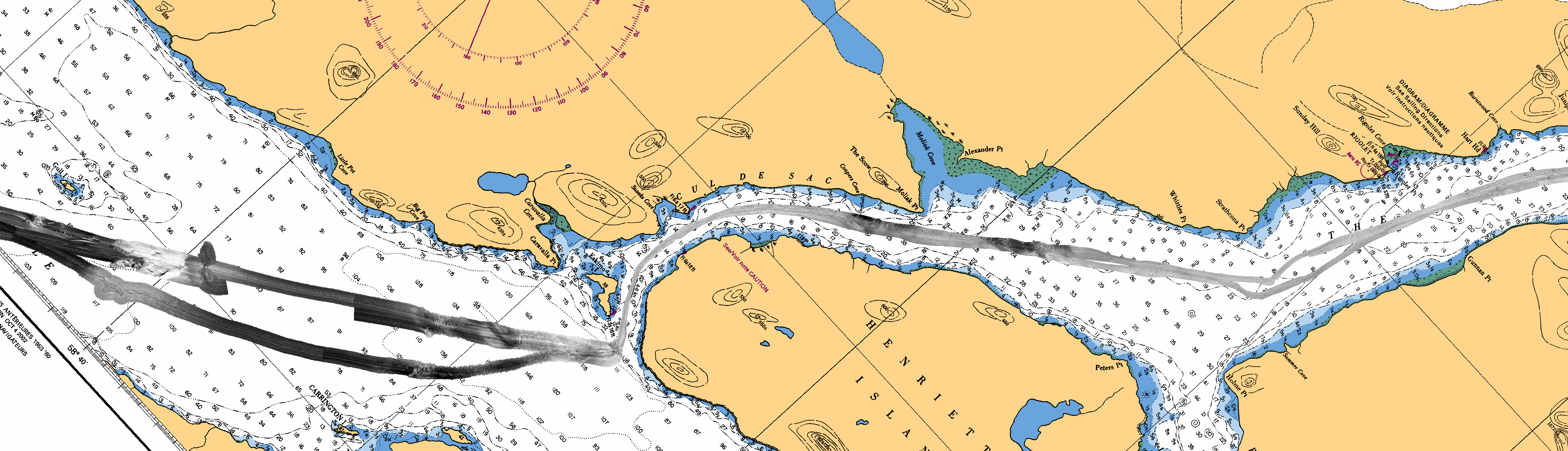
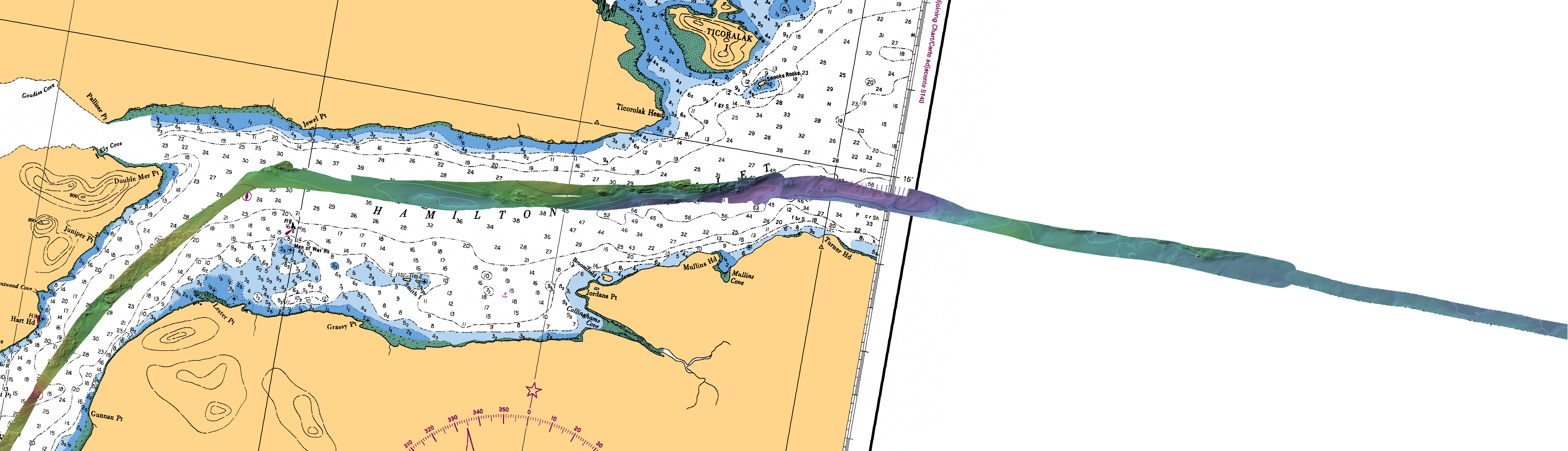
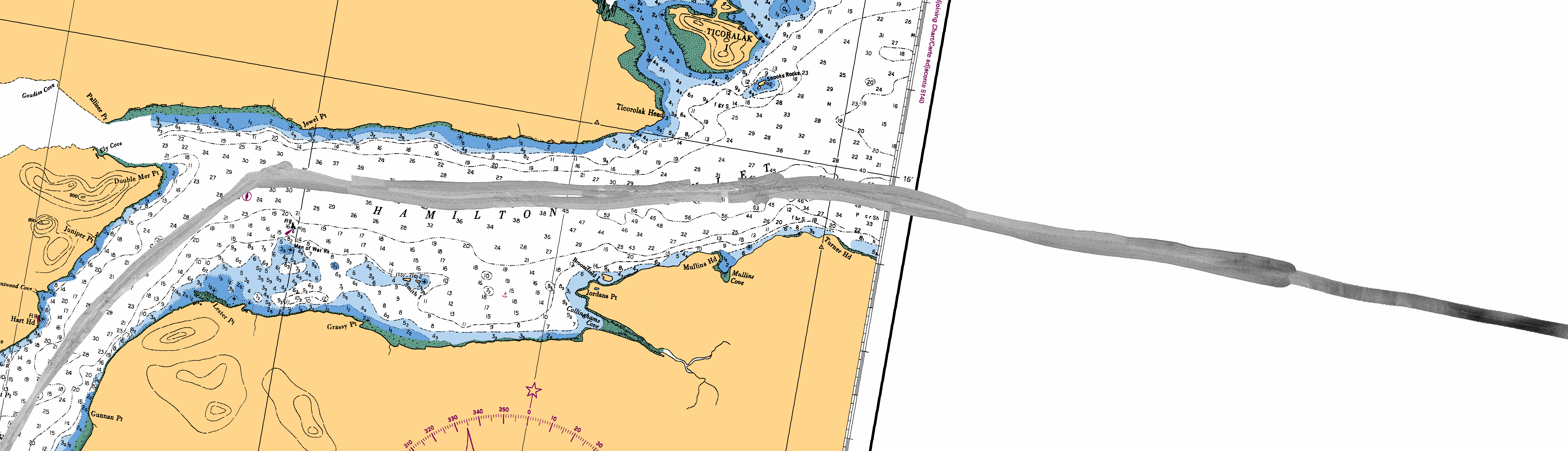
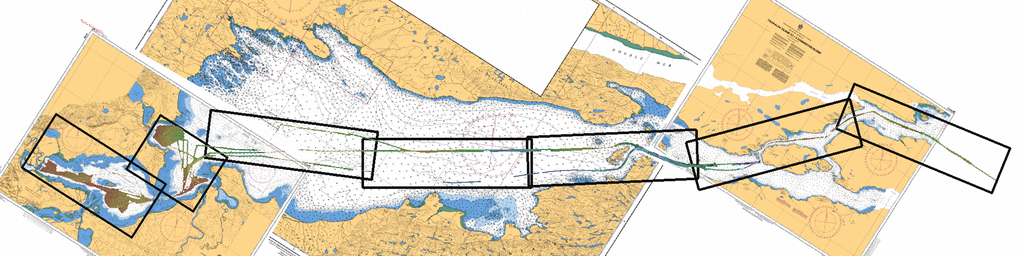
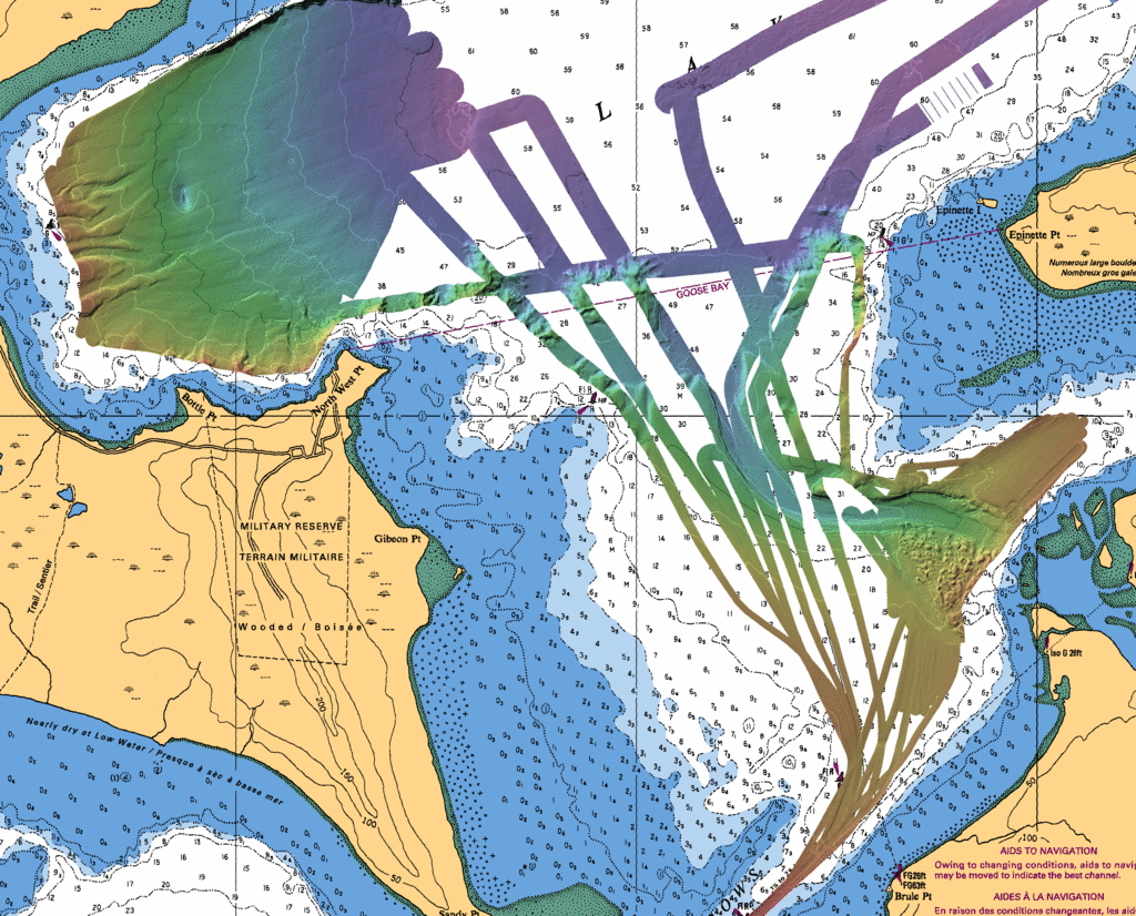
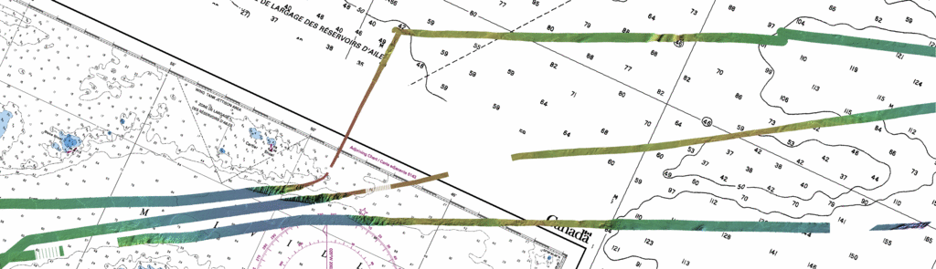
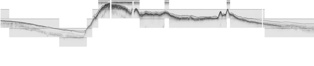
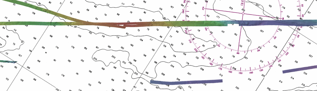
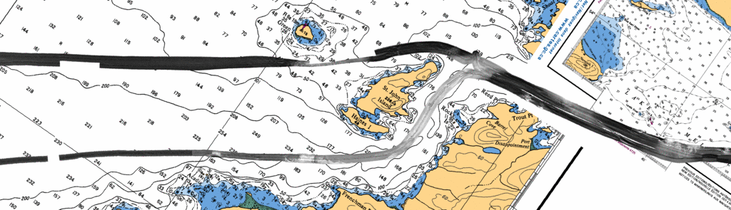
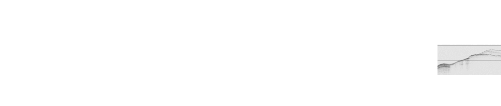
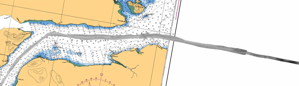
Below are 7 individual map sheets, all generated with a 5m pixel
showing the bathymetric and backscatter data as well as a
representative subbottom profile (derived mainly from the JD189/190
transit in and out).
For all, the backdrop is CHS charts 5413, 2724 and 2728.
Obviously "not to be used for
navigational purposes".
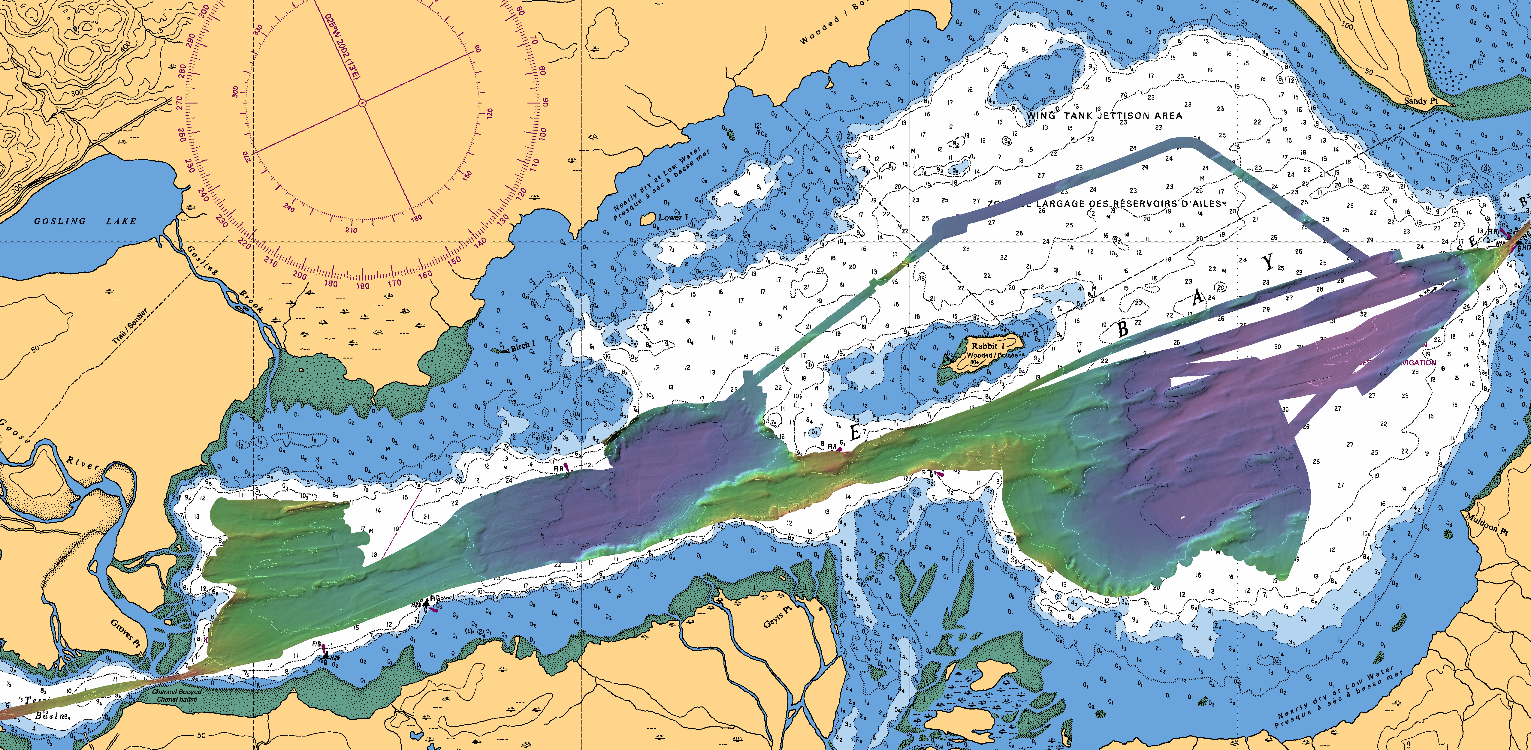
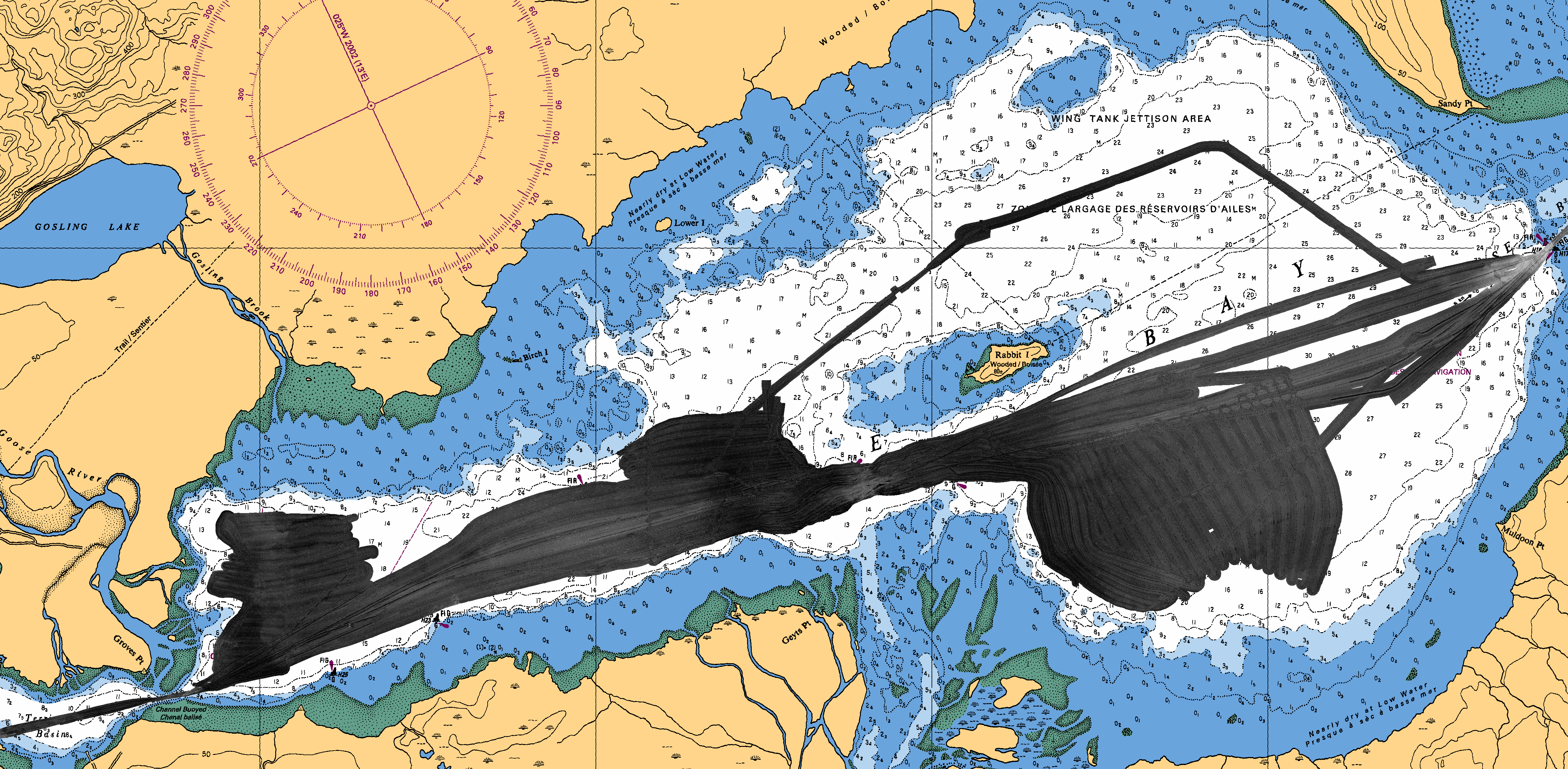
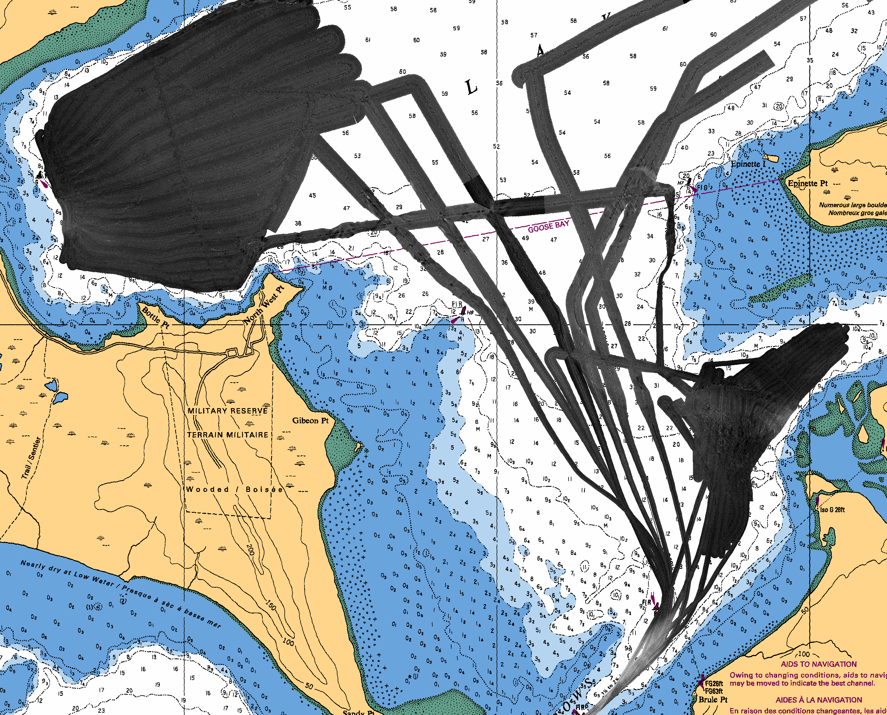
Area 0:
Bathymetry
contours:
10m - white
50m - black
|
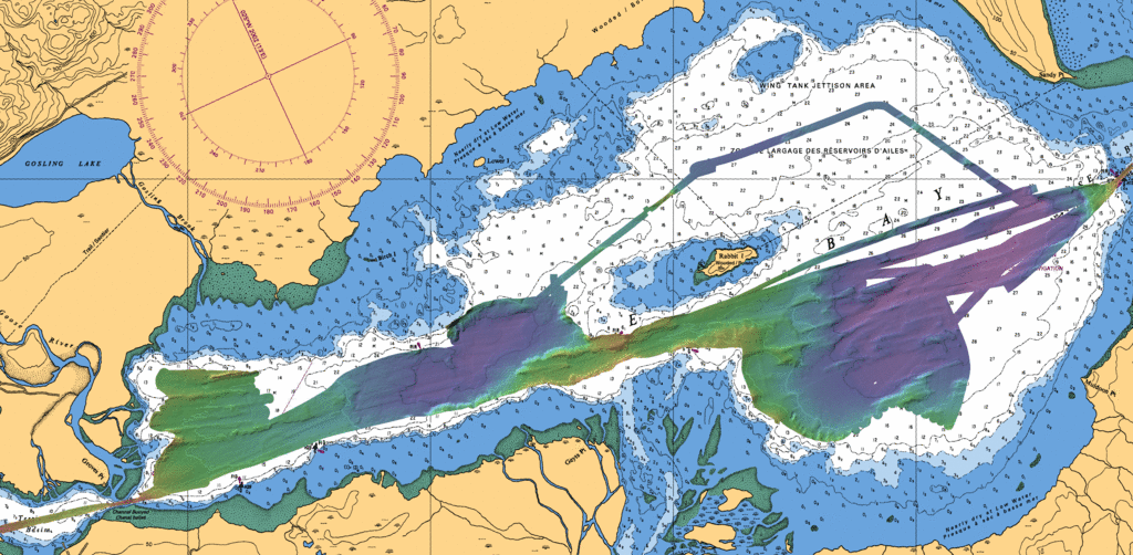 |
Backscatter
|
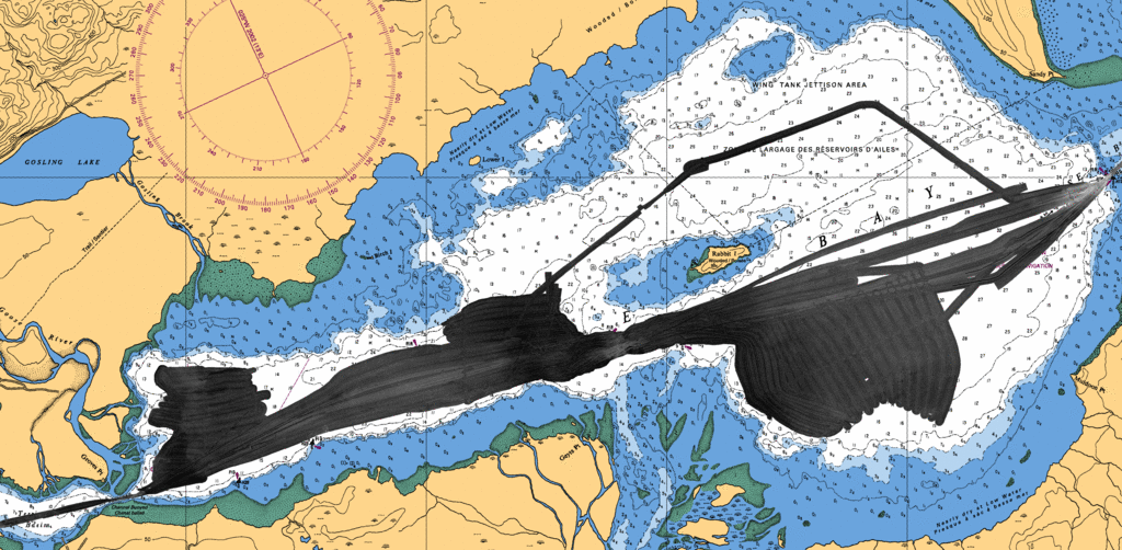 |
Subbottom
50m levels
|
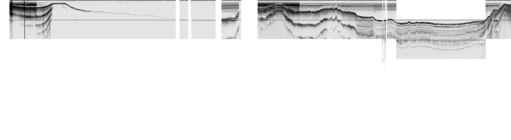
|
Area 1:
Bathymetry
contours:
10m - white
50m - black
|
 |
Backscatter
|
 |
Subbottom
50m levels
|
 |
Area 2:
Bathymetry
contours:
10m - white
50m - black
|
 |
Backscatter
|
 |
Subbottom
50m levels
|
 |
Area 3:
Bathymetry
contours:
10m - white
50m - black
|
 |
Backscatter
|
 |
Subbottom
50m levels
|
 |
Area 4:
Bathymetry
contours:
10m - white
50m - black
|
 |
Backscatter
|
 |
Subbottom
50m levels
|
 |
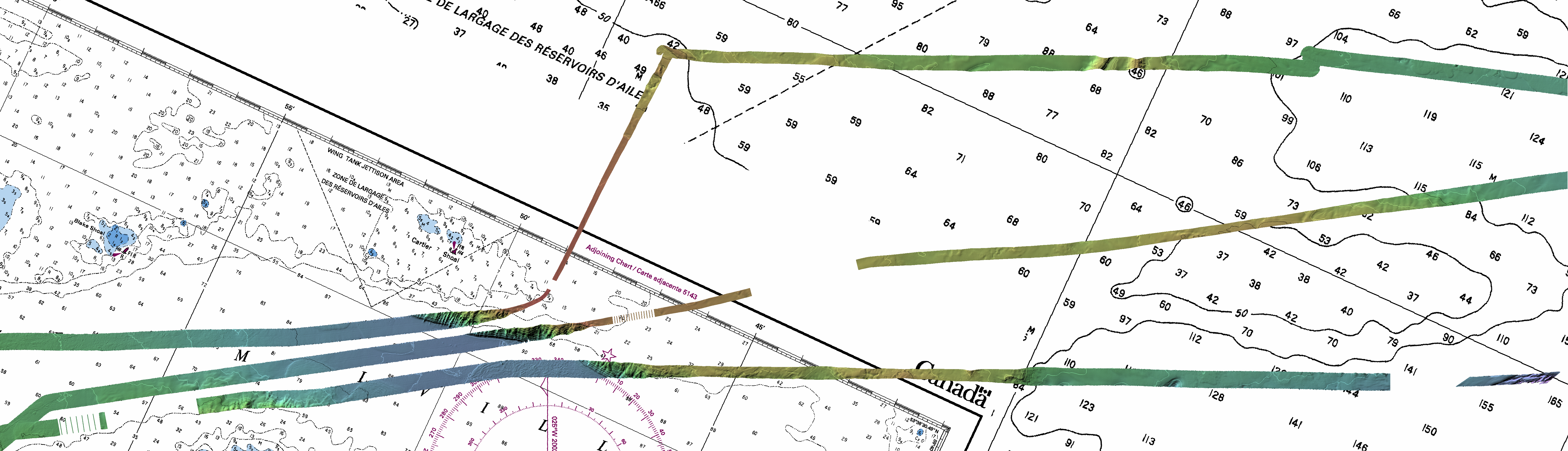
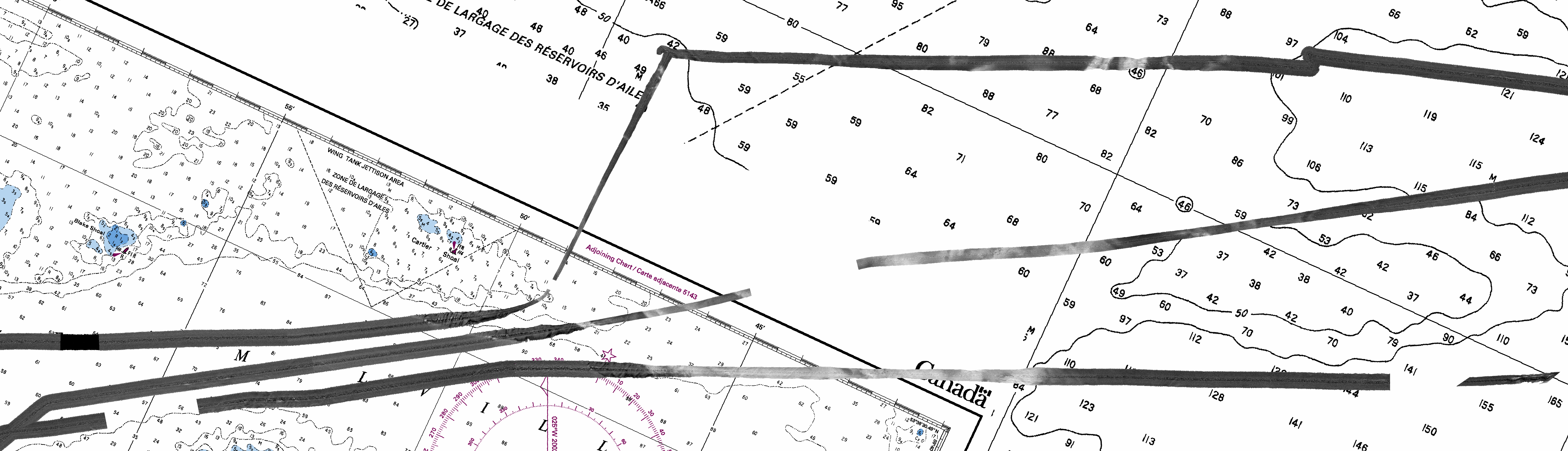
Area 5:
Bathymetry
contours:
10m - white
50m - black
|
 |
Backscatter
|
 |
Subbottom
50m levels
|

300m deep !
|
Area 6:
Bathymetry
contours:
10m - white
50m - black
|
 |
Backscatter
|
 |
Subbottom
50m levels
|
 |
page generated, late, July,
2012. JEHC