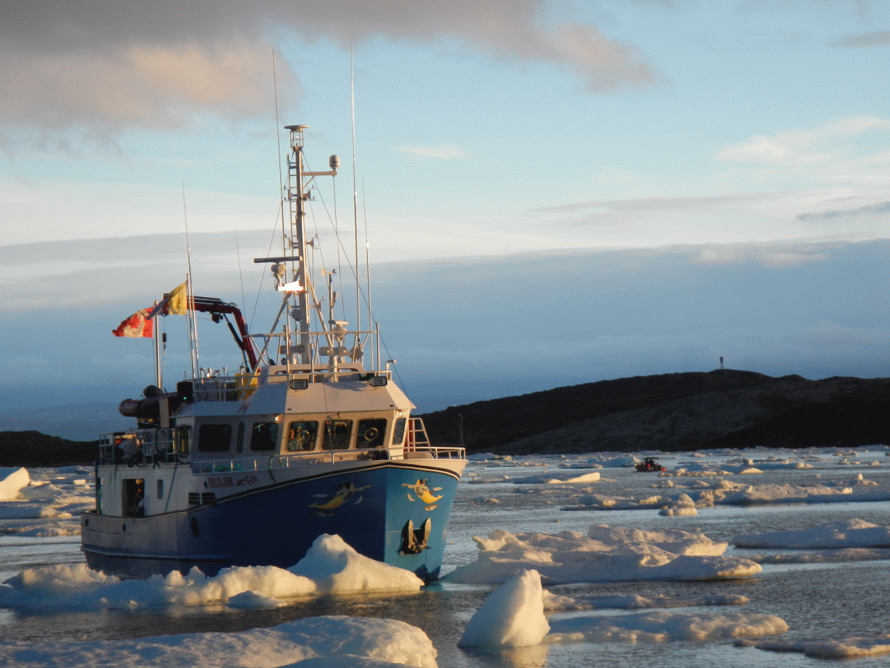
photo credit: Travis Hamilton
James Muggah, Travis Hamilton, Steve Brucker, Weston Renoud, Anand Hiroji,
Ian Church and John Hughes Clarke
Ocean Mapping Group
Dept. Geodesy and Geomatics Engineering
University of New Brunswick
|
photo credit: Travis Hamilton
|
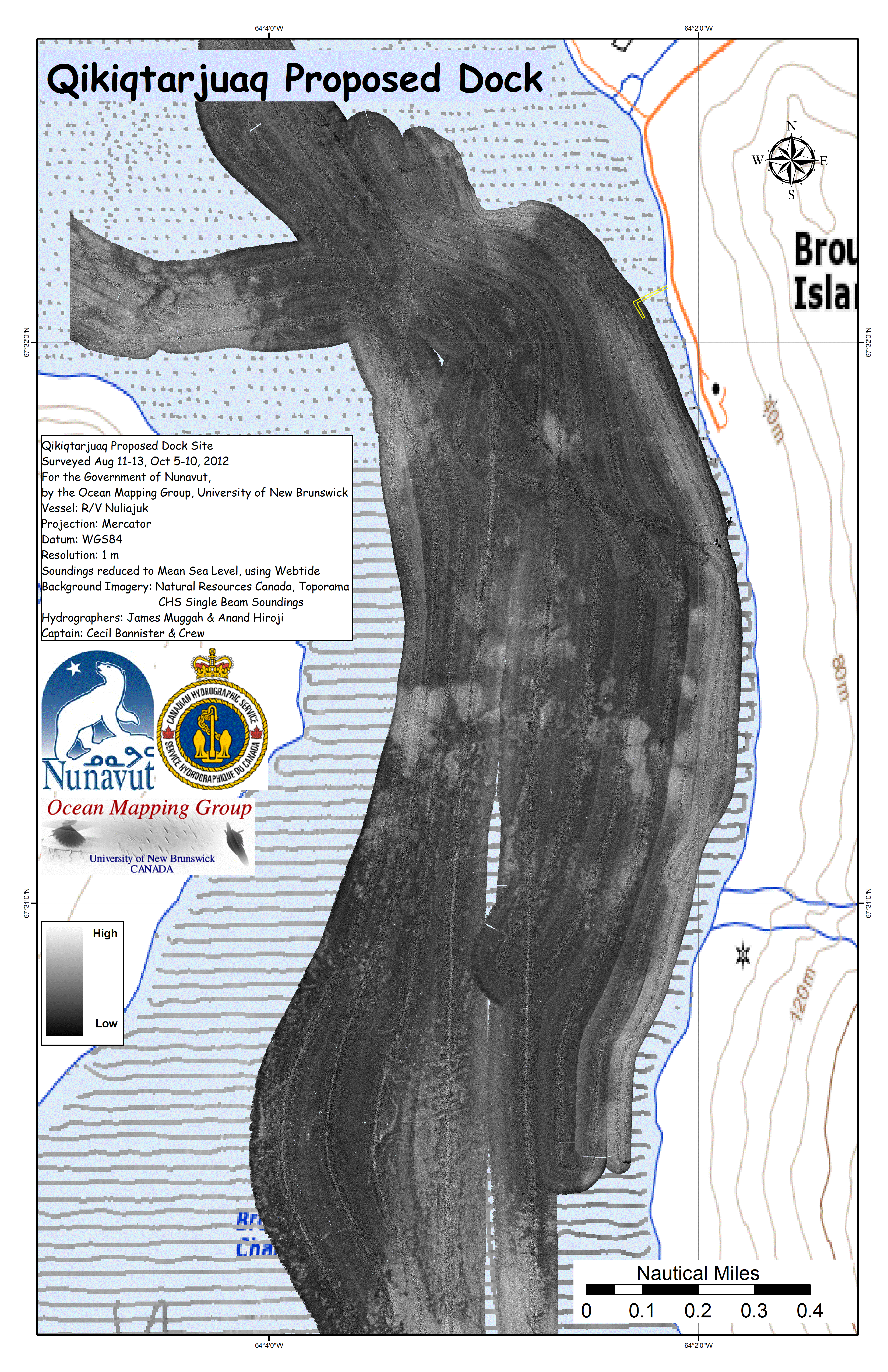
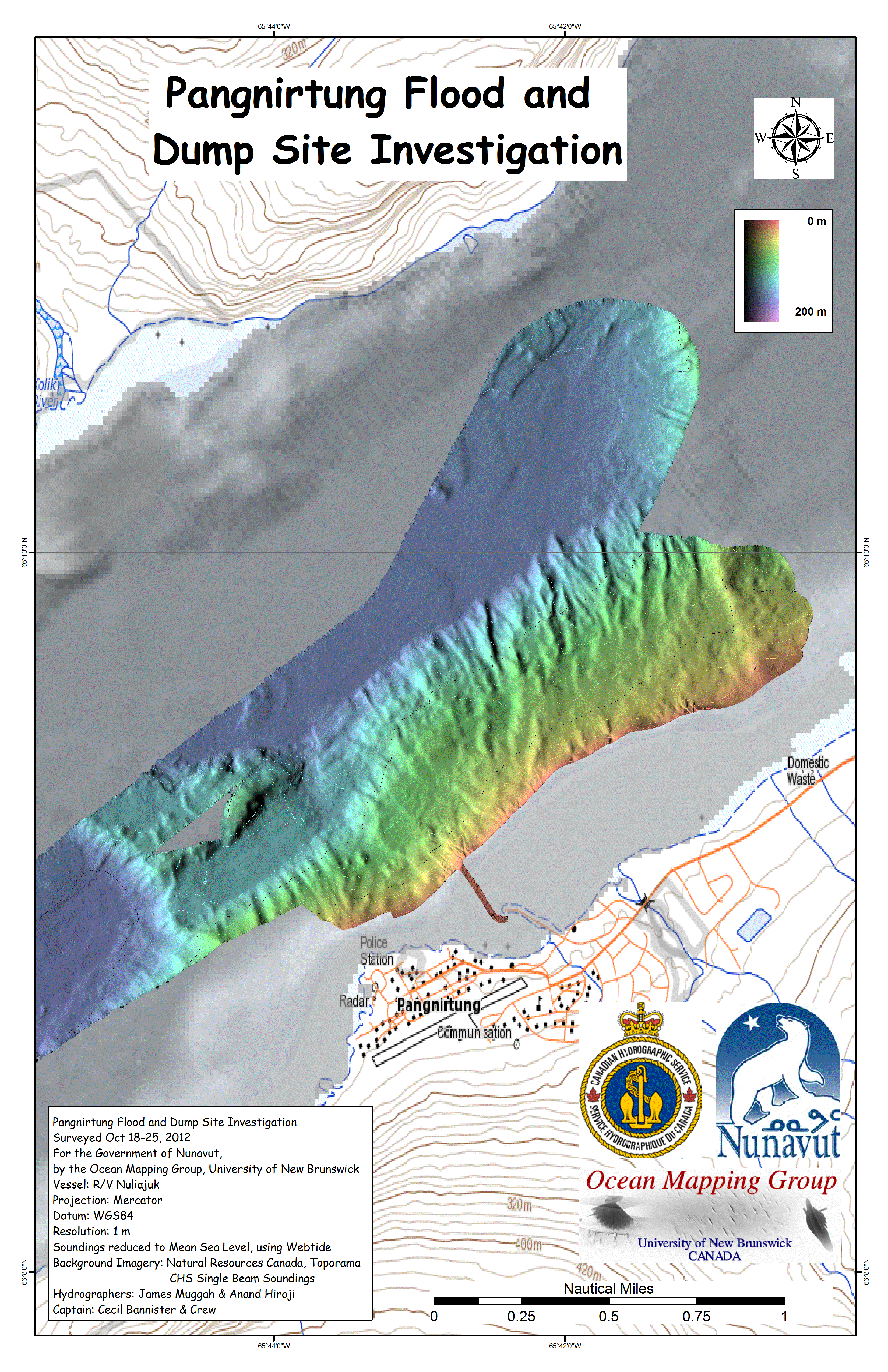
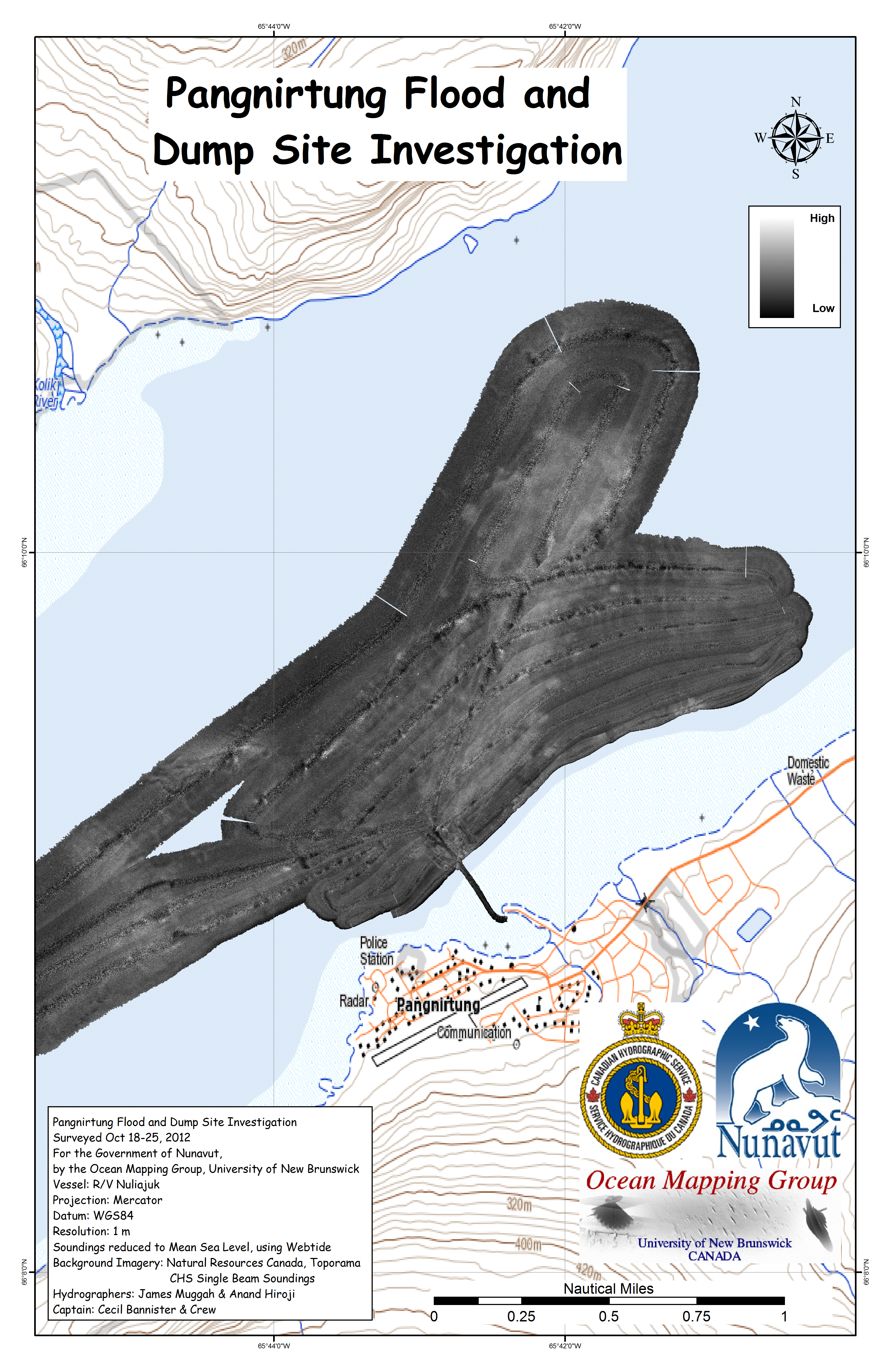
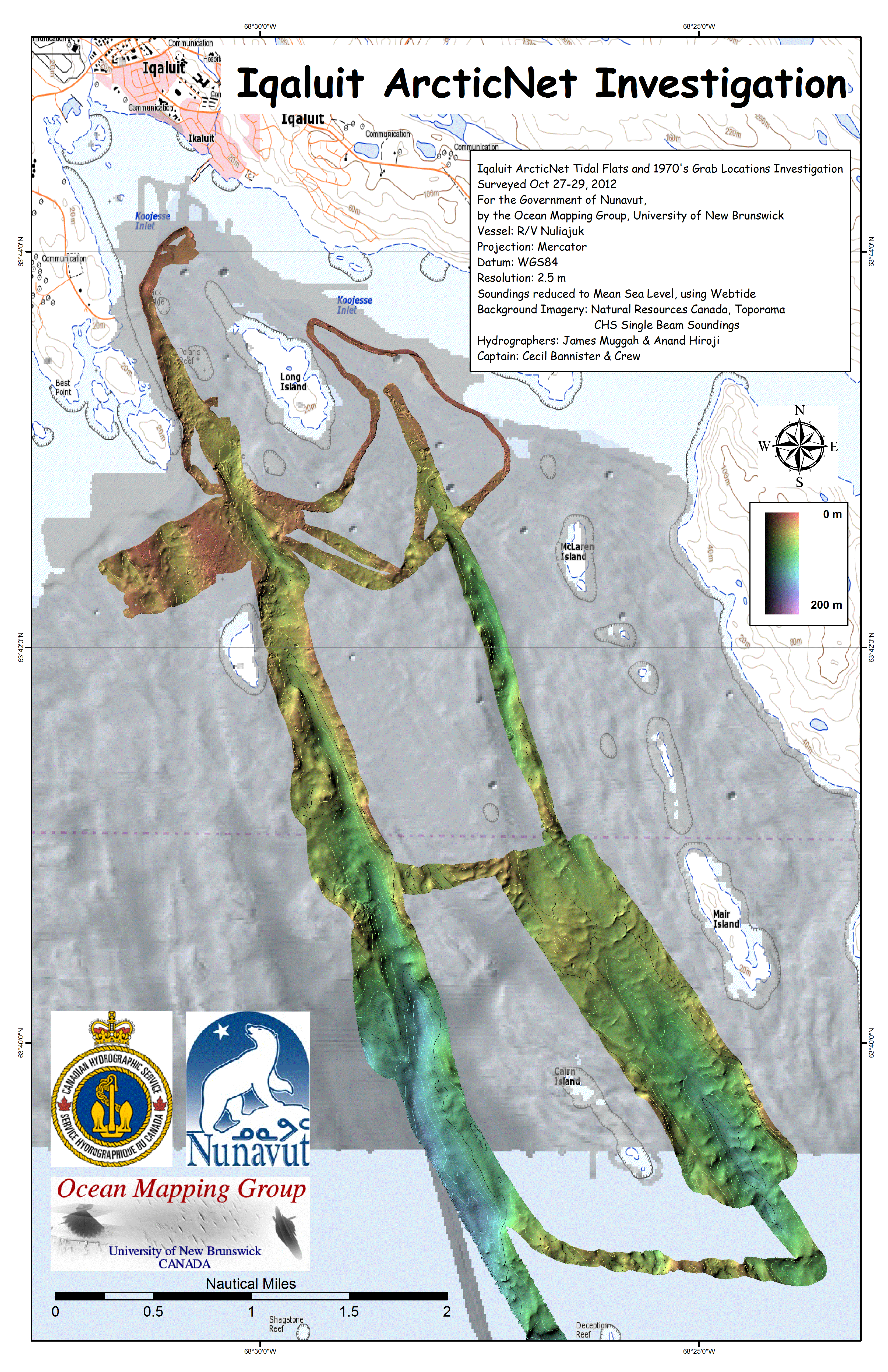
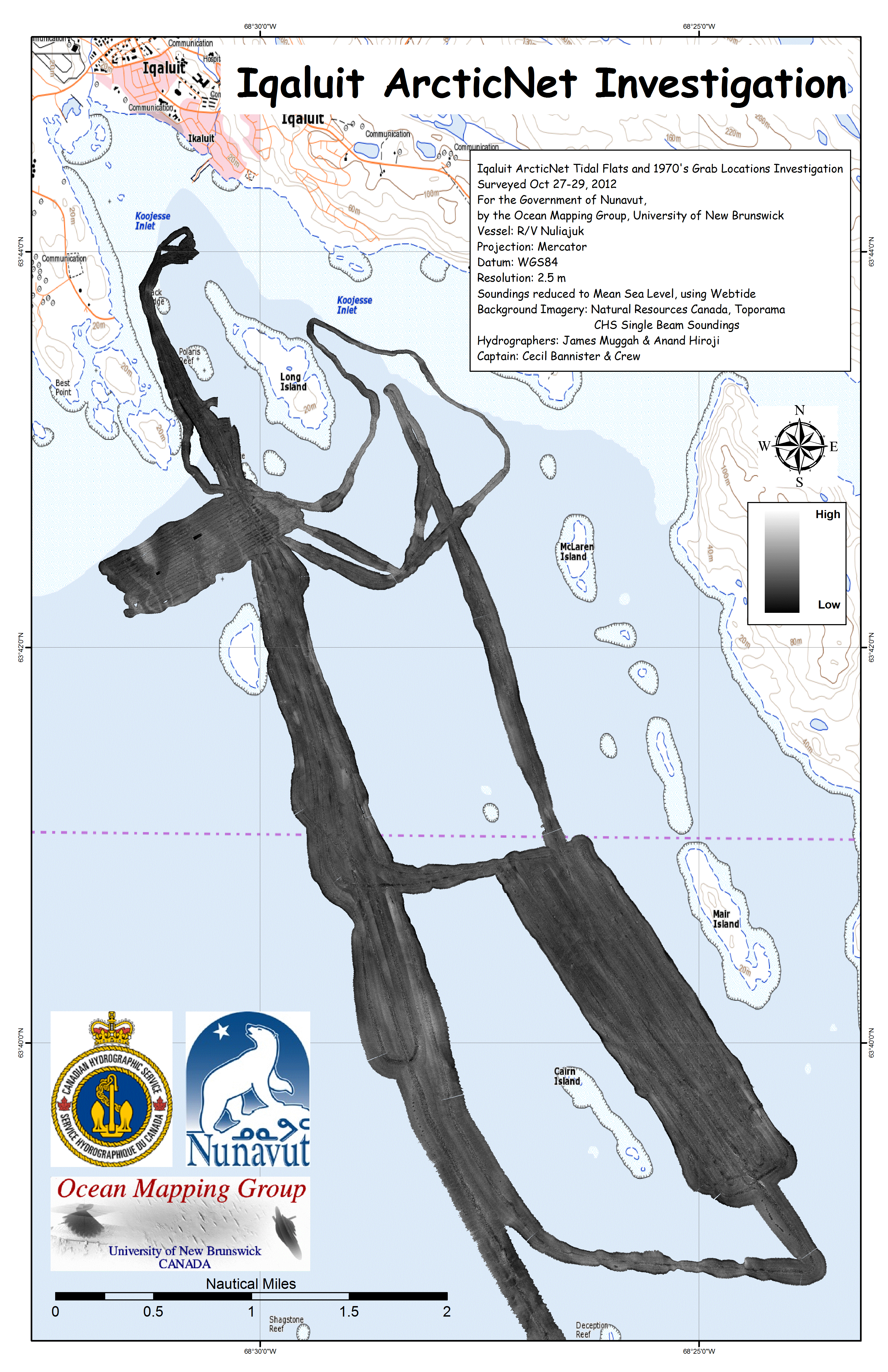
Nuliajuk 2012 Mapping Operations
-
Preliminary Results James Muggah, Travis Hamilton, Steve Brucker, Weston Renoud, Anand Hiroji, Ian Church and John Hughes Clarke Ocean Mapping Group Dept. Geodesy and Geomatics Engineering University of New Brunswick |
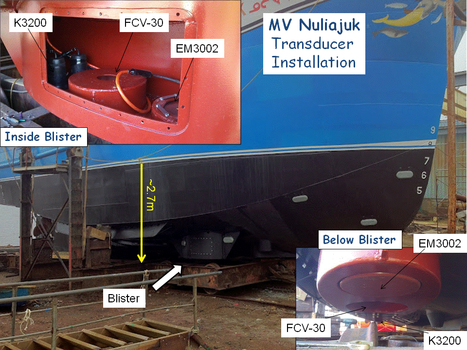 |
The new equipment was installed
together with the FCV-30 on a dedicated
new steel blister on the starboard underside of the vessel. This steel
blister has proved to be ideal. No significant flow or
engine-associated noise has been noted. Compared to the same sonar,
when previously installed on the CSL Heron in the same conditions
(Baffin Island fjords in 2006/8), the maximum depth now achieved is
over 300m whereas the Heron only ever achieved 220m, suggesting
improved noise characteristics. The installations provides high quality data at speeds up to 10 knots (warp speed) and in +/-5 degrees of roll and or pitch. The installation is permanent, and the transducers will be left on board over winter for possible 2013 operations. All topside electronics are being returned to UNB for storage, maintenance and upgrading. |
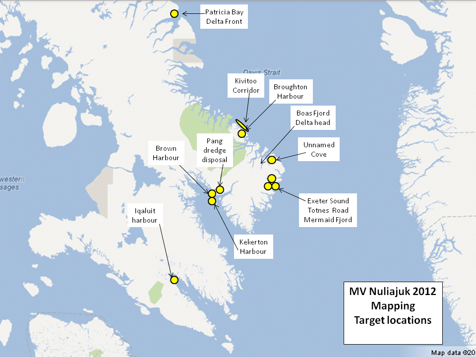 |
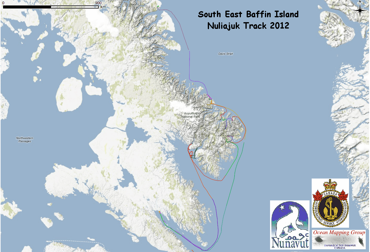
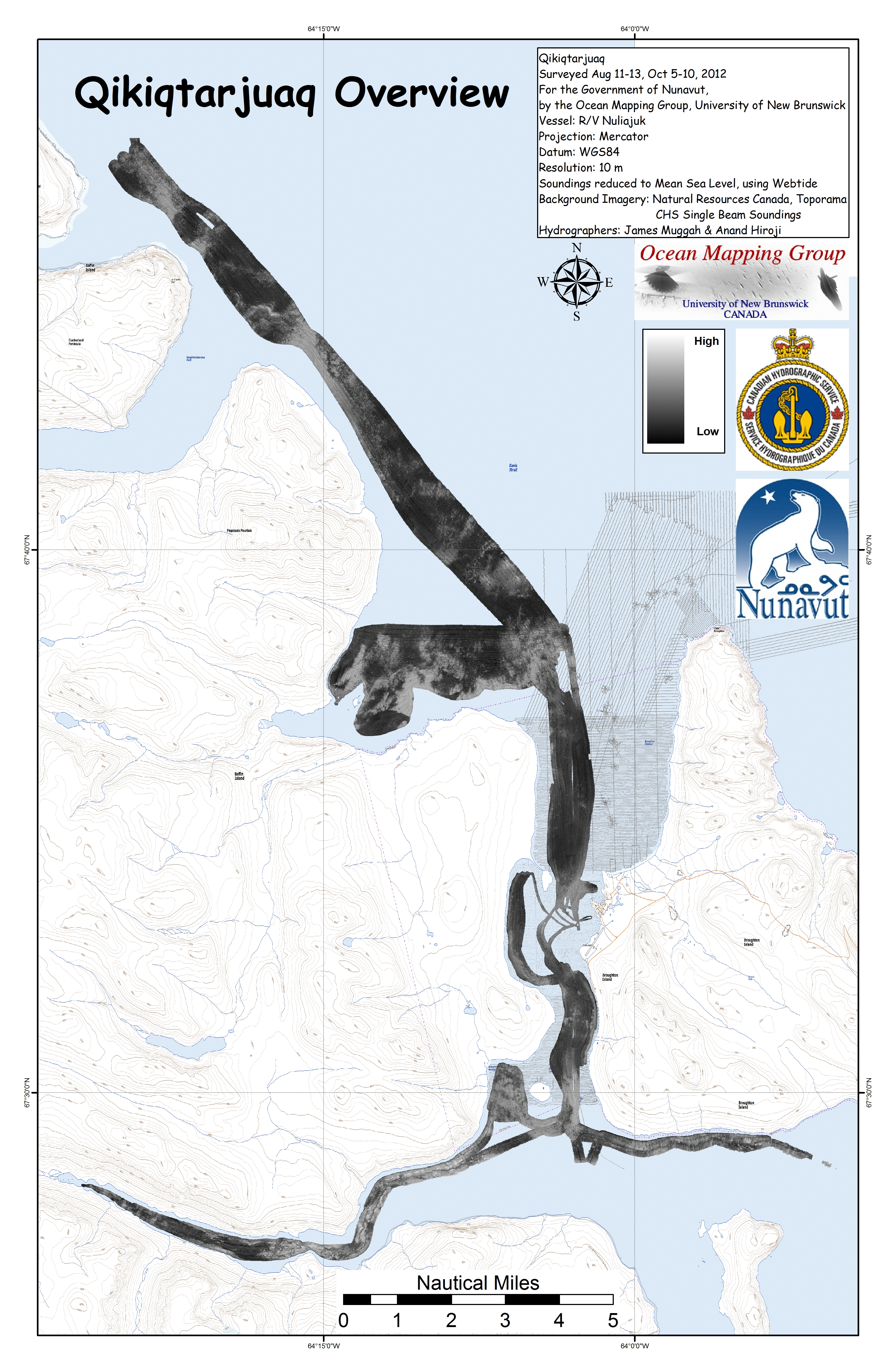
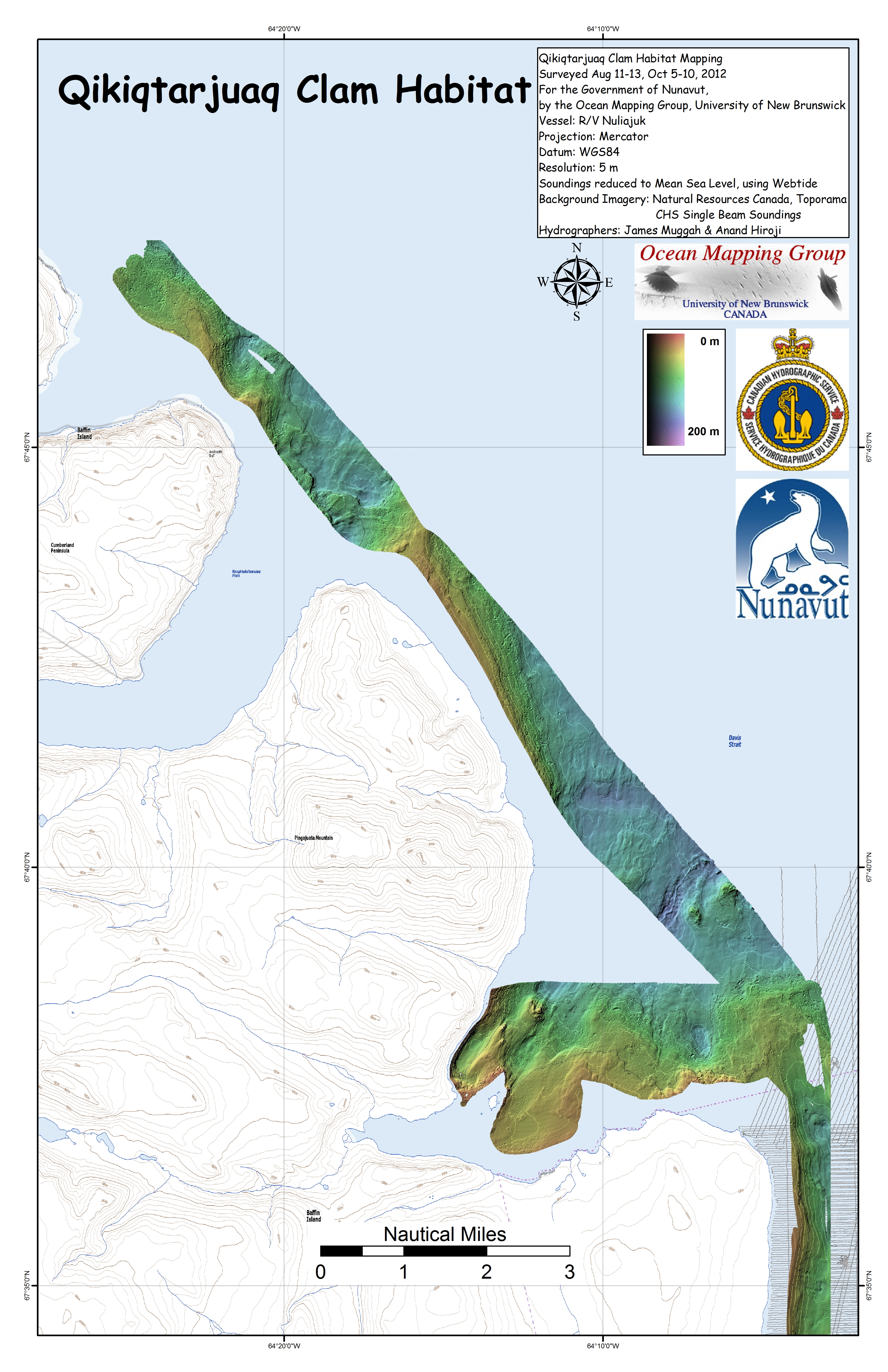
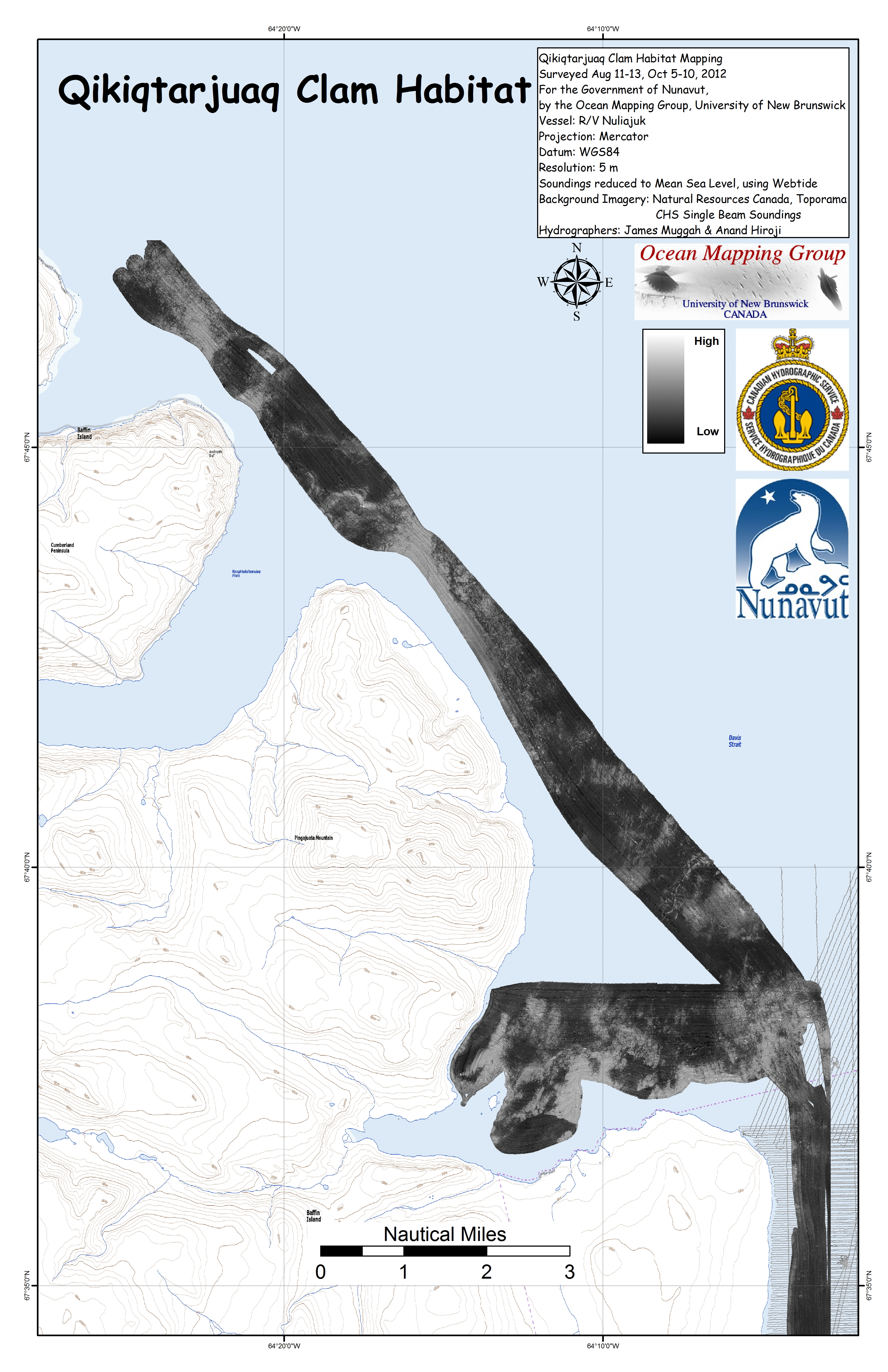
Overview
map
from
Clyde
to
Iqaluit. Apart from a 2 day window in mid August, all the Nuliajuk mapping in Nunavut took place during a 30 day period covering the full month of October. The UNB mapping team boarded in Clyde River and disembarked in Iqaluit. The main target areas were:
|
 |
 |
 |
 |
 |
 |
 |
 |
 |
 |
 |
 |
 |
 |
 |
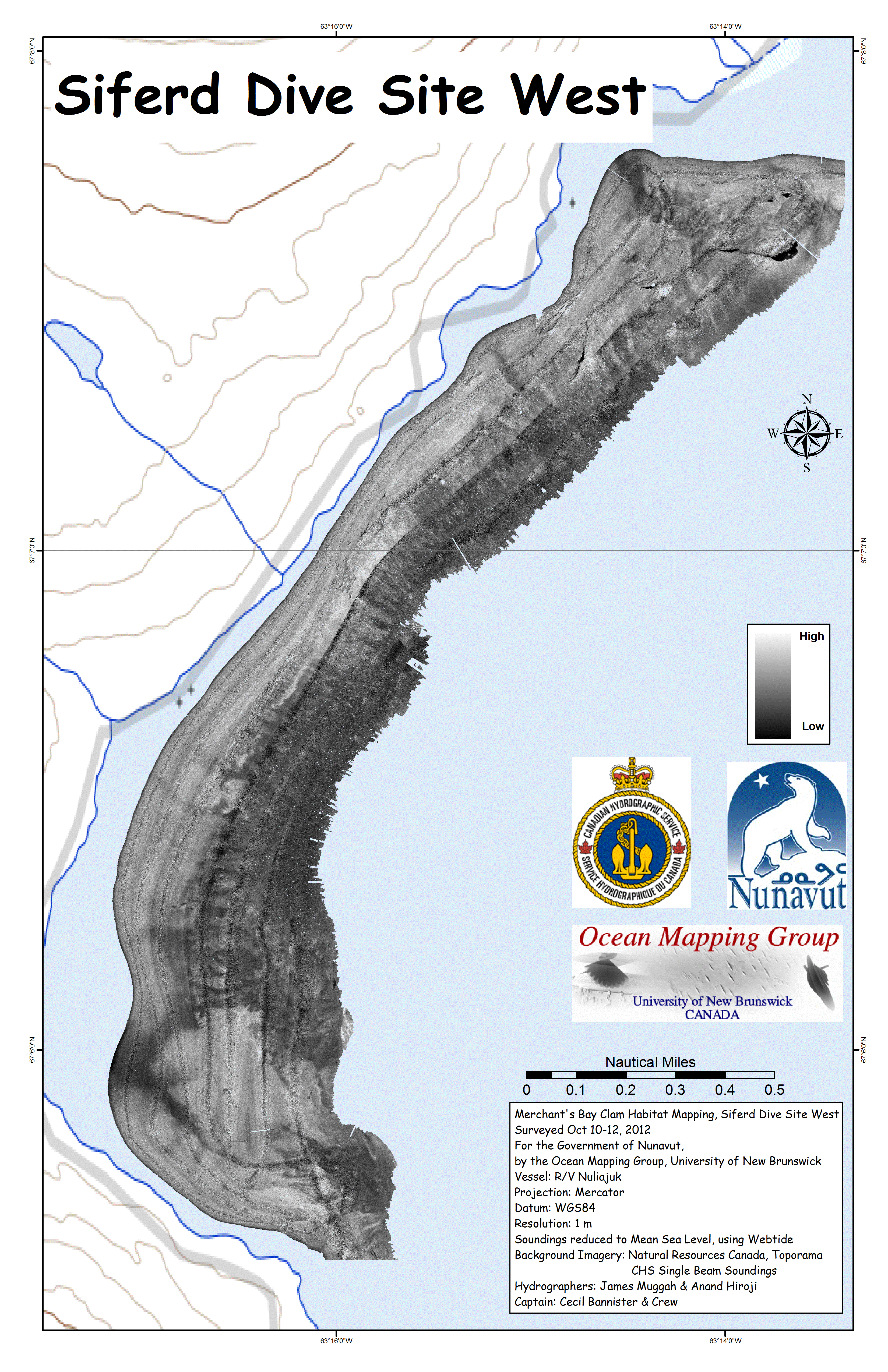 |
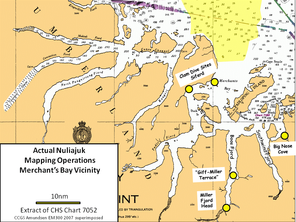
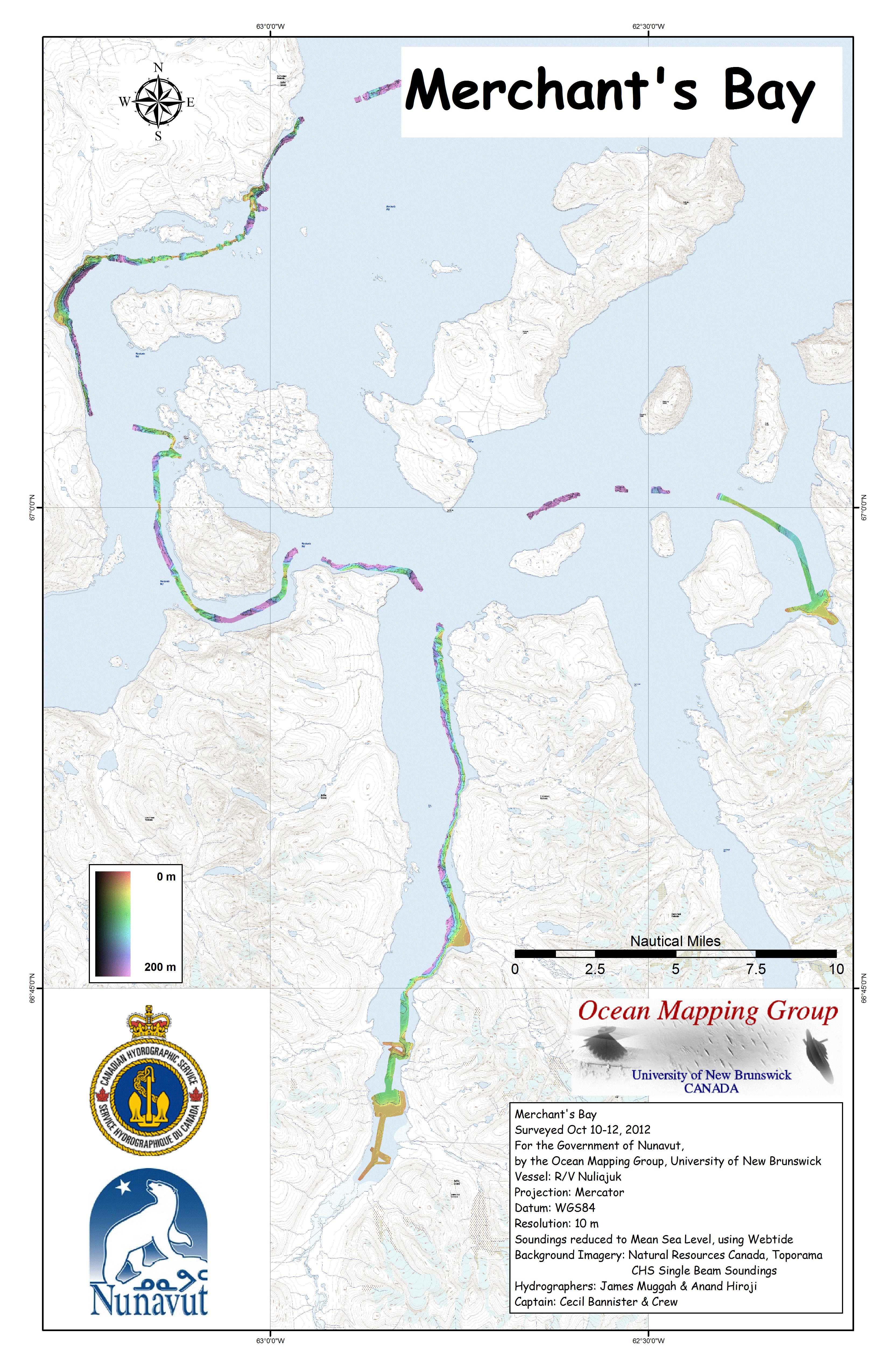
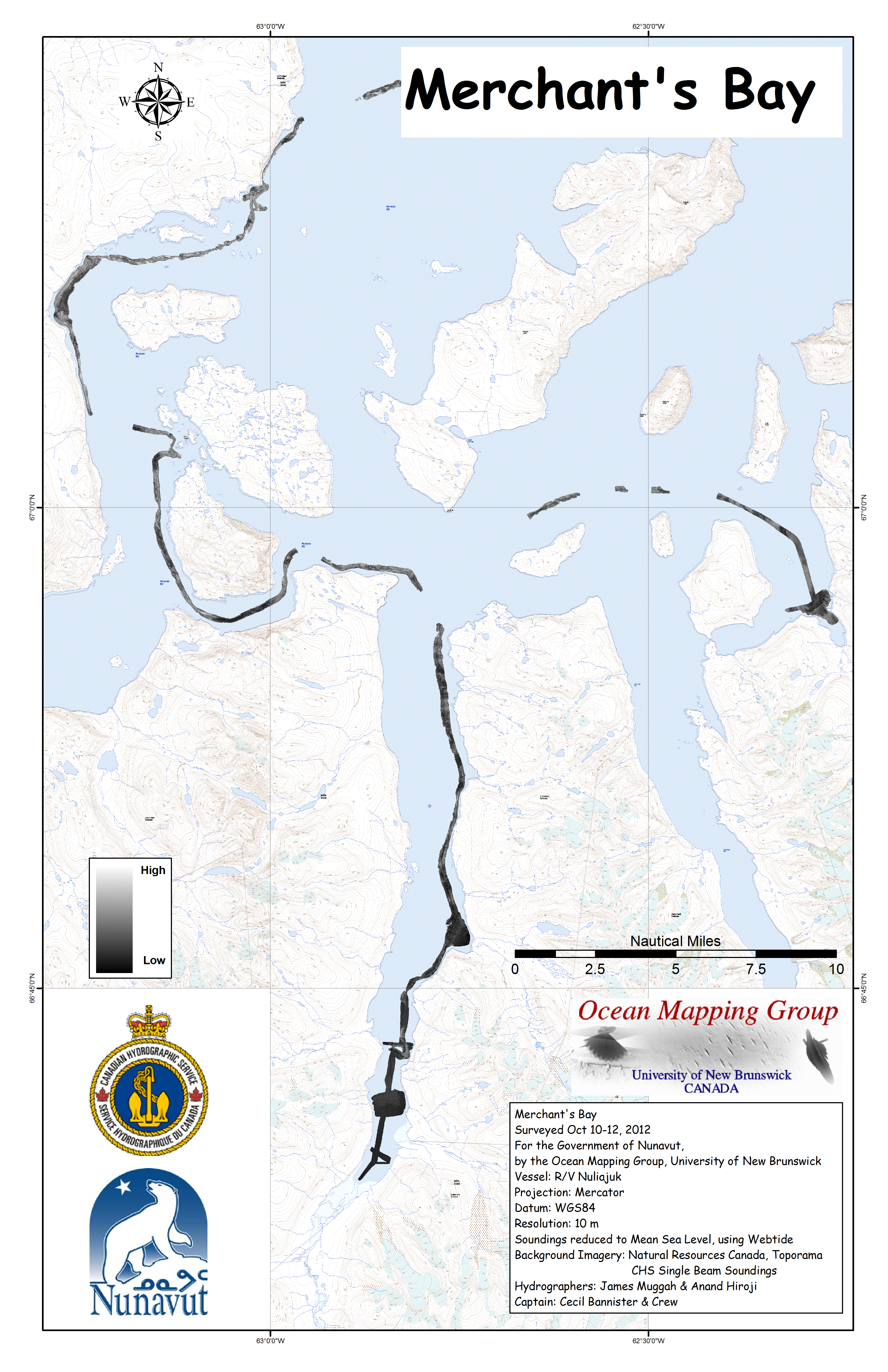
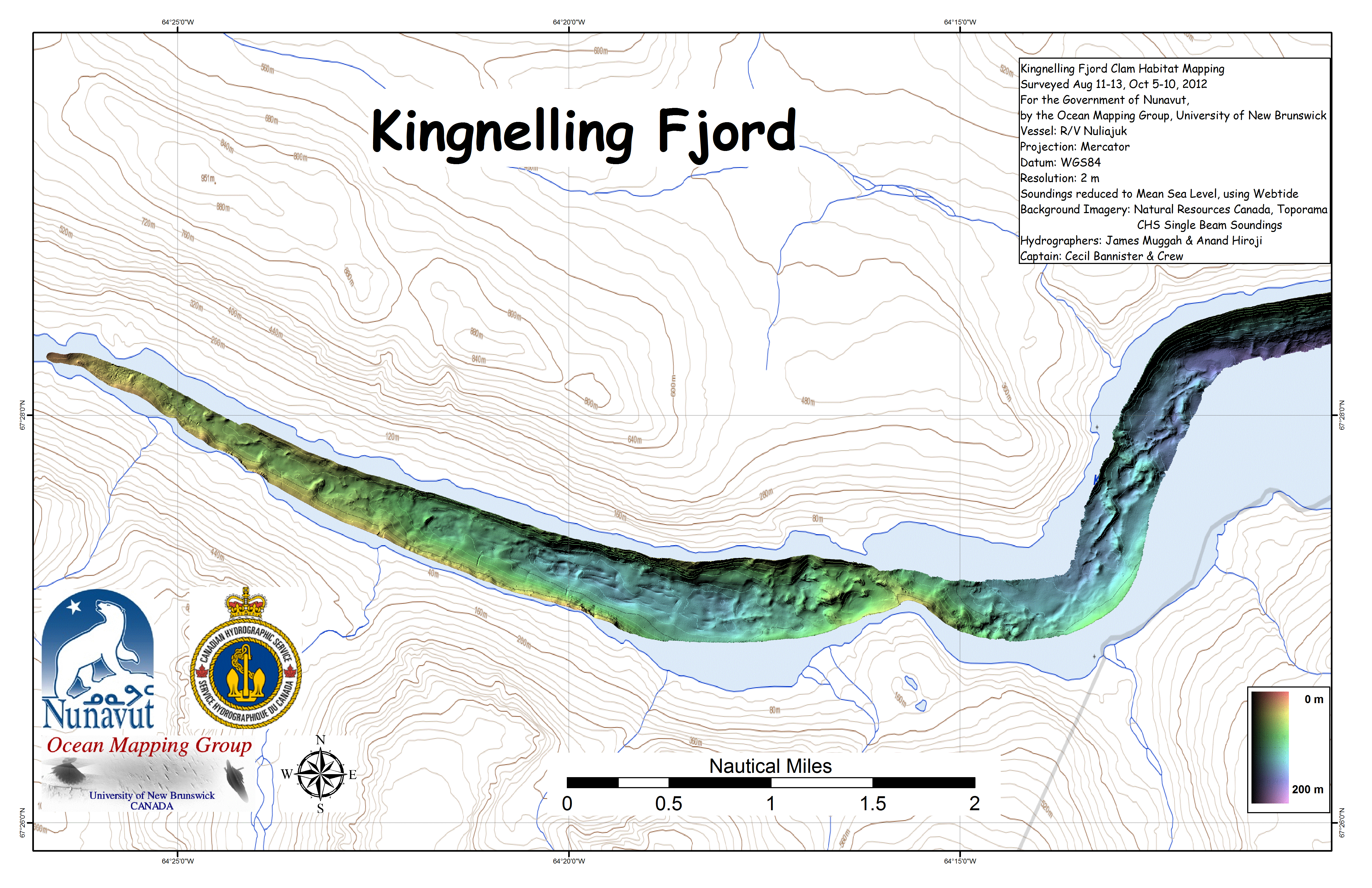
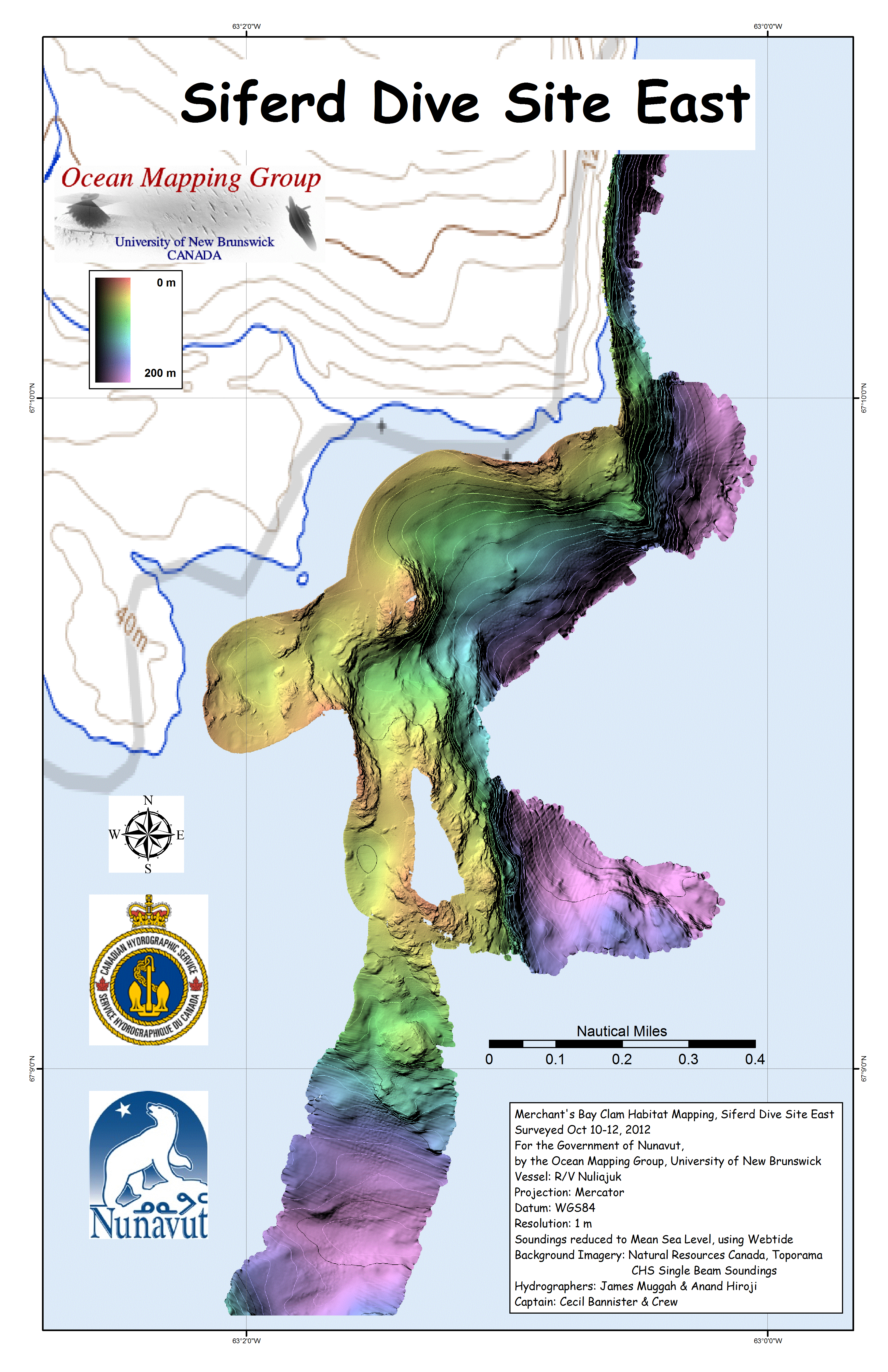
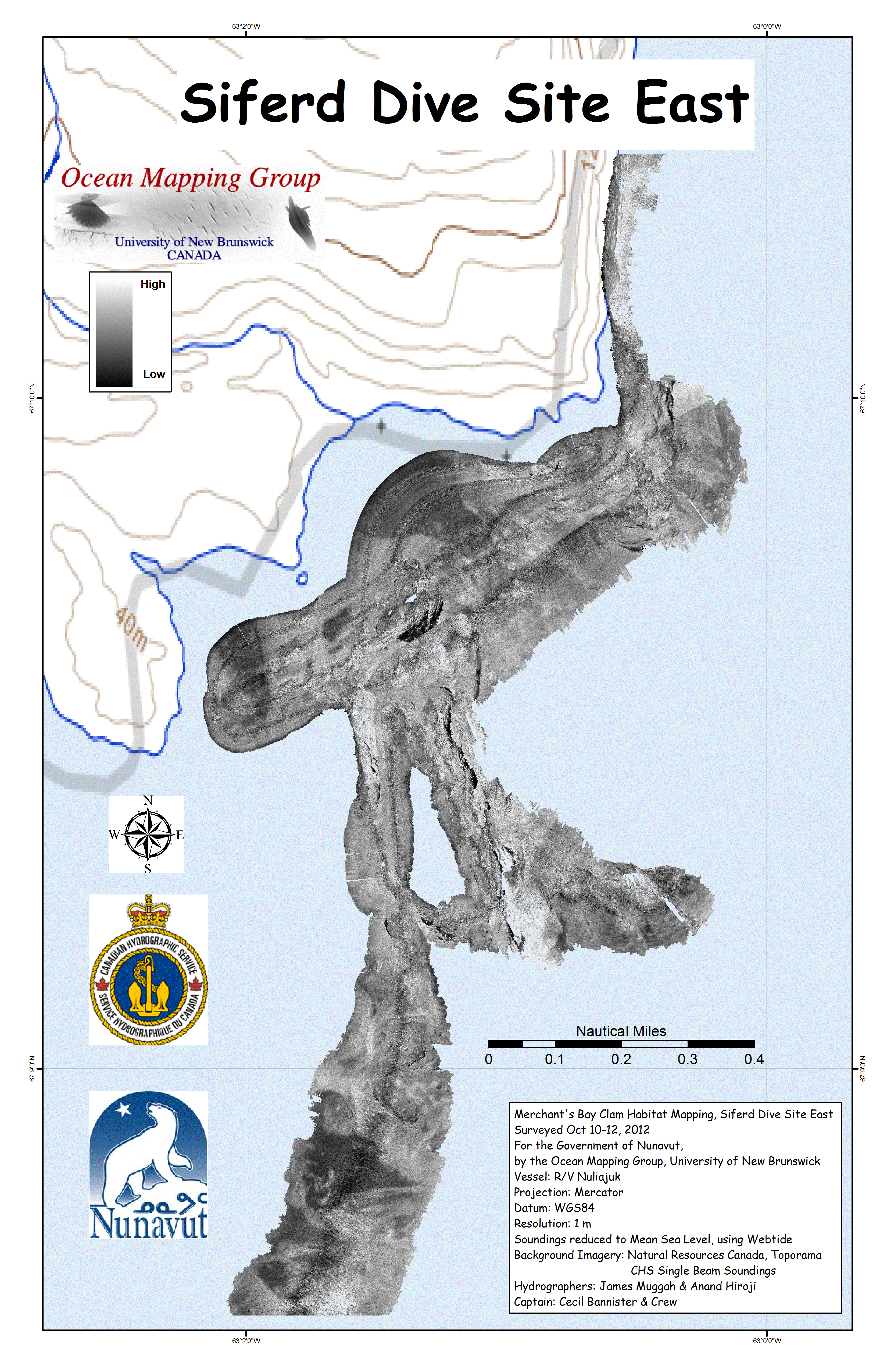
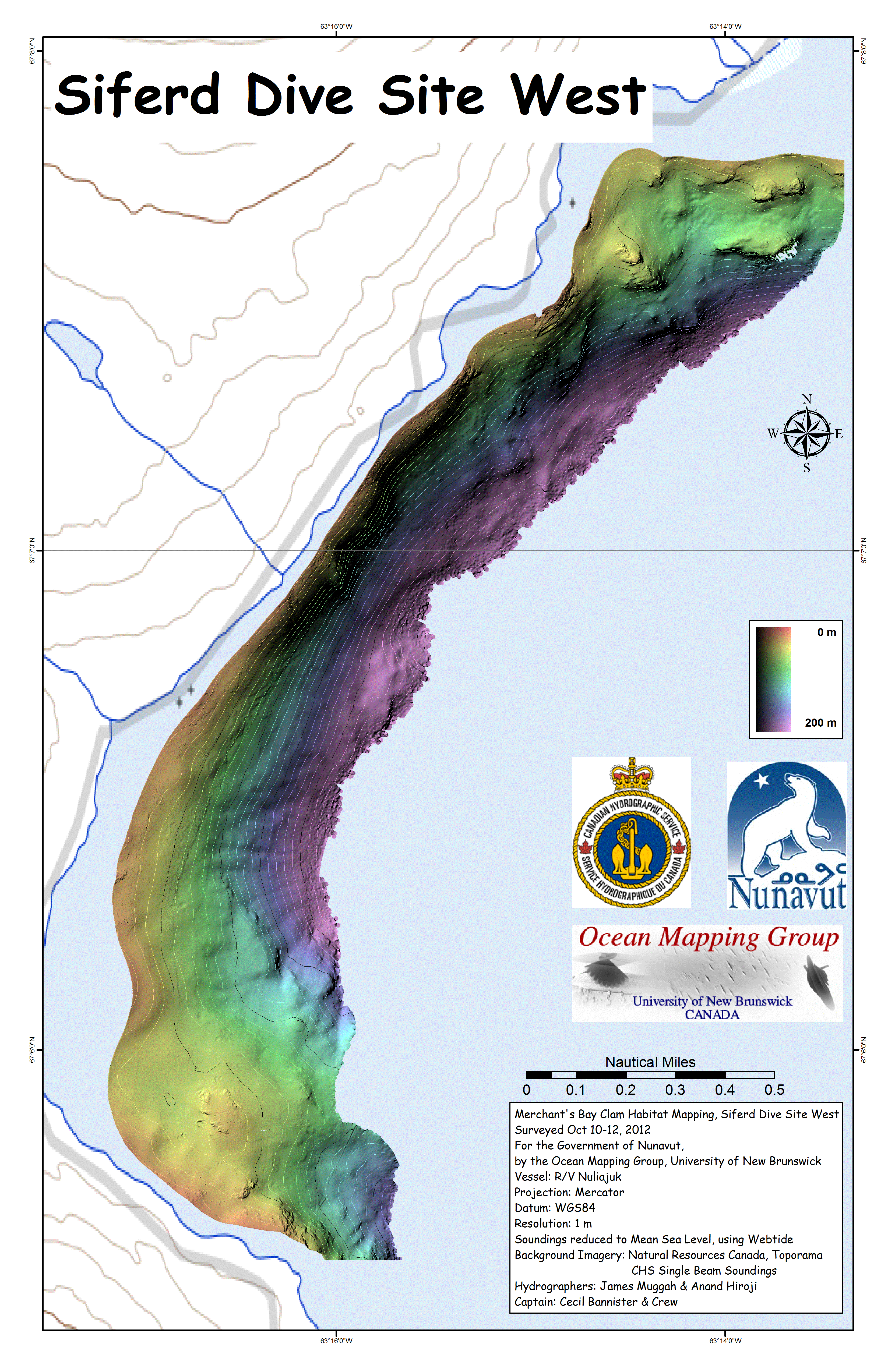
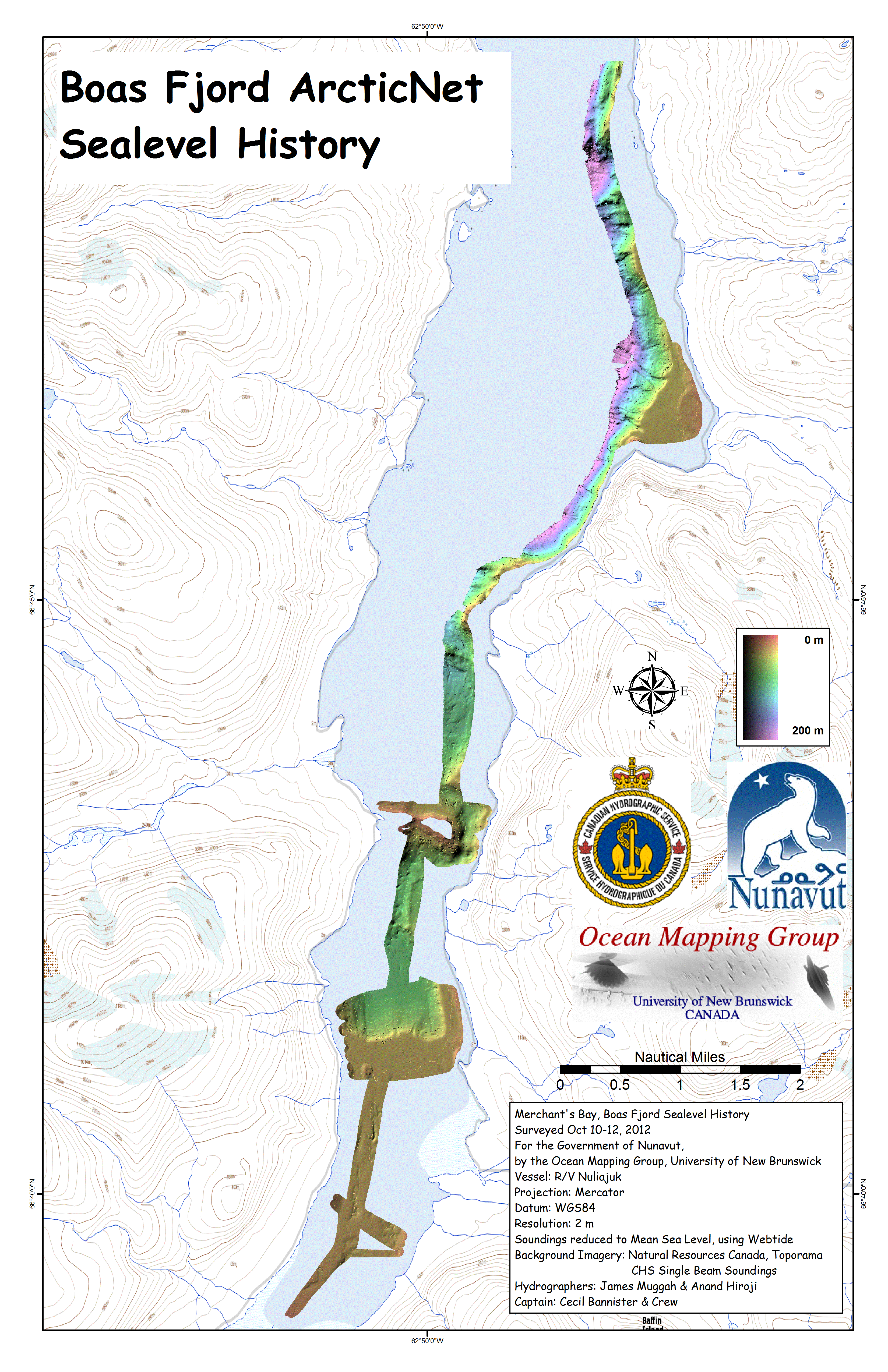
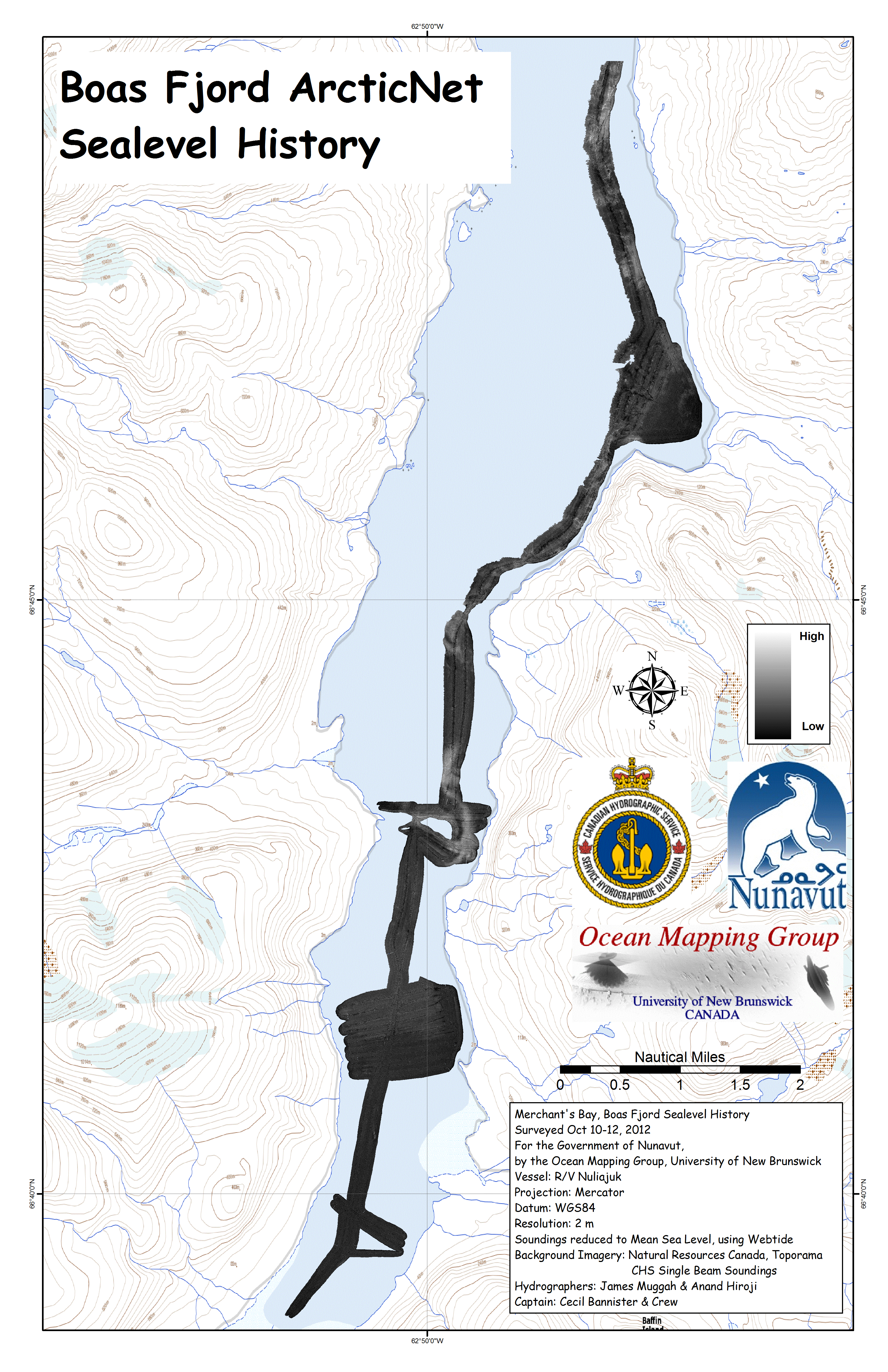
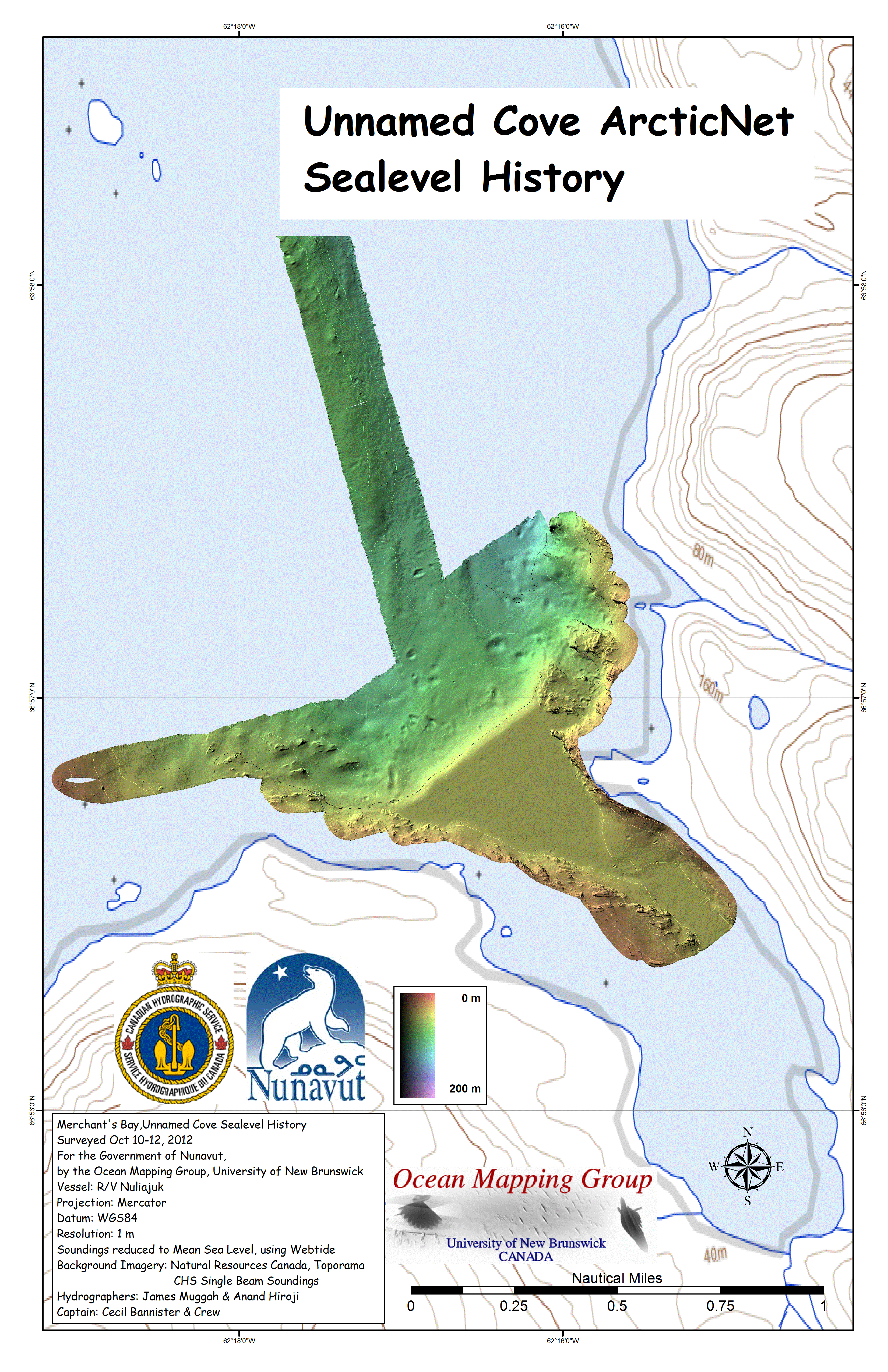
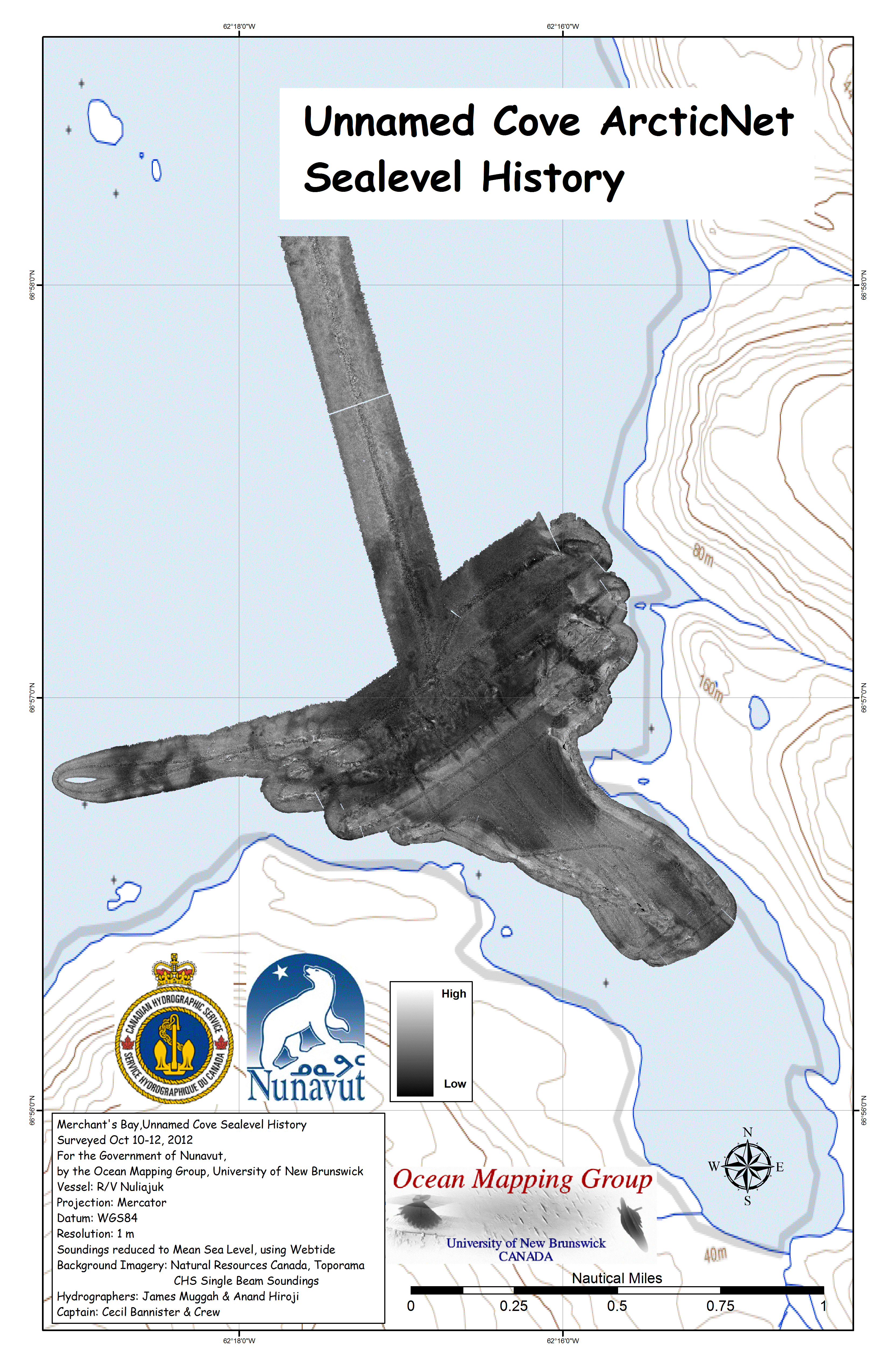
| Merchants
Bay
East
-
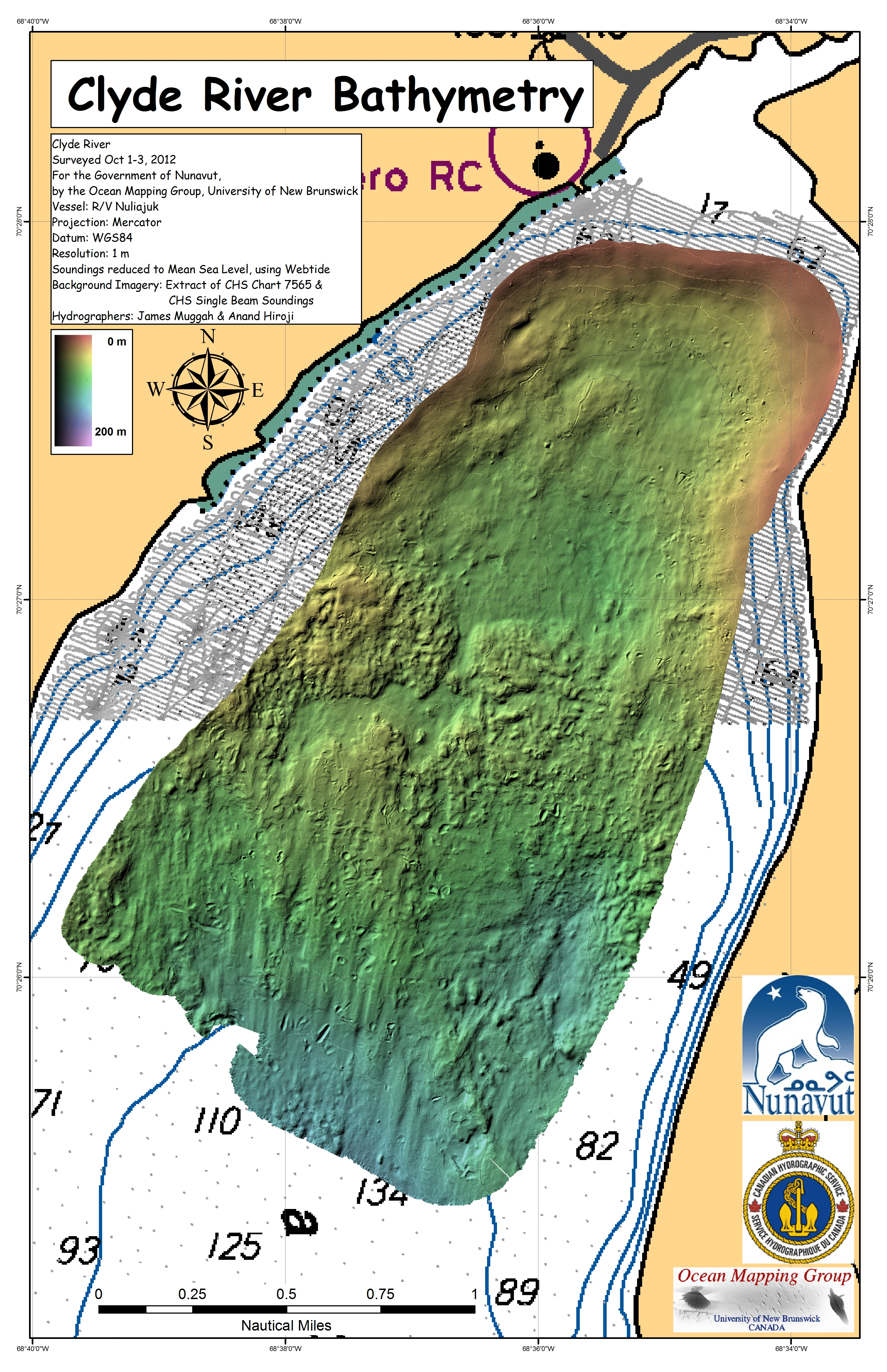
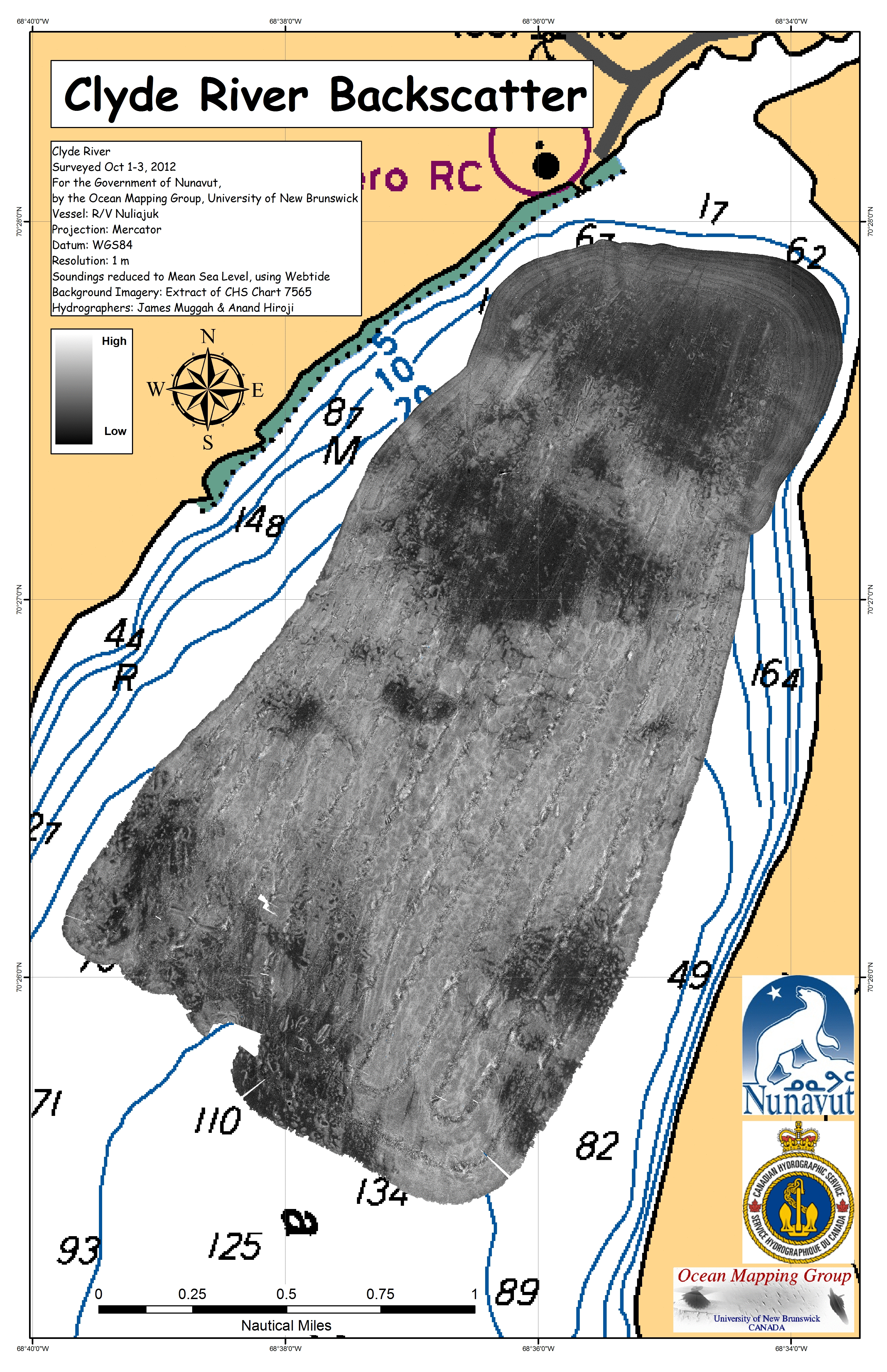
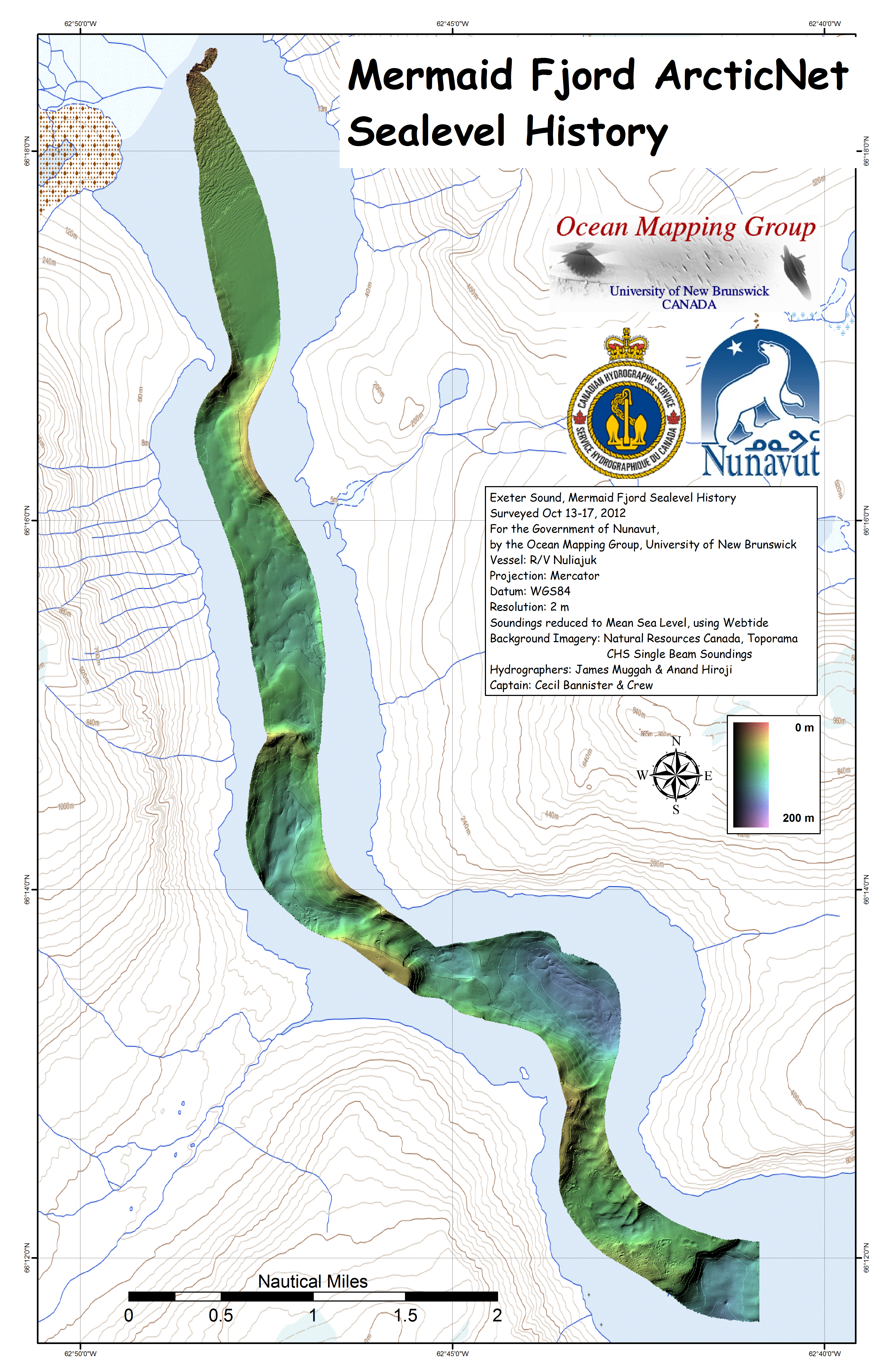
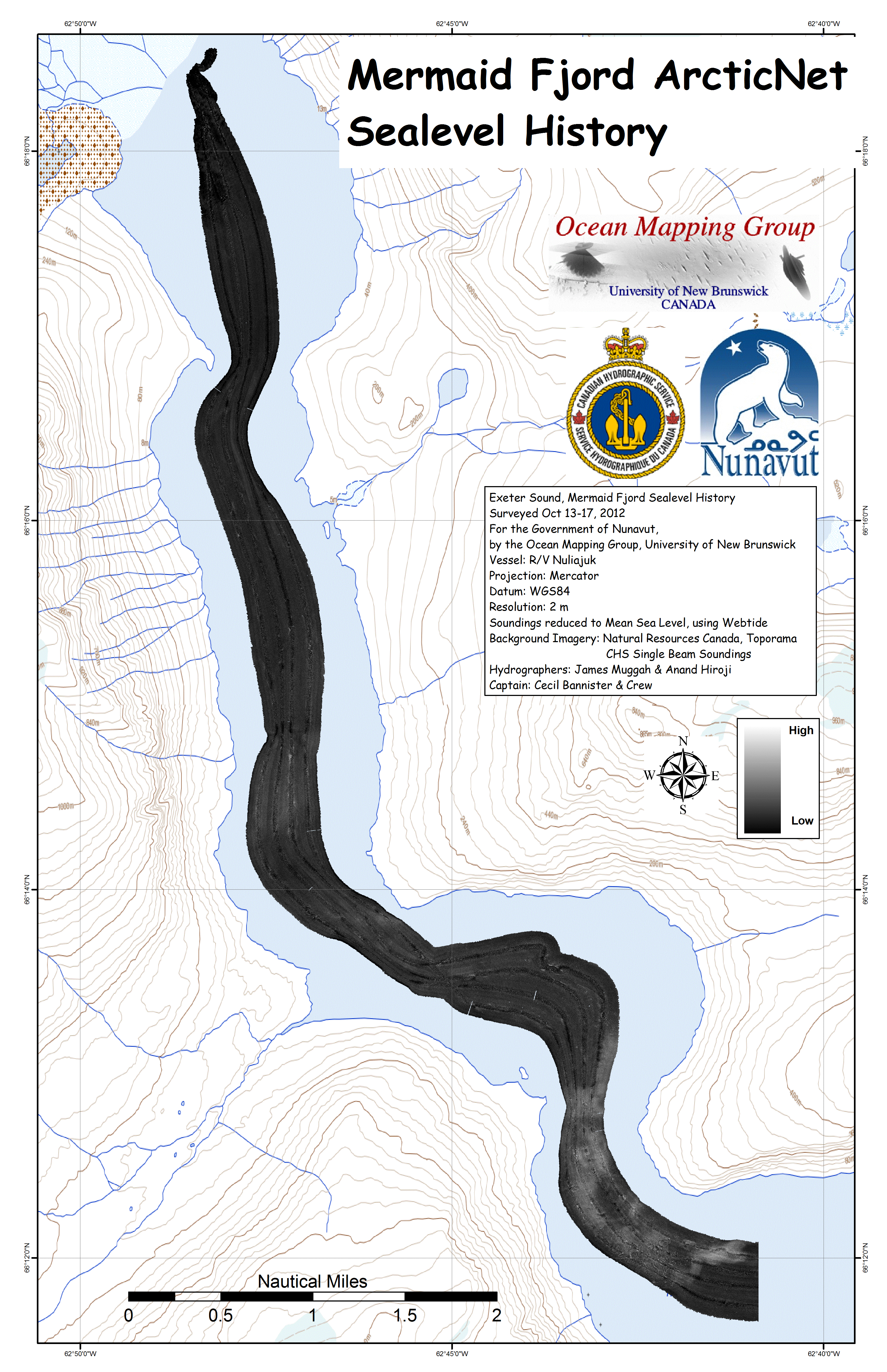
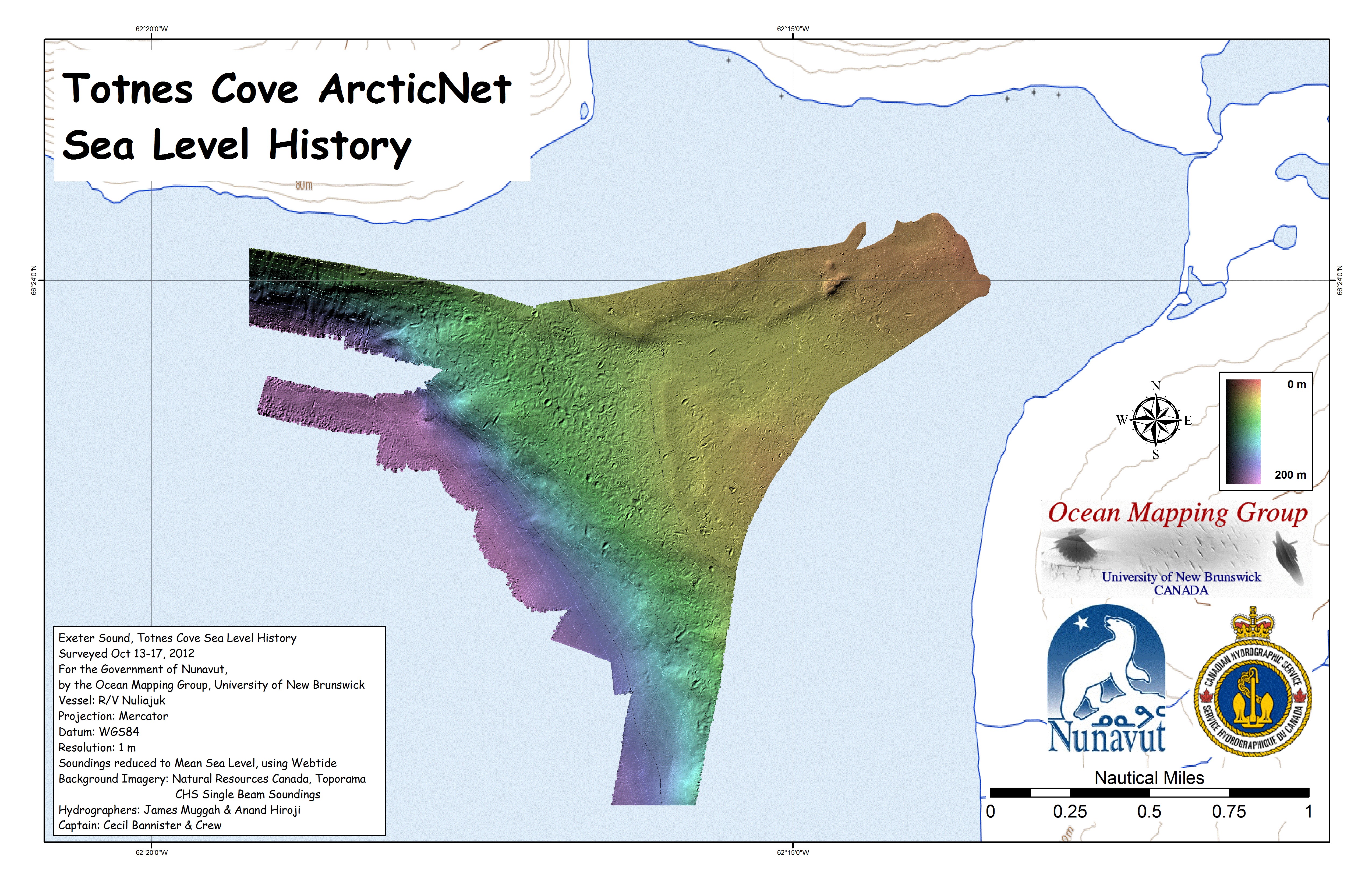
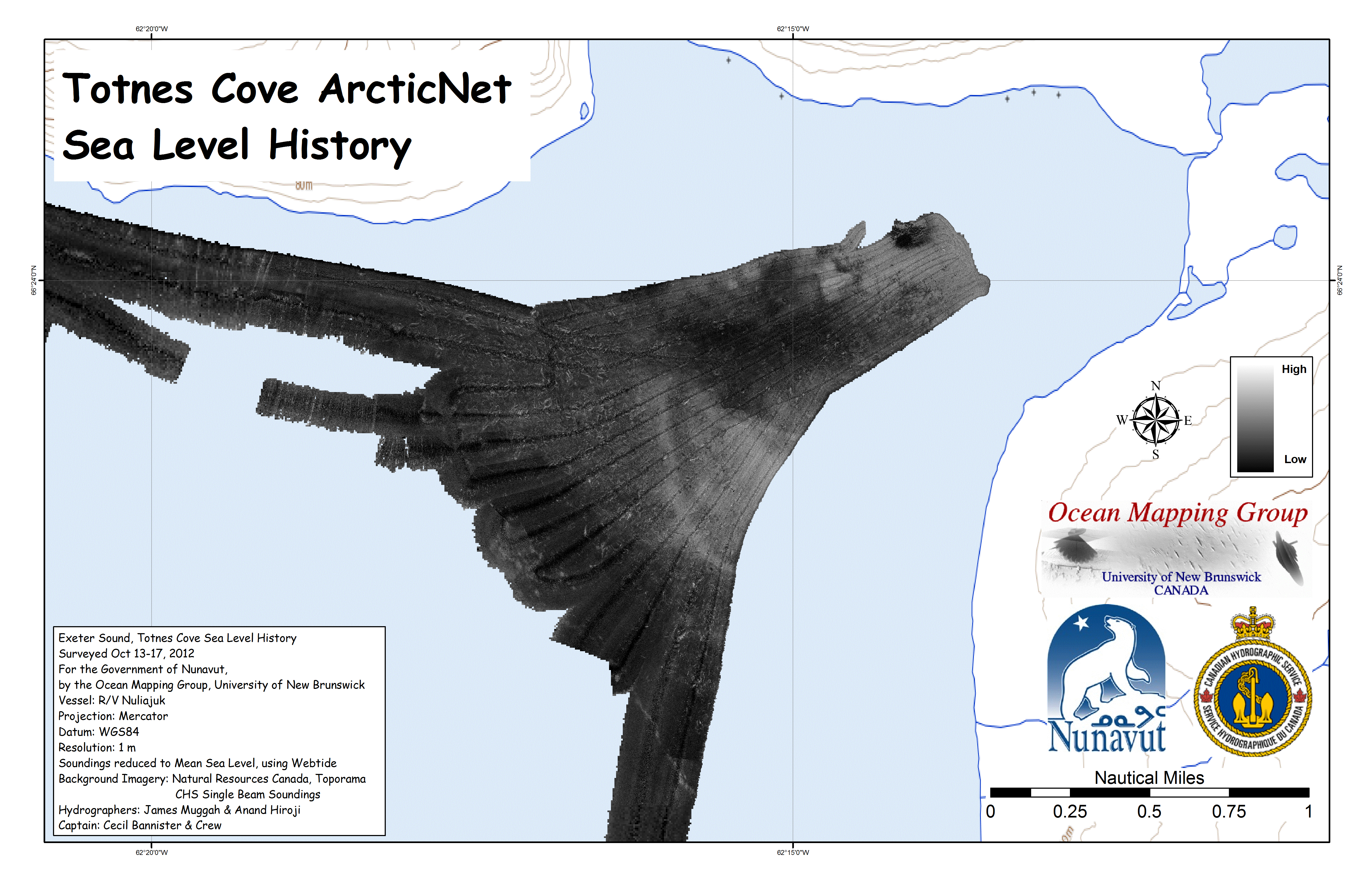
ArcticNet
sites The focus site was Boas Fjord where a suspected terrace halfway in and one at the head of the fjord were both investigated. In addition, in order to get to the head of the fjord, a previously unknown sill was identified and partially surveyed (enough to safely get around it). Note that the centre of the fjord is beyond EM3002 tracking depth. The FCV-30 sounder maintains tracking (up to > 1500m) and thus it is hoped that at least a crude representation of the bathymetry > 300m can be preserved. As an anchorage site on the way out, the "Unnamed" cove was investigated and found to also contain a useful submerged terrace. |
 |
 |
 |
 |
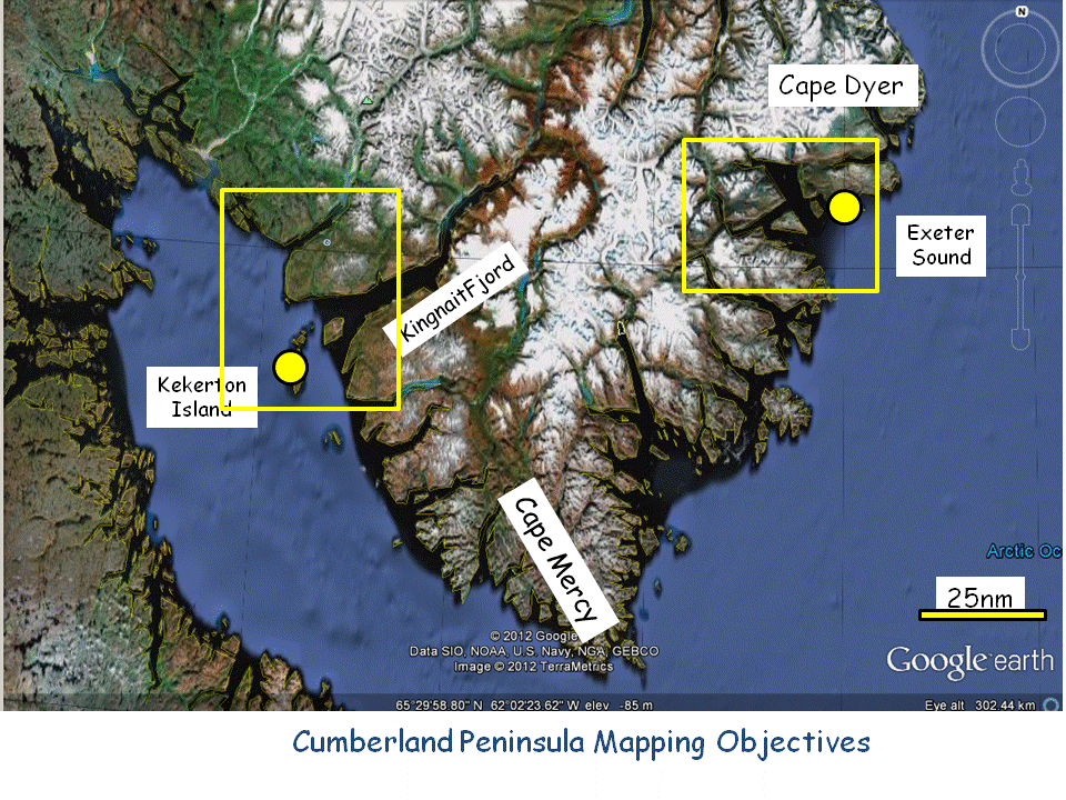 |
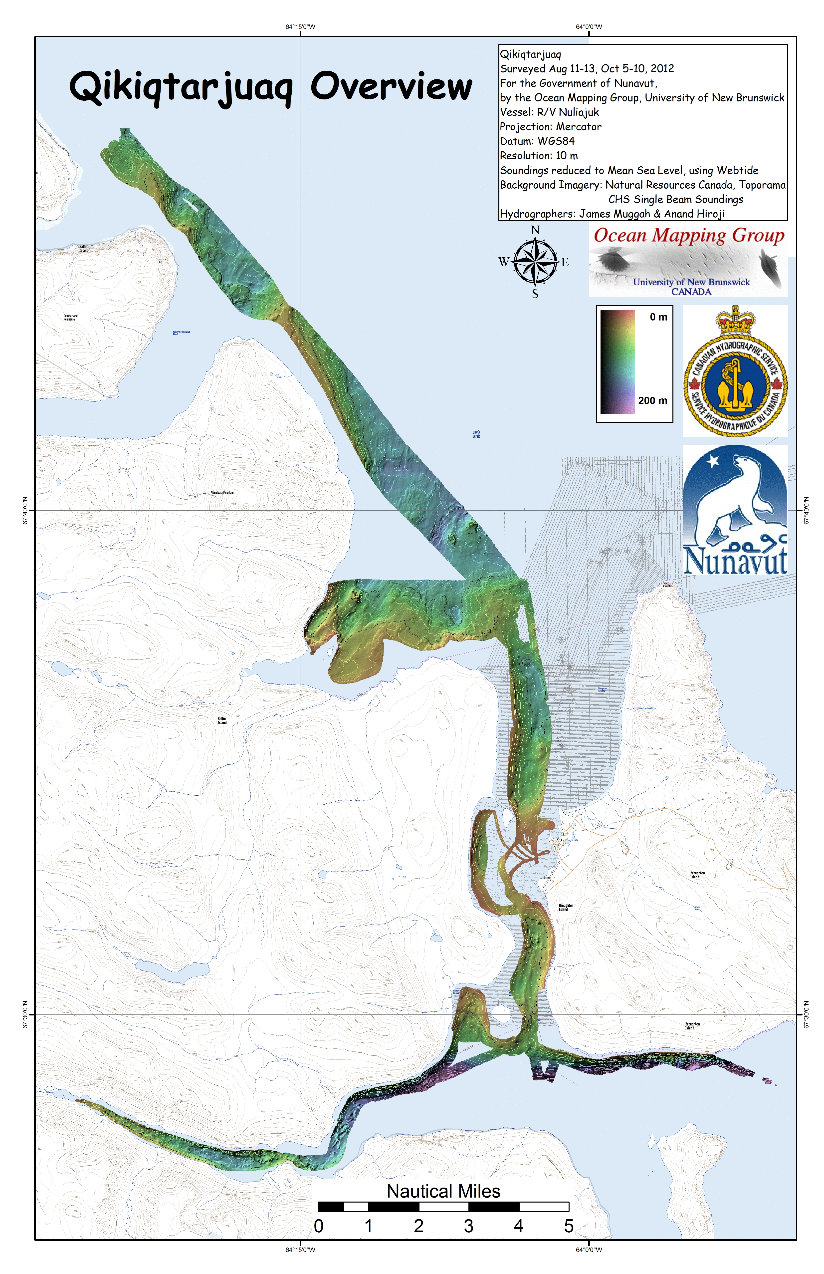
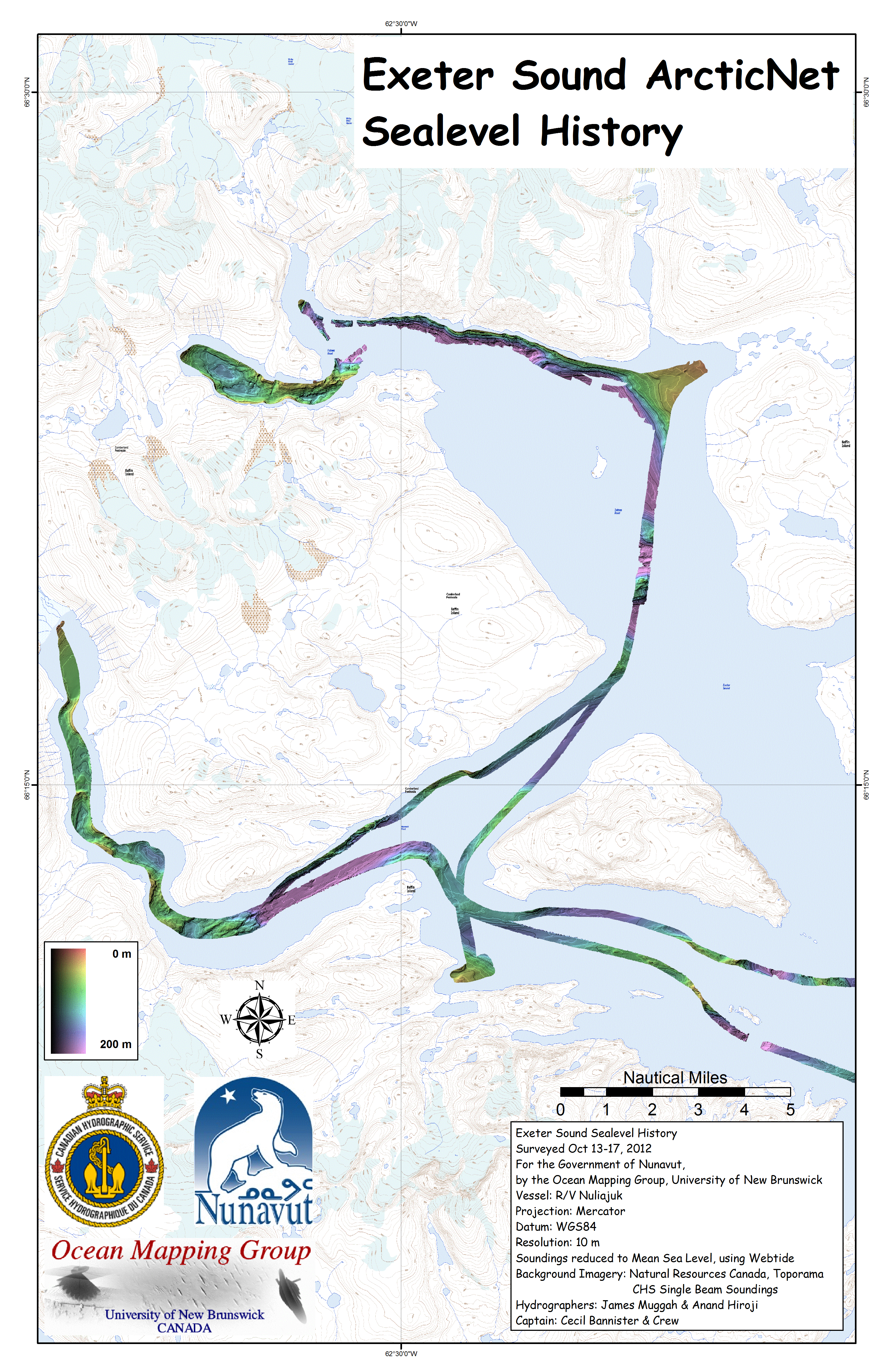
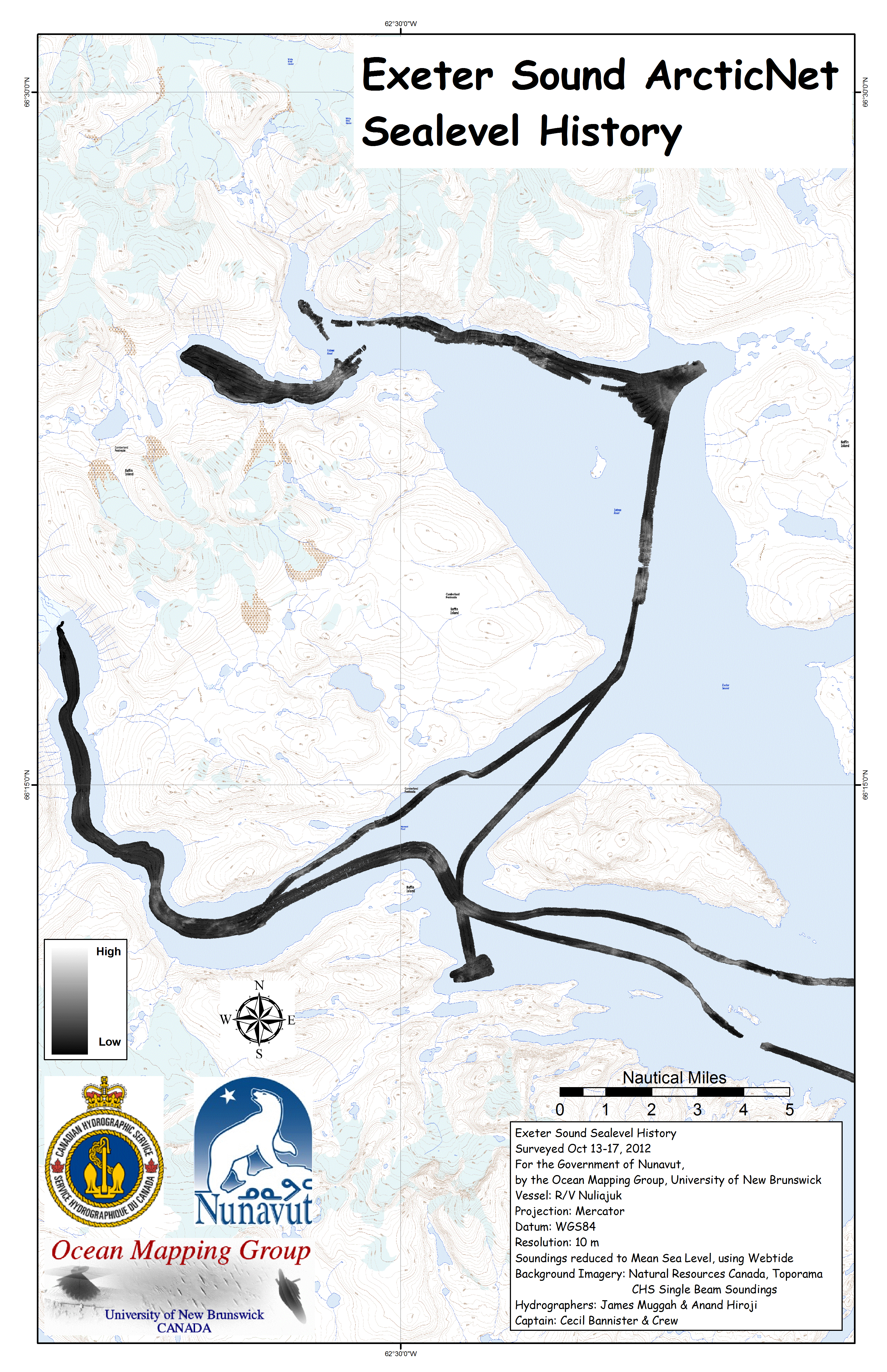
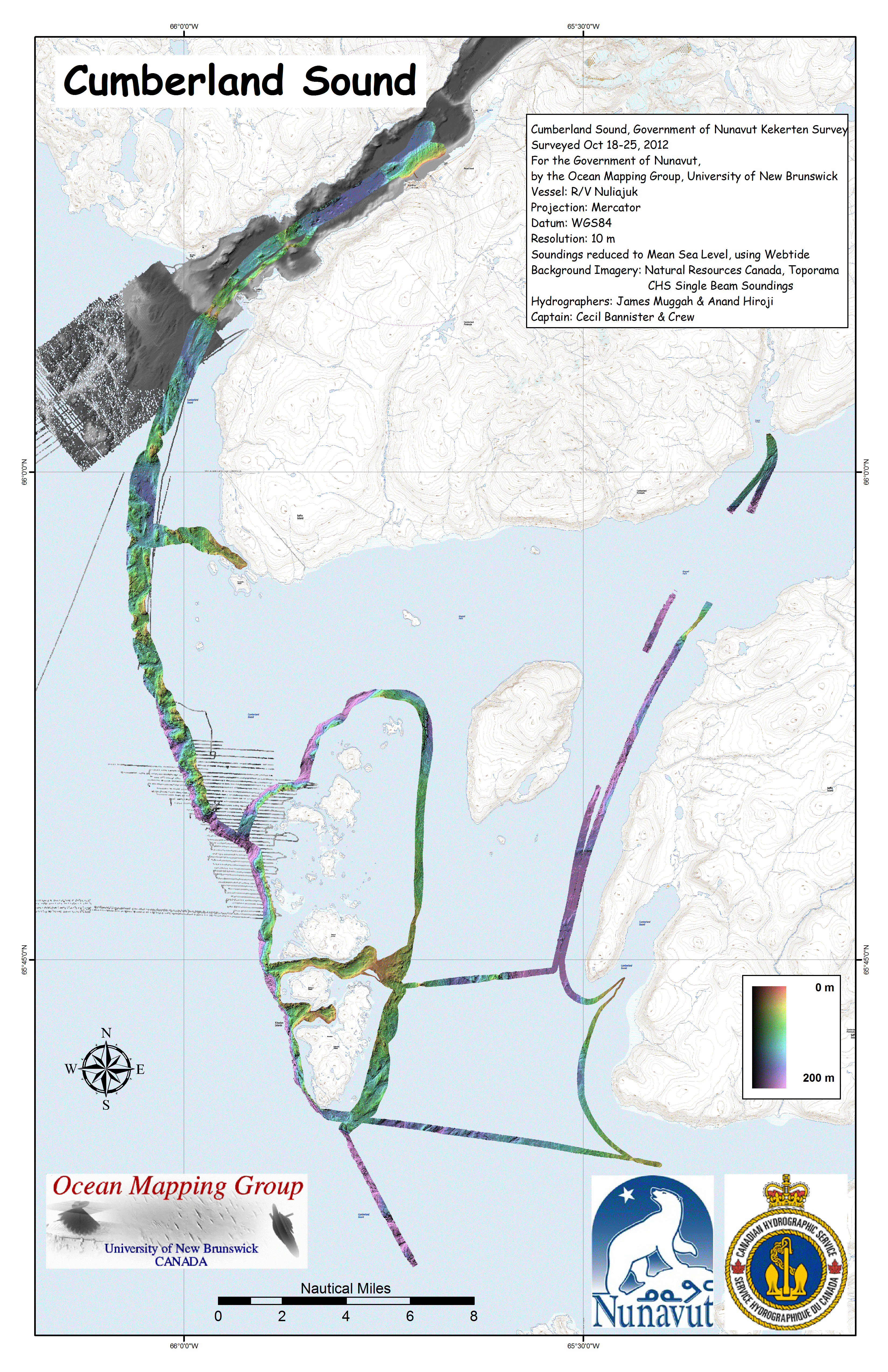
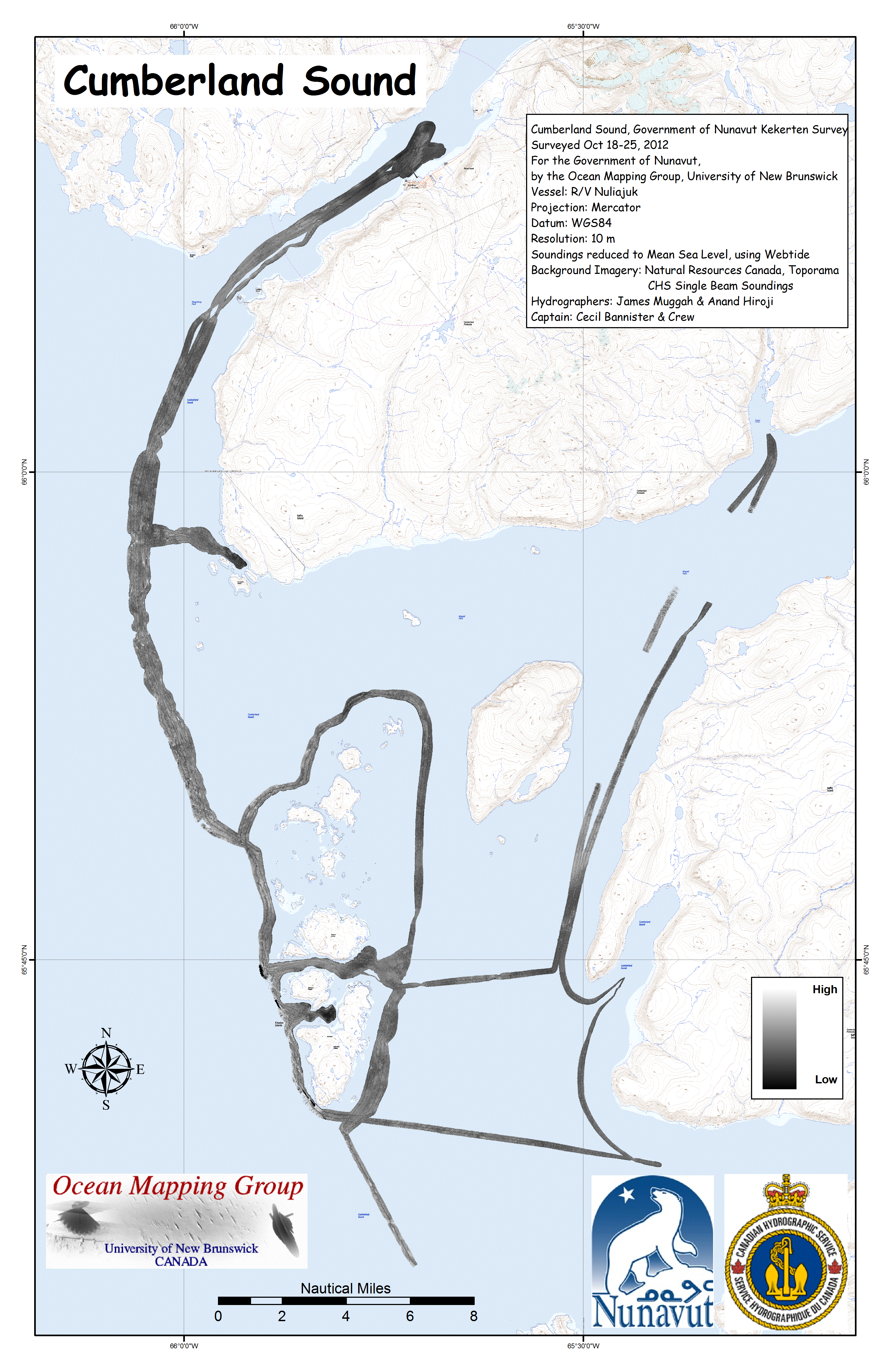
Cumberland
Peninsula
Mapping
Objectives There were two main objectives on the Cumberland Peninsula:
|
 |
 |
 |
 |
 |
 |
 |
 |
 |
 |
| Kikistan to
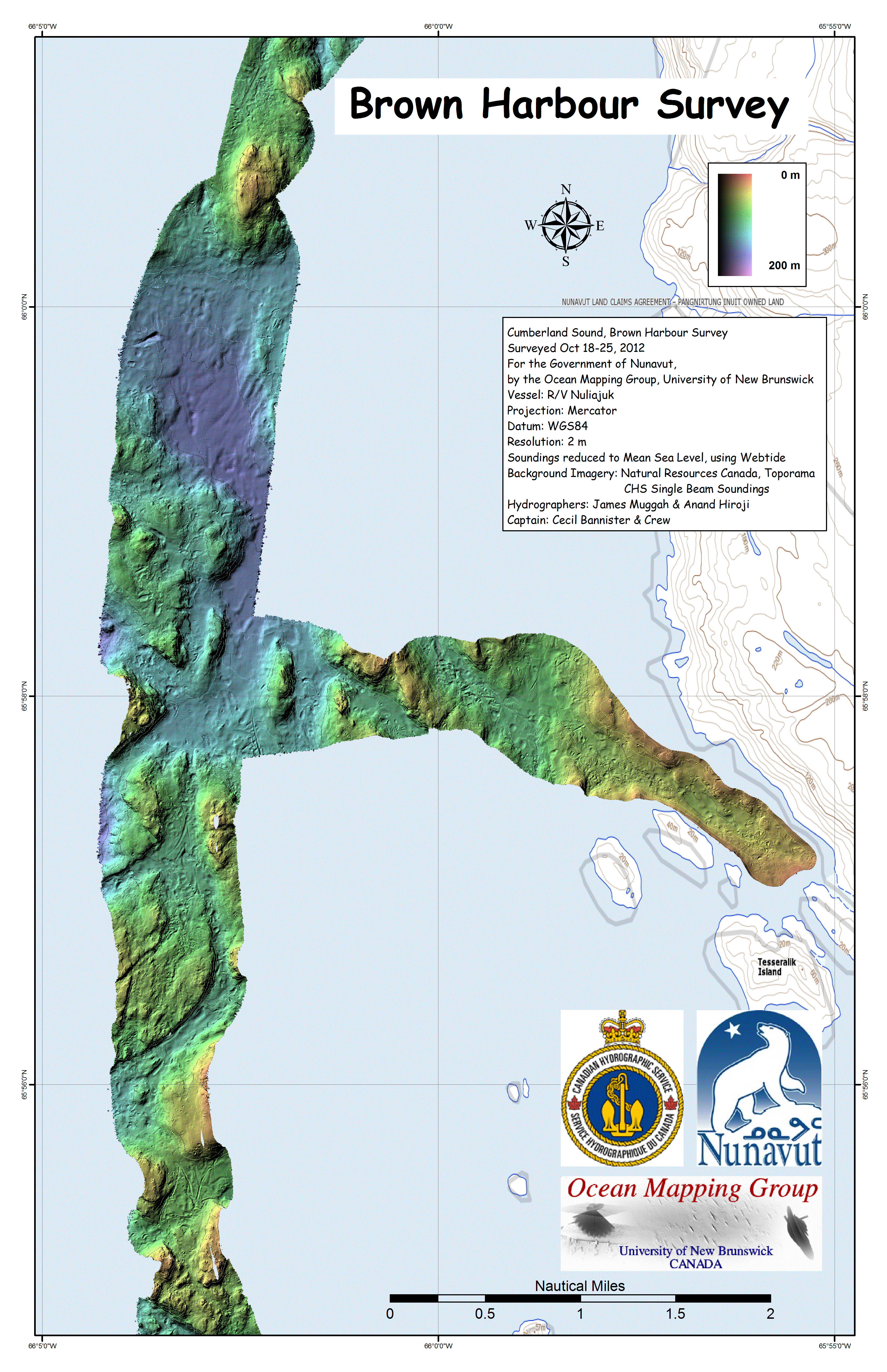
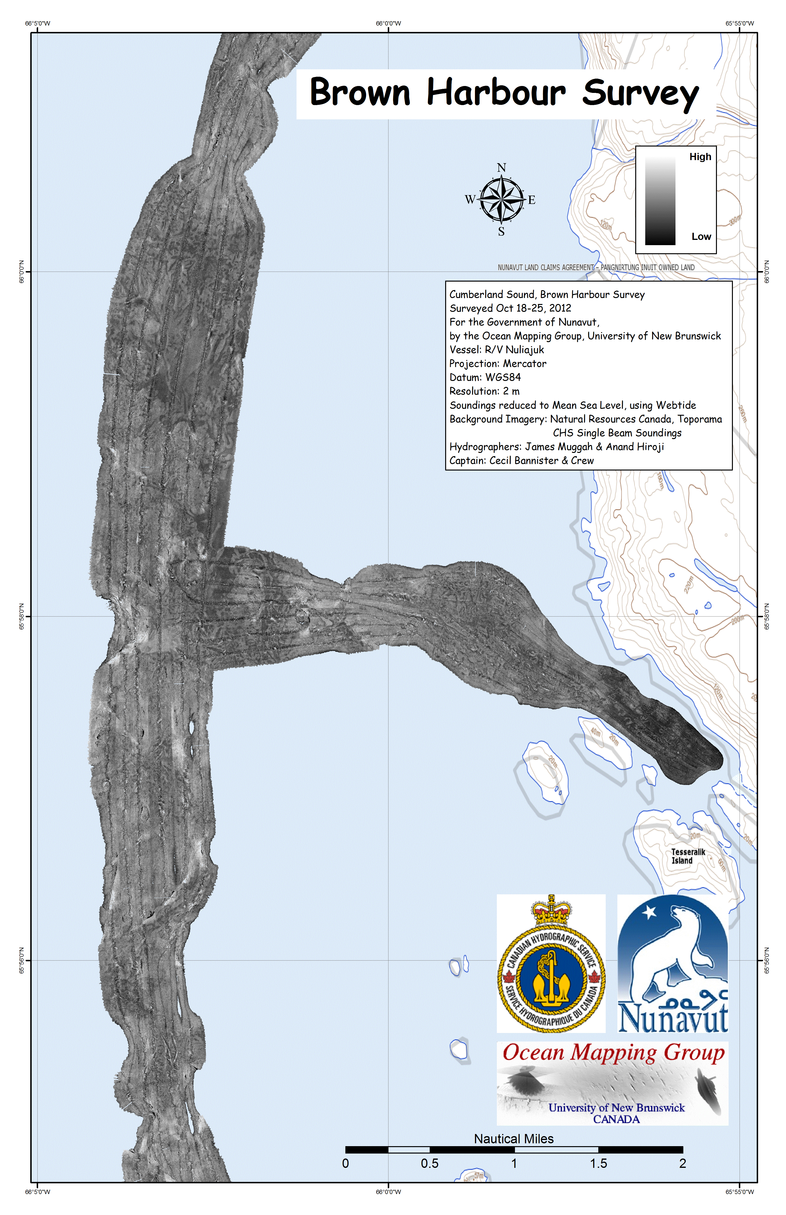
Pangnirtung Corridor with section into Brown Harbour |
|
 |
 |
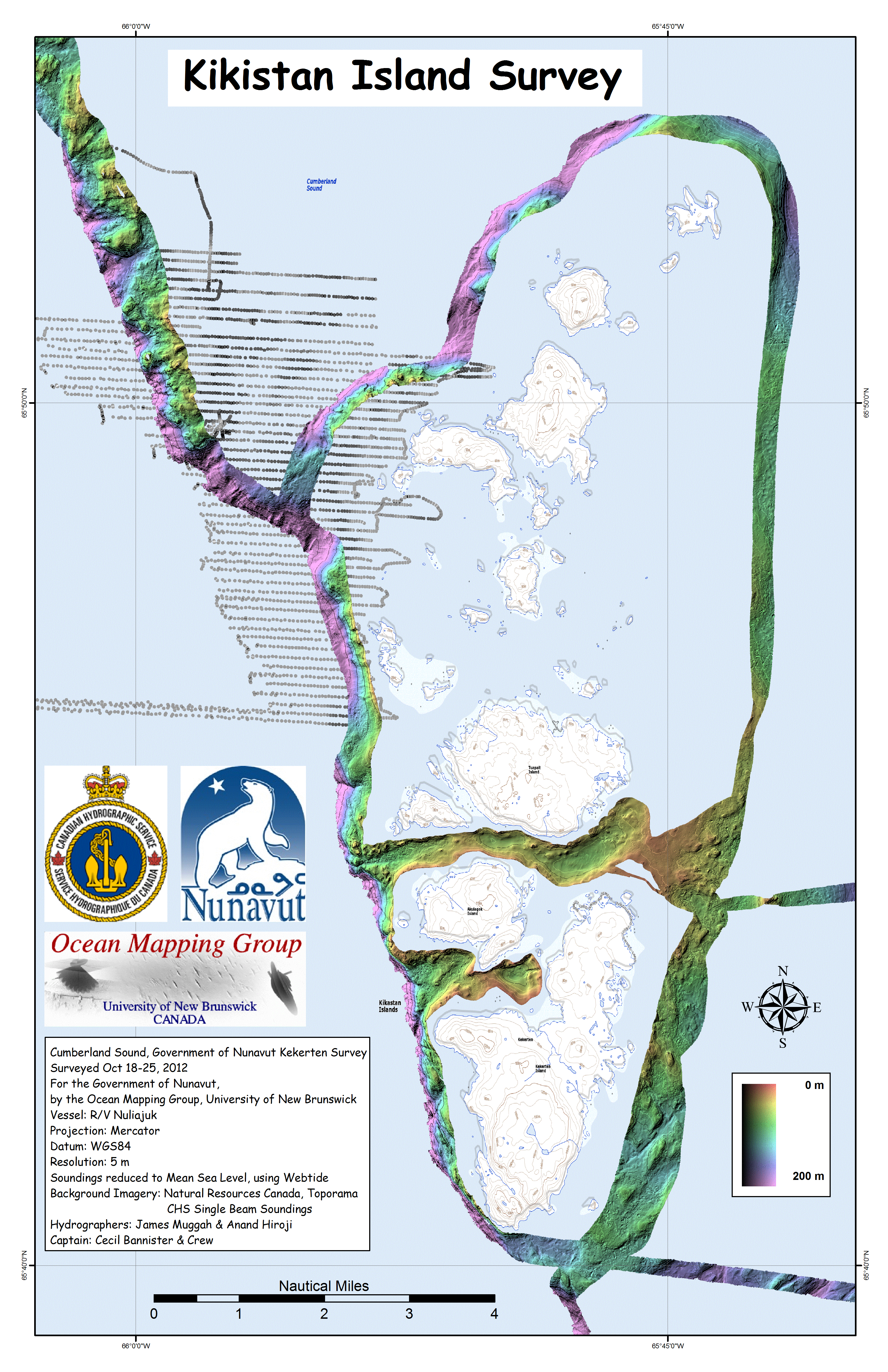
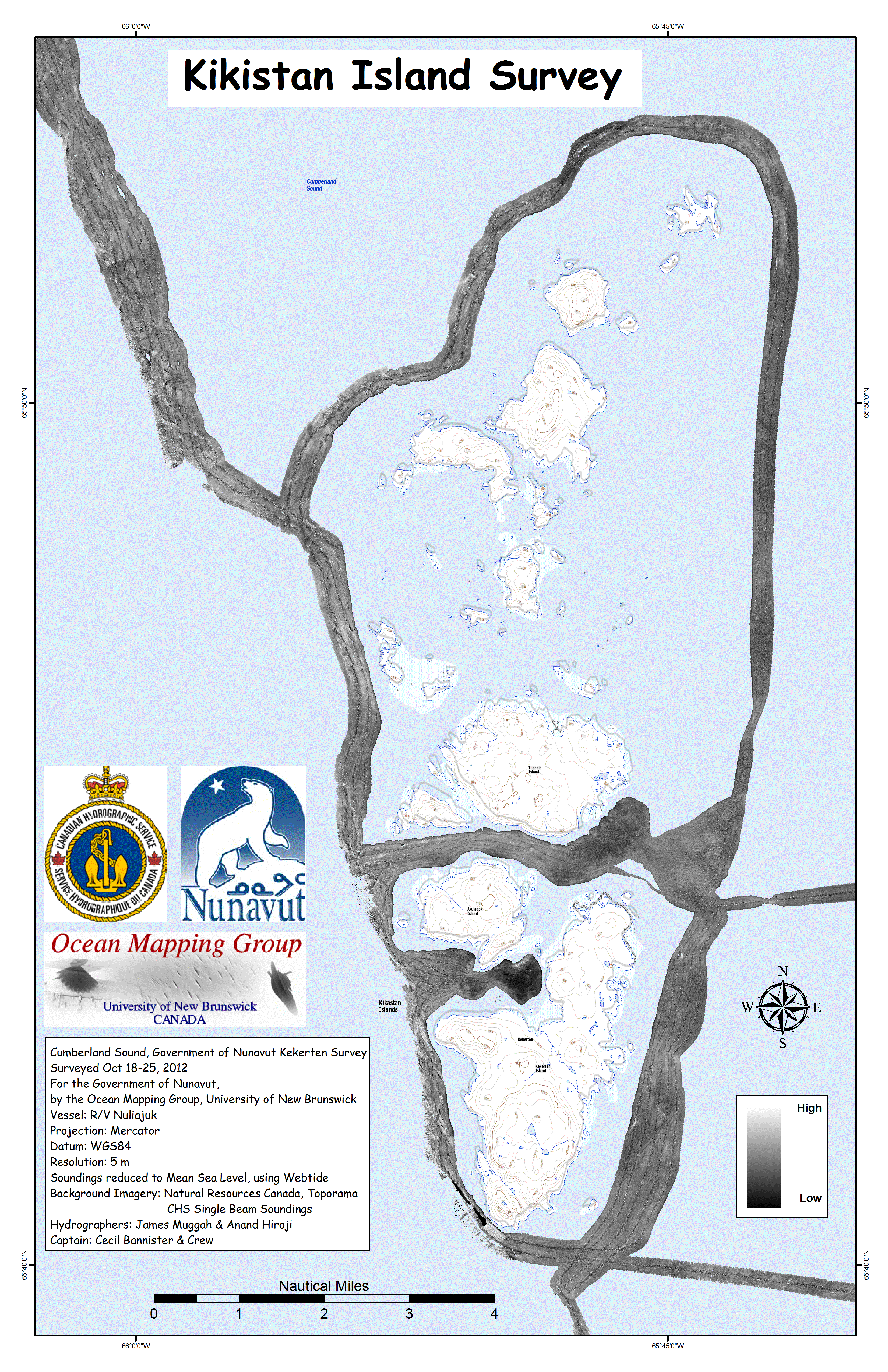
| Kikistan Island Reconnaisance | |
 |
 |
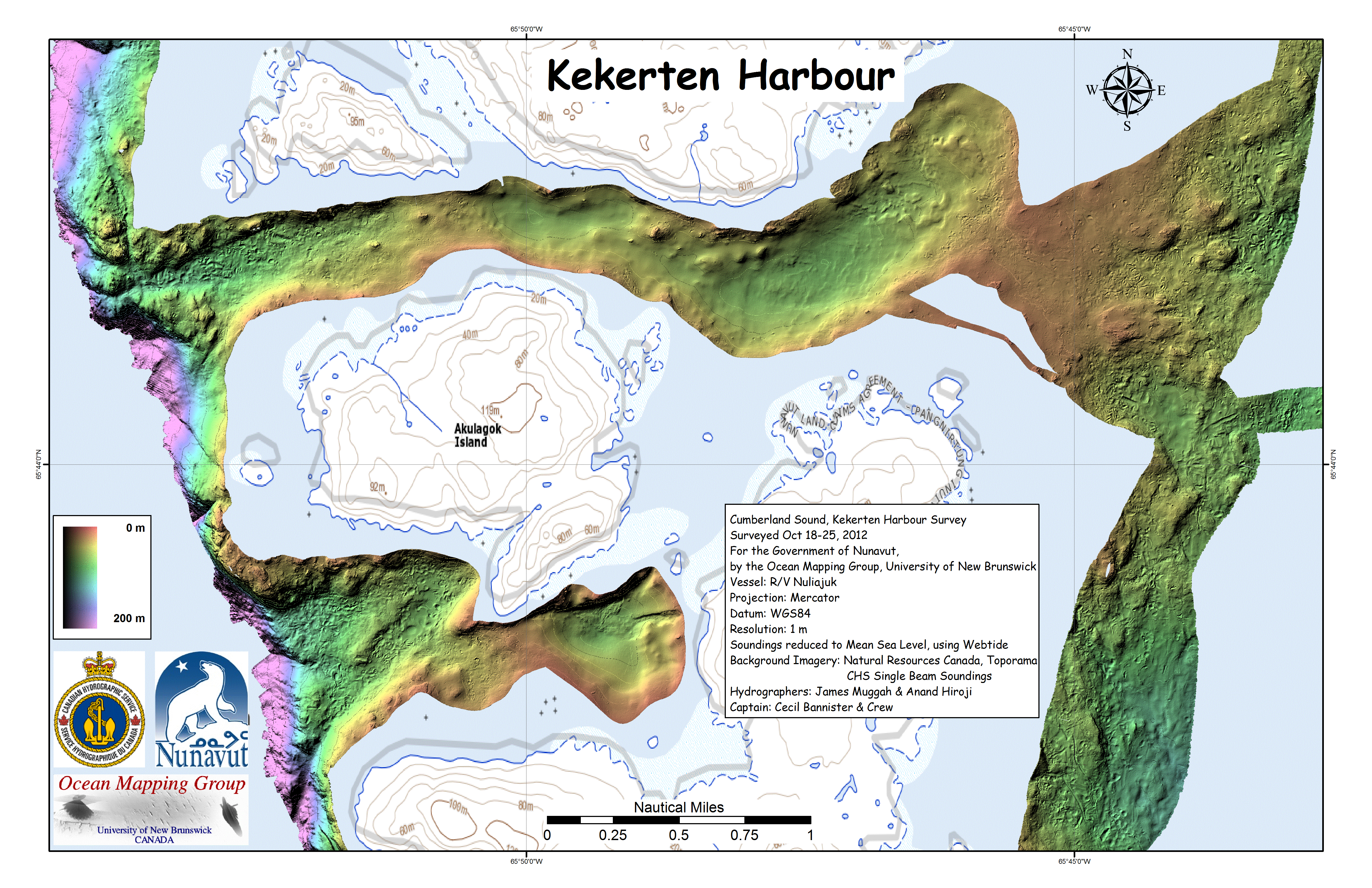
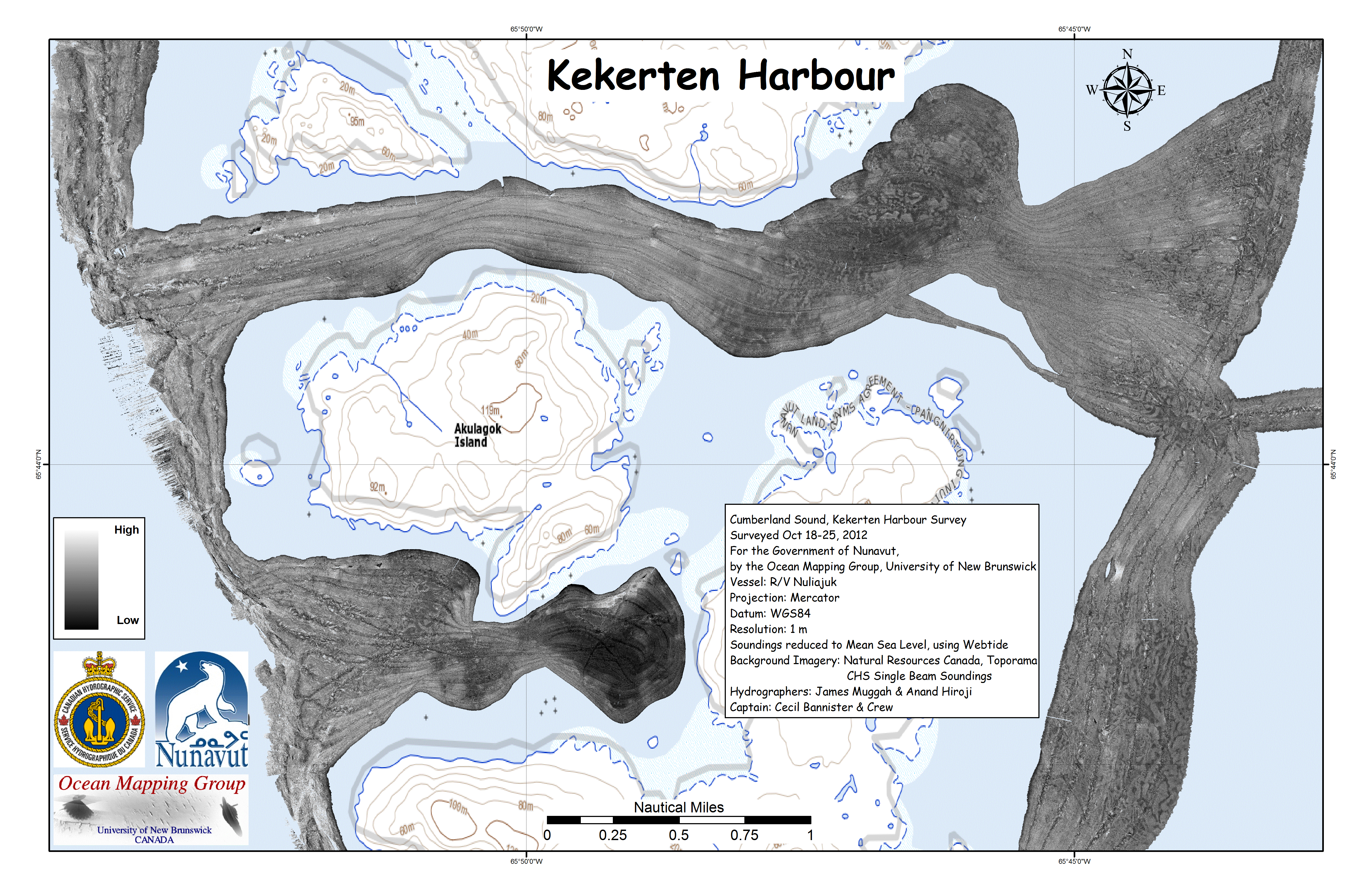
| Kekerten Harbour Detail. | |
 |
 |
 |
 |
 |
 |
 |
 |