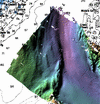
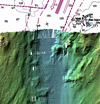
Placentia Bay
EM1000 1995 Multibeam
Surveys
CCGS Frederick G. Creed
Reprocessed
by Anya Duxfield
Ocean
Mapping Group
UNB
for
John
Shaw and Russell Parrot
Geological Survey of Canada - Atlantic
Natural Resources Canada
Bedford Institute of Oceanography
Overview
This data was collected on CCGS Frederick G. Creed by Michel Goguen of
PWGSC. Semme Dijkstra of the Ocean Mappnig Group was onboard and did
real
time processing, delivering a first pass set of mapsheets in 1995. There
was
a renewed
effort to map Placentia Bay in 2004 and as part of NRCan
Geoscience
for Ocean
Management Progam, these data are being reprocessed using newer
software
tools to incorporate this archived data with new Creed and Matthew
surveys.
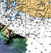
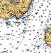
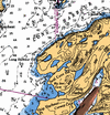
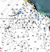
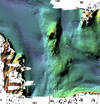
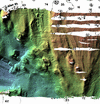
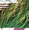
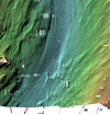
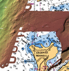
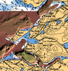
The survey area was broken into 14 individual mapsheets with 2 east-west oriented rows of 7 mapsheets each. The northern and southern rows of mapsheets have different projection latitudes that minimize distortion within the individual mapsheets. As such, they cannot be tiled in a GIS without reprojection. Bathymetry and backscatter maps of the entire area are available as an alternative to the individual mapsheet geotiffs.
Download:
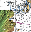
Or browse data by mapsheet via the following index map.
Last modified by J.Beaudoin March 2005