back to:

Report
Index
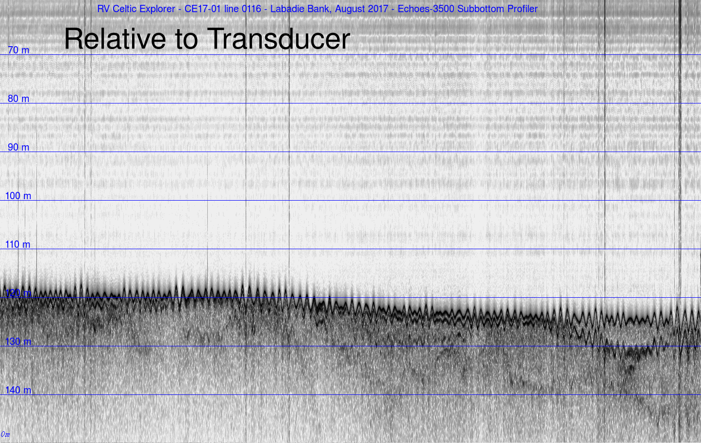
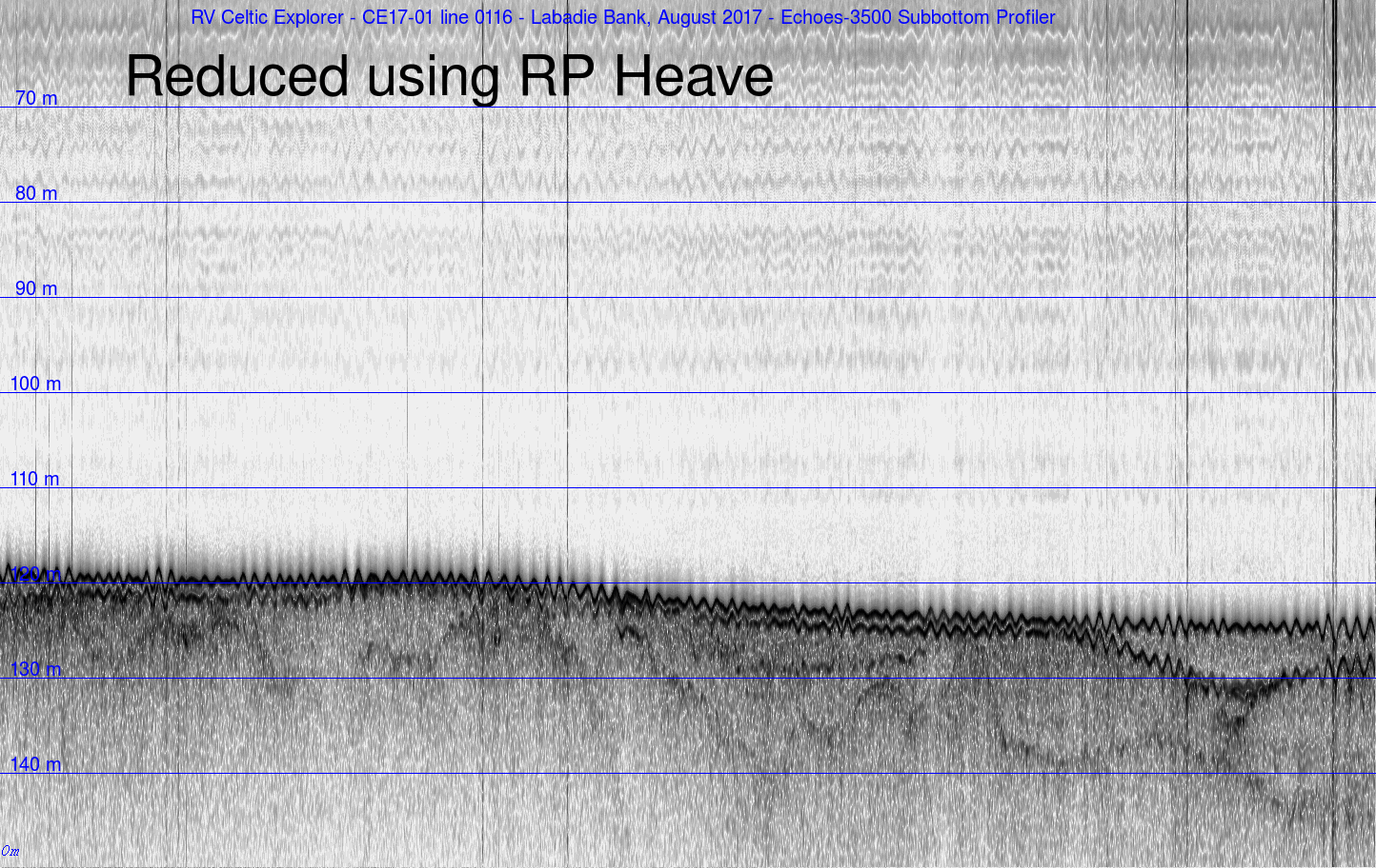
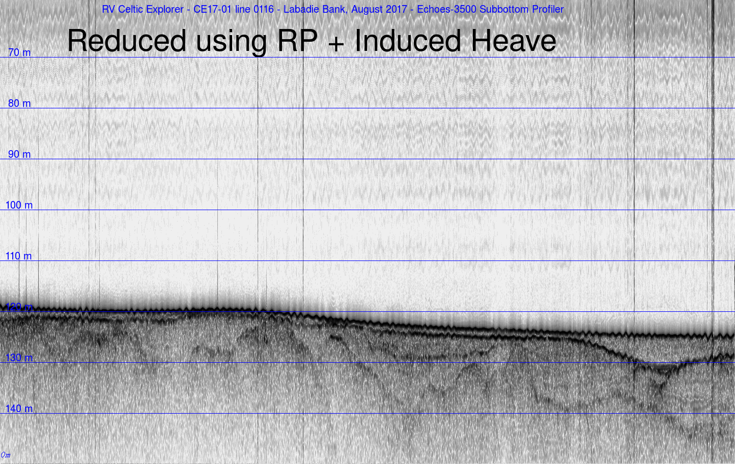
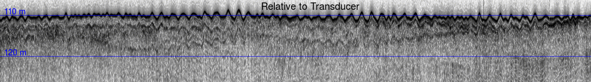
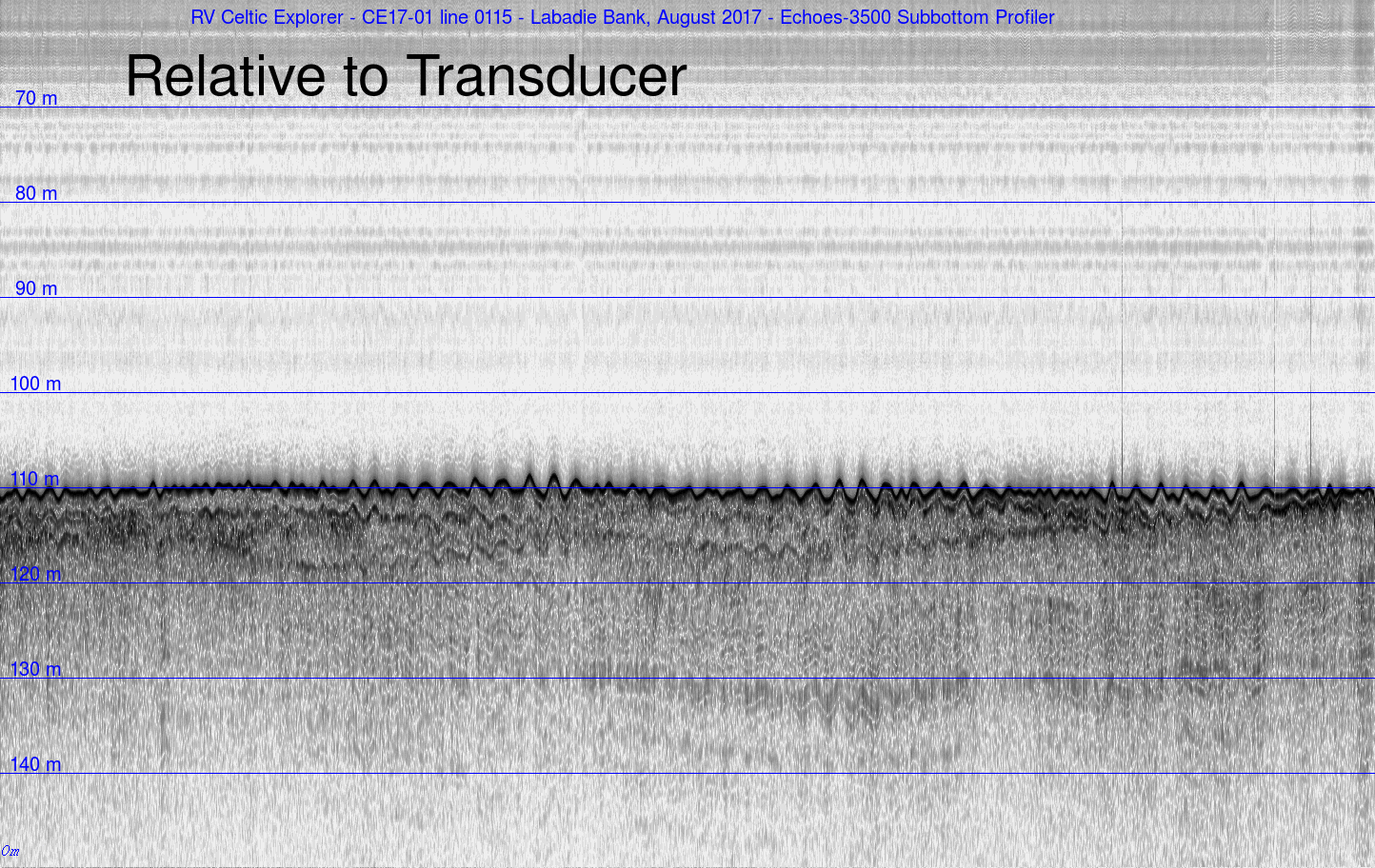
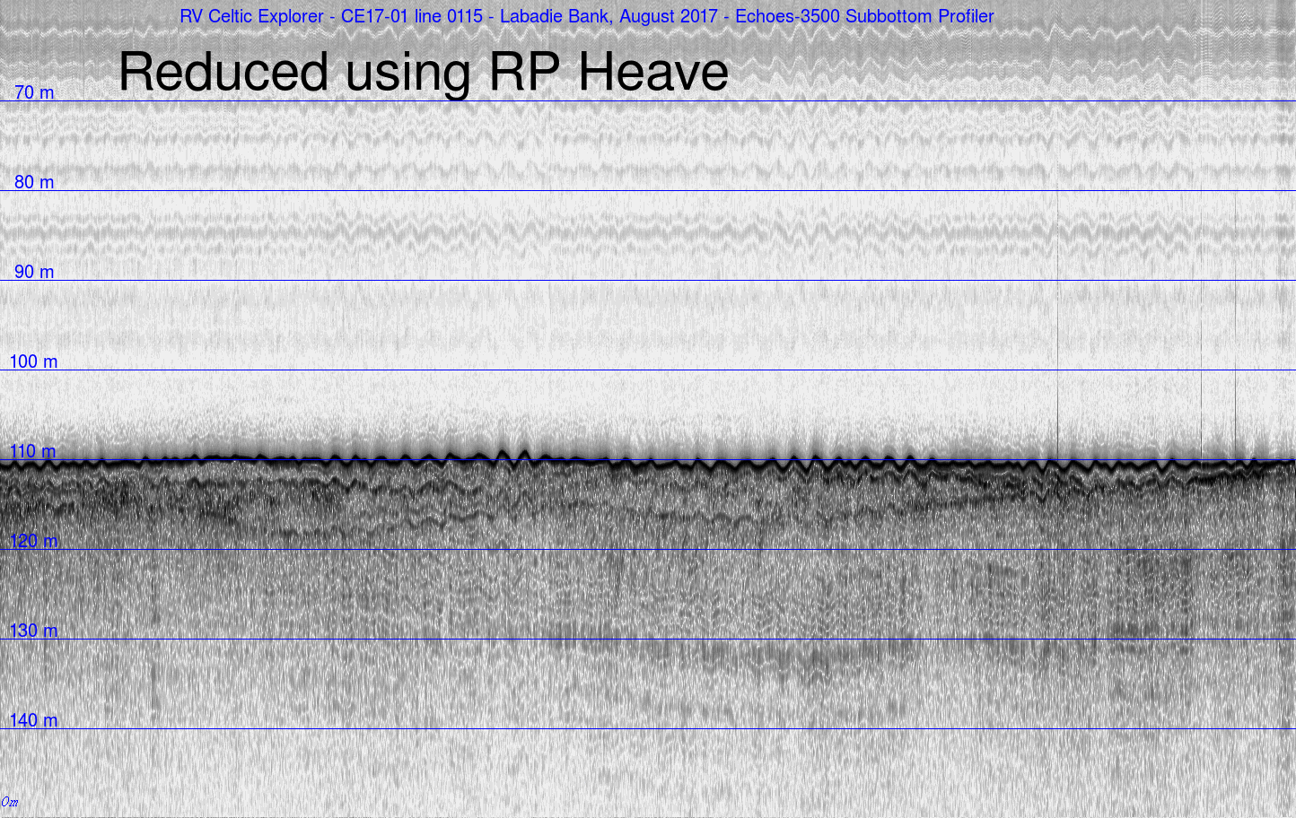
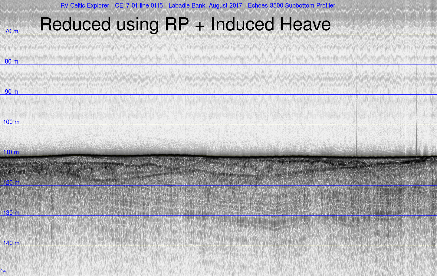
Echoes-3500 
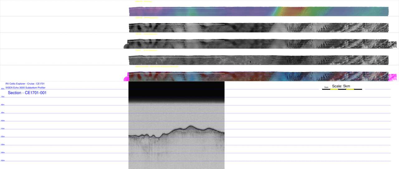
Subbottom Profiler Data
RV Celtic Explorer Cruise CE17-01
Chief Scientist: Kevin Sheehan, MI
July 22nd to August 6th 2017
John E. Hughes Clarke
Anand Hiroji
Jose Cordero Ros
Center for Coastal and Ocean Mapping
University of New Hampshire

Overview:
Acquiring underway subbottom profiling is a core component of the INFOMAR mapping .To that end, an ixBlue Echoes-3500-T7 system is installed on the keel (just behind the EM302). The system puts out a 100ms chirp sweeping from 1700-5500 Hz (the "budgie"). This page demonstrates the nice results acquired from the system (after significant data massaging).

Removing Induced Heave:196

As with all the ship-referenced sonars, the data needs to be reduced for the vertical motions (the heavne).  For reasons we still don't quite understand, although the Delph Seis software accepts heave input (RP) and heave lever arms, the real time display does not show heave correction. Nor is the epxorted data, after "applying heave" any better.  As a result, the data were reduced in post-processing using the OMG-Swathed software. For this, the RP heave in the XTF telegram was extracted and combined with the RP to profiler lever arms (+16.317mX, +0.196mY, +7.130mZ). The figure below indicate the improvement in the data as a result.

anim
orig
rp heave
plus induced

anim
orig
rp heave
plus induced

As can be seen, the final data reduction is still not perfect. I'm pretty sure the lever arms are fine (from the survey report). Possible other issues may be that the heave logged by the Echoes is jsut at TX and doesn't reflect the heave at Rx time (which actually varies through the image).


Sequential Subbottom Sections:

As we ran lines at about 300m spacing, after geo-referencing, one can examine a fence diagram from successive sections to look at the evolution of the subsurface stratigraphy. One can actually look at each section in sequence as a movie:

movie sbp
animation of all 95 seismic profiles - with co-registered plan view bathymetry and tri-frequency backsactter
note a link to the full resolution animation was not provided as it is 388Mb.


for each section, the corresponding plan view of the bathymetry and tri-frequency backscatter can be examined simultaneously. That way, the relationship of the surficial backscatter boundaries can be related to the presence or absence of thin surface layers or outcropping horizons.

Each one of the 95 frames (with link to the full 10m resolution image) are presented below.