2019 Squamish Estuary Surveys
CSL Heron Operations
EM2040P trials
April 21st to June 20th, 2019

John E. Hughes Clarke, Brandon Maingot
Ivan Guimaraes and Leo Araujo
Ian Church
Anand Hiroji
Center for Coastal and Ocean Mapping
University of New Hampshire
Ocean Mapping Group
University of New Brunswick
Dept. Marine Science
University of Southern Mississippi
Technical Support: Gordon Allison (CCG retired) and Mike Boyd (Polar Diving)


For a 3 month period, the MkII version of the EM2040P was loaned to a collaborative group (UNH, UNB, USM) operating on the CSL Heron in British Columbia, Canada.

The Squamish Estuary feeds the Squamish prodelta that is gradually filling in the upper end of Howe Sound. As such it has been the subject of surveys since 2011 by the CSL Heron as part of  investigations into the mass wasting on the prodelta. To that end, multibeam transects up the lower part of the estuary have been performed to try and understand the mobility and flux of sediment coming down the river.

Long Term History.

In 1973 the training dyke was built to allow the development of Squamish Terminals. As such it drastically changed the course of the lower estuary. The animation below gives an overview of the evolution of the river from the confluence with the Cheakamus River to the fjord since 1984.

anim
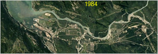
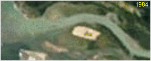
Squamish River - Cheakamus merge to Howe Sound
1984-2016 annual time series of LandSat imagery
(from Google Earth Historical Imagery)


The current area of interest for us is the lower meander and the two intertidal sandbanks and mouth bar.
Upstream of the intertidal sandbanks there are two meanders that are ultimately constrained in their wanderings by either the bedrock on the west side of the fjord, or the training dyke on the east.The animation below illustrates the evolution from soon after the dyke went in. The lower meander has widened and migrated downstream consuming the salt marsh. One can see the initial dredge spoil dump and its gradual colonization by vegetation to the east (lower in figure) of the training dyke. Upstream of that is the second meander that is constrained against the training dyke.
zoom landsat anim
closeup animation (1984-2016) of the lower estuarine section.


The Survey Challenge:

Our original (2011) reason for working here was that the estuary is the conduit for all the sediment that ultimately ends up on the prodelta (a long term monitoring program since 2004). Previous work (PhD thesis of Danar Pratomo, UNB, 2016), has investigated the evolution of the subtidal bedform population in response to the river discharge and tidally modulated flow regime. That study focused on the first 1km section. Data up to 2km upstream had been infrequently collected although the shoaling makes it difficult.

From the point of view of testing the EM2040P in 2019, the estuary provides an accessible very shallow (<5m) region with strong relative topography (dune heights can be up to 30+% of the total water depth, thus casting nice shadows). This allows us to assess the extra wide swath options (the MkII is supposed to increase the allowable swath from +/-70 to +/-80).  In response to expression of interest by the Squamish Watershed Society, in 2018 (with a MkI) and again this year we tried penetrating further upstream.  In addition to the shoaling depths, the main issue was found to be submerged trees, especially along the actively eroding banks. These banks correspond to the outsides of the two meanders. The greatest issues were present on the upper of the two meanders. Photos below show the bank, as seen from land at the previous low tide, and the same area from the vessel at high tide (4.2m above datum).

low
                tide
high tide
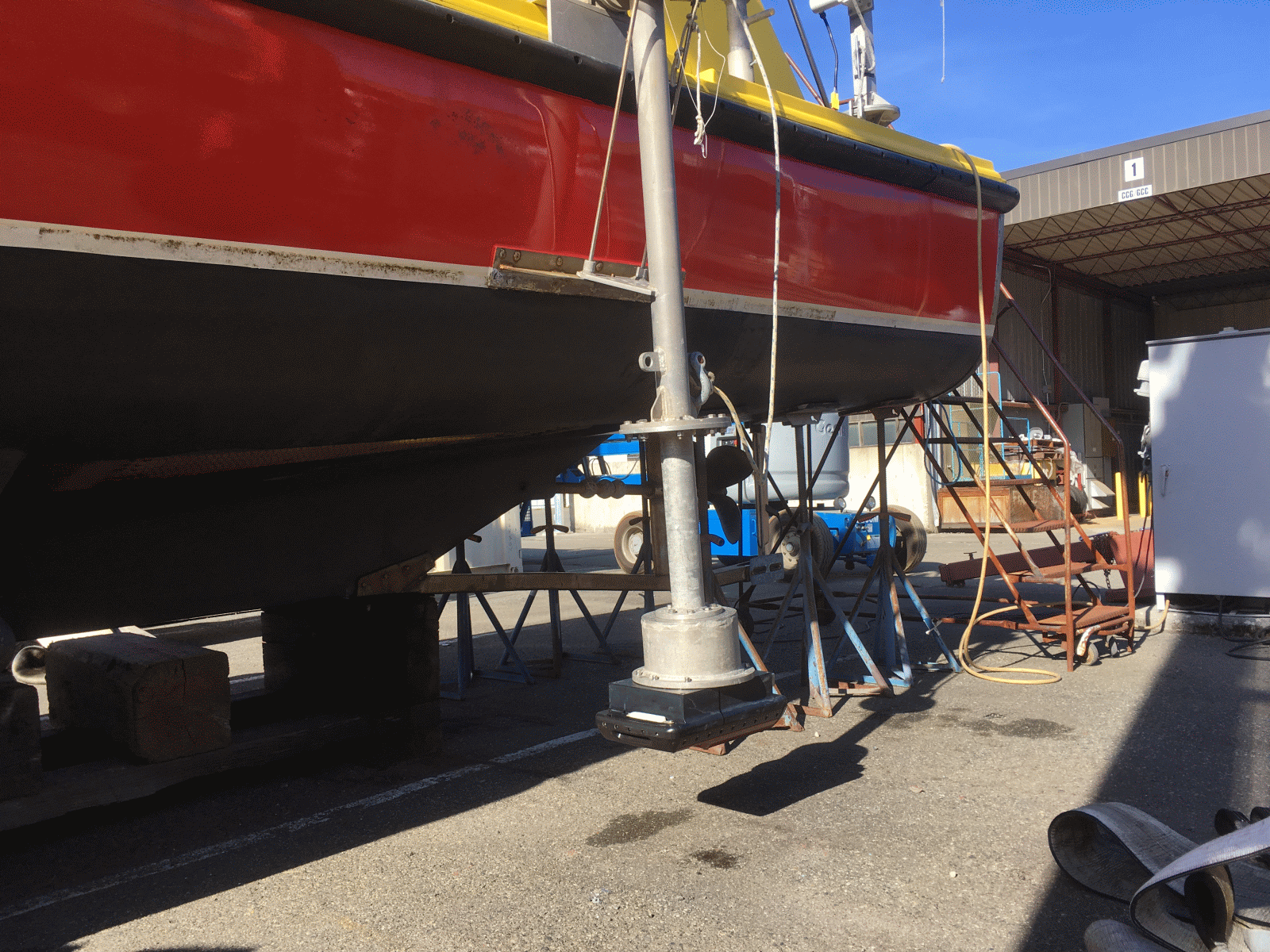
looking upstream at low tide (CD+1.0m)
looking downstream from the Heron at high tide (CD+4.2m)


EM2040P Pole Considerations

The concern for us was the likelyhood of hooking up the EM2040 mount with these submerged trees. The Heron draws ~ 1.15m and the deepest point is the aft end of the skeg. The EM710 gondola is mounted on the port side amidship and sits safely above the keel. The pole has a bolt plate about 40 cm below the water line, but the extender and adapter for an EM3000 (to which a 2040P bolt pattern mates), resulted in the lower side of the transducer face being below the keel. While this is ideal to avoid aeration in open water, it is rather exposed in these constricted and tree-filled environments.

pole
pole pole
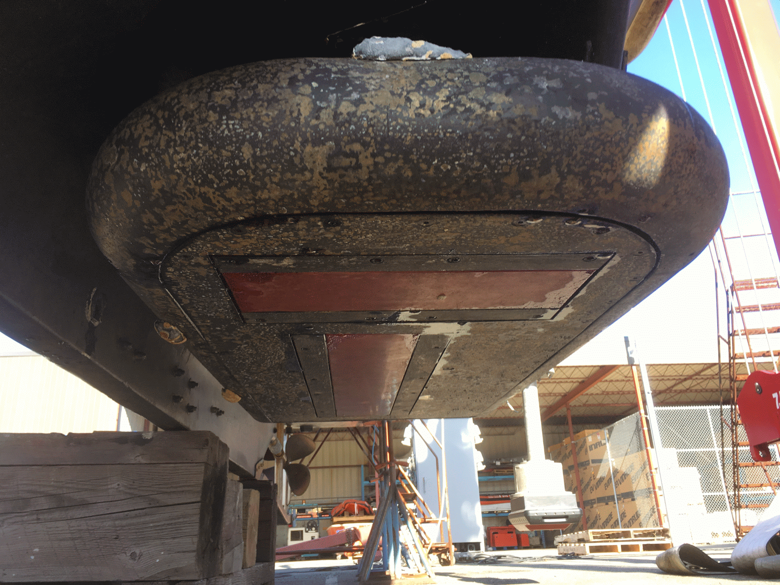
looking astern past the EM710 gondola
to the EM2040P behind
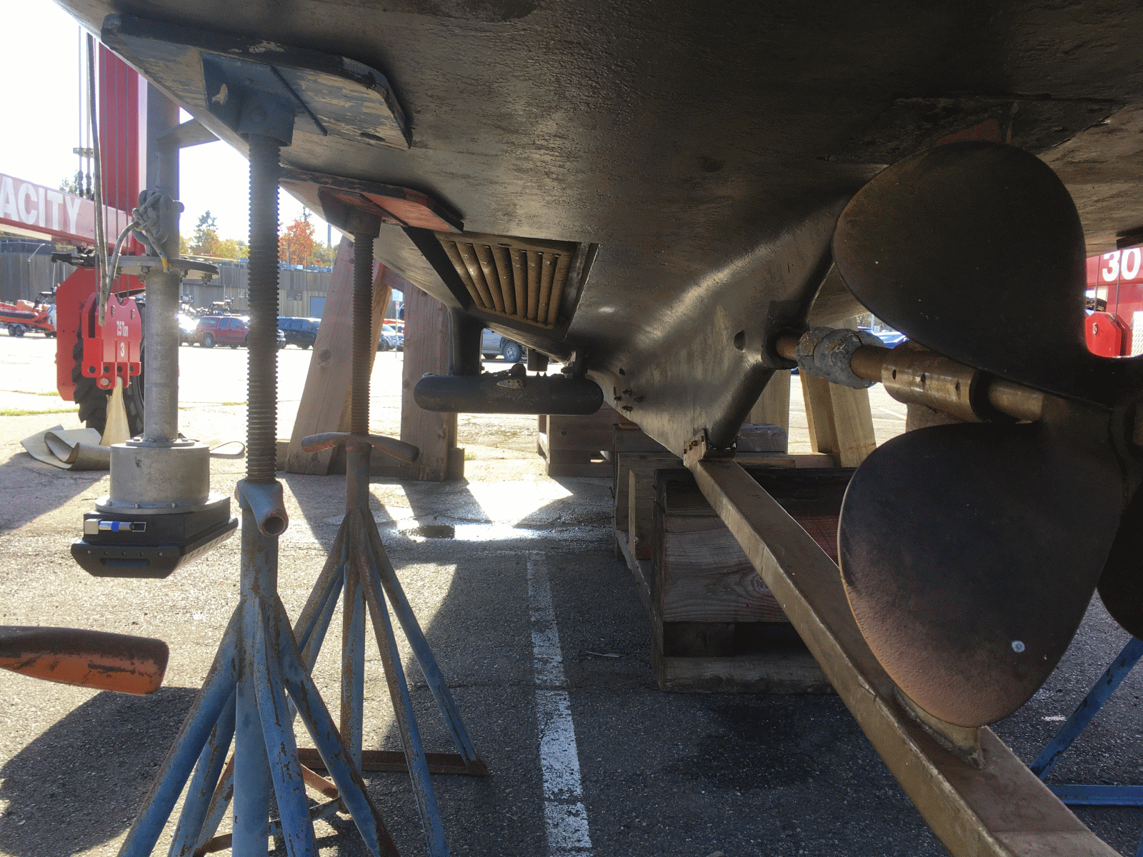
looking forward showing the location of the base
of the pole relative to the gondola
side view showing the pole mount.

Evolution over the 8 year monitoring period

First Survey - 2011
We first went upstream in 2011. The maximum extent of penetration was just to the upper end of the first meander. That section was repeated weekly in the summer of 2011 (Pratomo's work). At the time, there was a notable shoaling in the section between the two meanders and so no further penetration was attempted.

2011 survey

Most Recent Survey - 2019

This year, we ran up to the start of the second meander's erosive outer bank before aborting the survey.
2019 April
Download:
flt
hdr
prj

Eroded Western Bank

The following pair of images illustrates the 8 year downstream and lateral migration of the lower meander and associated pointbar.


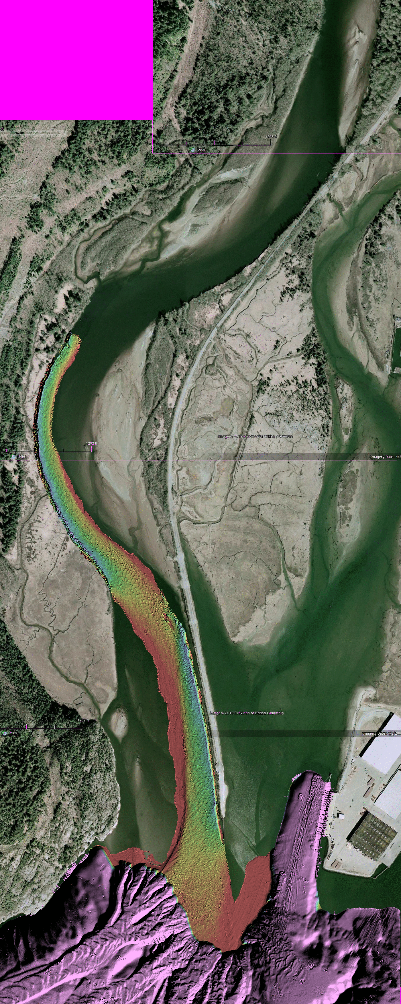
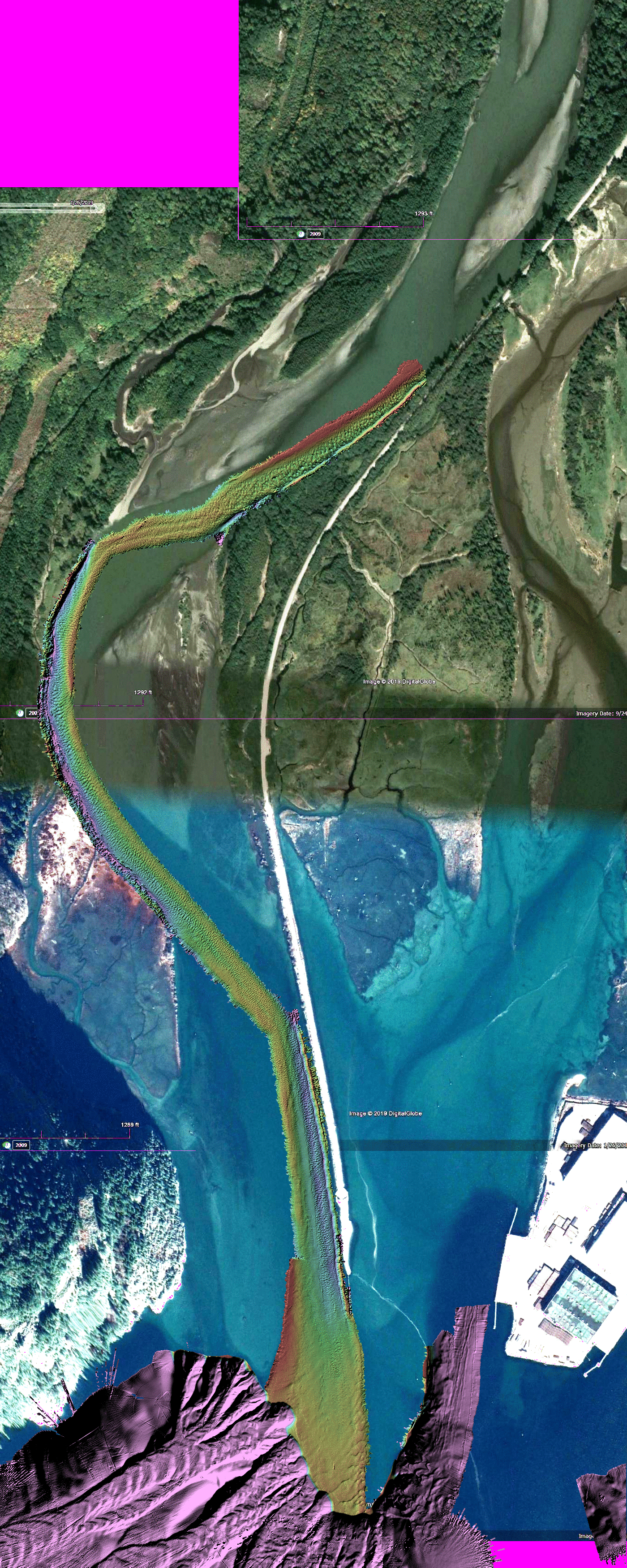
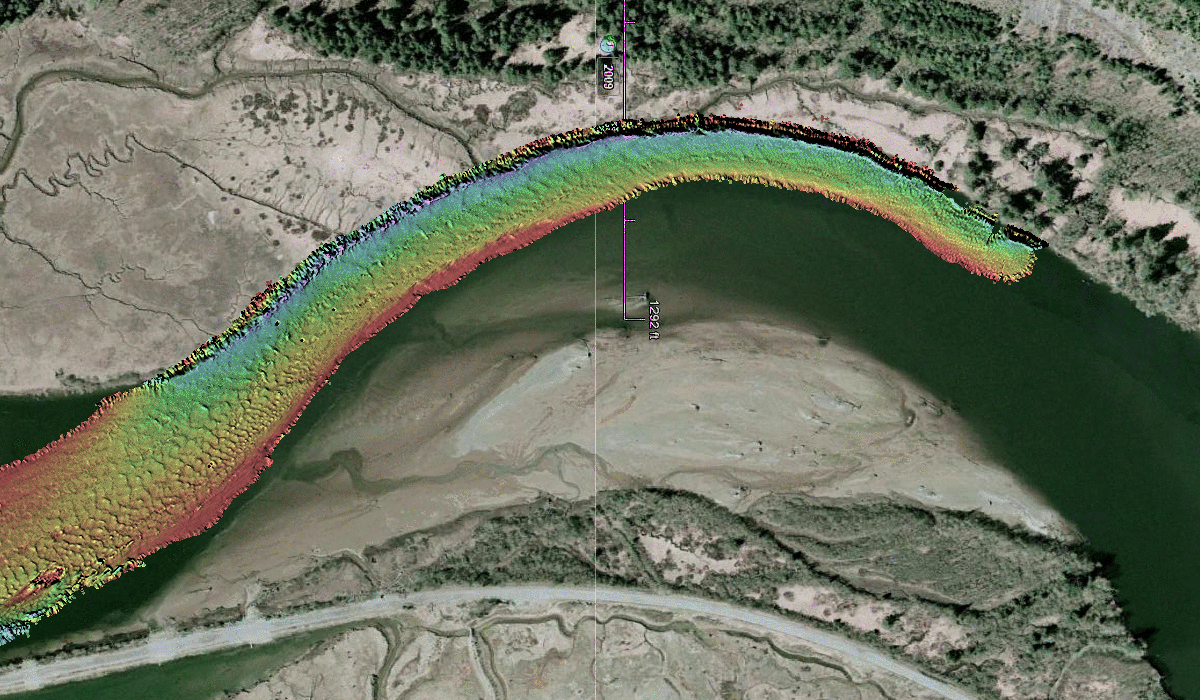
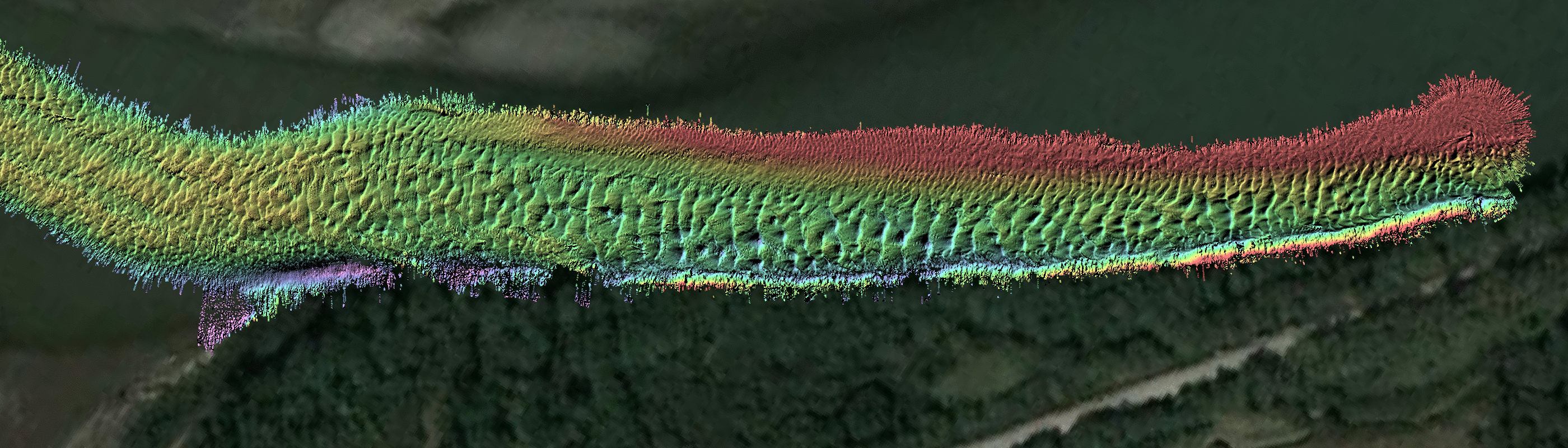
Comparison of 2011 v. 2019 western (top)
 channel flank against salt marsh

Illustrating Outer bank erosion and
Point Bar migration

2011 - used 2009 air photo

2019 - uses 2016 air photo
anim
animation contrasting the two
2011
2011 survey
2011
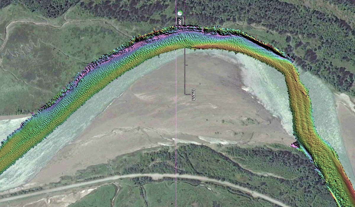
2019 survey
(note greater up-river penetration)


Upstream Eroded Eastern Bank:

The following images show the morphology and overlying estuarine structure along the eastern bank in April. At that time the river hadn't started flowing so the salt wedge is well established.


2019 bathy
25cm grid (click for full res.) of the EM2040P bathymetry along the eroding eastern bank.
The road on the top of the training dyke is just visible in the lower right.

line 0006 water column
 EM2040P water column imagery (300 kHz).  (surface to 6m, transducer is at ~ 1.2m).
co-registered (along the X axis) with the bathymetric map above.
Nadir Section showing halocline and KH wave mixing  (and location of two submerged trees)

Submerged Tree Imaging:

As we'd reconnoitered the location of the recently collapsed trees on the previous low tide, we were able to slowly approach them at high water and imaged them as we passed over them.

panorama banks
panorama looking downstream (left) and upstream (right) along the eroded eastern bank of the Squamish estuary. Low water (+1.0m CD)


downstream tree
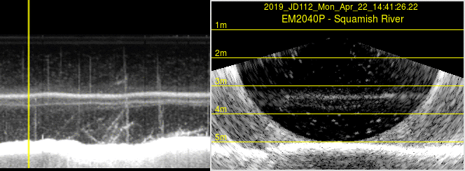
downstream tree - at low water
upstream tree
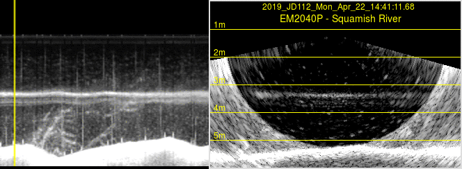
upstream tree at low water
anim WC
animation showing nadir section (left) and pie sections (right)
as we passed over the downstream tree (steaming downstream)
anim WC
animation showing nadir section (left) and pie sections (right)
as we passed over the upstream tree (steaming downstream)


page generated by JHC from April to June 2019