Proposed Extra Survey Lines at SandsHead
for CCGS Vector - late October 2017


prepared by JEHC

Should the Vector be passing SandsHead on the way home from Squamish, there a few opportunistic lines that could be run just to establish whether there was any growth of the Fraser Canyon Valley in the summer of 2017.

Two options are presented:
The following figures show the survey coverage achieved by the Heron at SandsHead in 2017. The DDL location is indicated. The proposed survey line options are overlaid.

April
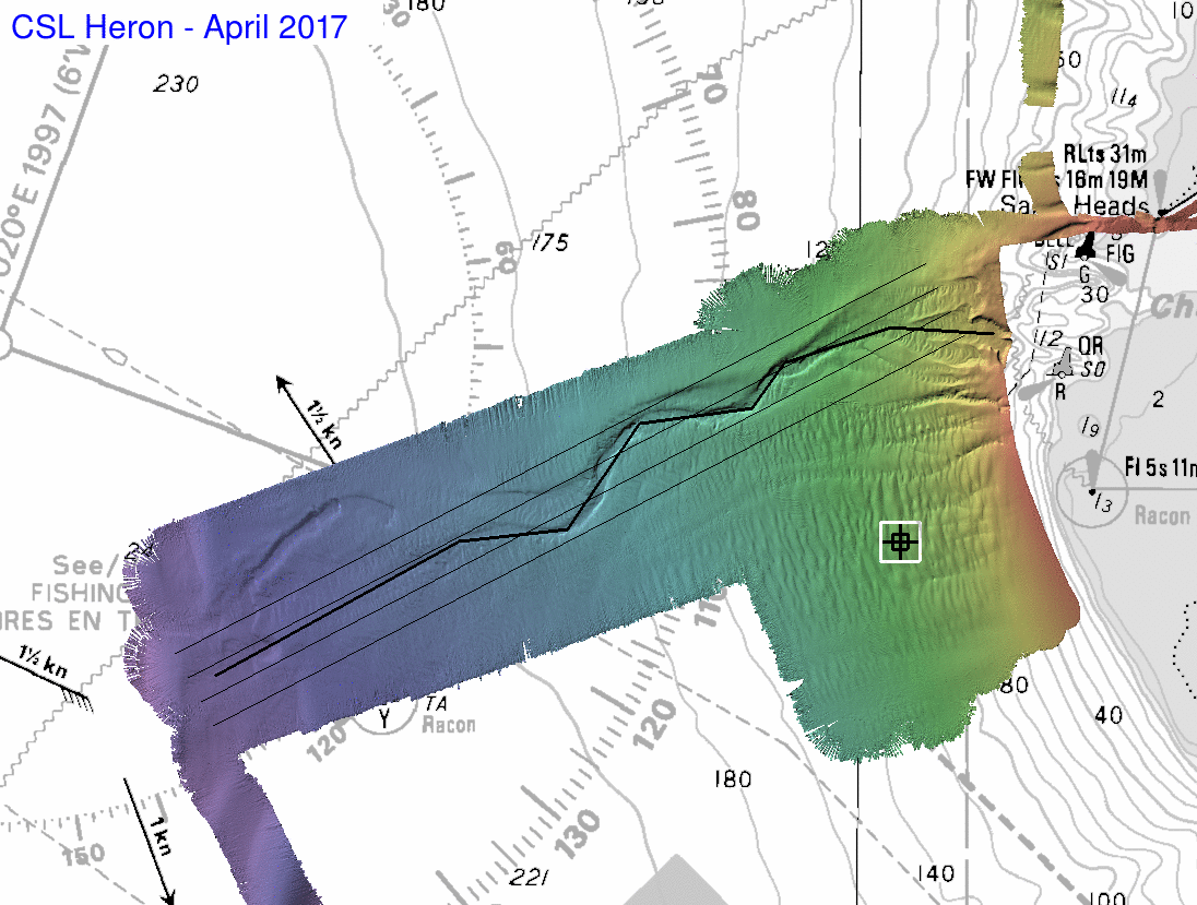
April Survey (25th/26th)
Deep survey all conducted on the first day as seastate forced us to
abort the shallow work on the second day
october survey
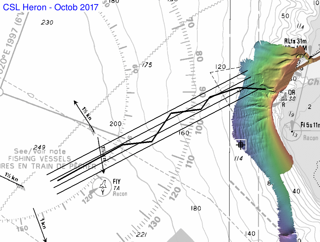
October Survey (9th -10th)
Just the delta lip down to the DDL location was done on the first day
as the seastate forced us to abort the second day.
change - summer 2017
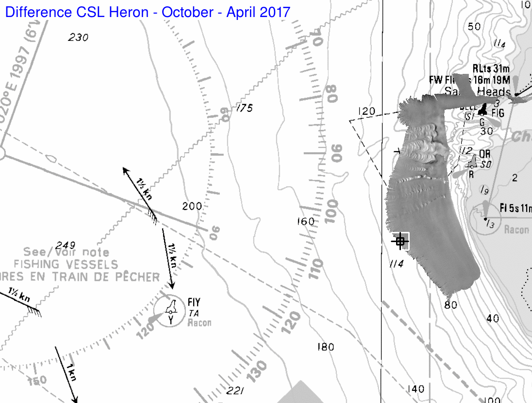
Resolved differences
As can be seen, the Sea Valley head was very active, but nothing
resolvable happened around the DDL site.
Proposed Lines

THe following ASCII lists detail the line locations:

Sea Valley Axis only
(a single zig-zag line down the axis)


4 parallel Lines
(offset to image the  backscatter best)


Latest Survey Data

and so that CHS-P and PGC have the latest data:

Raw EM710 data from October 2017

and for the two surveys, here is an ASCII dump a 2m grid:


Should either one of the survey options be possible, the Vector EM710 should be set to the following settings:
In general, for best quality deeper 200m, the EM710 should be prevented from switching into MEDIUM mode unless really wide swaths (300+m per side) are required. The bathy near nadir is far better if SHALLOW mode is maintained until at least 300m. Shallower than 100m, the system could switch to VERY SHALLOW mode, but as little work in being done in these depths, for simplicity for these instructions it is probably easier to just leave it in SHALLOW mode.


prepared by JEHC - October 16th 2017