Proposed Grab Sites and EM710 Survey Lines at Squamish
for CCGS Vector - late October 2017


prepared by JEHC

The 2017 CSL Heron EM710 mapping program (April to October) has focused on the more distal aspects of the Squamish prodelta system. As part of that, curious variations in seabed backscatter have been noted across the more distal southern channel and extending out onto the lobe. As the Heron is not adequately configured to do grab sampling in these depths (130-230m), Gwyn Lintern has kindly offered to attempt a limited grab program as they pass by in late October.

2016 june survey
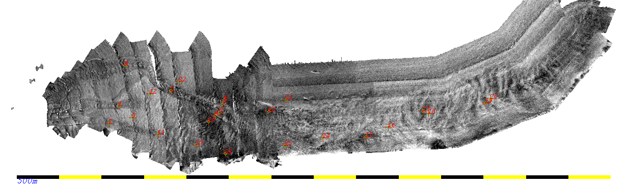
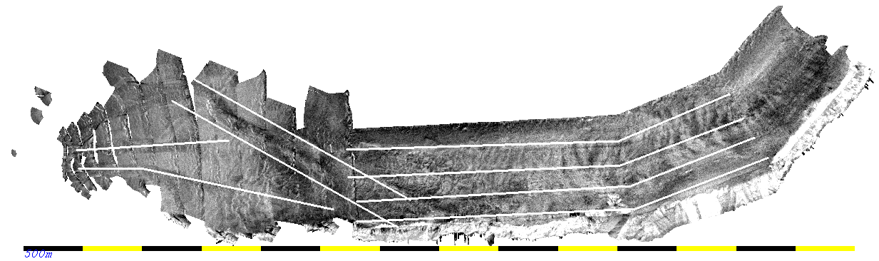
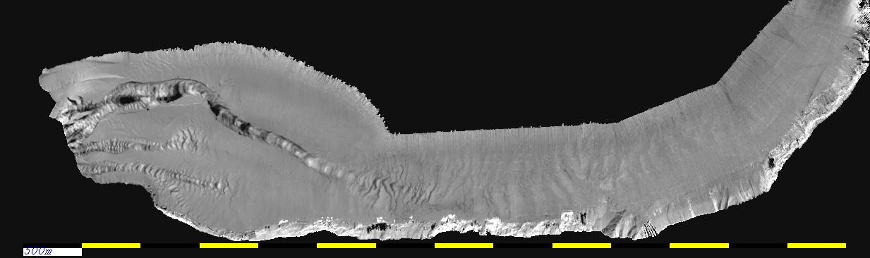
CCGS Vector 2016 bathymetry - June 2016.
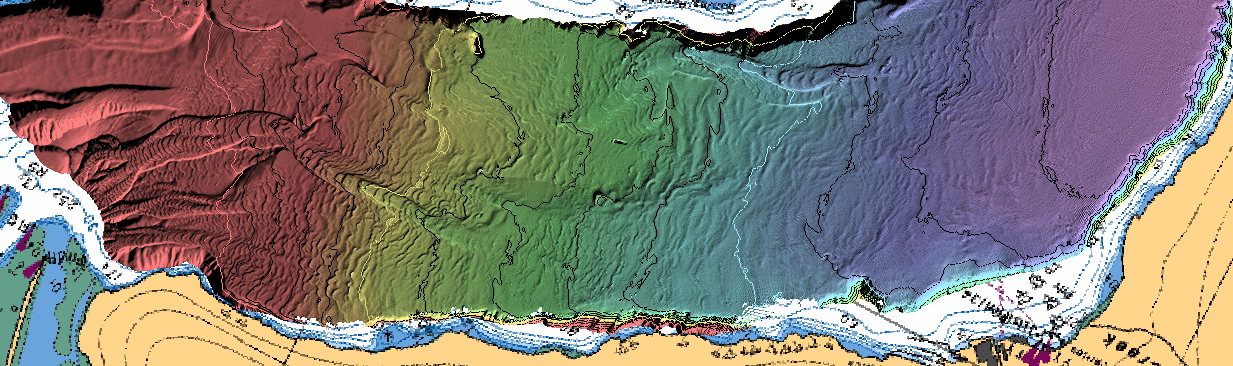
100, 150 and 200m contours  in white - intervening 10m contours in black
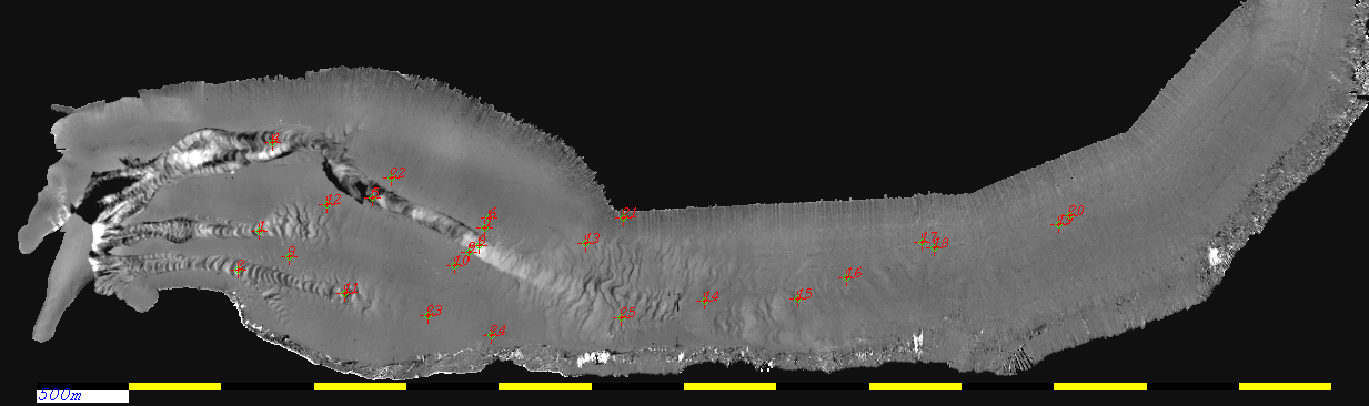

Survey Differences:

The semi-annual differences for the past 2 years reveal where the prodelta and lobe system are currently active.

Summer 2016 : October - June
(Vector-Vector)
Summer 2016
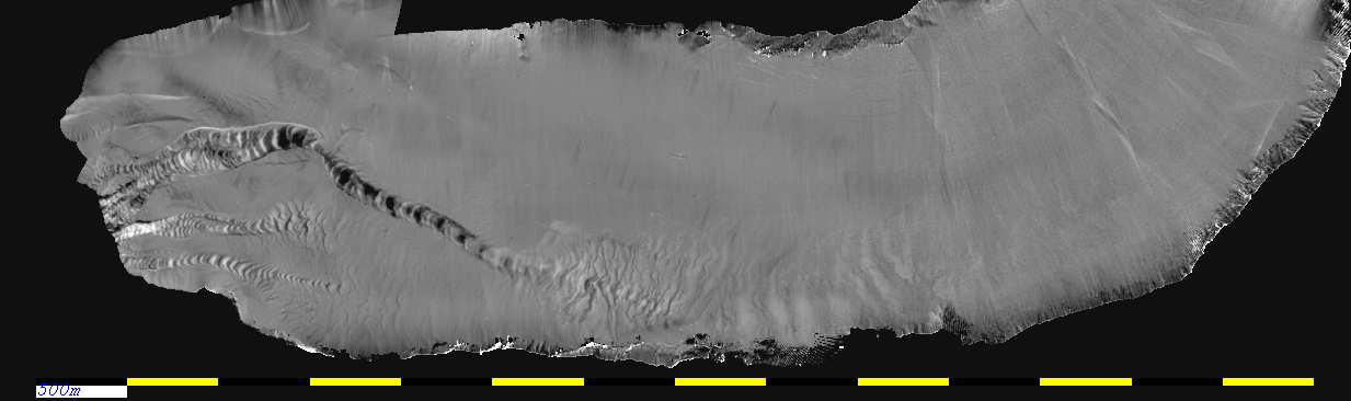
note the dominance of the Southern Channel, extending beyond the CLTZ onto the lobe almost to Woodfibre.

Over Winter 2016-12017 : April - October
(Heron-Vector)
over winter
the single most active winter ever recorded! - note that the resolvable distal lobe activity now extends beyond Woodfibre.

Summer 2017: October-April
(Heron- Heron)
summer 2017
A dry summer - but in June/July the activity did reach toward Woodfibre. It is this activity that we are primarily trying to  sample


Potential Grab Locations:

Based on the 7th-8th October EM710 backscatter surveys of Squamish by CSL Heron, and on the bathymetric differences over the summer of 2017 (April-May-June-July-October), the following 25 possible grab locations and survey lines are suggested:

grab locations
25 grab locations,  plotted on the October 7th/8th EM710 backscatter imagery.

The grab locations are listed in this text file


Potential Survey Lines:

And as the Vector has to steam in and out anyway (and Brent is on board) , the following survey lines are proposed:

survey lines
the 8 survey lines proposed superimposed over the October 7th/8th EM710 backscatter imagery.

The line SOL and EOL's are listed in this text file


These lines are exact reruns of the geometry used by the CSL Heron this week to image the active channel and lobe system. This way we can:
  1. take advantage of the superior imaging quality of the 0.5x1.0  degree Vector  EM710 (compared to Heron's 1.0x2.0)
  2. see if the backscatter has changed since the Heron was there (I'm hoping for an autumn surge in the next week!).

There are three line clusters:

LOBE CORRIDOR-  4 lines - 15 nm (2 hours at ~ 7.5 knots)  which should be run with the following settings:
 SOUTH CHANNEL - 2 lines 5.5 nm (~45 minutes at 7.5 knots).
CENTRAL and NORTH CHANNEL - 2 lines 4.3 nm (~ 40 minutes at 7.5 knots)

The usual more extensive set of survey lines, previously requested are not necessary as we have just done all of that with the Heron.                               


prepared by JEHC - October 13th 2017