Mamquam Blind Channel Surveys -  CSL Heron, June 2019

John E. Hughes Clarke
Center for Coastal and Ocean Mapping, University of New Hampshire


On an opportunity basis, the subtidal region along the base of the pilings in the Mamquam channel were surveyed by the CSL Heron using her EM2040P multibeam sonar system.


regional
Regional survey - click to see 0.25m resolution view
(Google Earth - May 2019 image as backdrop)

this survey is also provided as a kml file from this link:

http://www.omg.unb.ca/Projects/KML/inner_mamquam_blind.EM2040P.JD170_2019.reray.dep.kml


it can be used to import directly into Google Earth to get a feel for the data in the regional context (see still below, looking across site to the Chief).

google
                  view

The initial reconnaissance was done at high water on the 19th of June to see how close we could actually approach to the pilings. While doing so, the upper basins of the Mamquam Blind Channel were incidentally surveyed. This provides a regional context (see map above). On the high water of 20th of June additional lines were run just along the face of the pilings to better define the targets.

The survey configuration consists of a combined sonar, inertial navigation and satellite positioning. The sonar used was the EM2040P which has ~ 1.3x 1.3 degree beams. The achievable resolution depends on depth, speed and sector. For this operation, as it was so shallow, we decided to use an unusually wide swath (+/- 80 degrees off the vertical) to look out to the side. This provides bathymetry with horizontal resolution of about ~0.15m. To put that in context, the targets of interest appear to be about 0.5m radius hemispheres.

To achieve absolute positioning accuracy, the sonar is combined with inertial measurements of orientation  and RTG positioning. The absolute horizontal positioning confidence is limited by the RTG GPS solutions to about +/-0.3m. The bathymetric data are gridded at 0.25m and 0.1m respectively for the regional survey and the pilings face survey. If a single line is examined in isolation, such a resolution is justified. Where multiple swaths overlap (as is the case for the bathymetric surface), there is some defocusing. 
 
For the vertical, predicted tides were used (the closest permanent gauge is at Point Atkinson). Thus the absolute vertical accuracy is probably only within ~ +/-0.15m). As the data presented, however, were all acquired within 1/2 an hour near high water, the relative vertical precision is more like ~ +/-5cm.

Although a bathmyetric survey was the main aim, the EM2040 can provide a sidescan like image of the seabed scattered acoustic intensity.  For a single line, this actually provides better definition of the targets, especially where the surrounding seabed is of a contrasting material type.  Two lines of this data are also presented. As well as highlighting the targets, it show other debris. It also shows where the seabed is made of coarser material which shows up as higher backscatter (brighter in images).


Highest Resolution Data along length of construction

The following three images illustrate the detailed location of each of the reef ball structures, as laid along the face of the pilings. The images are rotated to align with the face. For each image, to see the 0.1m resolution version, click on the mapsheet.

To provide context, for each view, a Google Earth satellite image dated from the 8th of May 2019 is used as a backdrop. The available image resolution is probably only ~ 1m.


bathy
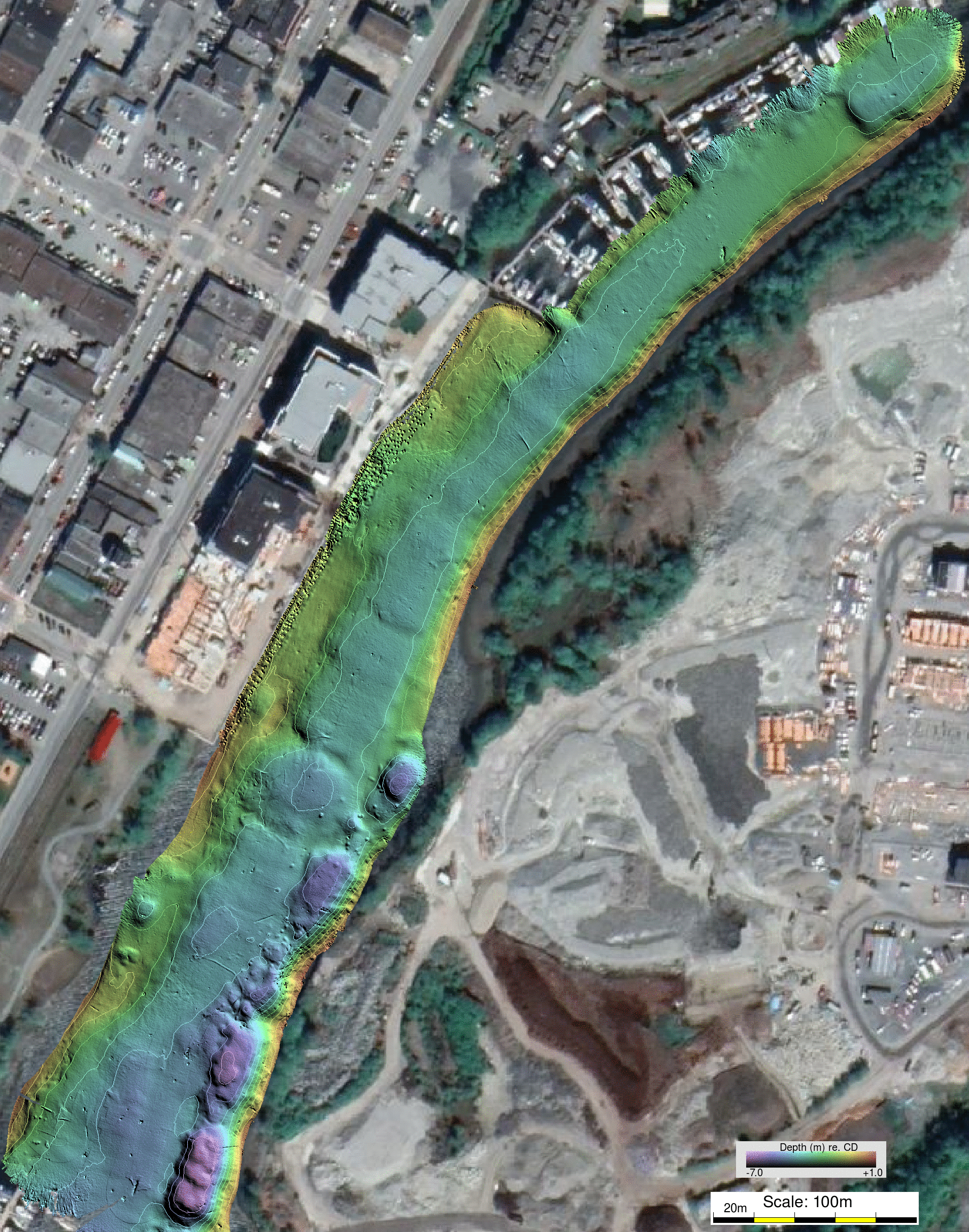
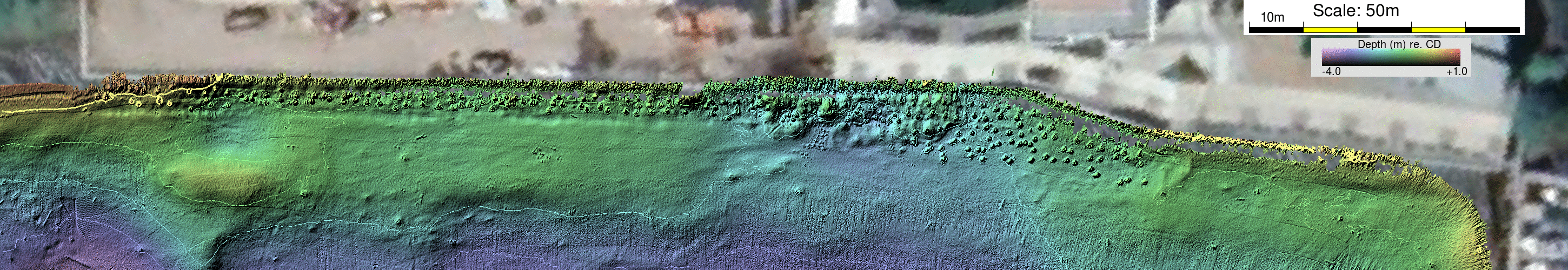
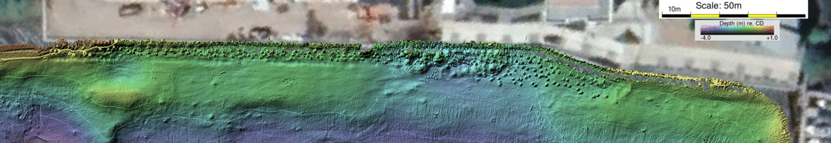
0.1m resolution bathymetic model aligned with wall.  The image is created from three swaths of overlapping data.
There is a small data gap on the NE end of the wall. This is a result of the sonar mistracking where the pilings echo is much stronger than the adjacent muddy seafloor

closest backscatter
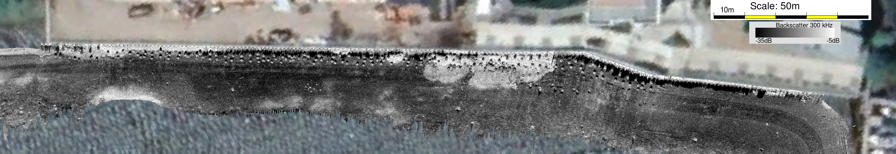
EM2040 backscatter (+/-80 deg) from line closest to pilings.
This illustrates how the targets show up particularly clearly by their cast shadow.   Note the shadow cast direction changed from side to side of the swath. Where the targets are right under the vessel, no shadow is cast.
The black band adjacent to the pilings in the area in which the sonar is mistracking (these correspond to the holes in the bathymetric model).

next outboard backscatter
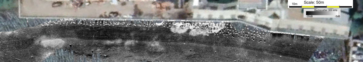
EM2040 backscatter (+/-80 deg) from next outboard line
By stepping away, the targets actually show up more clearly as the shadows are longer.


page generated by JEHC August 2019