 |
St. Andrews by-the-sea,
Charlotte County, NB
GGE-5083 HydroCamp 2002 CSL Heron, Simrad EM3000S, May 2002 This page is a work in progress. |
| |
St. Andrews by-the-sea,
Charlotte County, NB
GGE-5083 HydroCamp 2002 CSL Heron, Simrad EM3000S, May 2002 This page is a work in progress. |
 |
Area
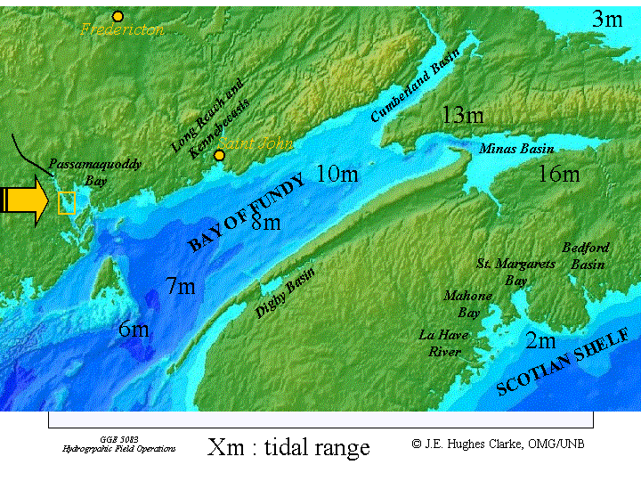
Of Operations - GGE5083 Hydrographic Field Operations 2002 The principal area of interest for GGE5083 Hydrographic Field Operations 2002 was St. Andrews Harbour, New Brunswick. The approaches to the harbour and limited deeper water of Passamaquoddy Bay were also included in the multibeam survey. This area is situated in the North West of the Bay of Fundy. |
|
Survey Design The harbour is very shallow, with
depth ranges from -3.3m to +2m above
chart datum. There is also a very significant intertidal influence. The
tide in Passamaquoddy Bay is semidiurnal with a maximum amplitude of
approximately 8 metres at spring tide. The main purpose of the project
was to familiarize students with several components of a hydrographic
survey such as data collection, data processing and error handling.
|
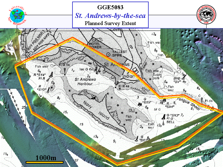 Extent of
planned survey for HydroCamp 2002
|
Students in class:
|
Instructors:
|
Survey Platforms and Instrumentation Survey Platform: This was the first year of operations for the CSL Heron, the Ocean Mapping Groups survey launch and all its sonar equipment. The students were ably assisted on board by initially, CHS's coxswain Carmen Reid. Loren Fleet, joined OMG staff and took over the responbility of the launch and its driving on a permanent part-time basis. |
|
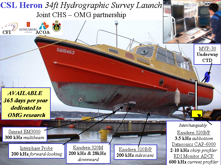 |
Sonar Equipment:
|
Objectives of Survey Although this survey is principally for training purposes the collected data will be used for several applications. The harbour of St. Andrews is a very attractive destination for boaters and other tourists within the summer months. Therefore it is of common interest to update the harbour seafloor to ensure accurate navigational information, especially in an area of such variable water depth and tidal currents. The strong currents in the area result in erosion and could cause the movement of subsurface objects. The final products of survey will also be provided to the City of St Andrews to support future decisions that are related to the harbour, such as dredging and the building of new docks. |
|
| The data gathered in this survey
has been added to the previous
surveys done in the general area over the proceeding ten years, giving
very good and extensive coverage of what is a very interesting
area ,
both in oceanographic and geological terms. For images using all the data gathered in Passamaquoddy Bay follow the link. |
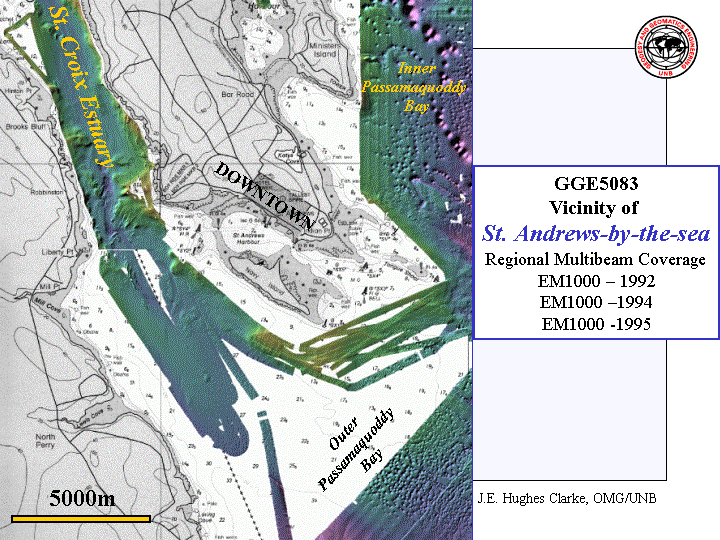 Archived Multibeam
Bathymetry
EM1000 data from
1992, 1994 and 1995
|
St. Andrews by-the-sea, HydroCamp, 2002 Final Products |
|
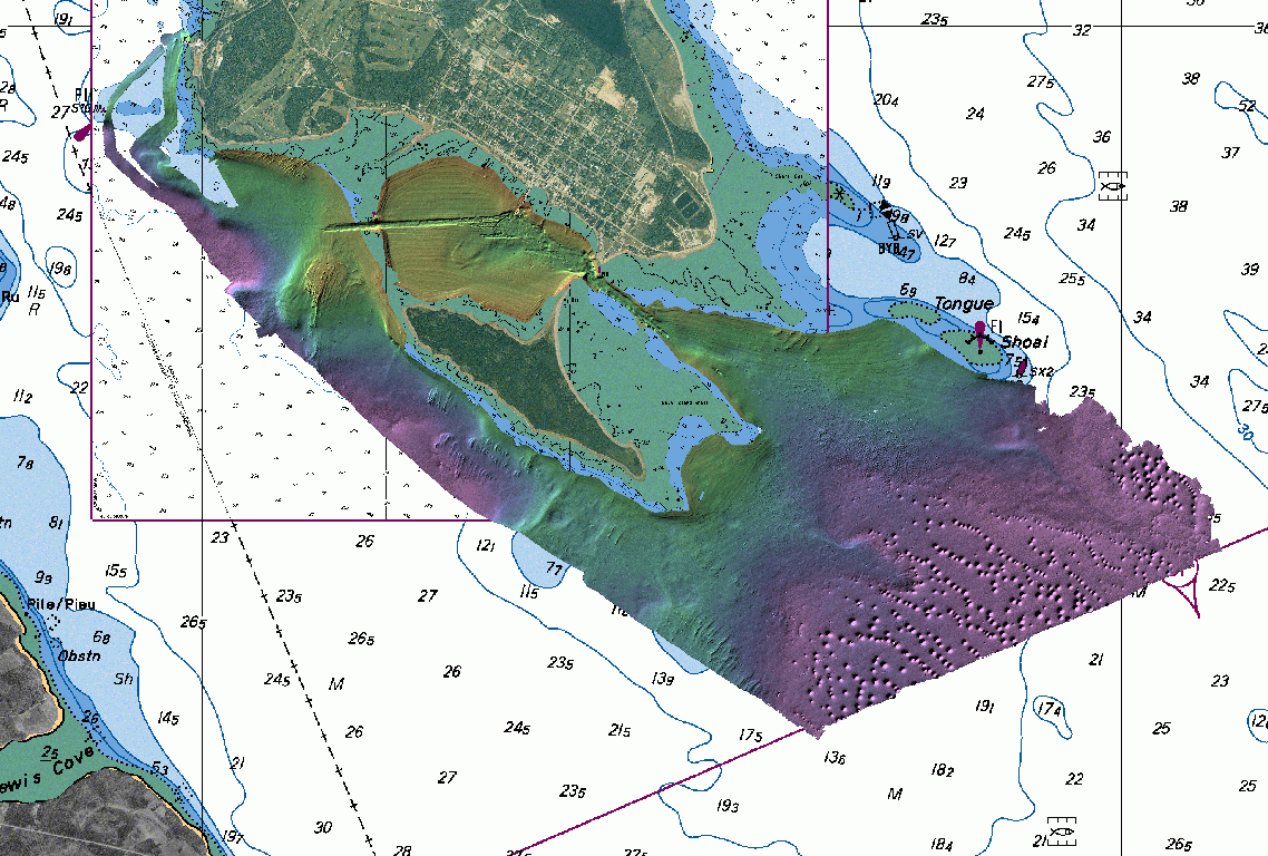 EM3000S Multibeam bathymetry. |
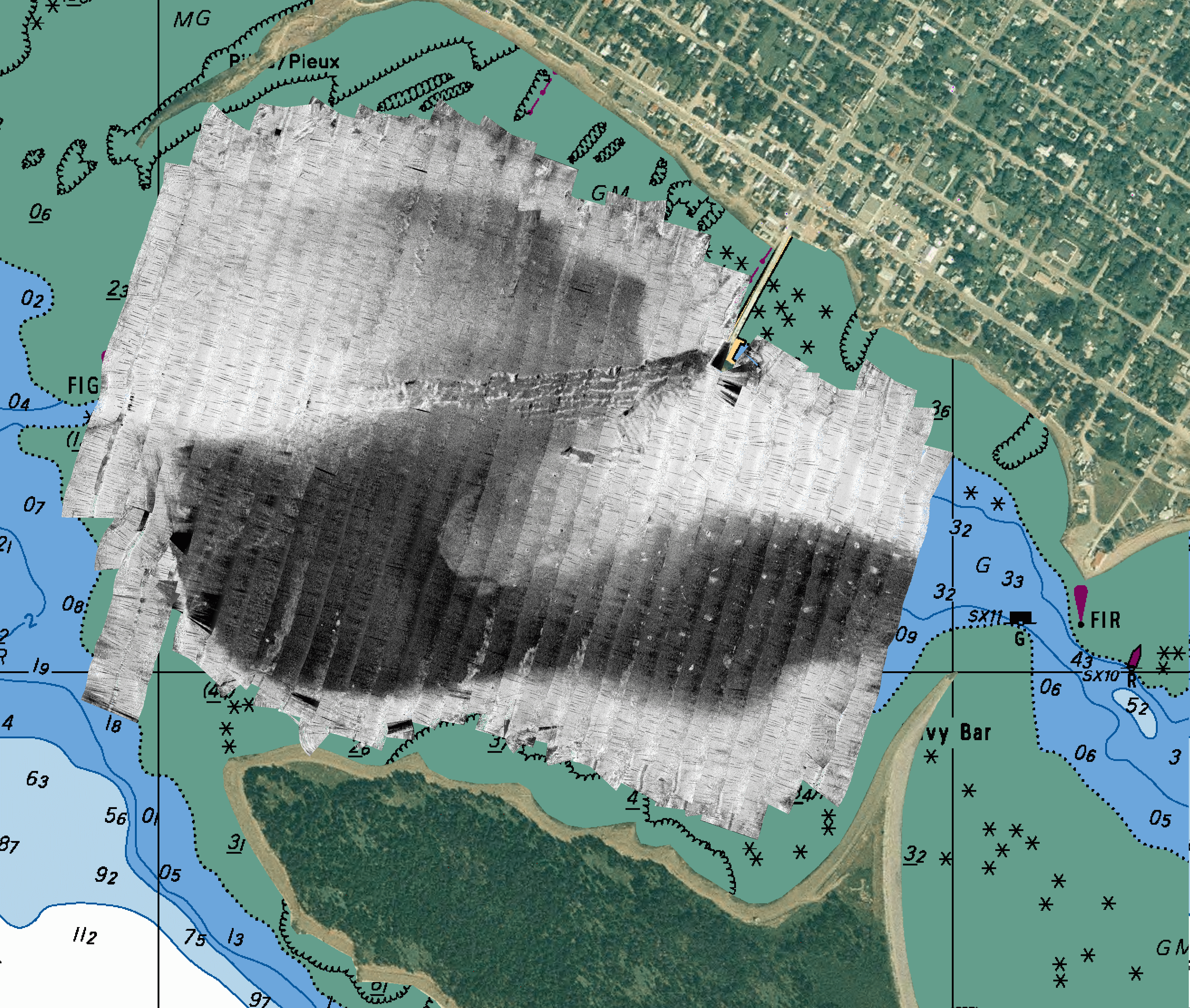
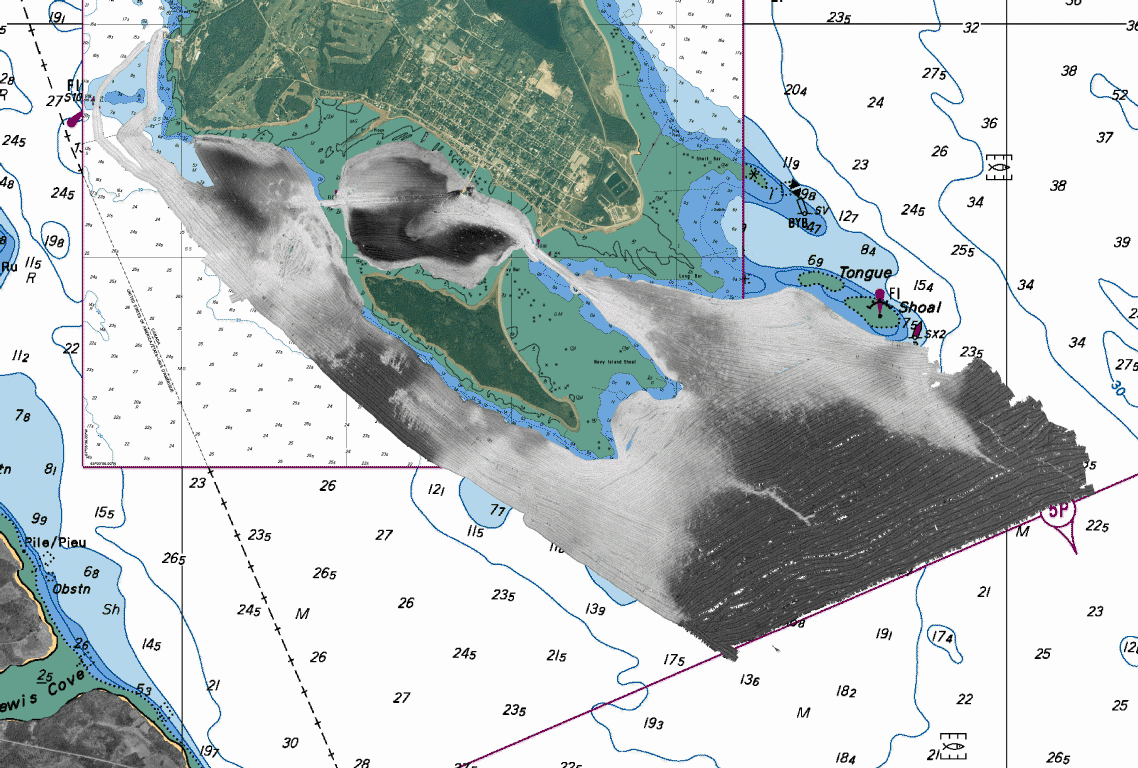 EM3000S Multibeam backscatter |
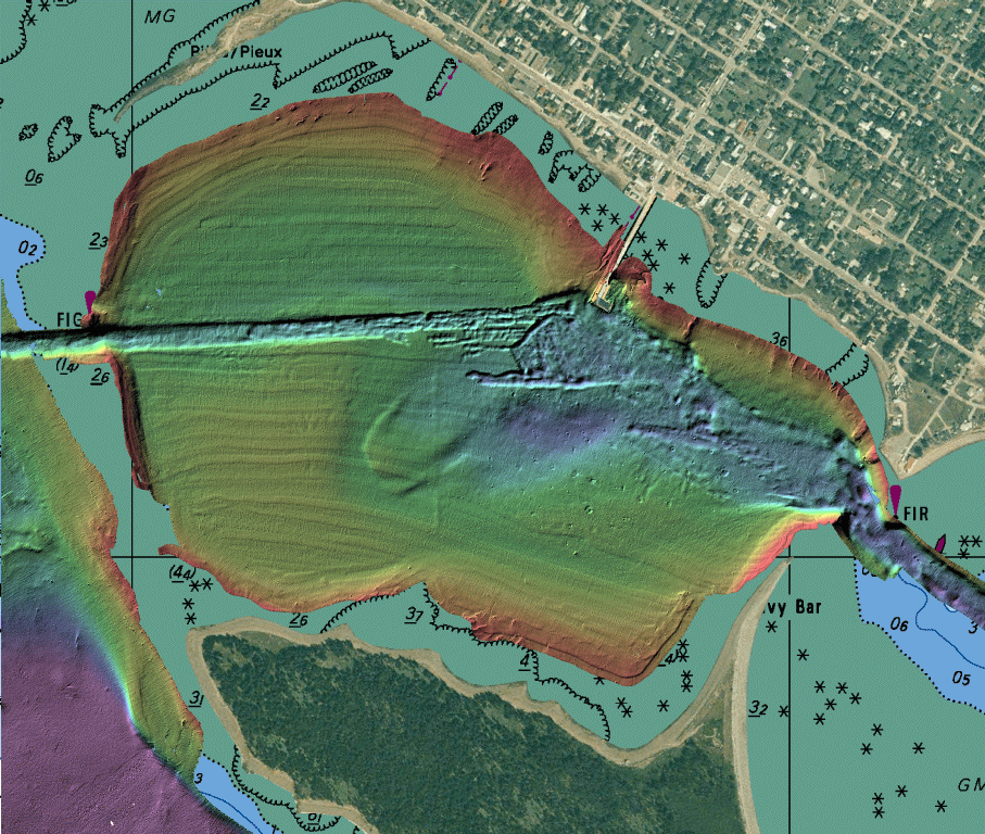 Enlargement of the harbour area. Multibeam bathymetry. |
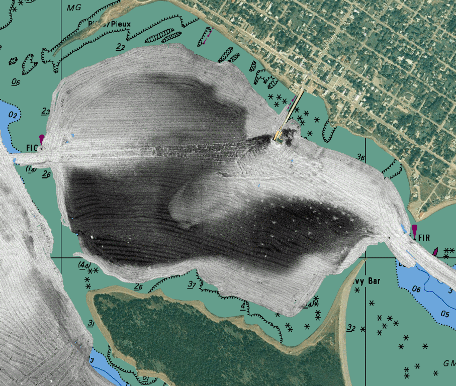 Enlargement of the harbour area.Multibeam backscatter. |
 Keel mounted sidescan staves and Knudsen 320B/P Controller. Enlargement of the harbour area. Sidescan image. |
|
| St. Andrews by-the-sea, HydroCamp, 2002 Survey Operations Report |
|
| The students Survey Operations Report is available as a Word Document. |
|