animation of data types Multi-Sensor, Underway Oceanographic Profiling
C.S.L. Heron - Long Reach, Saint John River
October 20th  2003
John E.Hughes Clarke and Nicole Delpeche
Ocean Mapping Group
 Dept. Geodesy and Geomatics Engineering
University of New Brunswick


Herein, we present the results of simultaneous underway oceanographic data collection using a combination of a  Brooke Ocean MVP-30 undulating instrument (with CTD and optical backscatter probe), an RDI 600 kHz monitor ADCP and a Knudsen 320 digital 200 kHz echosounder. All instrumentation is deployed simultaneously from CSL Heron, the primary research platform of the Ocean Mapping Group at the University of New Brunswick. Processing, integration and presentation software was written by JEHC. These data were collected as part of an ongoing investigation into the estuarine dynamics of the lower Saint John.
 
long reach chart
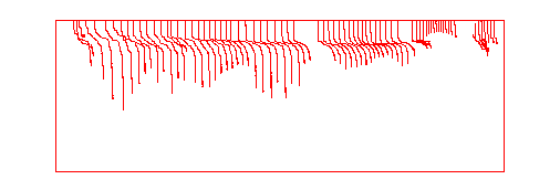
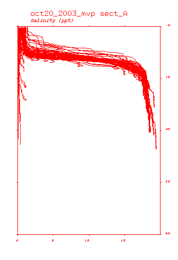
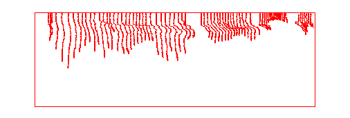
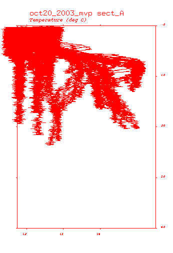
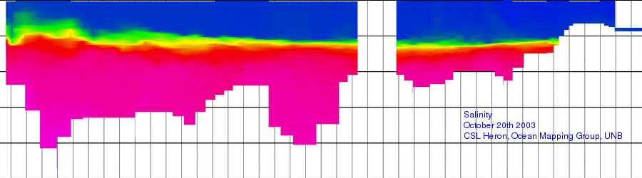
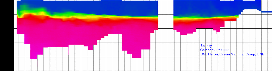
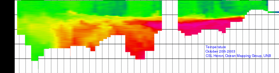
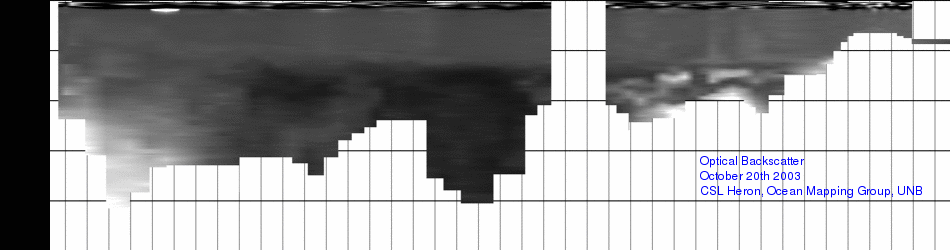
 As an example of the capabilities of the instrumentation and processing software, a single 
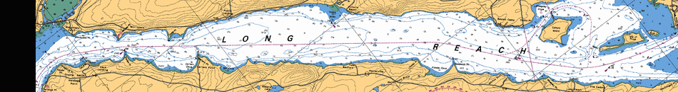
transect of Long Reach (Saint John River) is presented showing the different views available. Long Reach is one of the most oceanographically active sections of the estuarine part of the river system. Depending on the time of year, a salt wedge/brackish mixed layer, penetrates up this section and exhibits remarkable mixing dynamics (the current MScEng thesis of Nicole Delpeche).

All plots below represent data projected into the long axis of the chartlet above. For all plots, the depth range 0-25m, 5m grid intervals, horizontal units 50m per grid mark
salinity
Salinity - (colour range blue: 0ppt, pink: 20ppt)
derived from Brooke MVP-30 using AML smart CTD
dipping ~ every 500m (125 seconds at 8 knots) interpolated
geo-offset salinity profiles
salintiy profiles stacked
temperature
Temperature - (colour range blue: 11.75degC, pink: 14degC)
derived from Brooke MVP-30 using AML smart CTD
dipping ~ every 500m (125 seconds at 8 knots), interpolated
geo-offset temperature profiles
temperatureprofiles stacked
optical backscatter
Optical Backscatter - (colour range black: 100mV, white: 700mV)
derived from Brooke MVP-30 using ?an optical backscatter sensor ?
dipping ~ every 500m (125 seconds at 8 knots) interpolated
geo-offset temperature profiles
temperatureprofiles stacked
ADCP curents (100m ensemble averaging)
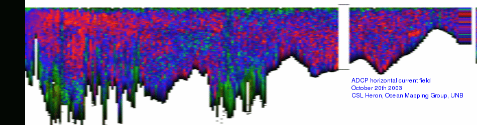
ADCP current vectors - (azimuths red: downstream, green-upstream, blue-out_of_screen, yellow-into_screen)
derived from 600kHz RDI Monitor ADCP, pole mounted - 50cm bins vertically
pinging ~ 1Hz (4m at 8knots), but ensemble averaged over 100m metres
600 kHz volume backscatter
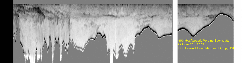
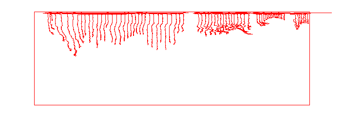
600 kHz Acoustic Volume Backscatter - (black - high intensity (linear range))
derived from 600 kHz RDI Monitor ADCP, pole mounted - 50cm bins vertically
pinging ~ 1Hz, averaged in 10m bins horizontally,
200kHz volume backscatter
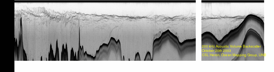
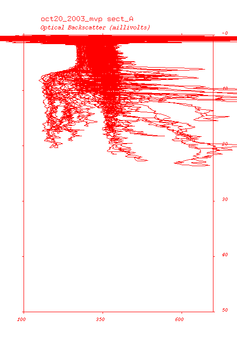
200 kHz Acoustic Volume Backscatter - (black - high intensity (logarithmic range))
derived from Knudsen 320BP - 200 kHz 6 deg. beam, over-gained
pinging at ~ 10Hz, stacked in 10m bins, 10cm vertically (0.1ms pulse)

The data illustrated above, provide an opportunity to make remarkable insights into the dynamics of the salt-water fresh-water mixing in this section of the estuary. At this point I will refrain from interpreting it (Nicole's job!), but clearly the availability of all these simultaneous views markedly improves our ability to observe and understand these gorgeous estuarine processes.

last updated by John E. Hughes Clarke , August 2004