sant john river Investigations into the Oceanography and Modern and Quaternary Geology of
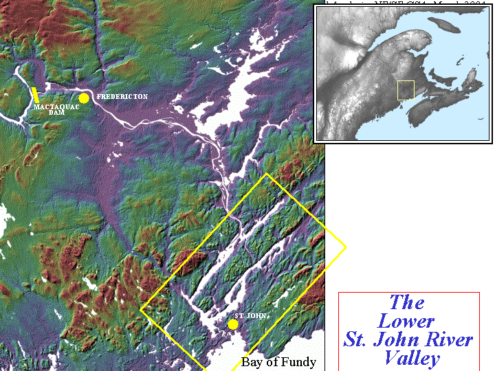
the lower Saint John River Estuarine System

John E. Hughes Clarke

Ocean Mapping Group
Dept. Geodesy and Geomatics Engineering
University of New Brunswick
Canada

As an extension of marine geomatics research at UNB (focussing on rapid sound speed variations in support of hydrographic surveys), a multi year project has been developed looking at the oceanographic and sedimentary characteristics of the lower Saint John River system. The lower section of the Saint John River exhibits some remarkable estuarine and fjord-like dynamics as well as evidence that the basins represented sustained fine-grained depocentres for much of the Quaternary history of the province. The Saint John is the largest input of freshwater into the Bay of Fundy (~ 60%) and drains central and northern New Brunswick as well as a significant portion of Northern Maine and parts of SE Quebec.
sant john river
The principal constraints on the morphology of the lower Saint John River Valley are imposed by the "Caledonian" (Proterozoic and Lower Palaeozoic) outcrop patterns. The principle strike of the  geology from the NE to the SW controls the axis of the two major structural depressions, Long Reach and the Kennebecasis.  The main Saint John river flows into the upper end of Long Reach and is abruptly diverted by 90 degrees at the lower end into the Westfield Channel.  Downstream, the Westfield Channel opens up into Grand Bay, which in turns drains out through a narrow gorge, over the Reversing Falls into the Bay of Fundy.

What makes the Saint John Estuary so remarkable is the massive tidal forcing, competing against the seasonally variable fresh water discharge. This interplay is strongly influenced by the constraining morphology, most significantly the constriction at the mouth by the Reversing Falls, the presence of which prevents this estuarine system from being completely tidally dominated.

sant john riverThe 
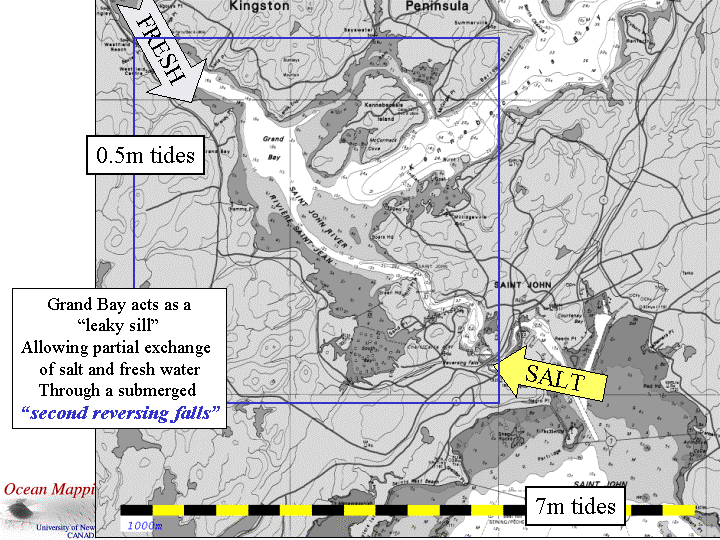
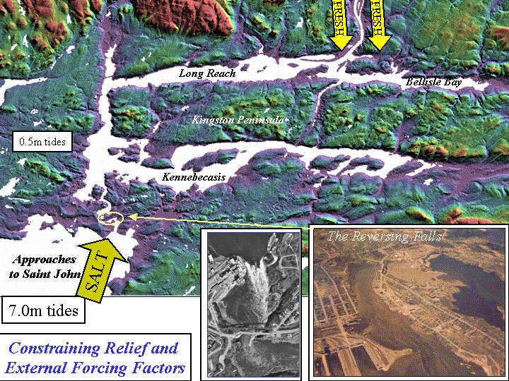
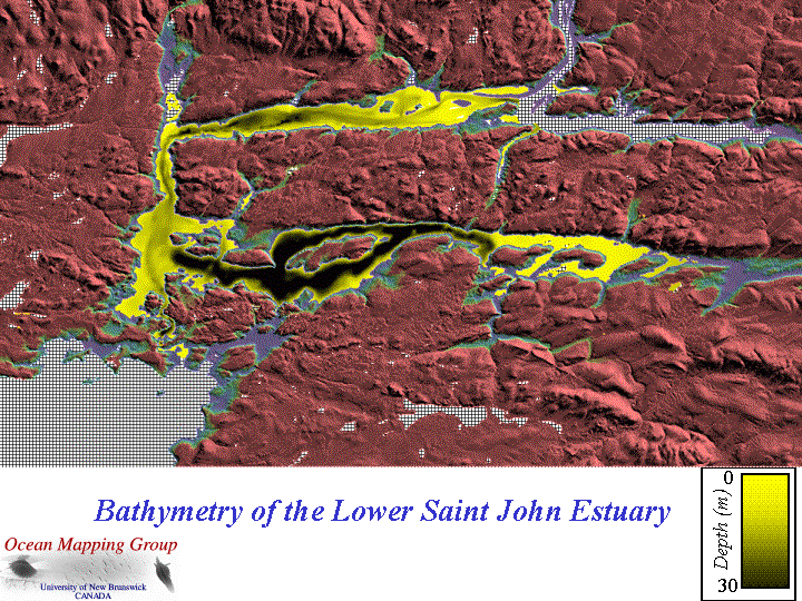
underlying bathymetric controls on the two longitudinal troughs, Long Reach and Kennebecasis are quite different. The Kennebecasis remains a regionally deep (> 30m) sediment-starved  fjord, whereas the Long Reach has clearly been filled in from the upstream end presumably by sediment coming down the Saint John river system. The Kennebecasis is filled with a largely conformal drap of laminated sediments of unknown age. The lower section of Long Reach is now know from subbottom profiling and multibeam morphology to be scoured into the underlying older stratified sedimentary sequence. In contrast the upper section of Long Reach appears to be mainly depositional, although given the near ubiquitous presence of near surface gas, it is impossible to look into the sedimentary sequence using conventional seismic systems.

The oceanography of the two basins is substantially different. The Kennebecasis has a near stagant body of brackish water (~ 20-23 ppt) that sits under a surface ~ 10-13m thick fresh water layer. There is little flushing of the fresh water layer as the discharge of the Kennebecasis and Hammond Rivers is much smaller than that of the main Saint John. The Long Reach in contrast, is a partially mixed or salt wedge estuary, depending on the time of the year. The lower brackish layer varies strongly seasonally and mixes with the overlying main Saint John River discharge in a spectacular fashion.
sant john river
The majority of the work to date has focussed on the Grand Bay area where we see that there is a pronounced bathymetric restriction that prevents the deeper (> 10m) waters in the Reversing Falls gorge from exchanging freely with the deeper waters of either the Westfield channel and Long Reach (i.e. going up the main river system) or into the Kennebecasis (to refresh the trapped deep saline body that exists throughout that basin). The main research platform, CSL Heron is based at the Saint John Marina on the west side of Grand Bay.  Increasingly the surveys are expanding to include the whole of the Kennebecasis and Long Reach areas, however, as their dynamics are controlled so strongly by the Grand Bay Sill exchanges.


A variety of field programs in the Saint John River estuary have been performed, some complete, and others ongoing. At this time, they include:


last updated by John E. Hughes Clarke - August 2004