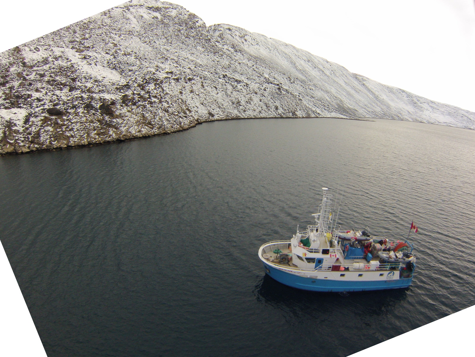
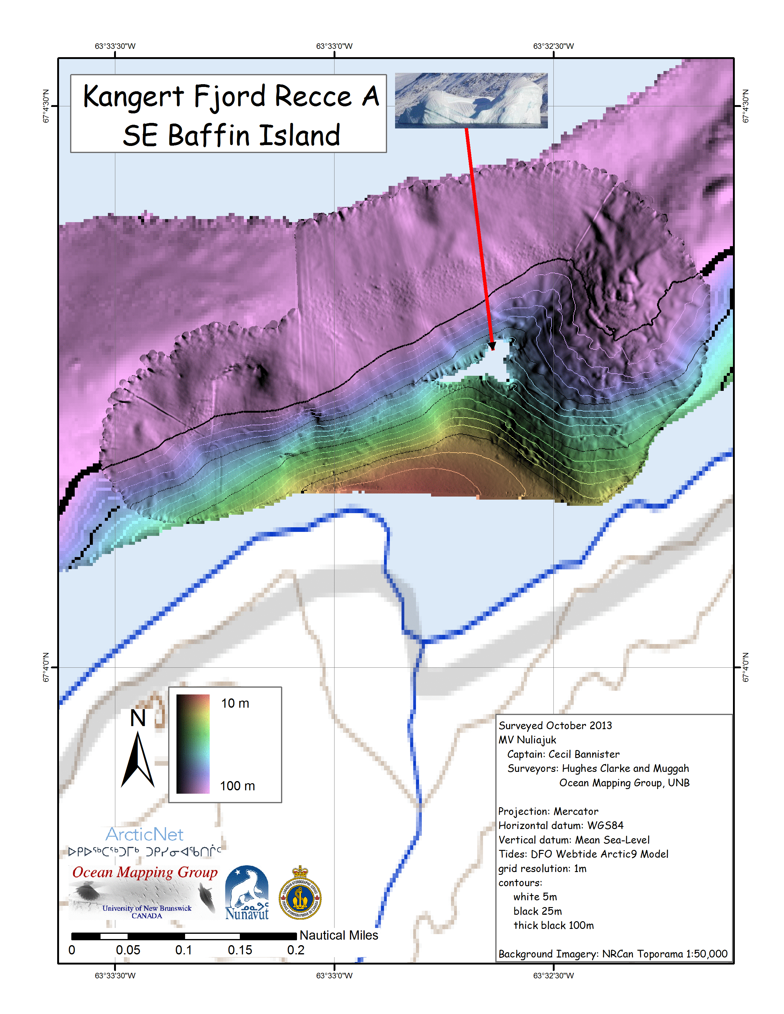
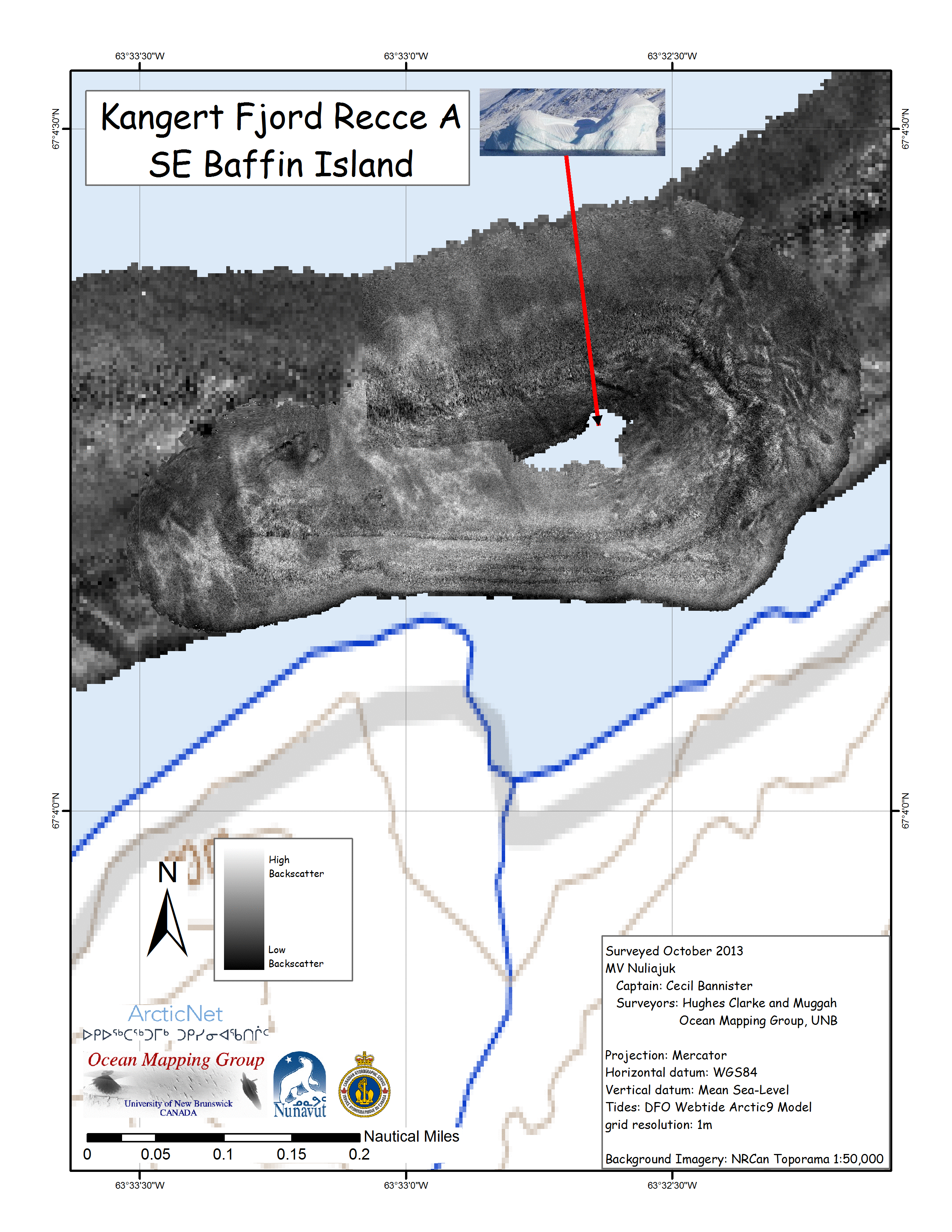
photo credit: James Muggah
John Hughes Clarke and James Muggah
Ocean Mapping Group
Dept. Geodesy and Geomatics Engineering
University of New Brunswick
Nuliajuk 2013 Index
|
photo credit: James Muggah
|
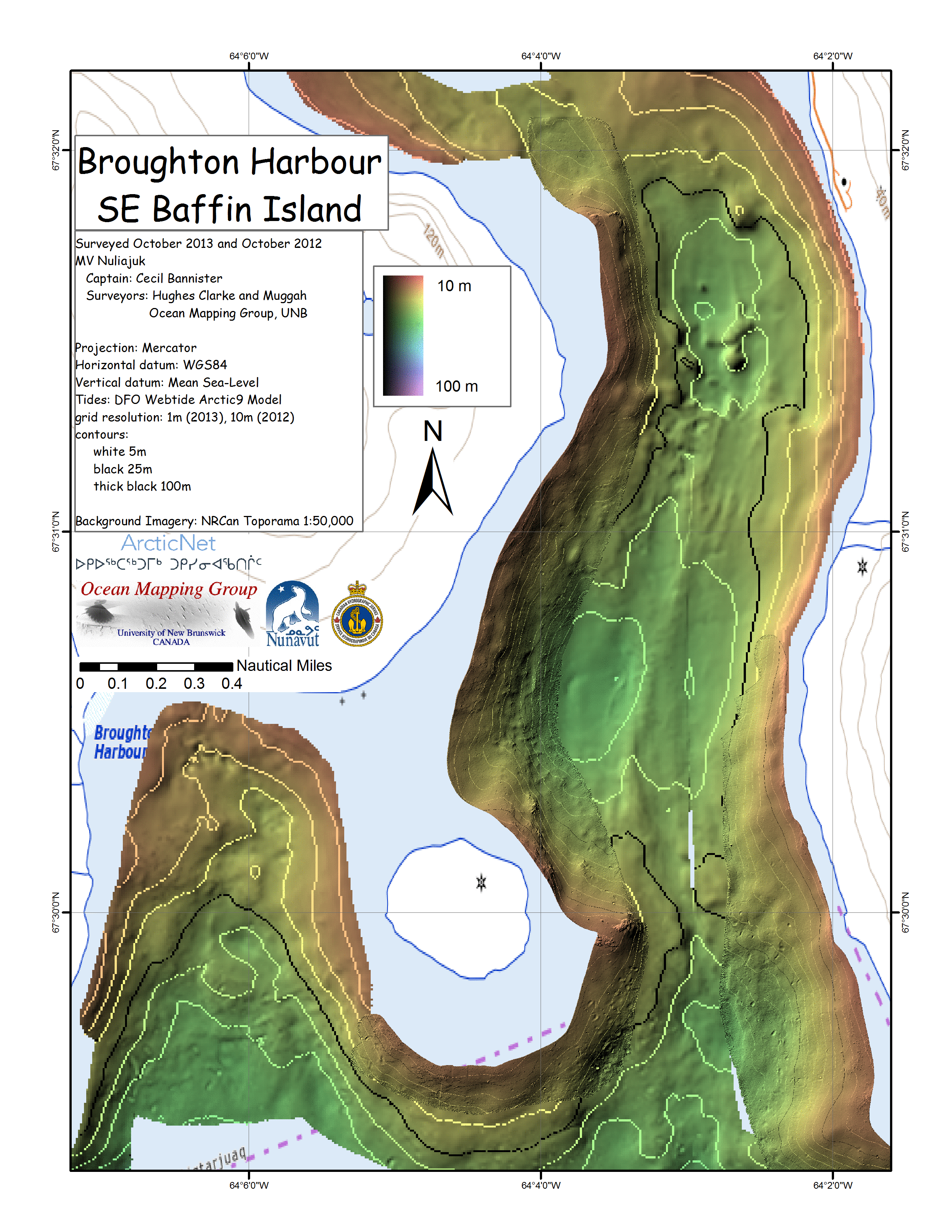
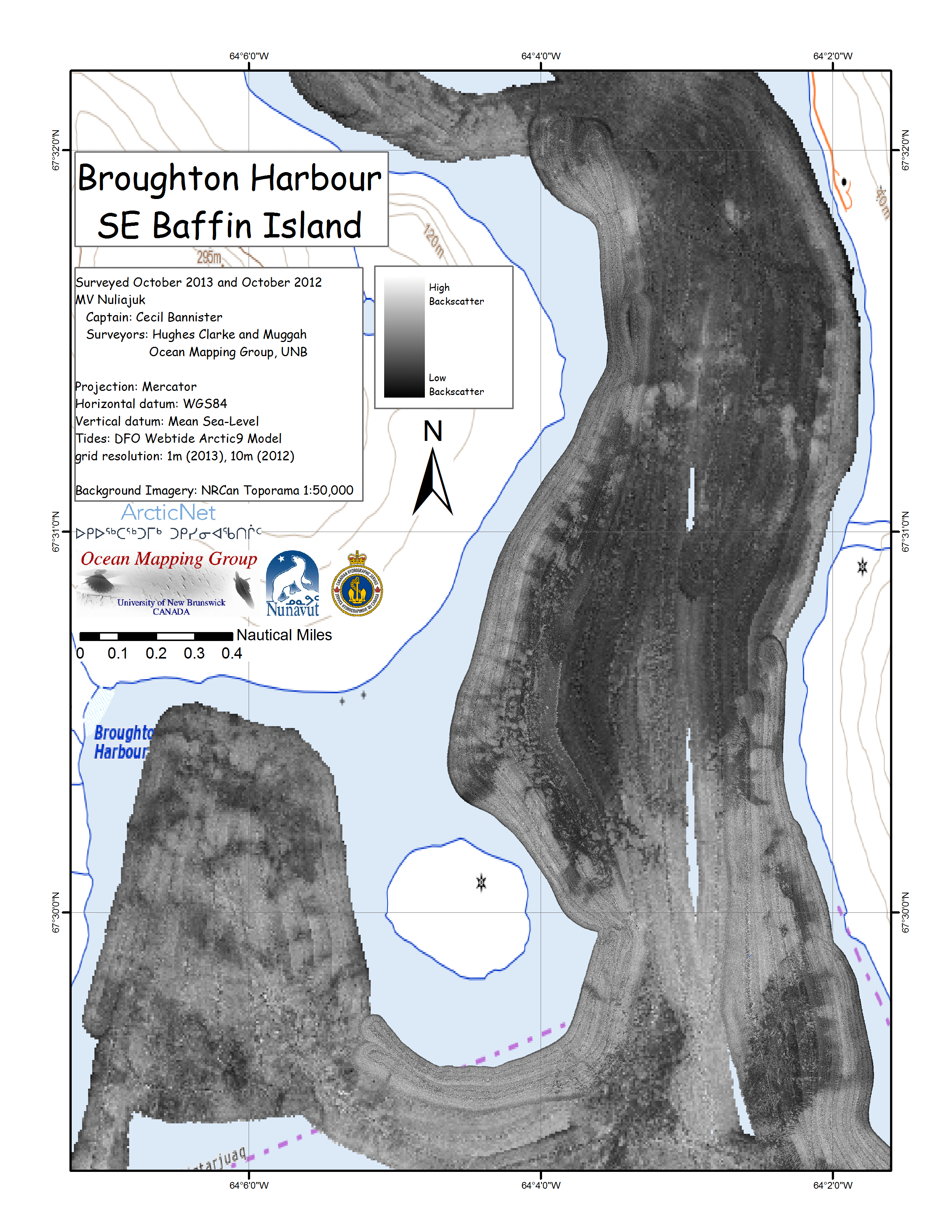
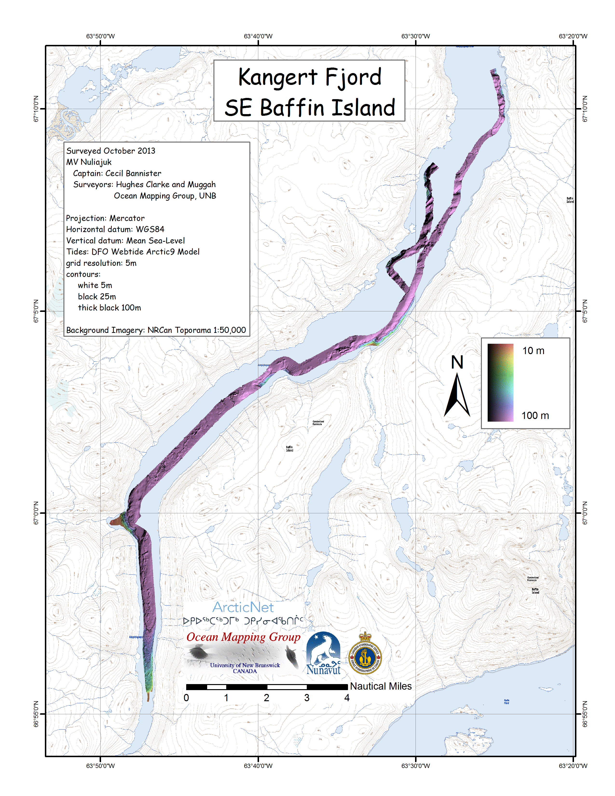
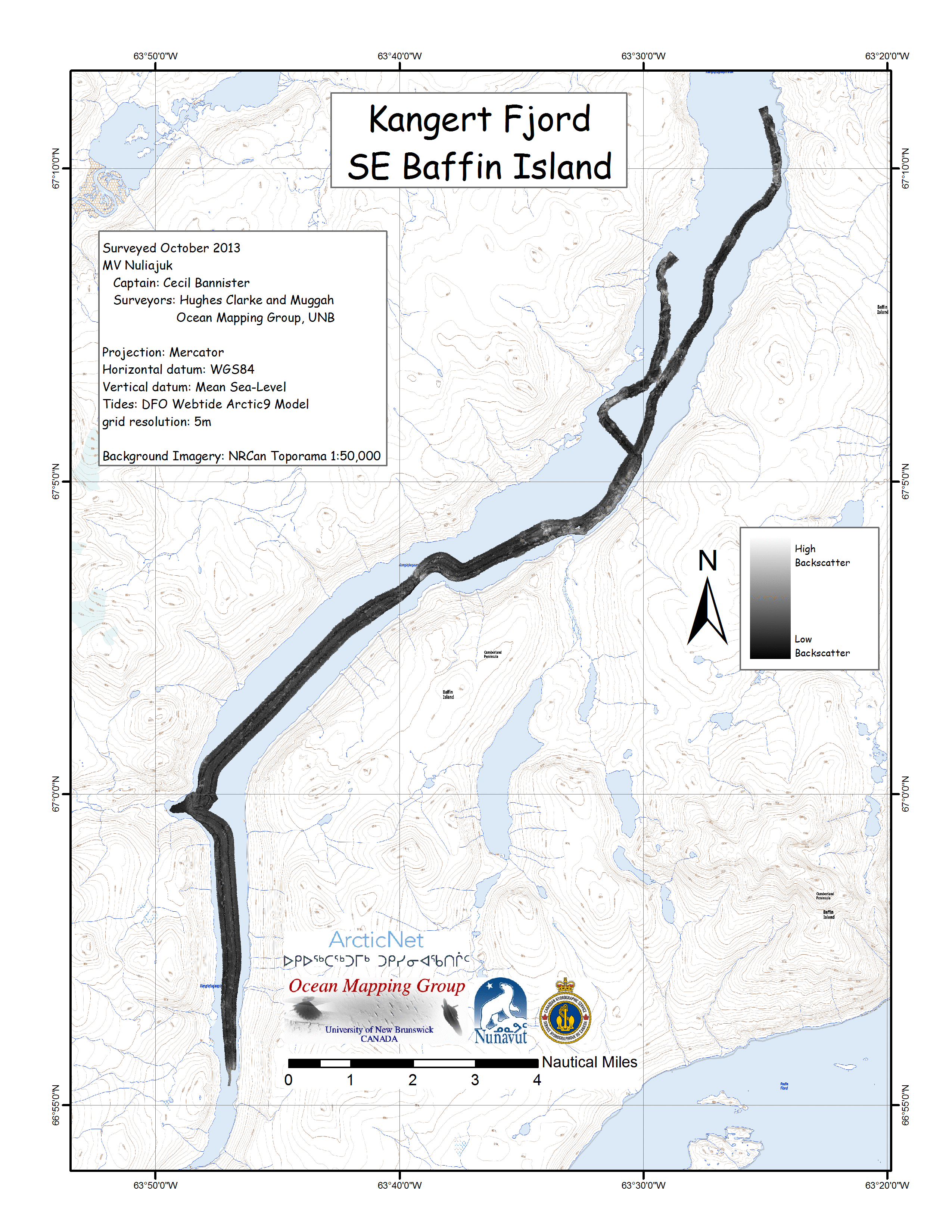
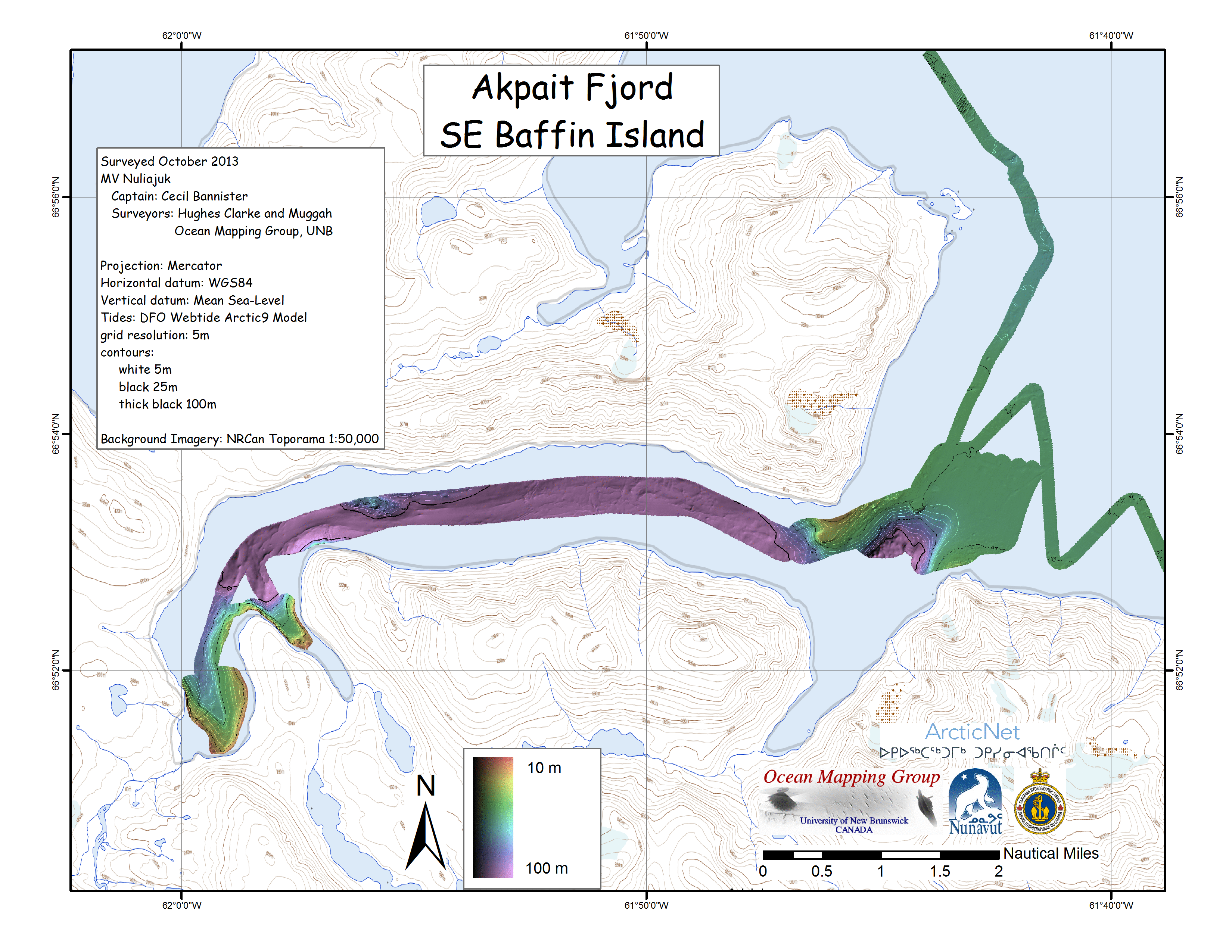
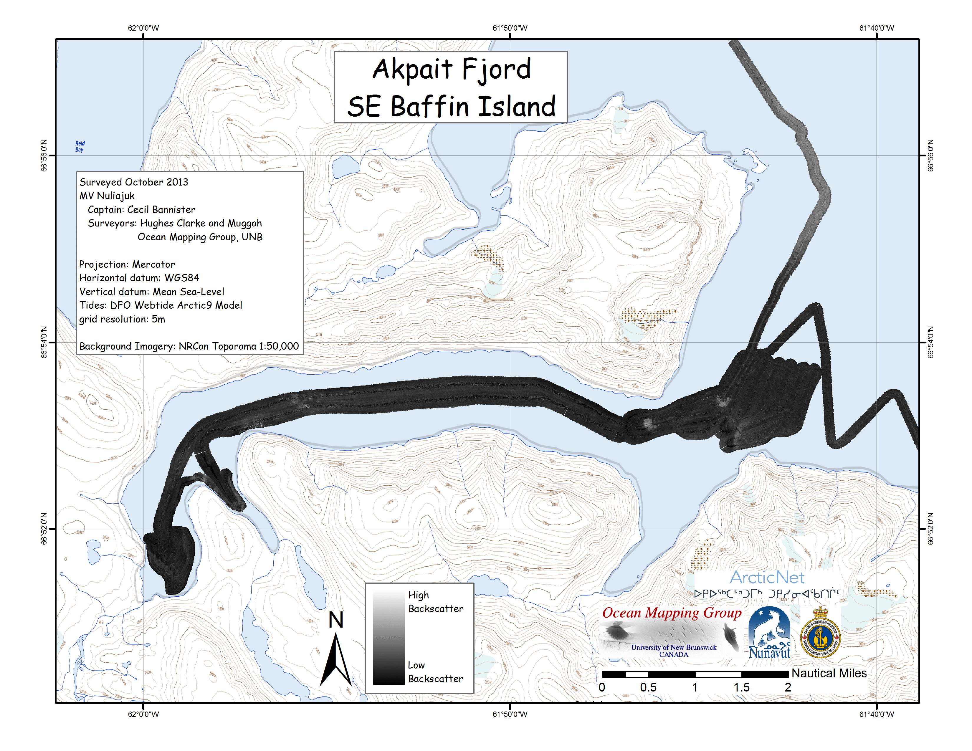
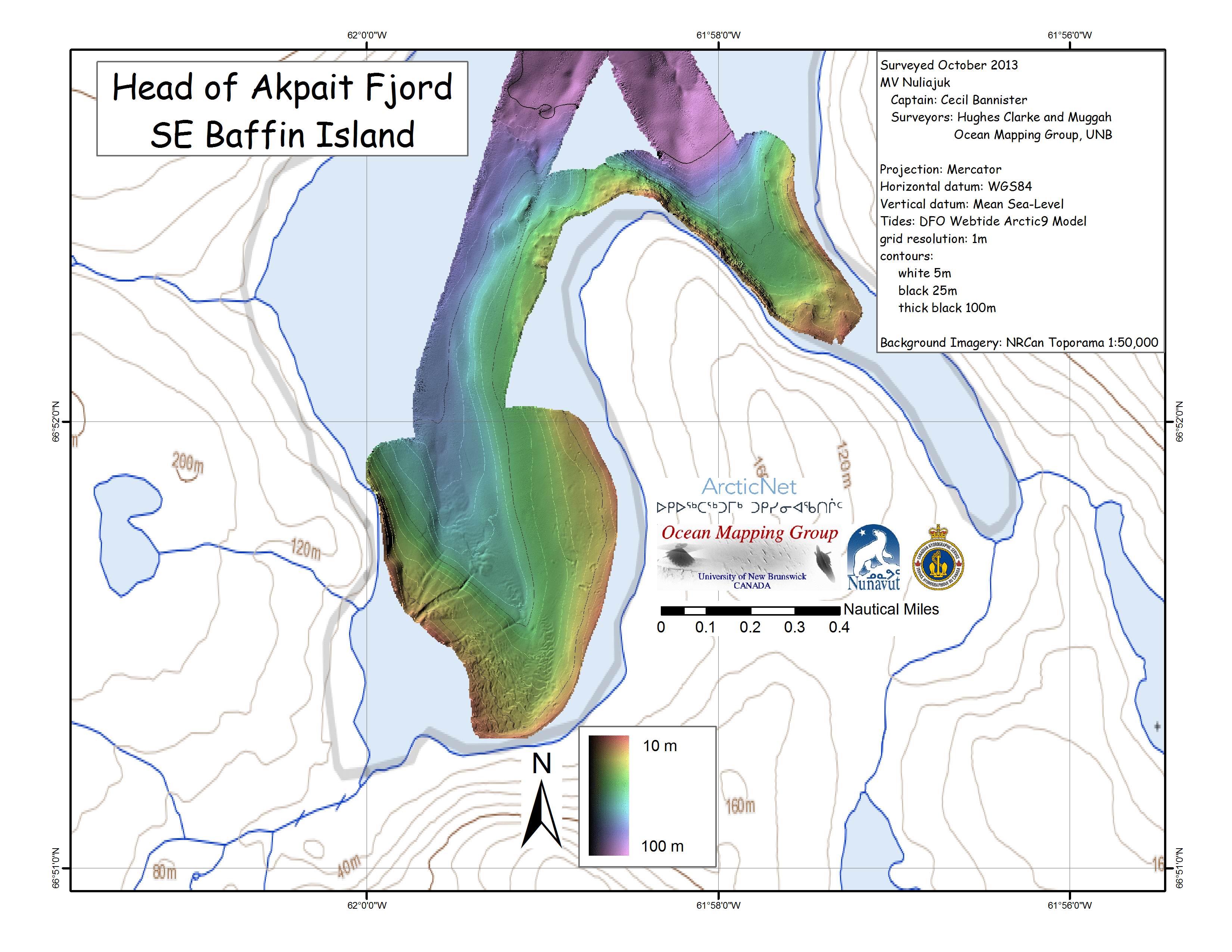
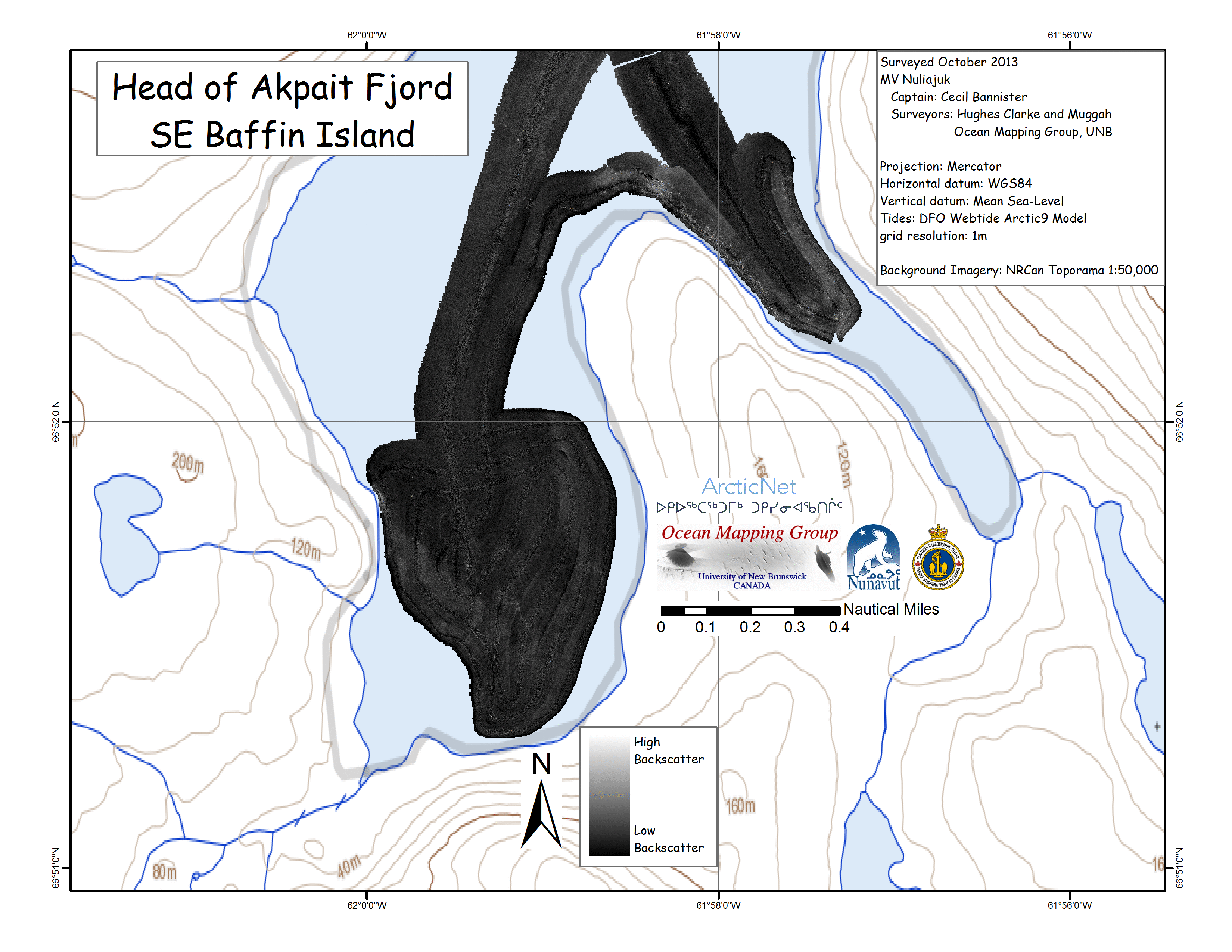
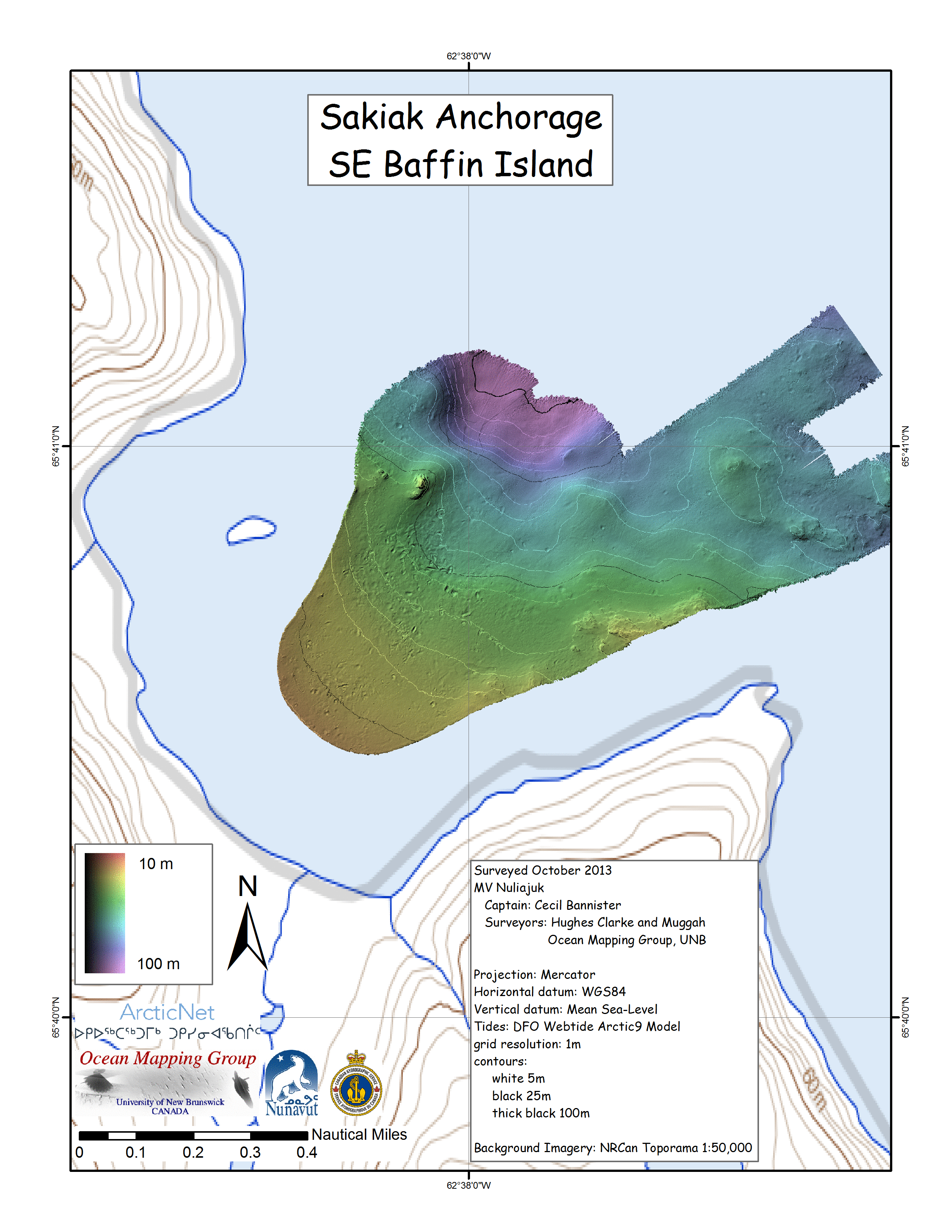
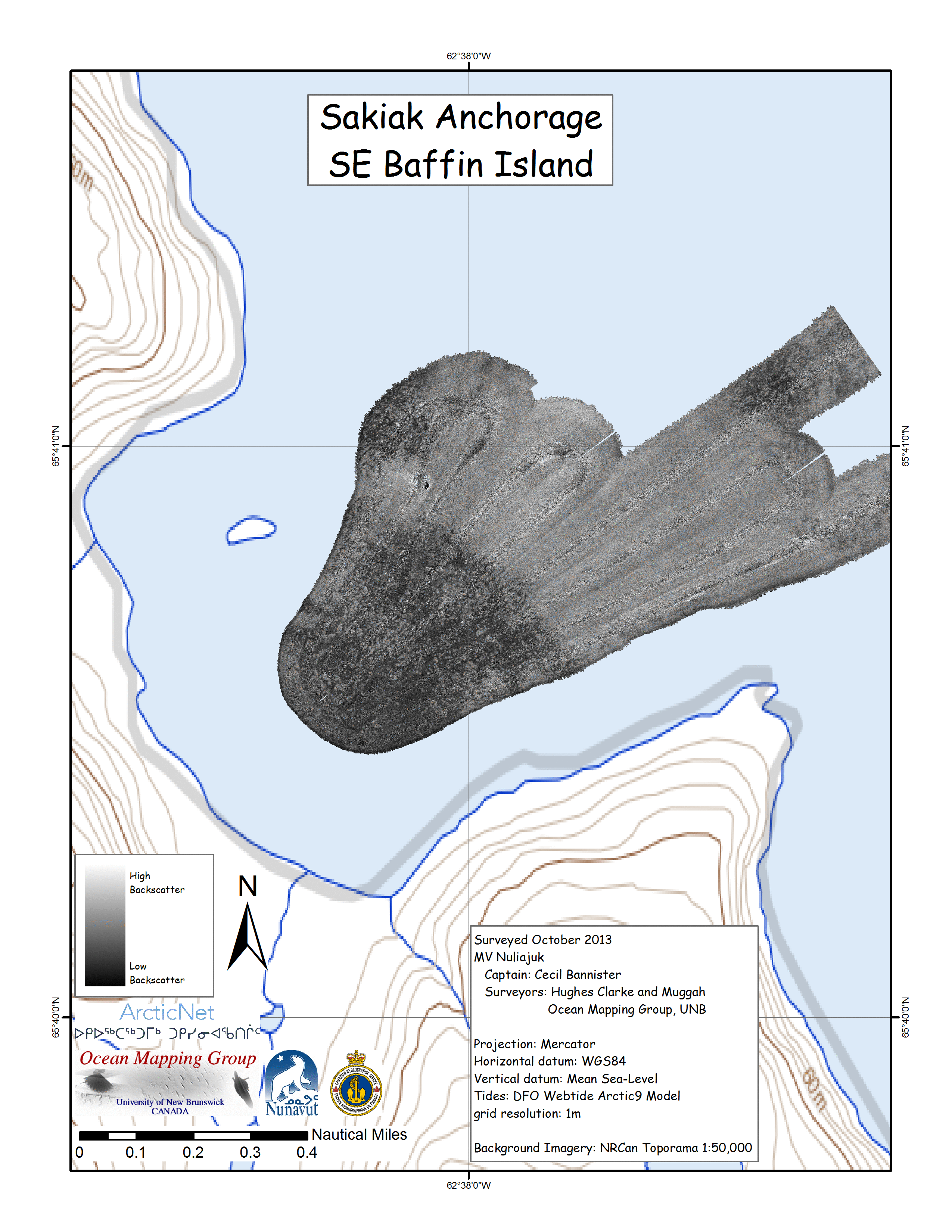
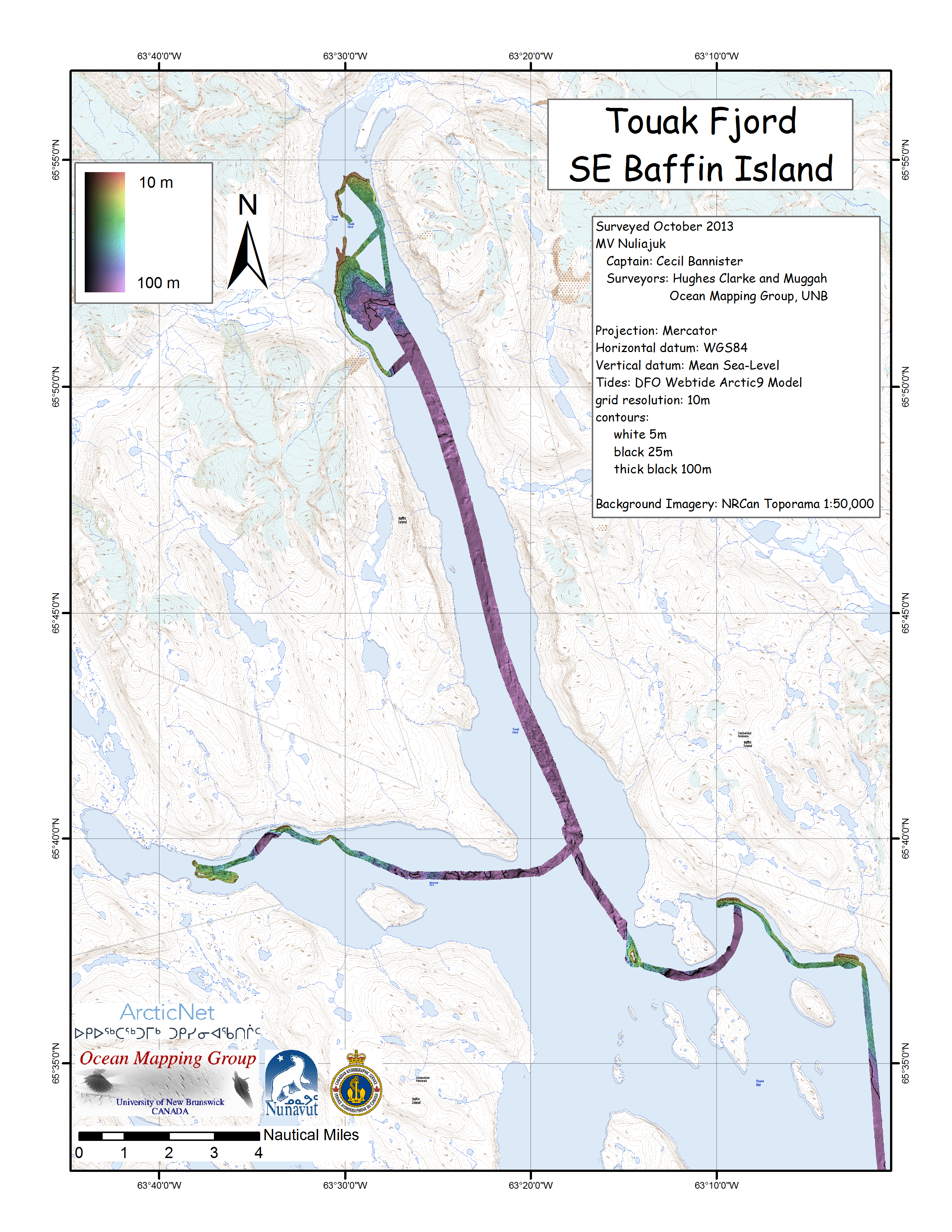
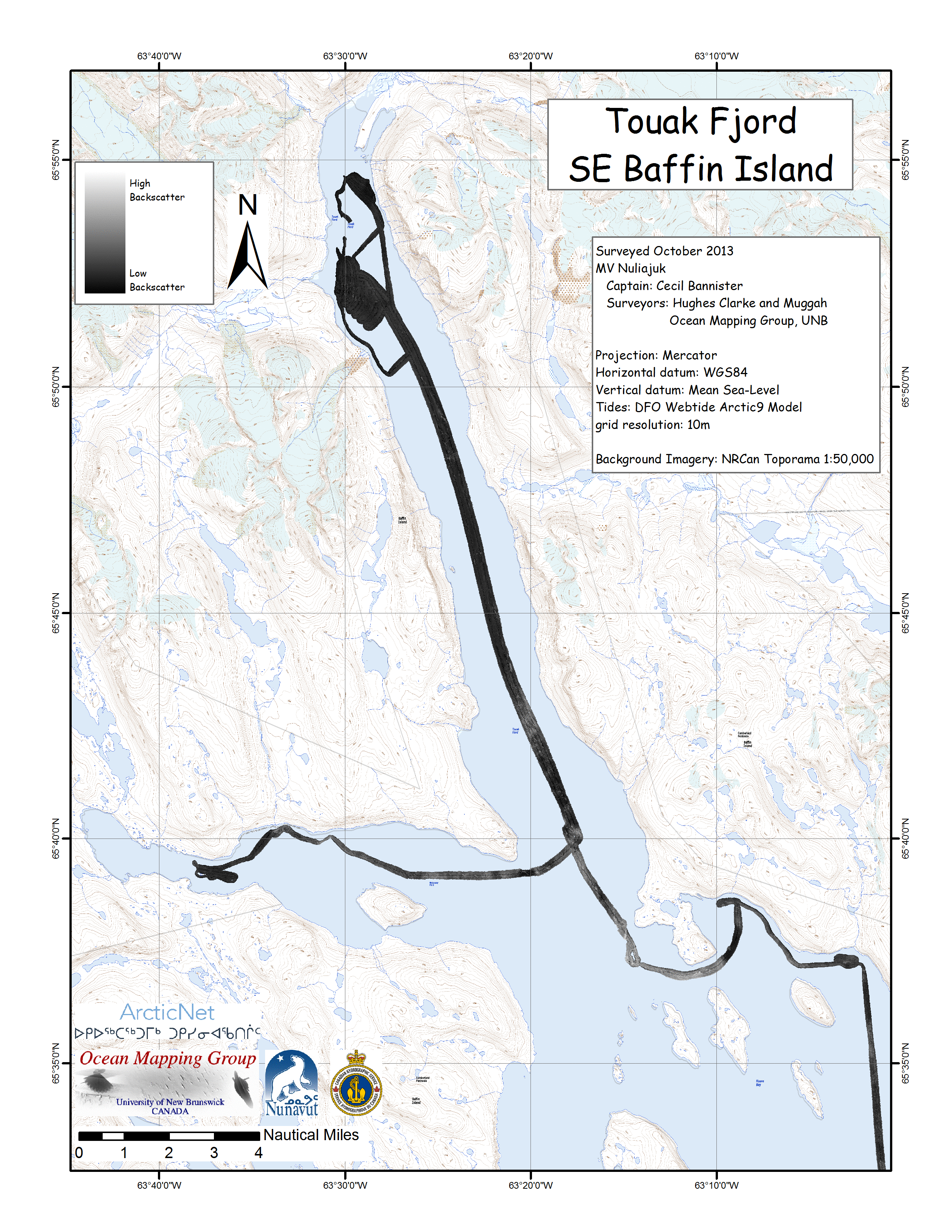
Nuliajuk 2013 SE Baffin Leg
1 Mapping Operations -
Preliminary Results John Hughes Clarke and James Muggah Ocean Mapping Group Dept. Geodesy and Geomatics Engineering University of New Brunswick Nuliajuk 2013 Index |
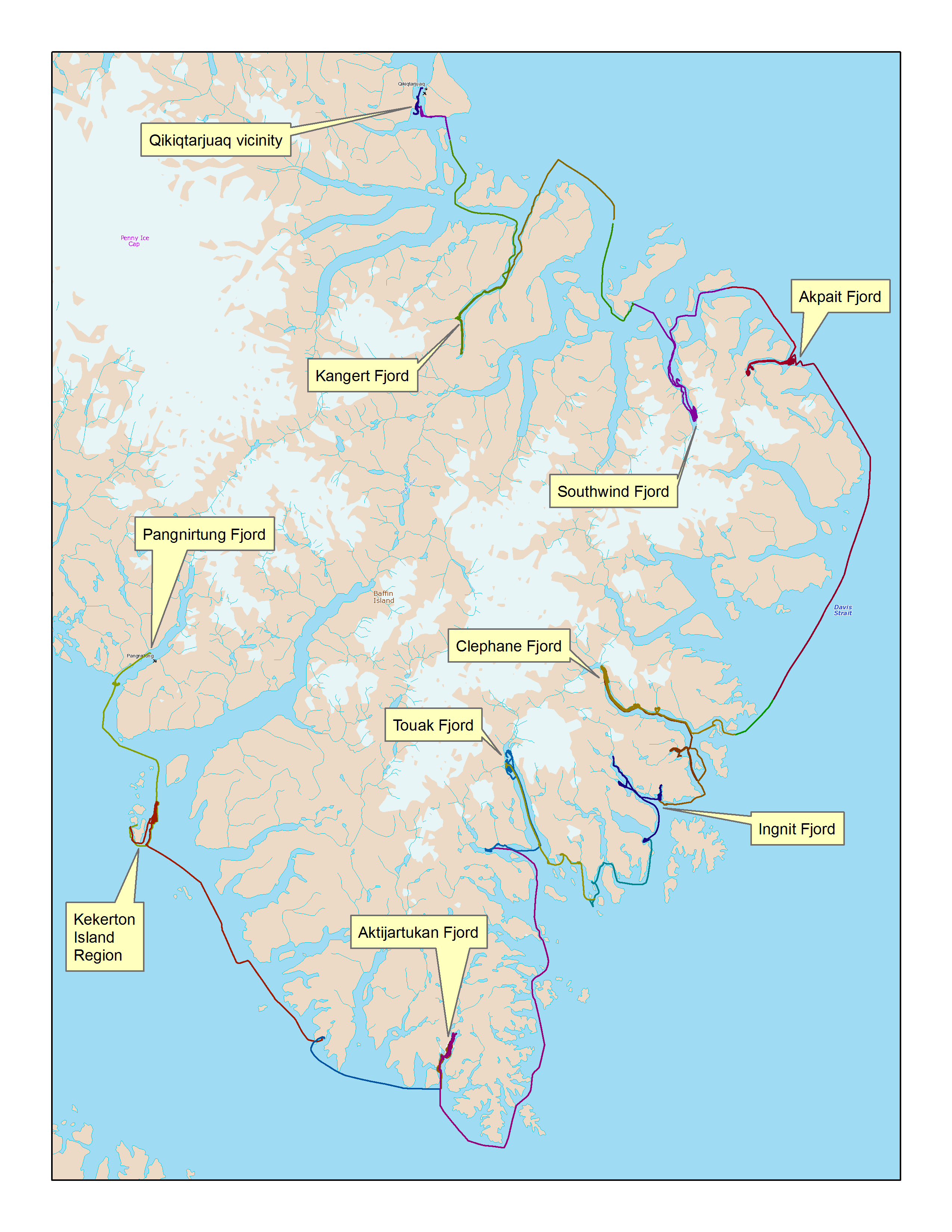 |
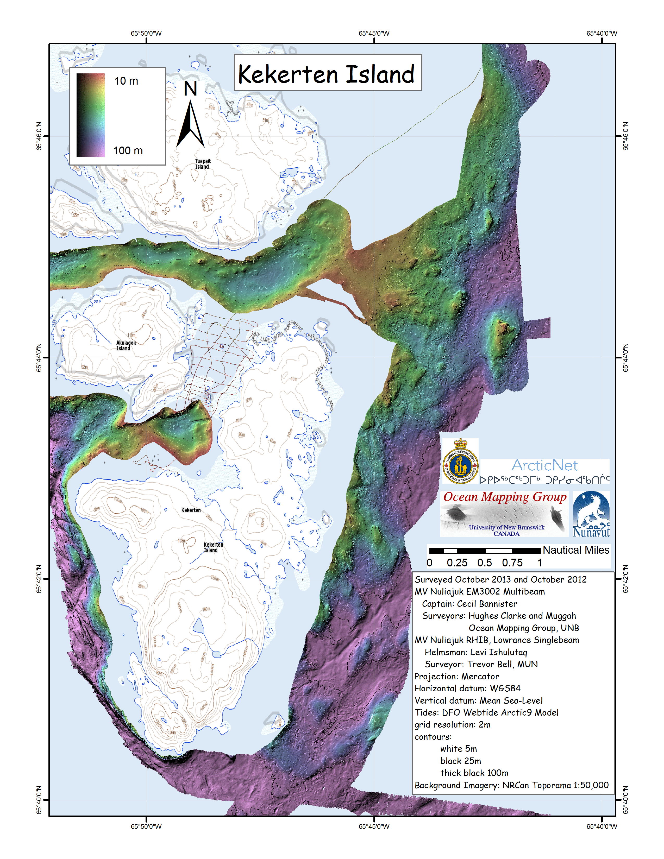
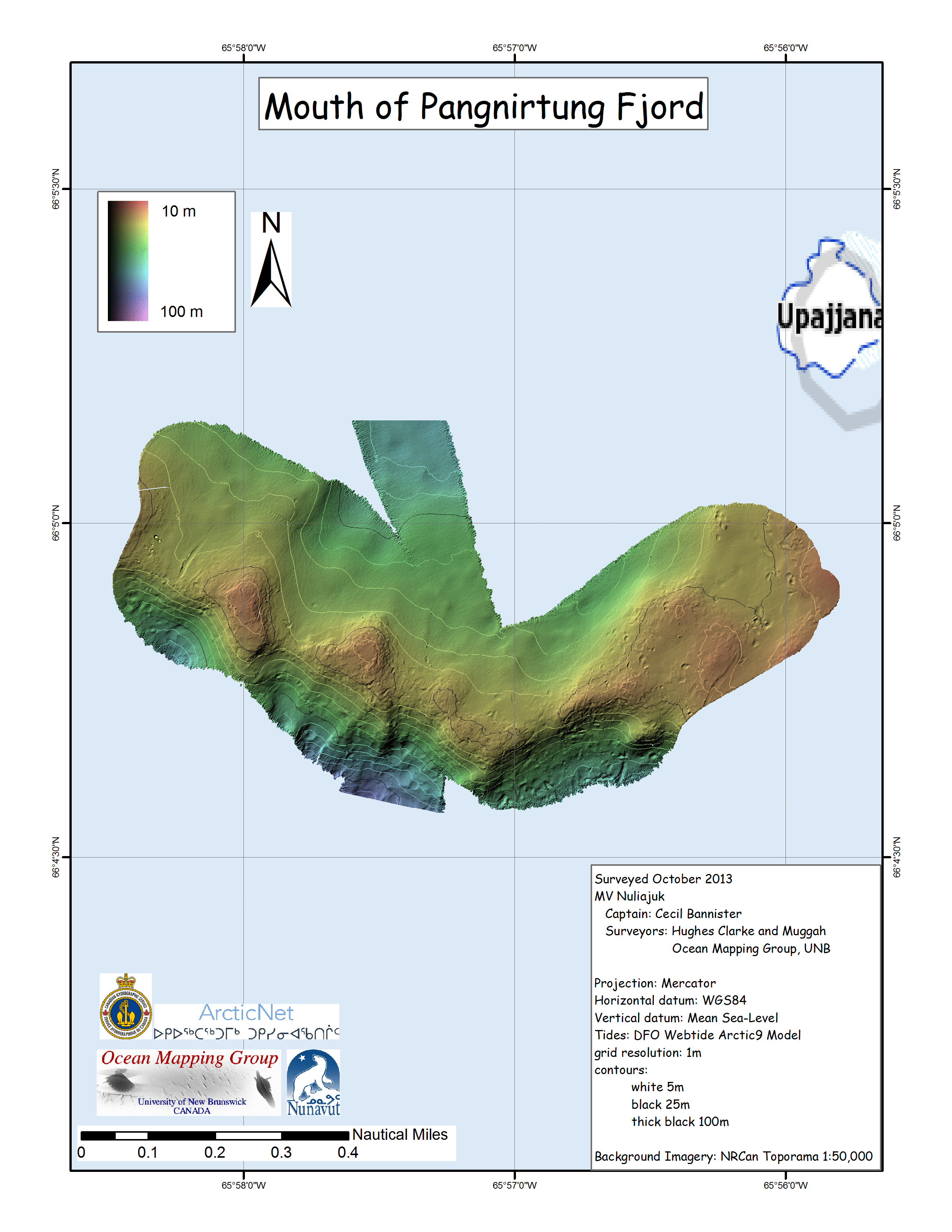
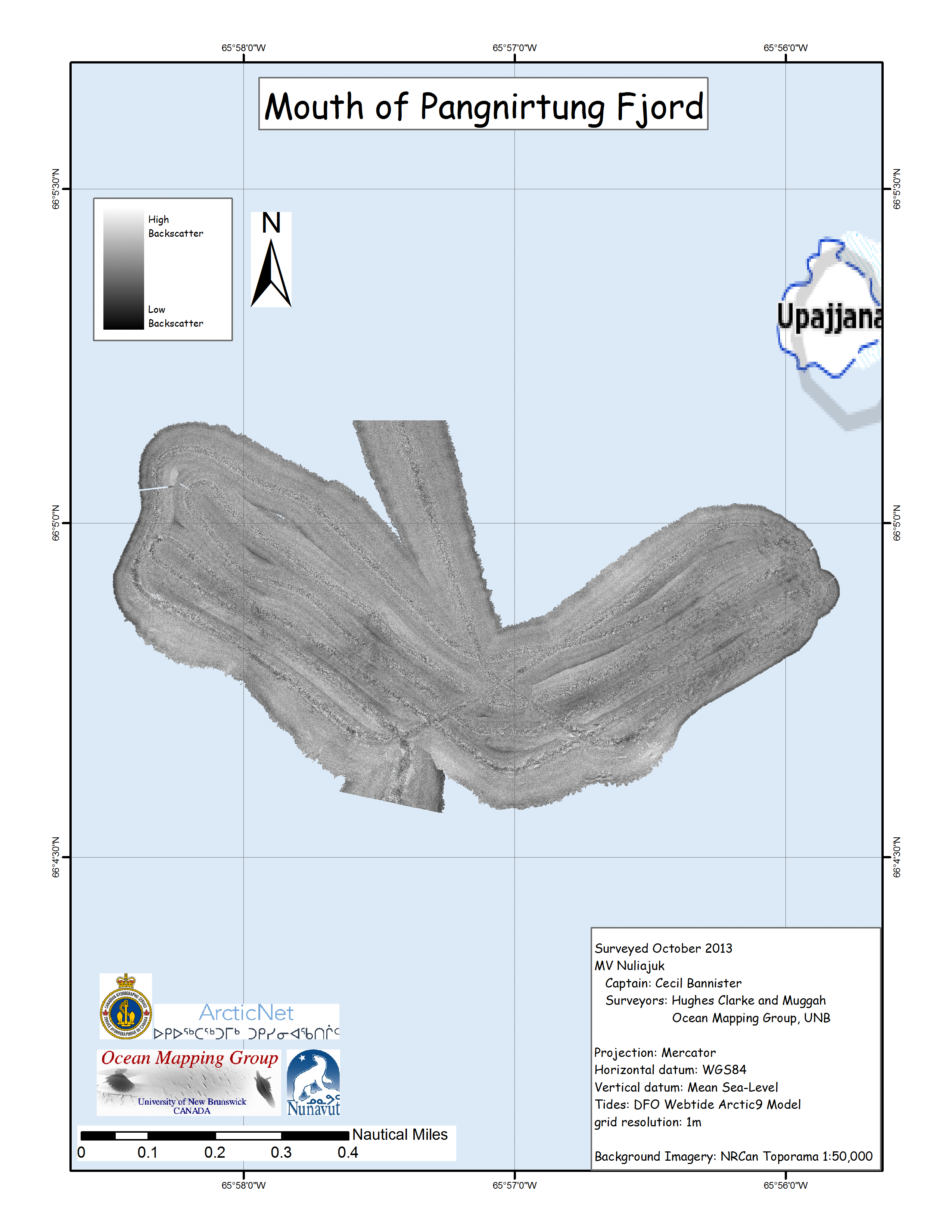
Overview map from Qikiqtarjuaq to Pangnirtung. Apart from a 2 week window in mid July, all the Nuliajuk mapping in Nunavut took place during a 29 day period covering the month of October. This report will covert he first 17 days of that cruise. The UNB mapping team boarded in Qikiqtarjuaq (Oct. 2nd) and disembarked in Pangnirtung (Oct. 19). The main target areas were: |
| Overview map of the Nuliajuk
track, colour coded by day, from Oct. 2nd to Oct. 19th. Survey areas are outlined. |
 |
 |
 |
 |
 |
 |
 |
 |
 |
 |
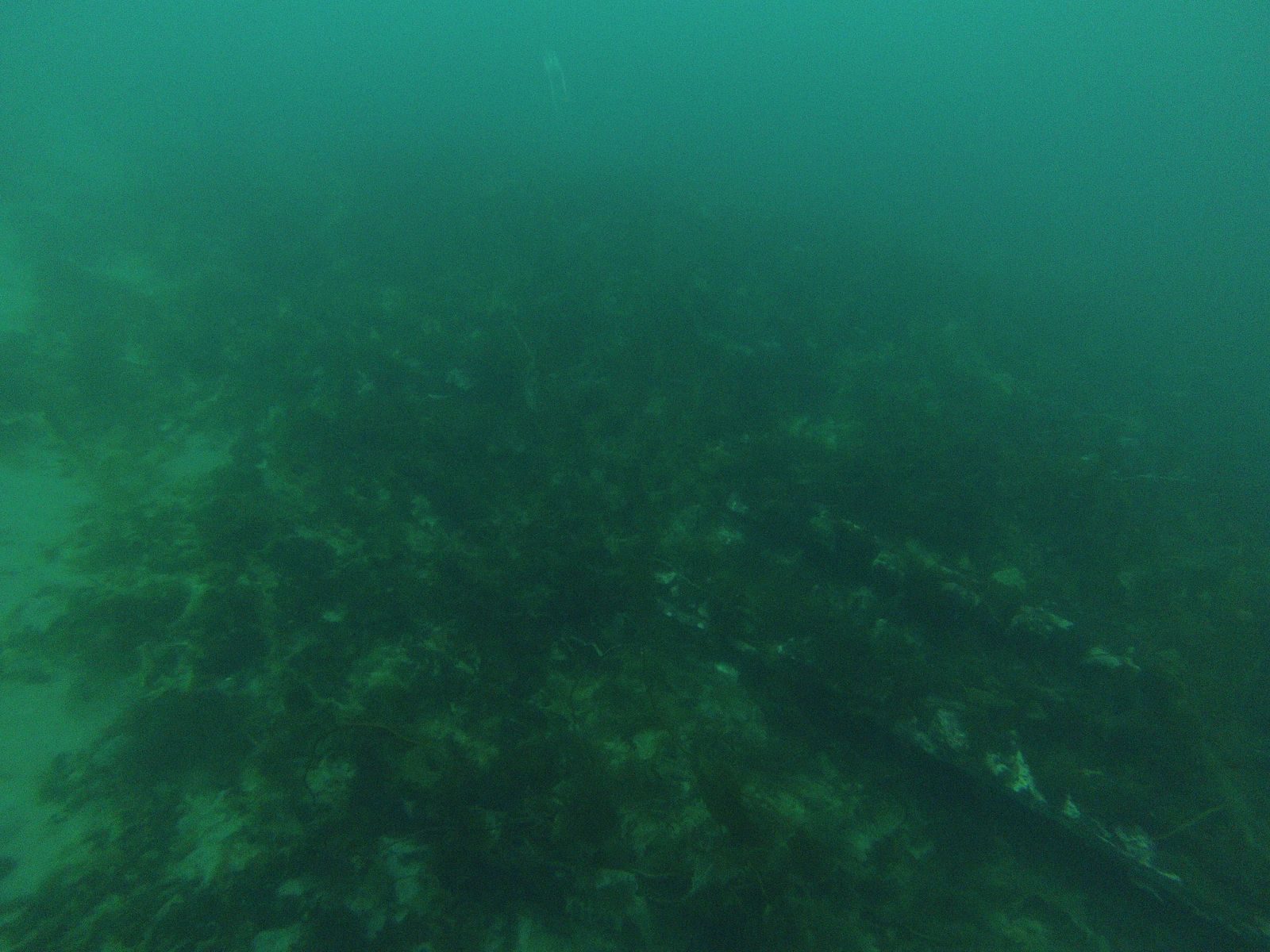
| Approximate drift (from bottom left, to top
right) while underwater camera was in use. |
 |
 |
 |
| Approximate drift (from bottom, to top), in
both sections, while underwater camera was in use. |
 |
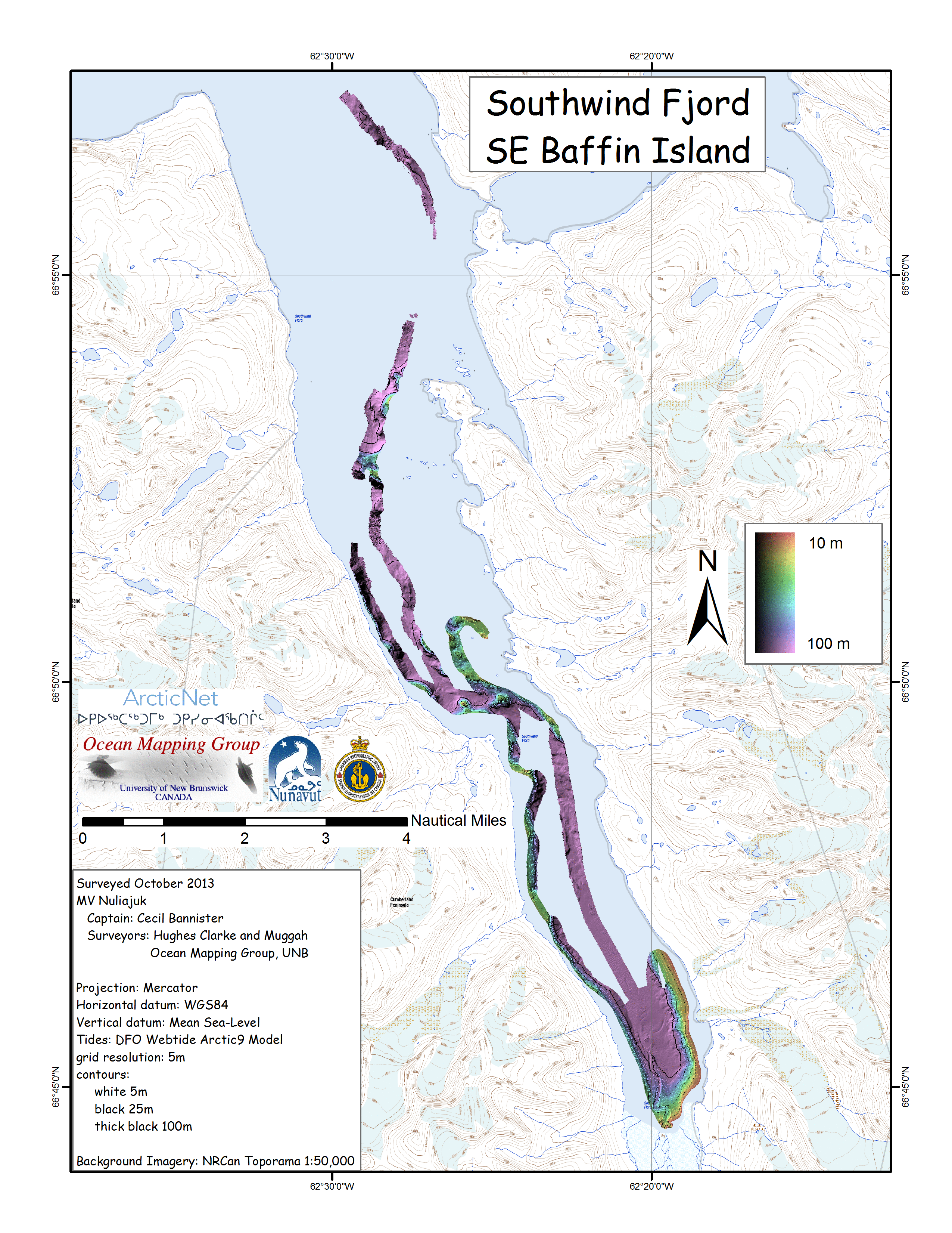
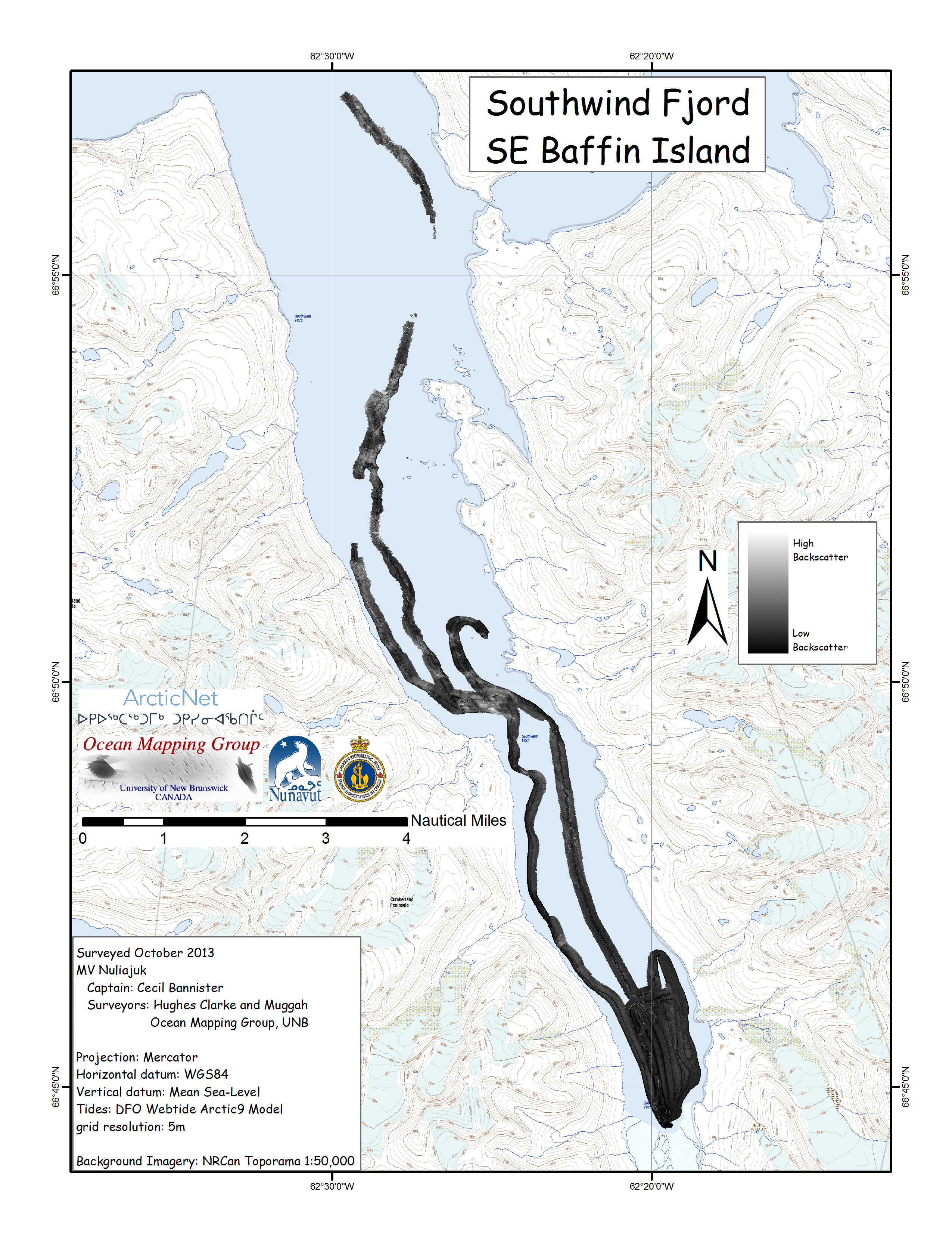
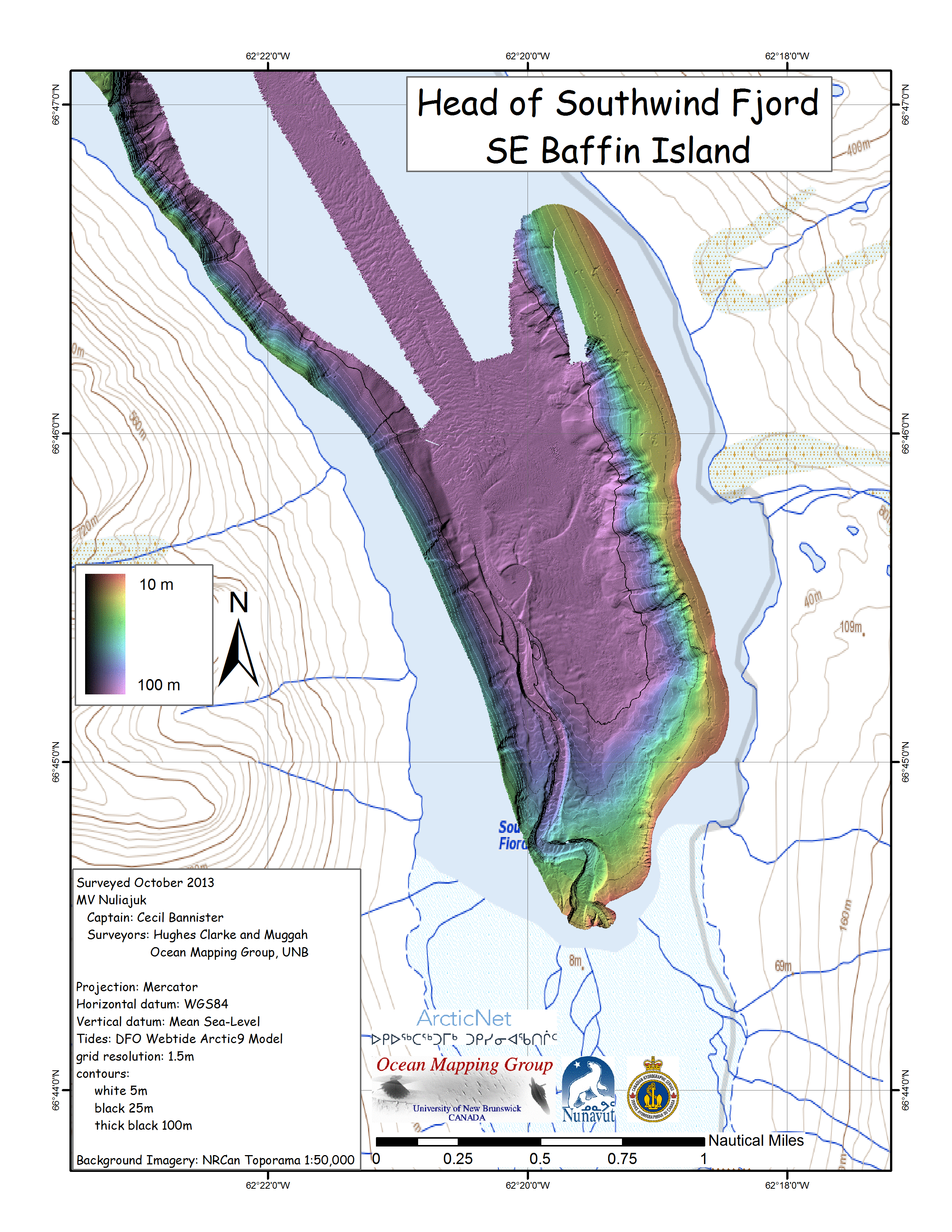
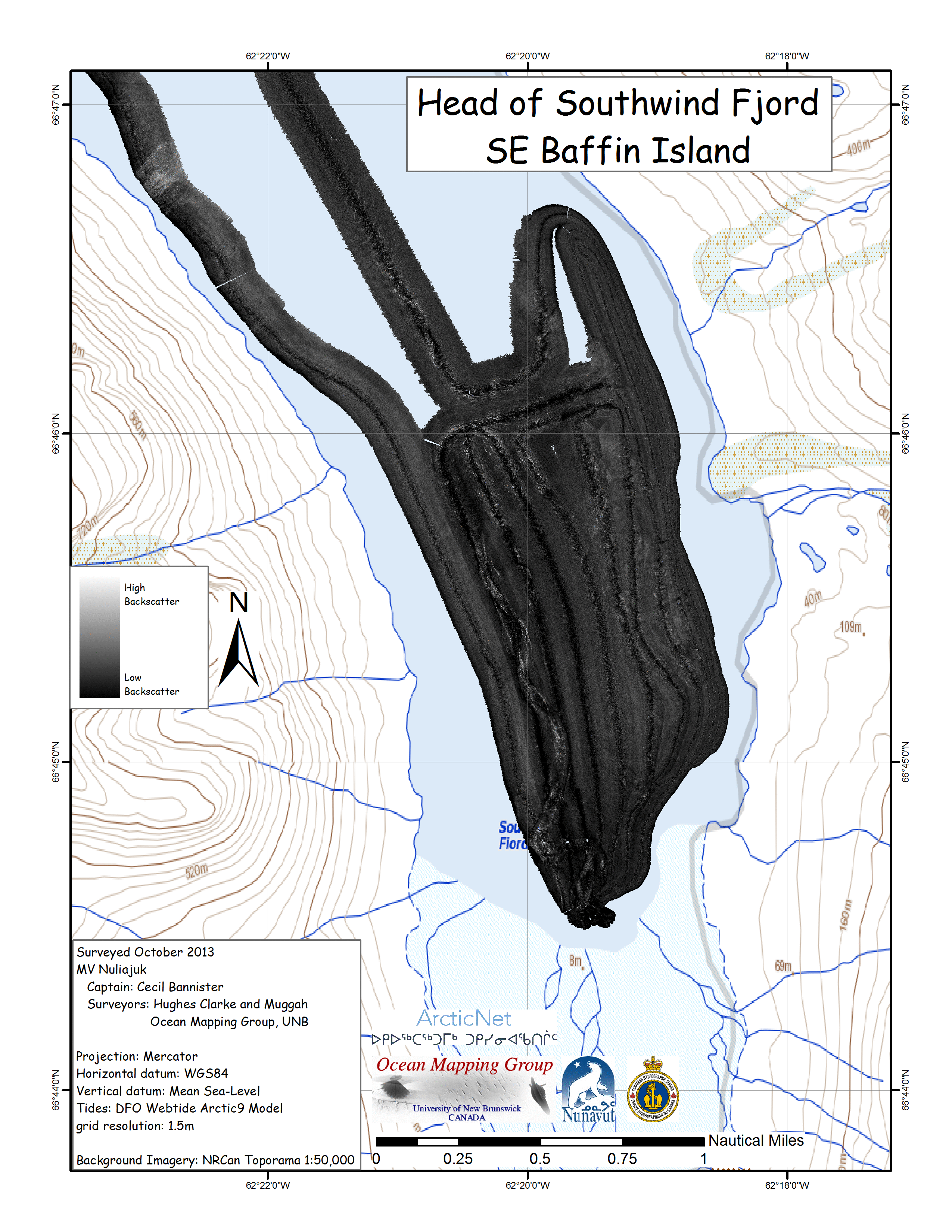
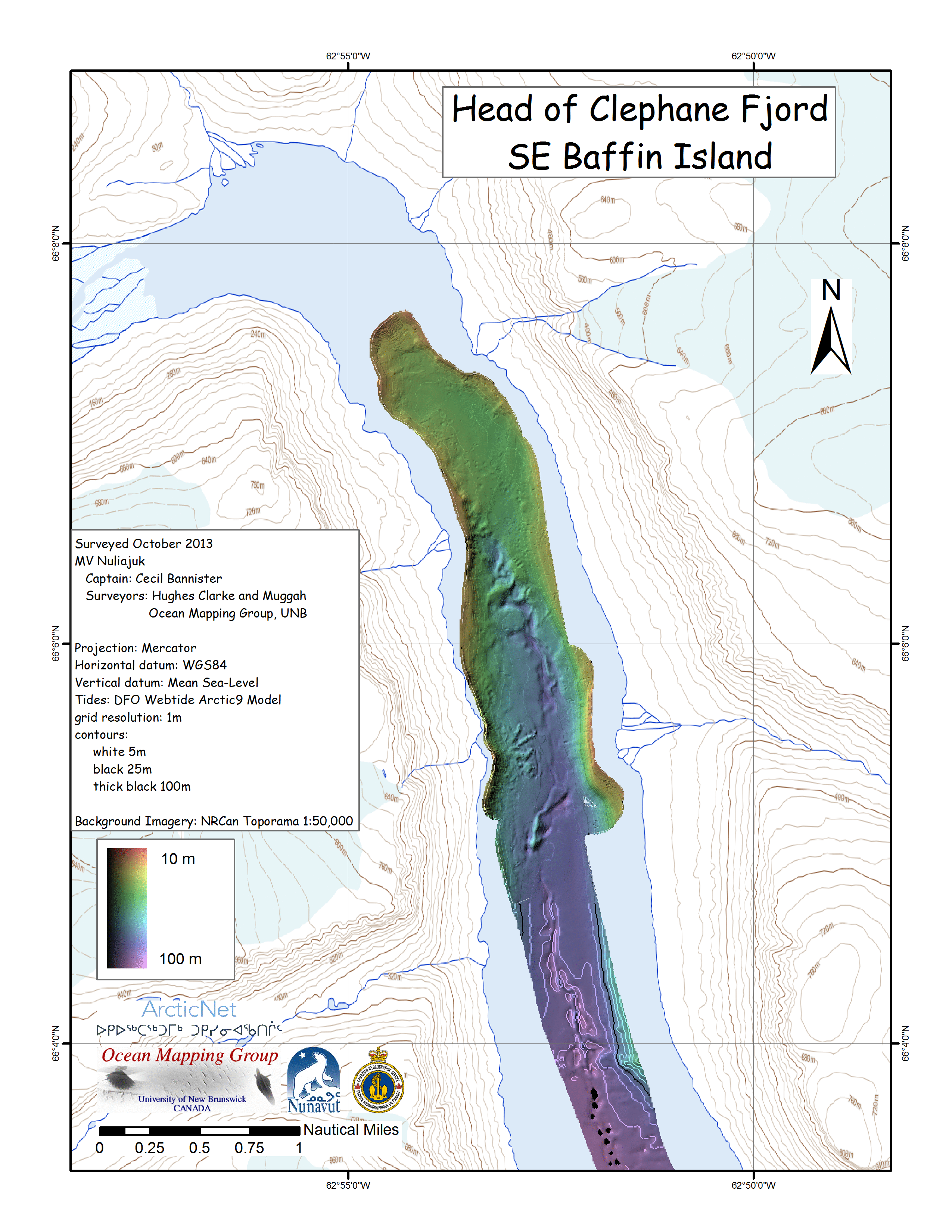
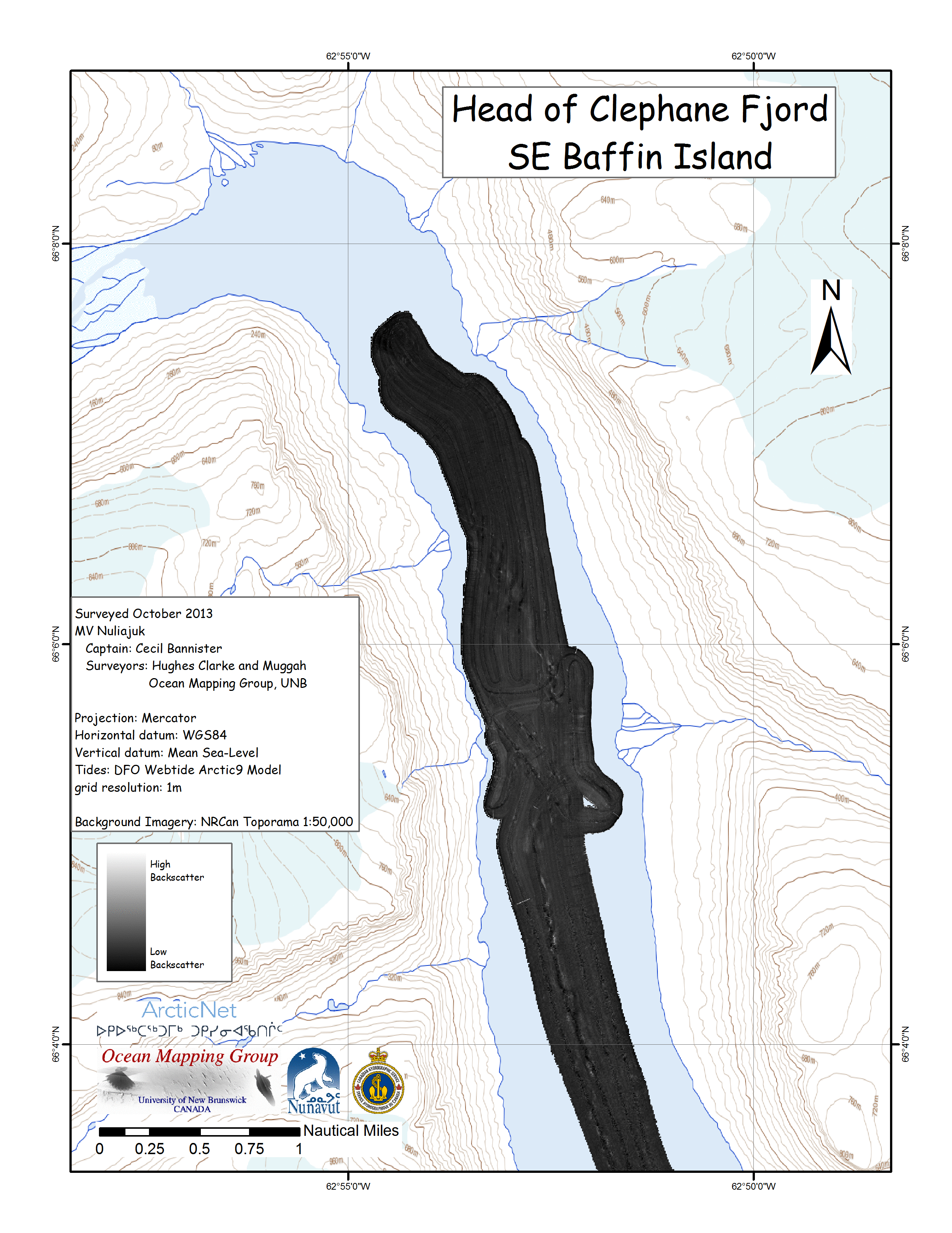
| Southwind Fjord -
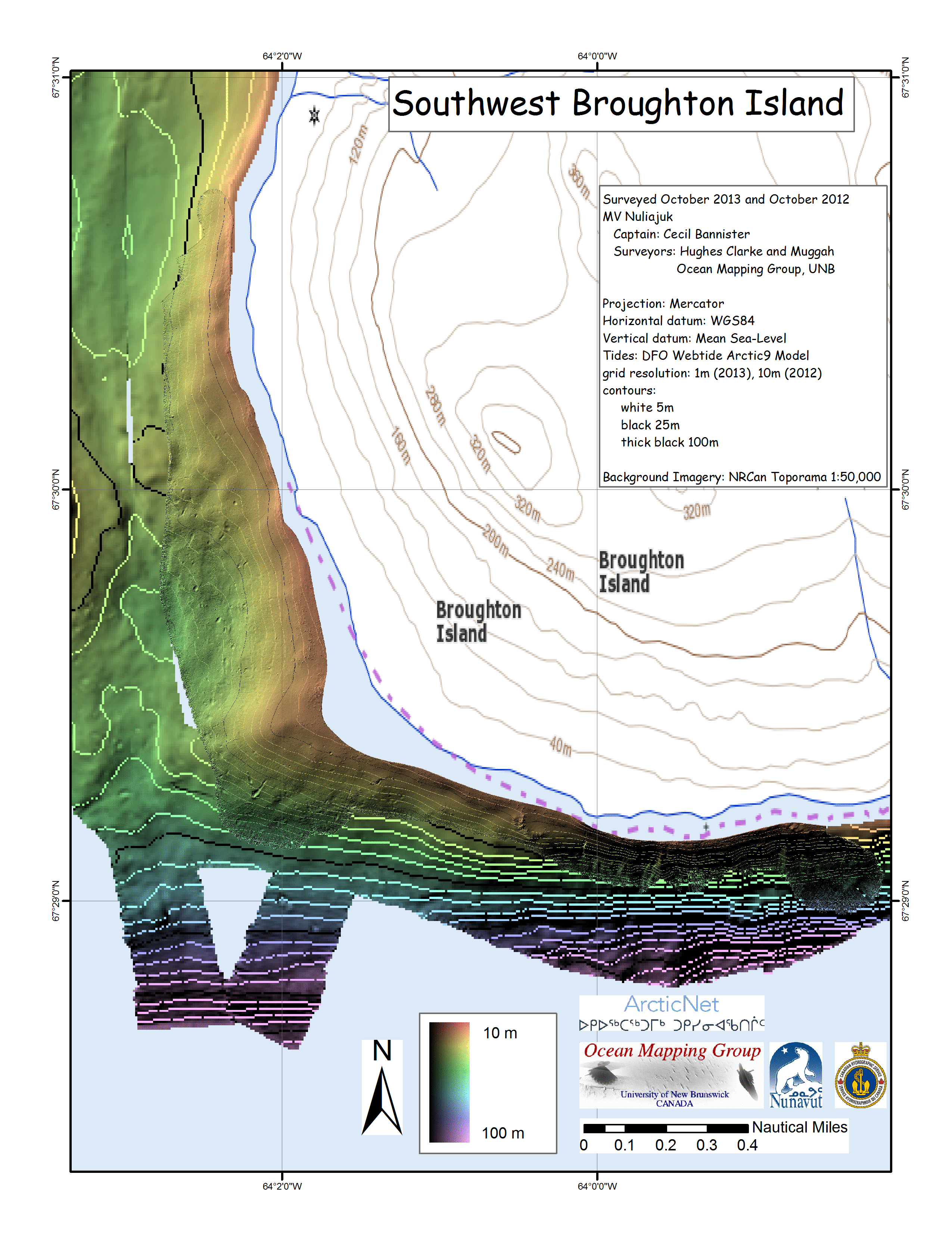
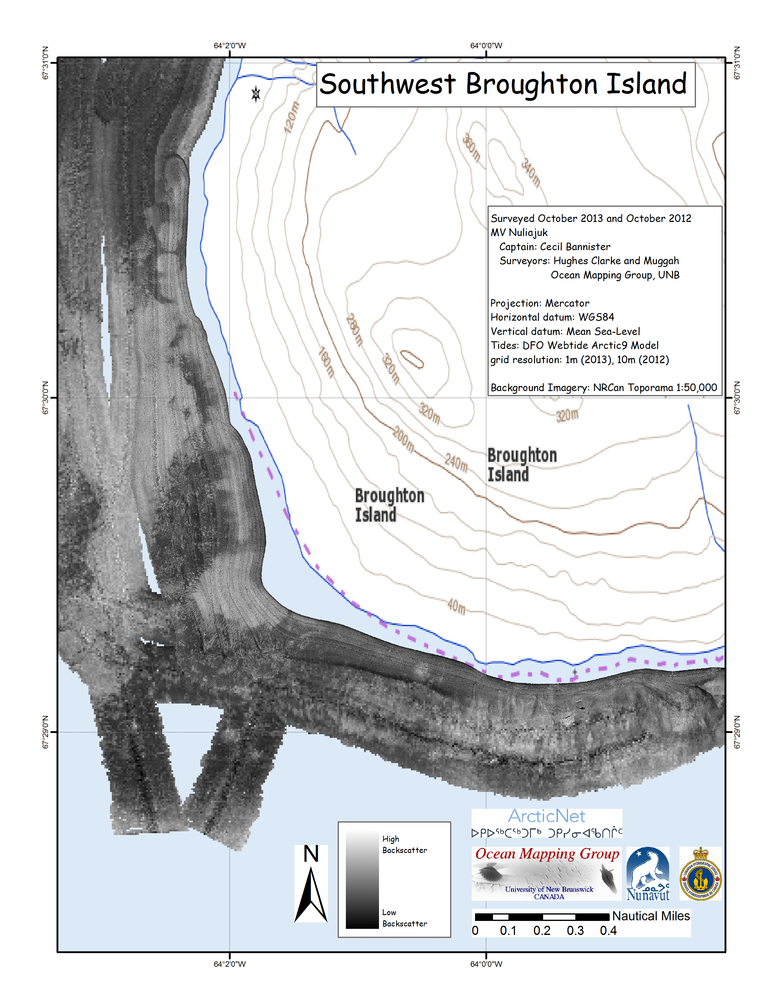
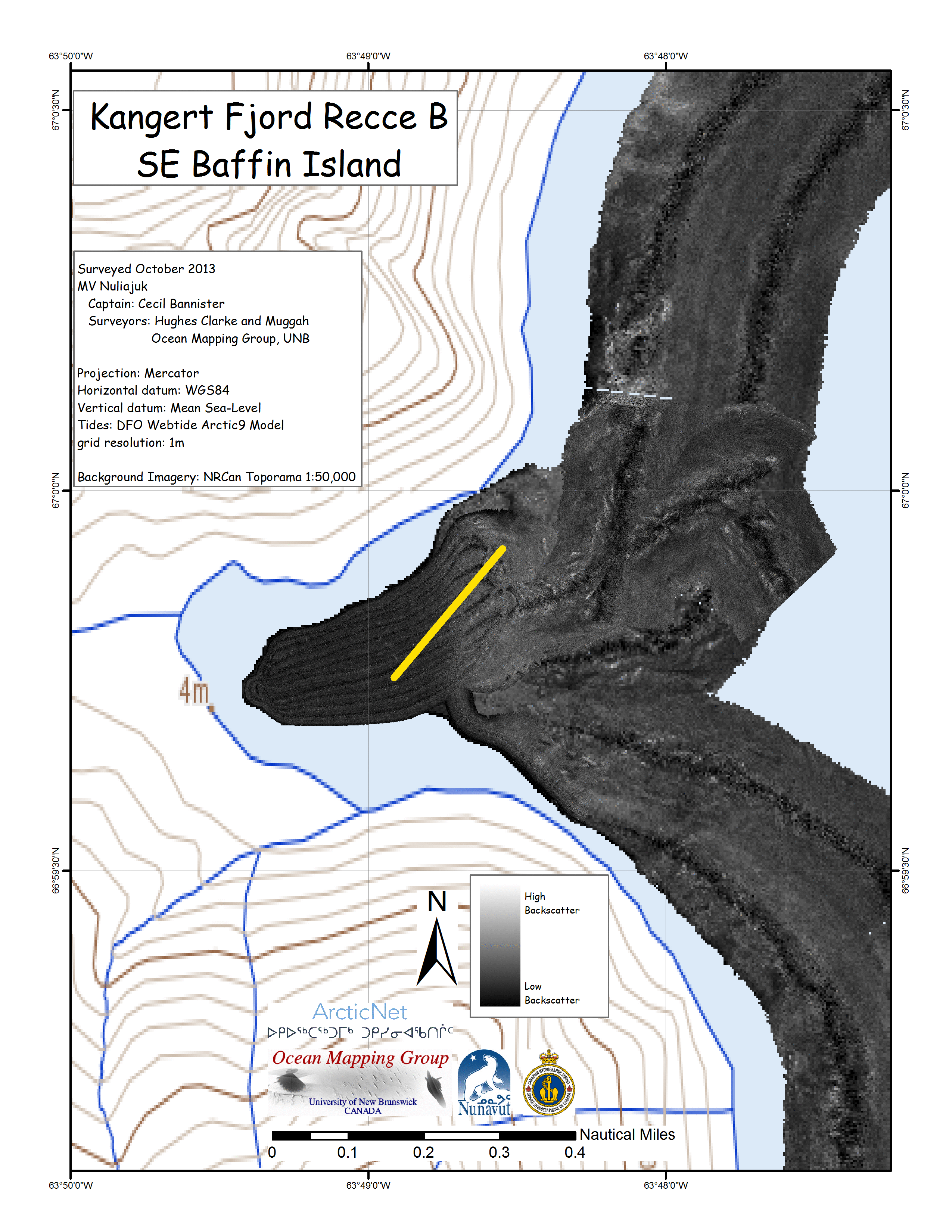
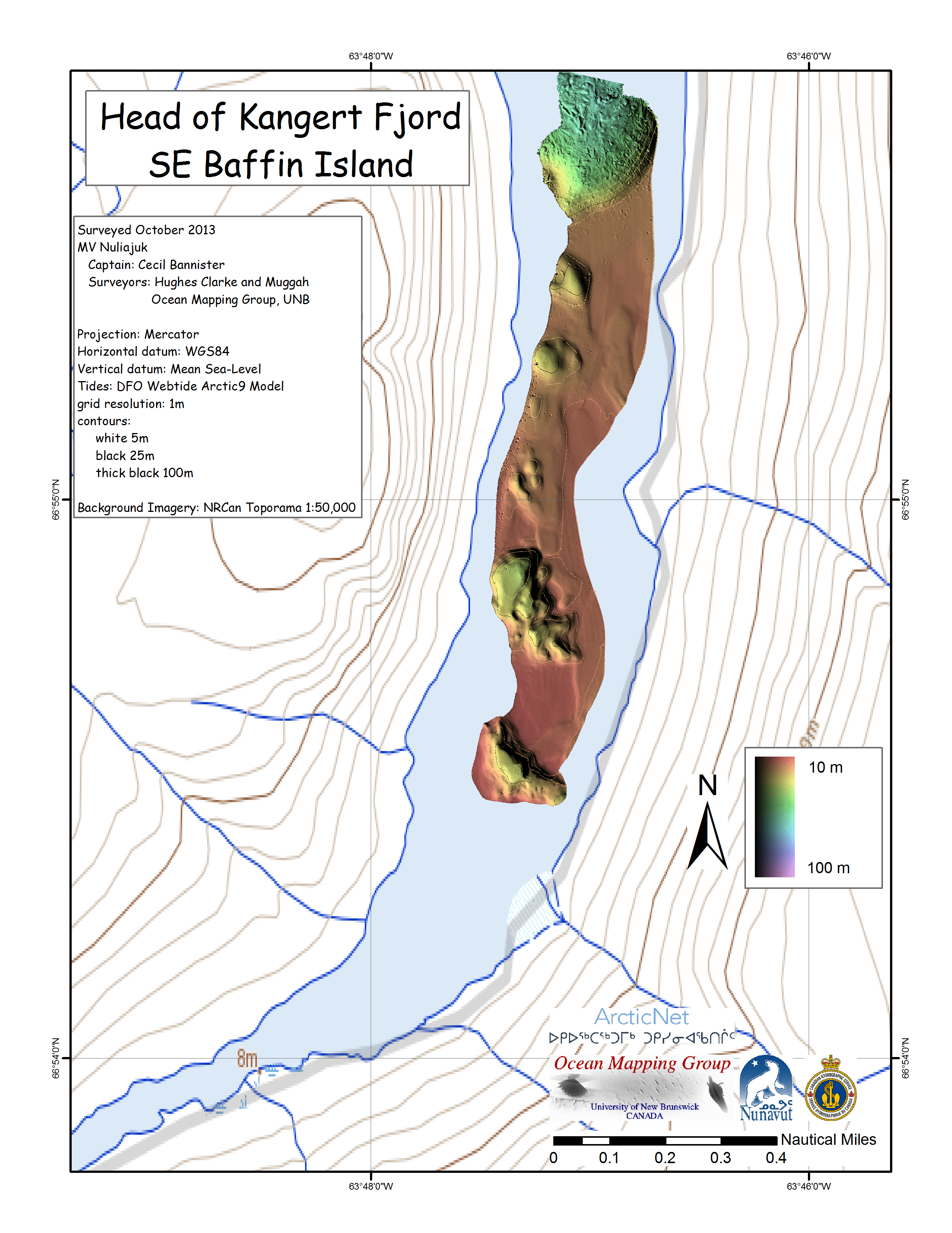
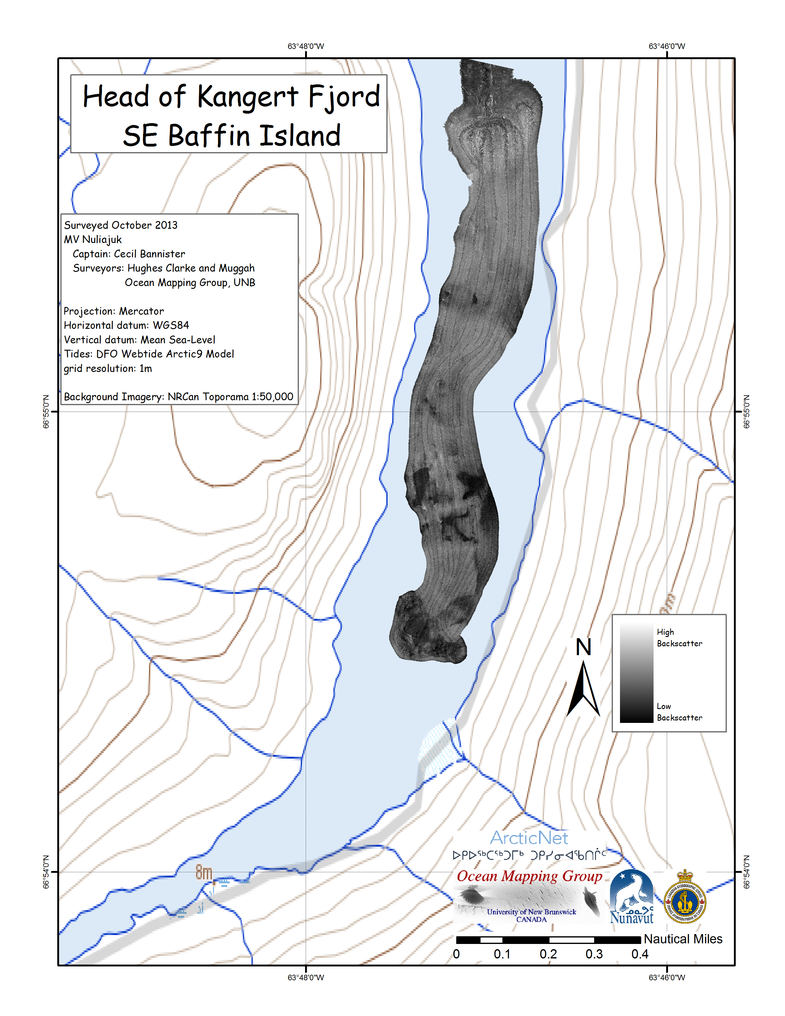
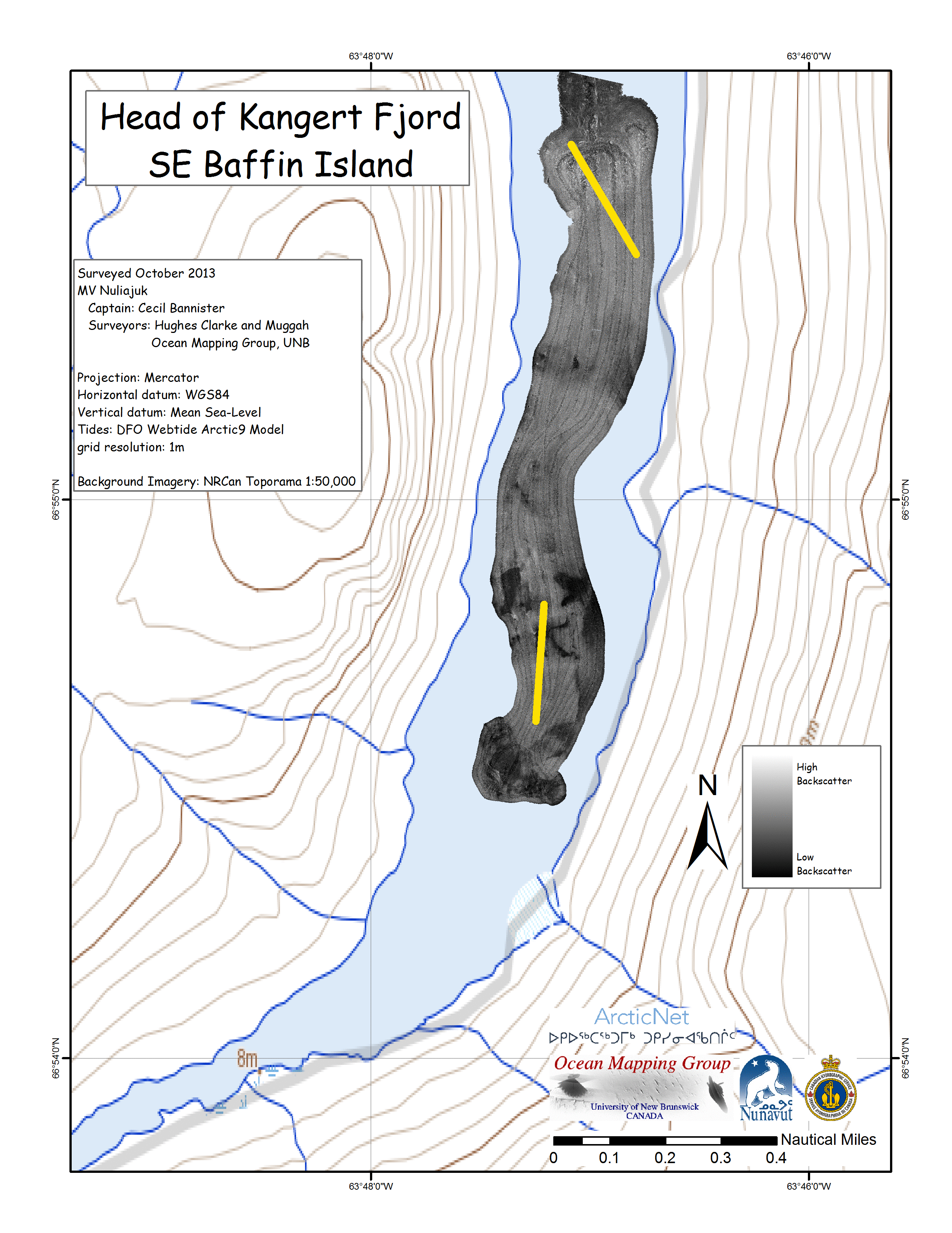
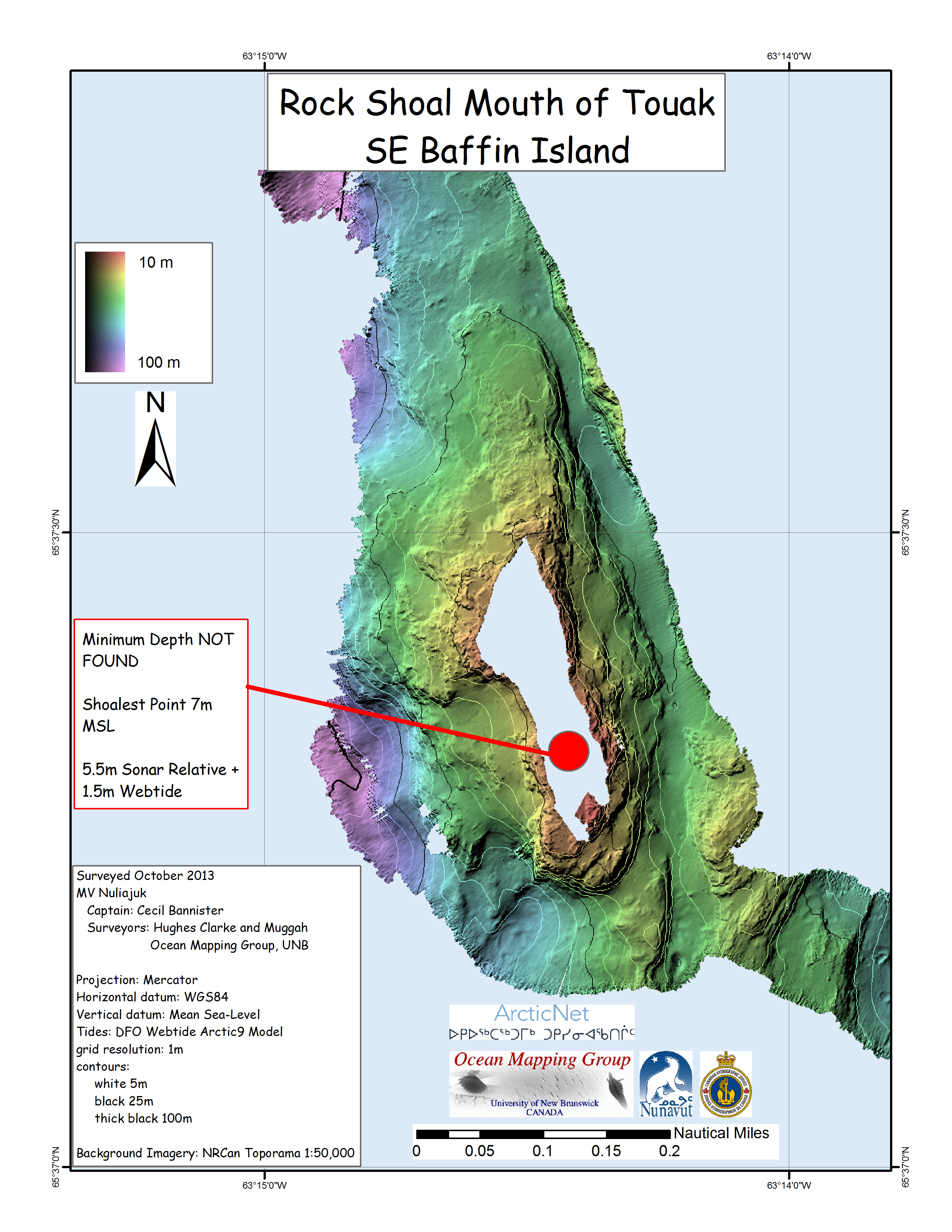
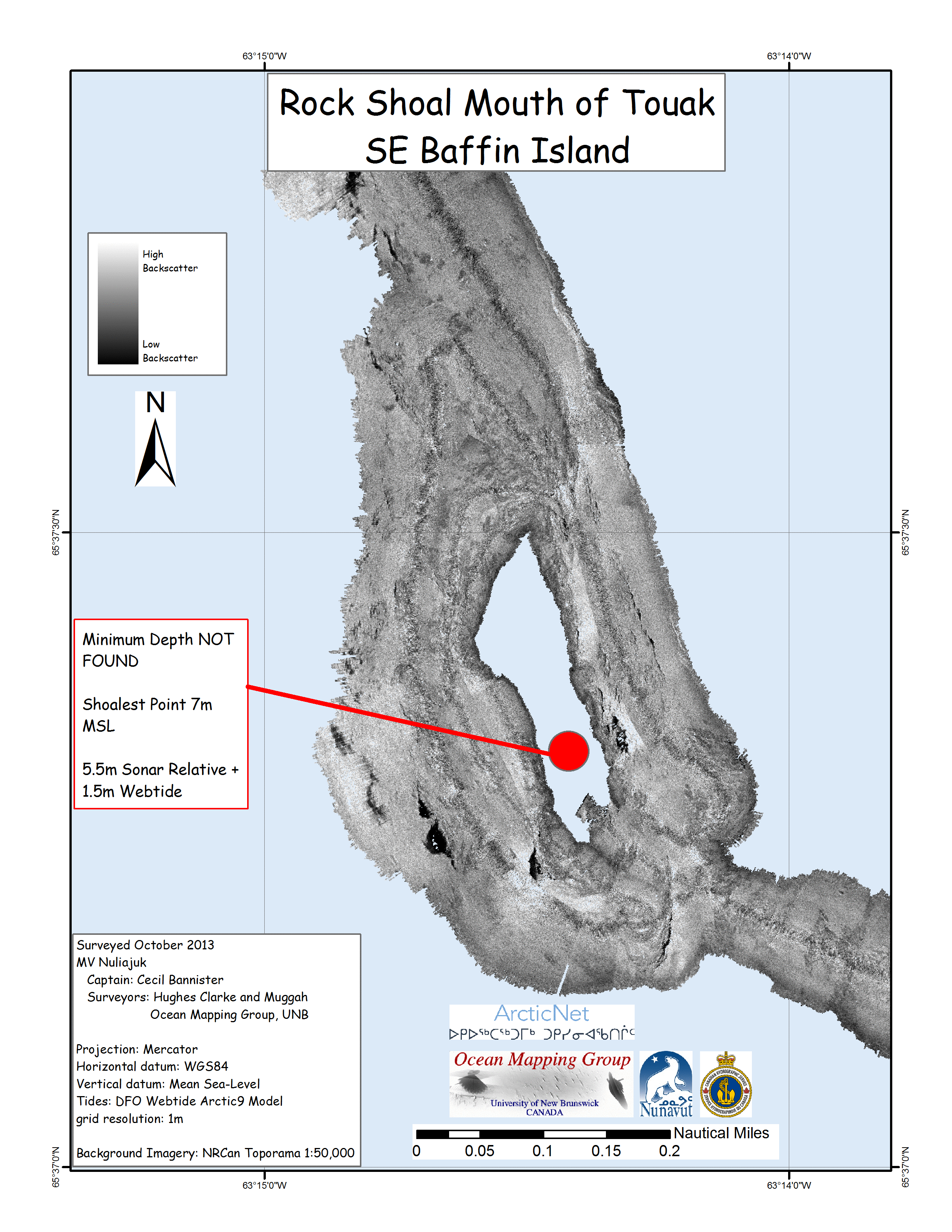
ArcticNet site Southwind Fjord was investigated for a suspected terrace at the head of the fjord. A few areas near the outer edge of the fjord were too deep for the EM3002 to track (>300m). The Nuliajuk therefore deliberately steamed into shallower water to obtain useful sounding data. The head of the fjord proved to have an active delta, with a nice channel system cutting through the softer sediments. It would be useful to re-survey this channel in following years to determine the activity of the delta front. See Squamish Prodelta Experiment for other examples of active delta systems. On the way out of the fjord, at a lower tide, two rock outcrops were found which had not been indicated on the chart or the Natural Resources Canada toporama products. A safe passage around the East side of the rock outcrops was mapped. The Knudsen Chirp 3200 echosounder had an AC to DC power board failure during the survey. In the remoteness of the area, a new power board was not readily available. The board had to be ordered, shipped to UNB and carried up to the Nuliajuk in the hands of Weston Renoud, who boarded the ship in Pangnirtung. |
 |
 |
 |
 |
 |
 |
 |
 |
 |
 |
| Approximate drift (from bottom left, to top
right) while underwater camera was in use. |
 |
 |
 |
 |
 |
 |
 |
 |
 |
 |
 |
 |
 |
 |
 |
 |
 |
 |
 |
 |
 |
 |
 |
 small small |
 |
 |
 |
 |
 |
 |
 |
 |
 |
 |
 |
 |
igure |
 |
 |
 |
 |
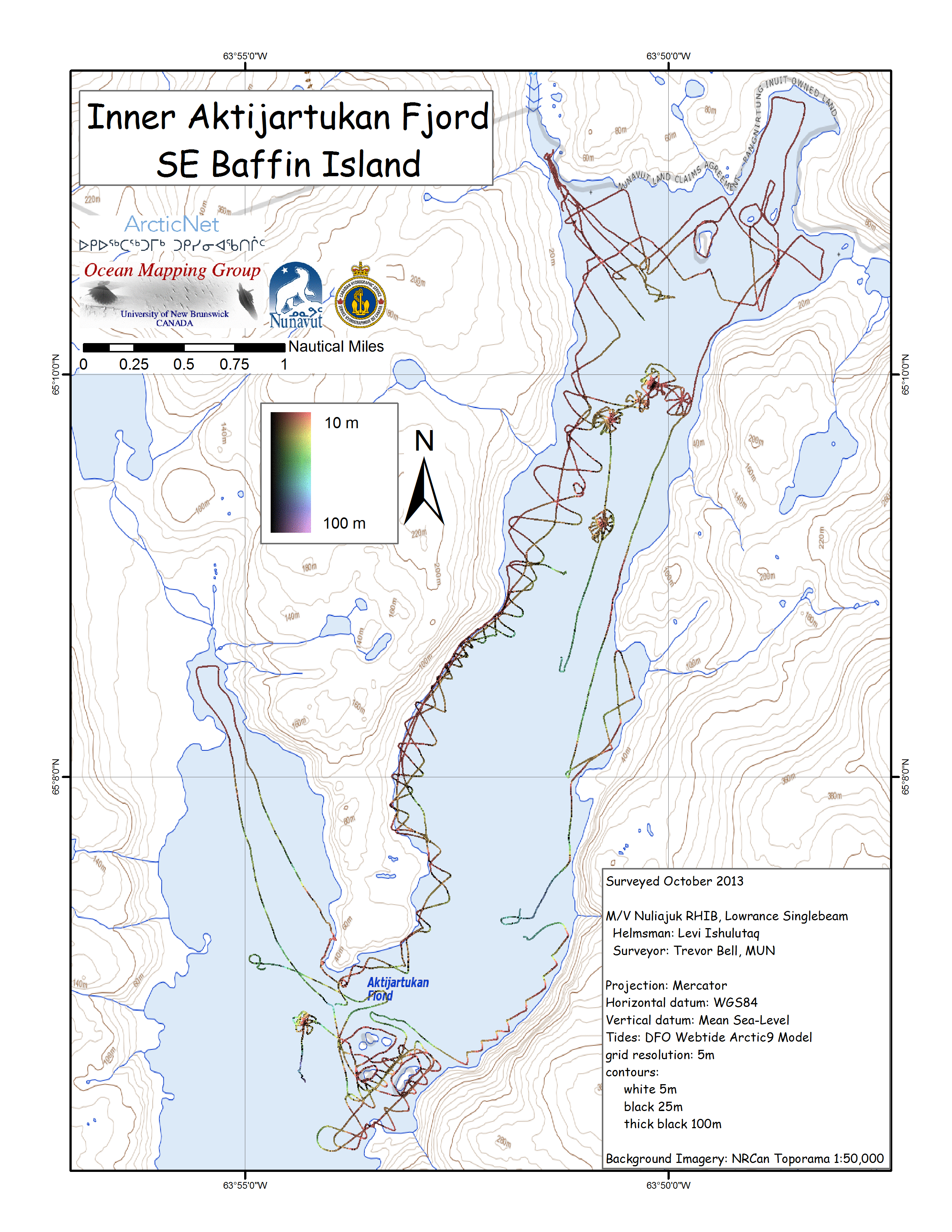 |
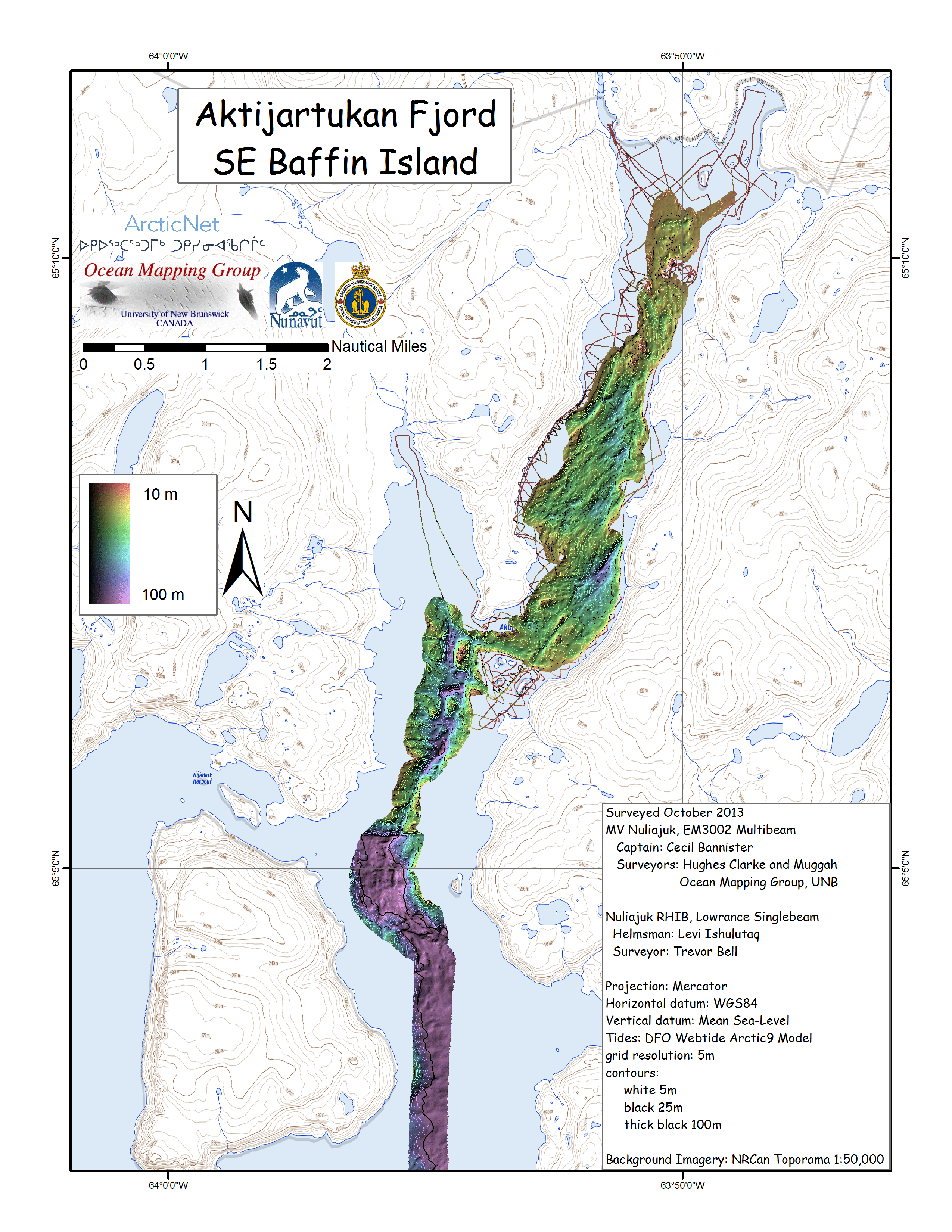
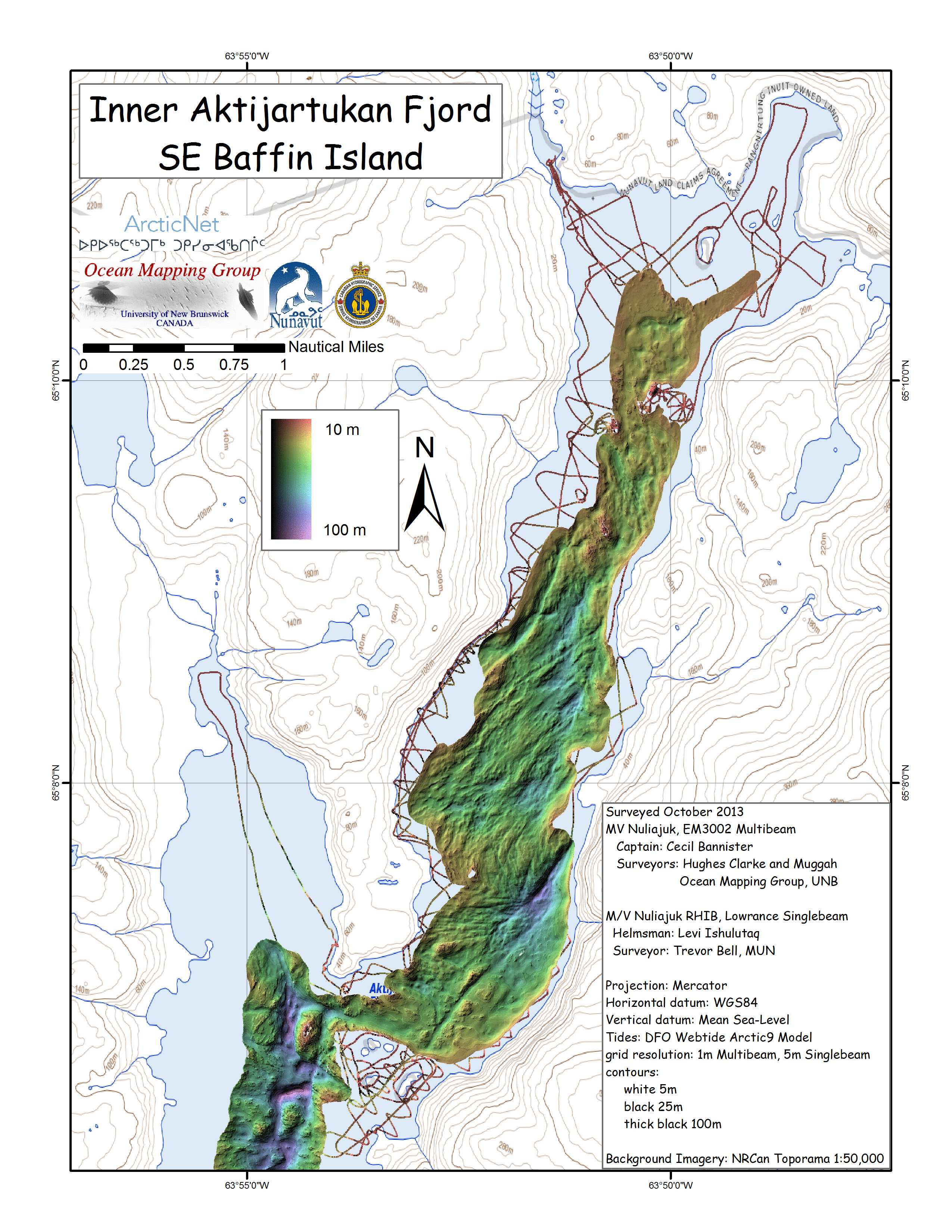
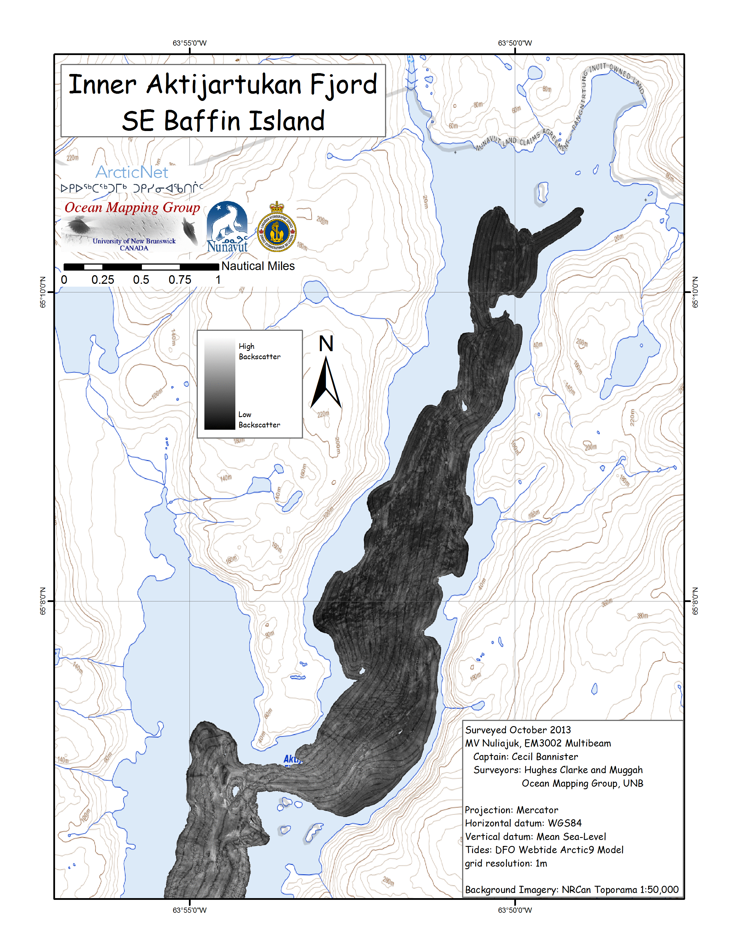
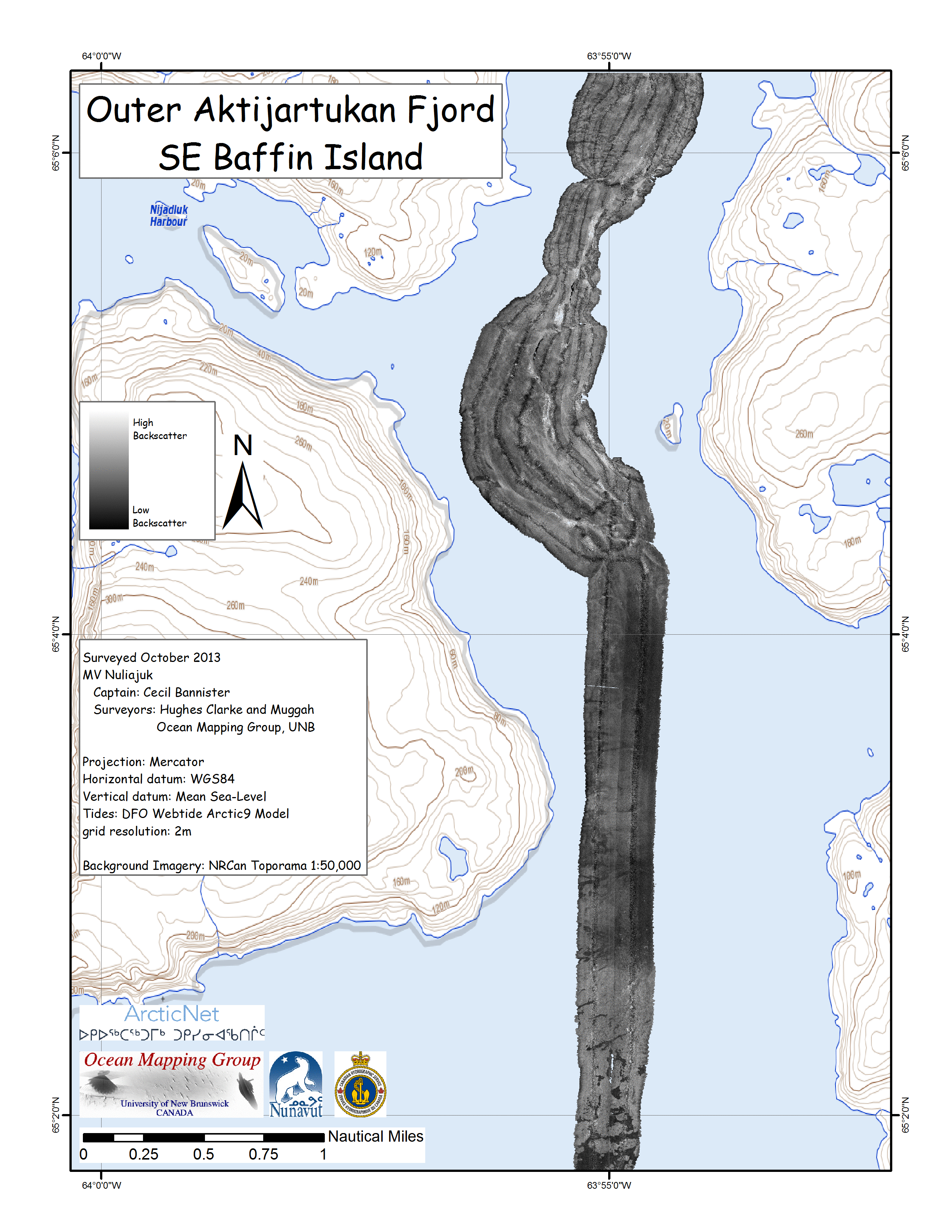
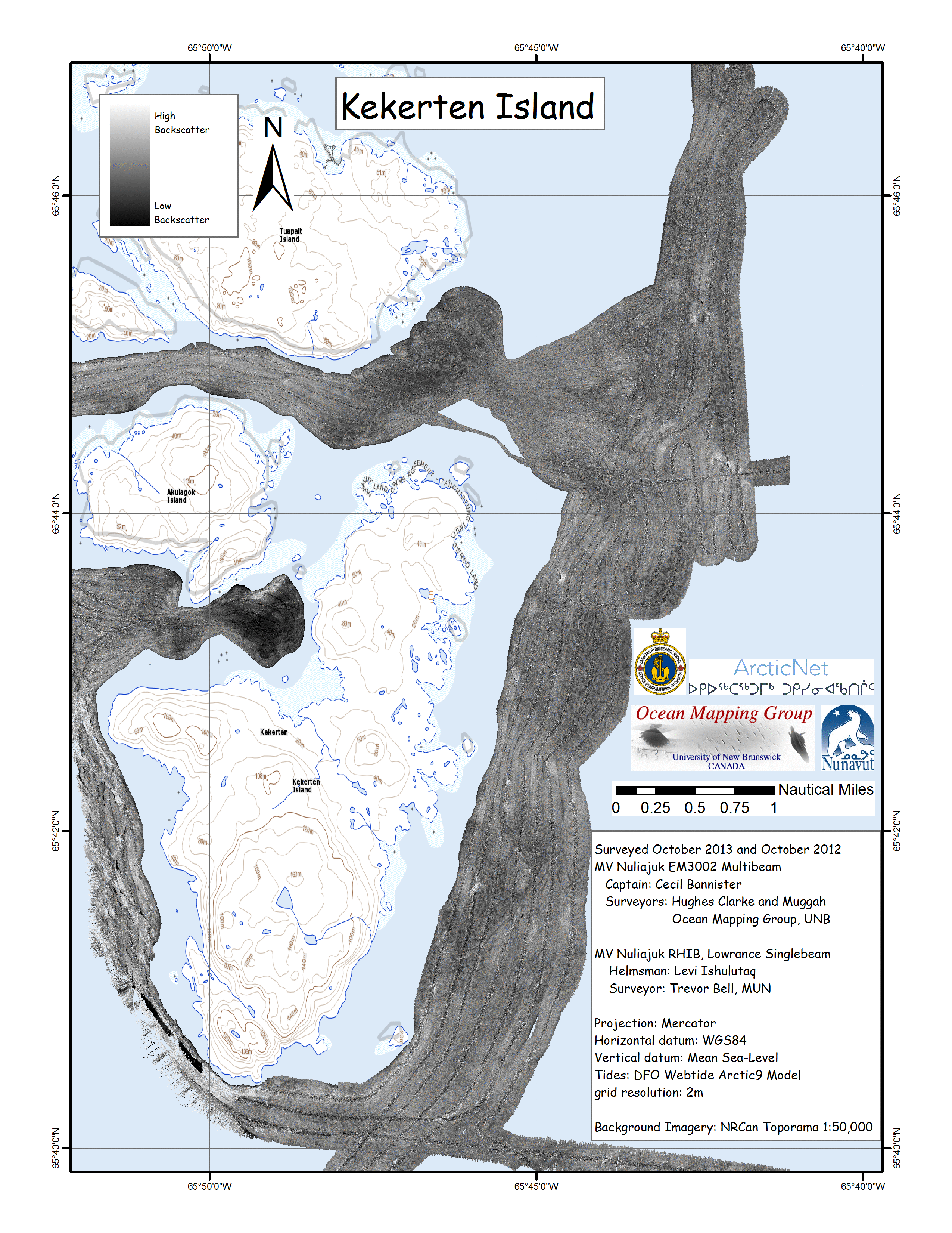
The map on the left shows the single beam
coverage of the Nuliajuk RHIB in Aktijartukan Fjord. The
RHIB was able to ring the shoreline, shoals and
constrictions, while also zig-zagging to find the 20m
contour. Any shoal that was too shallow for the Nuliajuk
(<20m) was surveyed using a star pattern by the RHIB to
find the least depth. |
 |
 |
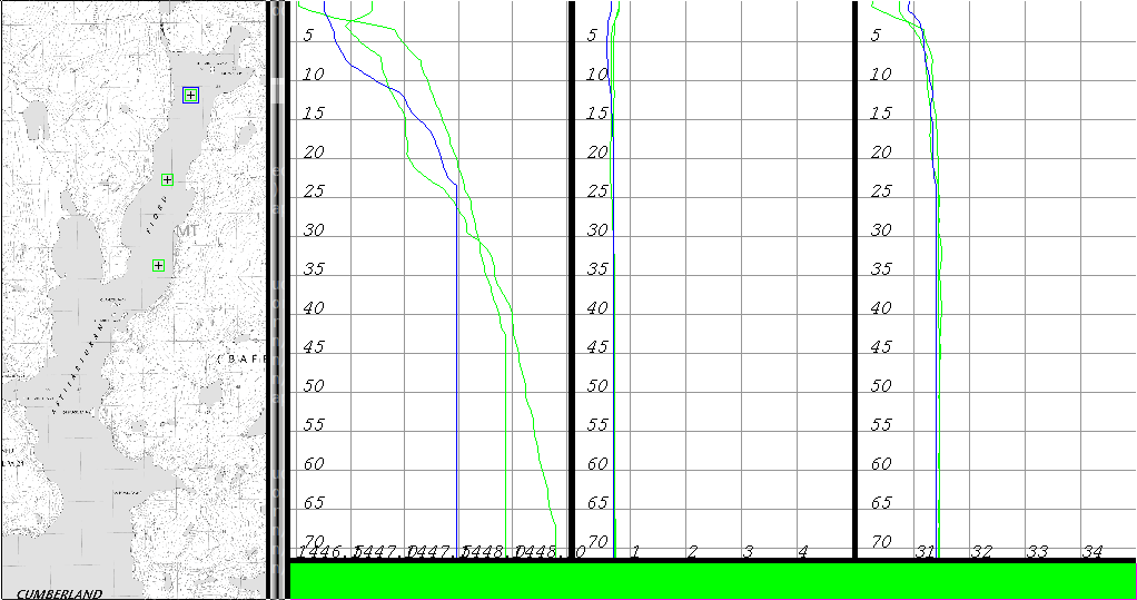
| Aktijartukan Fjord CTD casts. Location on left Sound speed distribution on middle left Temperature on middle right Salinity on right |
 |
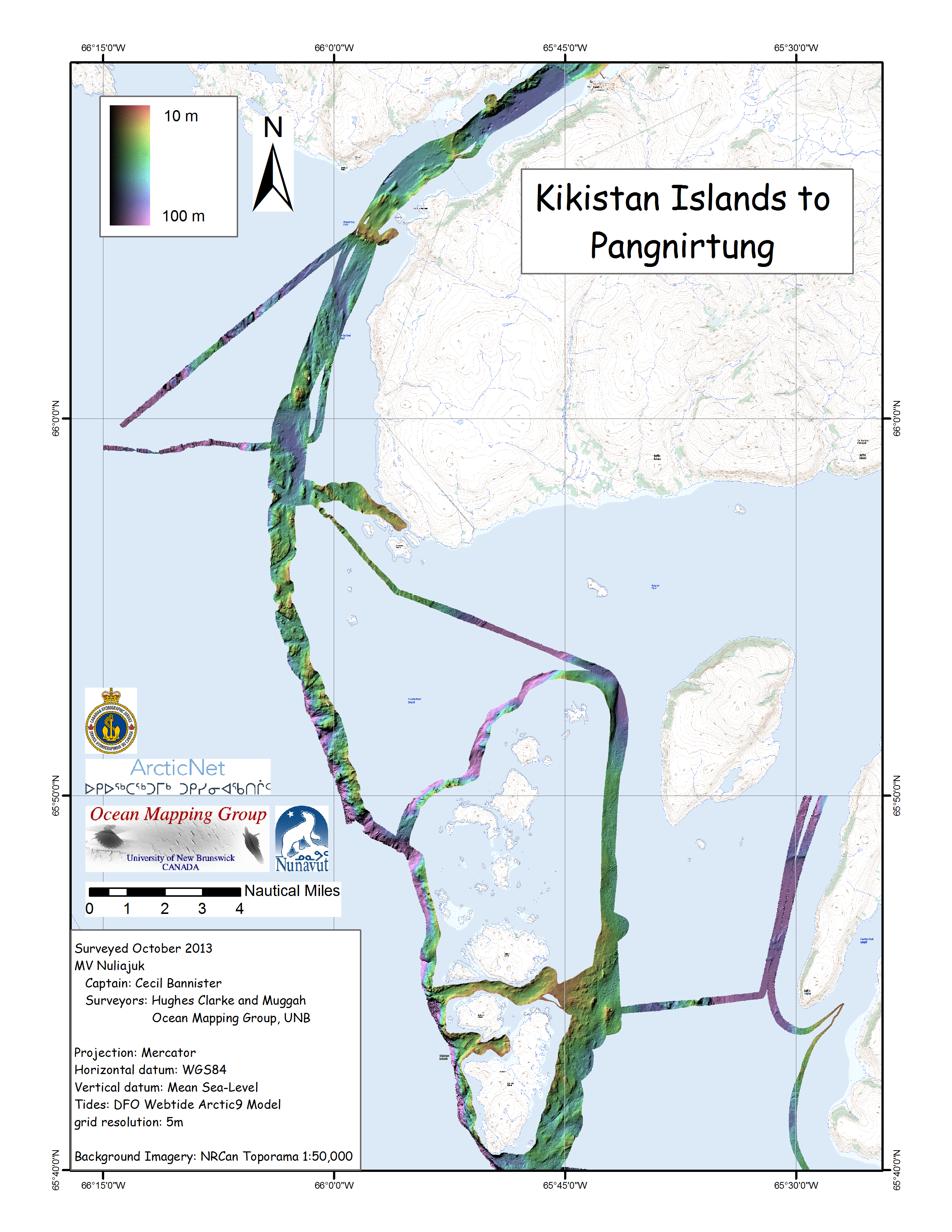
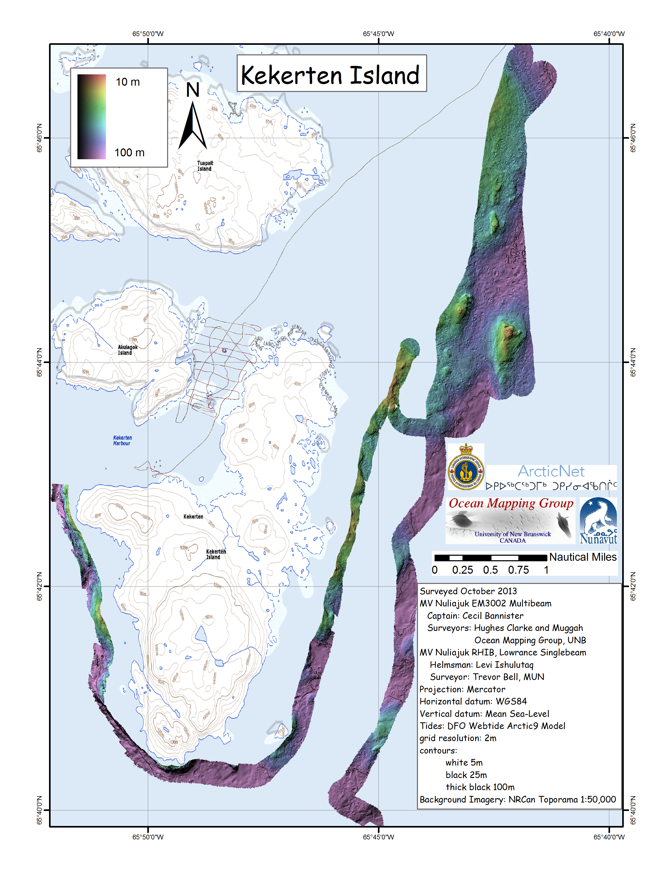
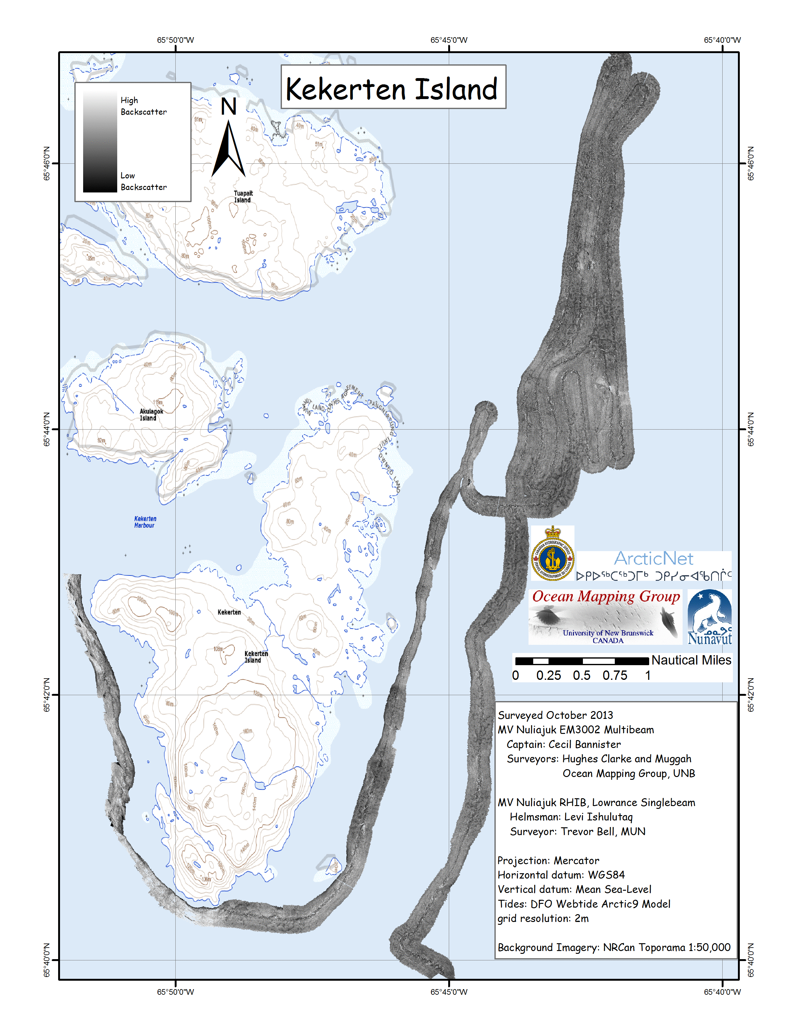
| New
Kikistan to Pangnirtung Corridor |
|
 |
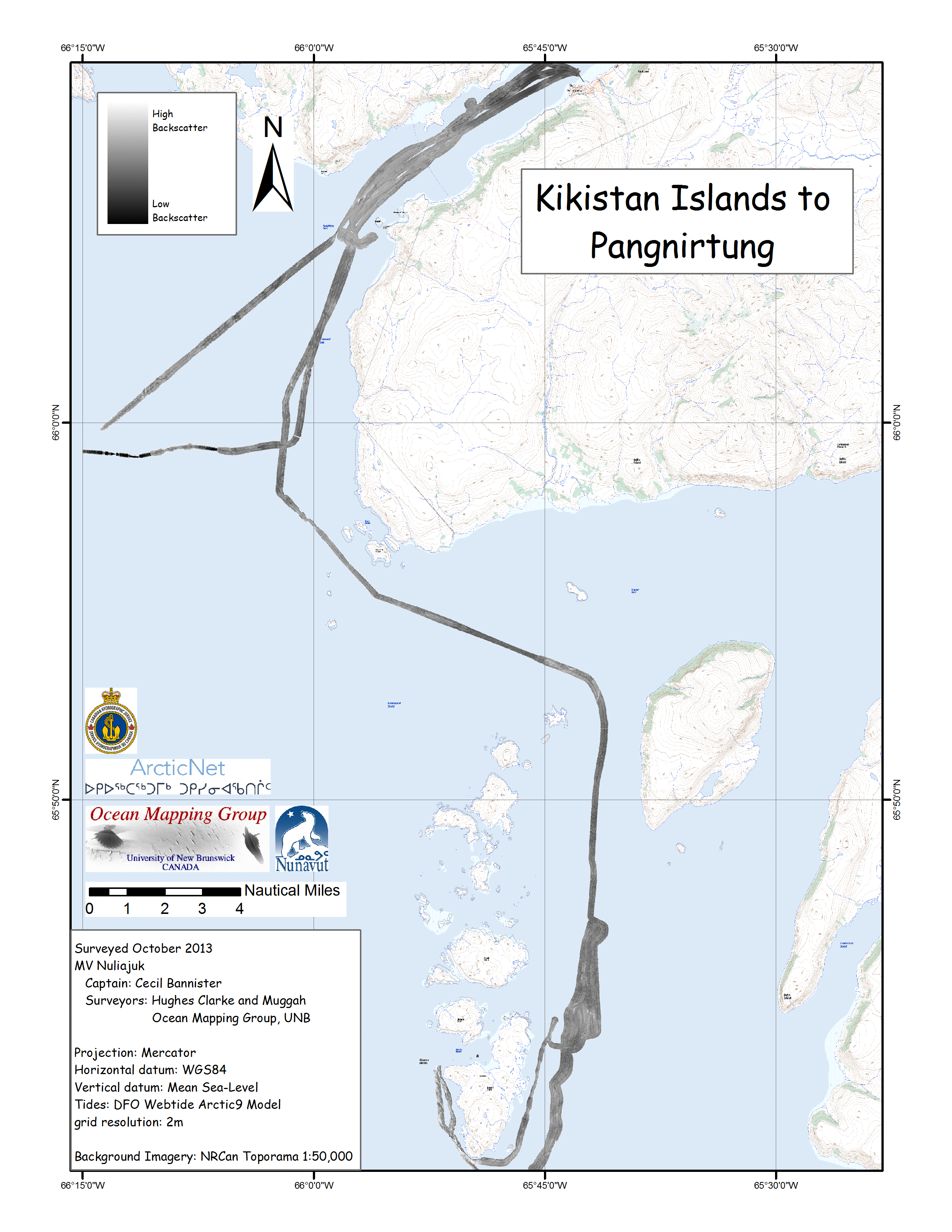 |
| Kikistan
Island Corridor building and Shoal Investigation |
|
 |
 |
 |
 |
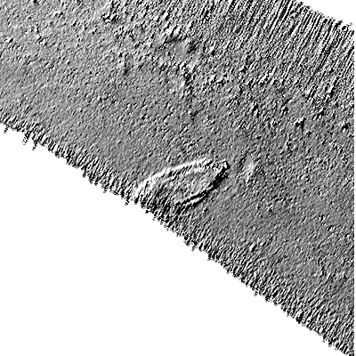
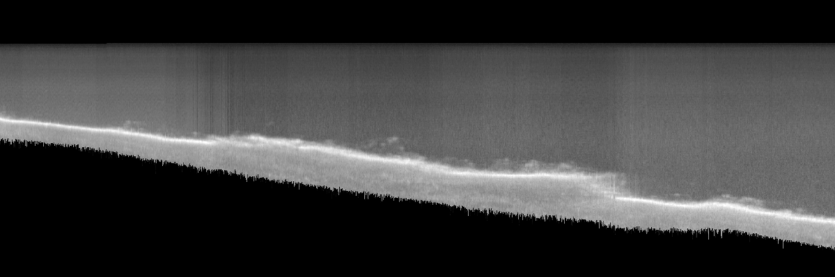
| Kekerten Harbour Wreck. | Water column along track
slice from nadir to outer beams. |
 |
 |
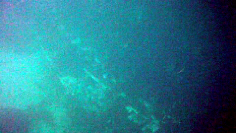
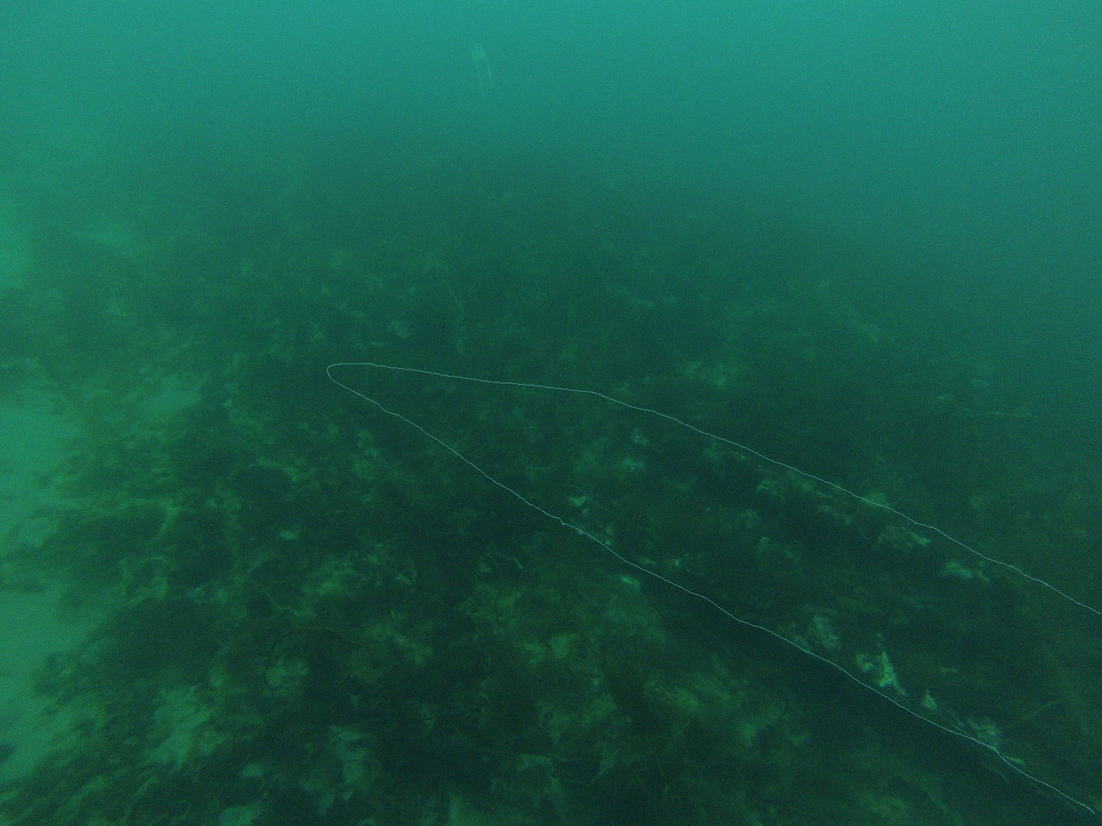
| Image of wreck from surface camera |
General outline of wreck from surface camera |
 |
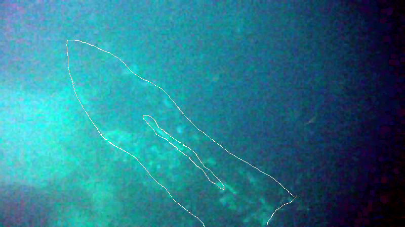 |
| Image of wreck from submerged camera |
General outline of wreck from submerged
camera |
 |
 |
 |
 |