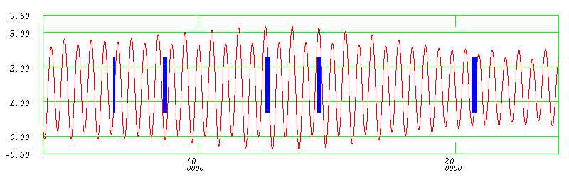
showing the 5 tide windows utilized in January
back to Project Index |
Piscataqua Mouth Estuarine Circulation
Study Experiment Overview RV Gulf Surveyor January 2021 |
| John E. Hughes Clarke and
Indra Prasetyawan EM2040 and ADCP ops |
Matt Rowell and Dan
Tauriello RVGS Operations |
Class of ESCI 896.02 (2021) Applied Physical Oceanography for Hydrographic Surveyors |
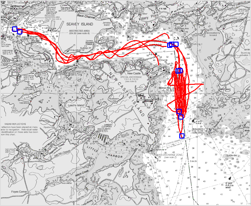
| January 6th |
January 8th | January 12th | January 14th | January 20th |
 |
 |
 |
 |
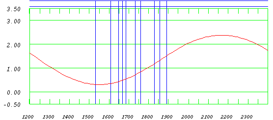 |
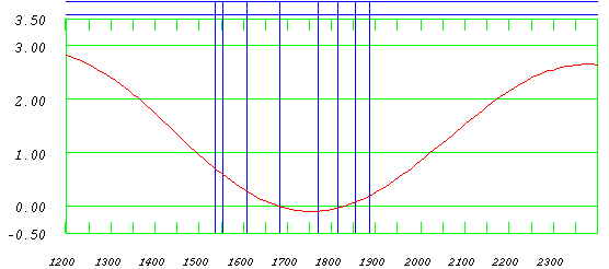
| mid flood |
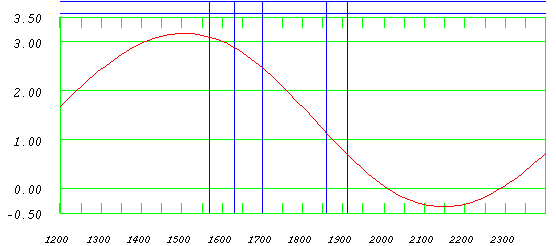
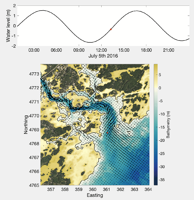
late ebb and slack |
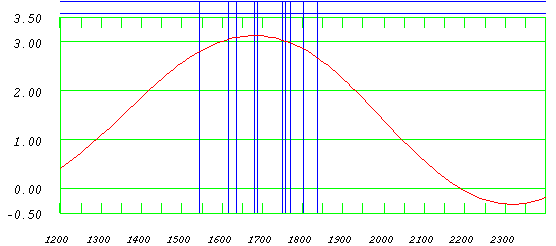
early to mid ebb |
around HW |
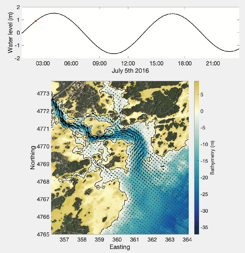
early to mid flood |
 |
 |
 |
 |
 |
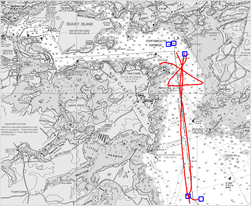
| first testing, establishing
transects |
focus offshore out to Isle of Shoals. |
testing 600/700 kHz out to thing 1/2 |
transects |
focus on sandwaves |
 |
 |
 |
 |
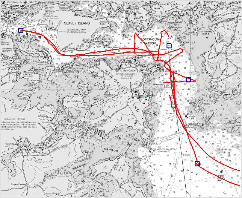
| late flood -1hr before HW. Note the well developed flood stream |
turn of the tide ~1.5 hour
after HW. Note the eddy north of Fort Point |
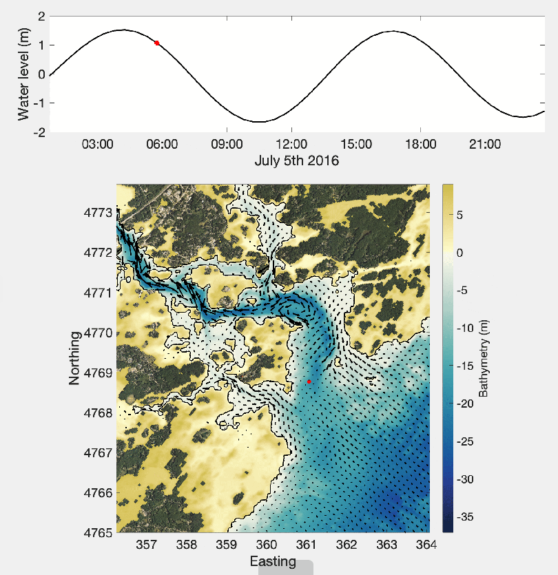
established ebb ~ 3 hours
after HW. Note ebb stream close to Fort Point and then around the sand bank |
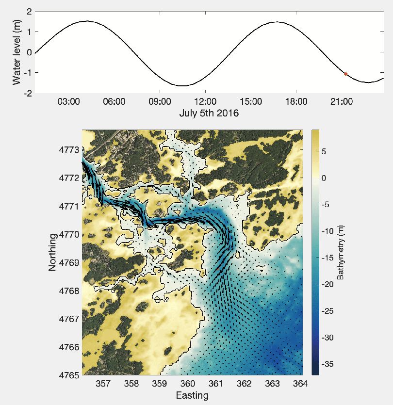
late ebb ~ 1 hour before LW. offshore plume just starting to develop |
 |
 |
 |
|
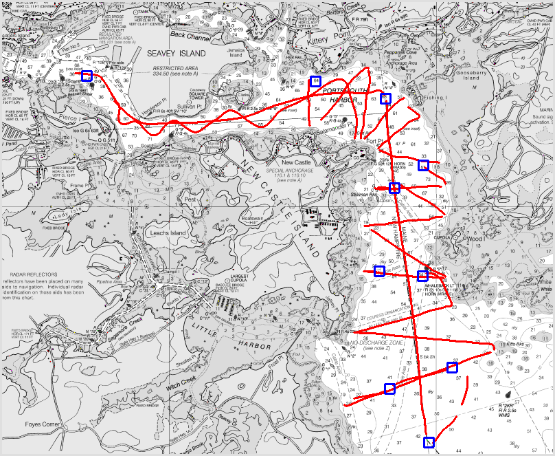
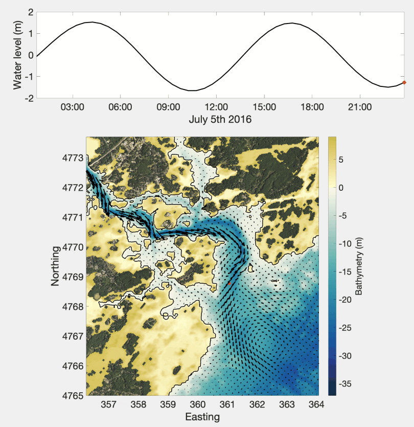
| continuation ebb ~ 1 hour
after LW note clear development of :
|
First actual flood stream ~ 3
hrs after LW mote :
|
Well established flood ~ 2
hours before HW note:
|