Lobe Changes 2008-2010-2014
CSL Heron - Bute Inlet Operations

 June 2014
Ocean Mapping Group, UNB


Overview:

Bute Inlet has been surveyed 3 times with multibeam. In early 2008, late 2010 and now early/mid 2014. The first pair of surveys cover a period over three freshets and the second pair also cover three freshets. Thus the apparent changes should be comparable if the process is pretty uniform.


Lobe Changes:

The Distal Lobe Morphology:

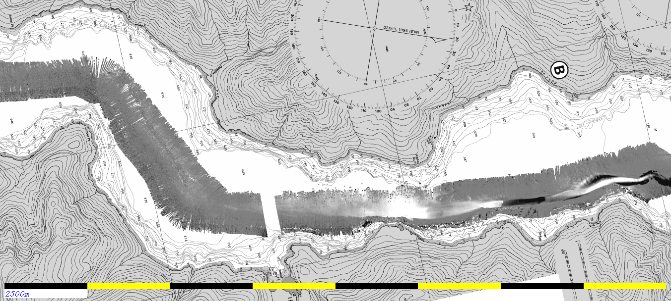
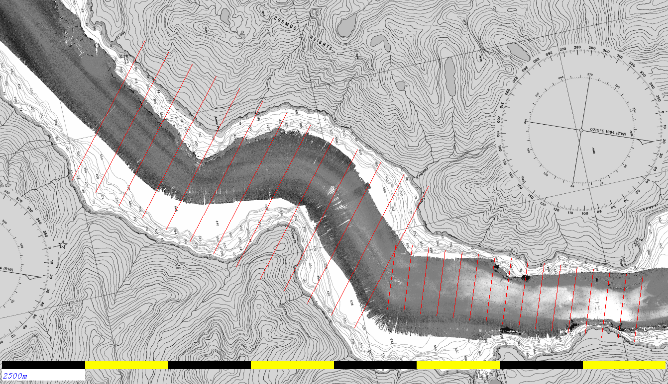
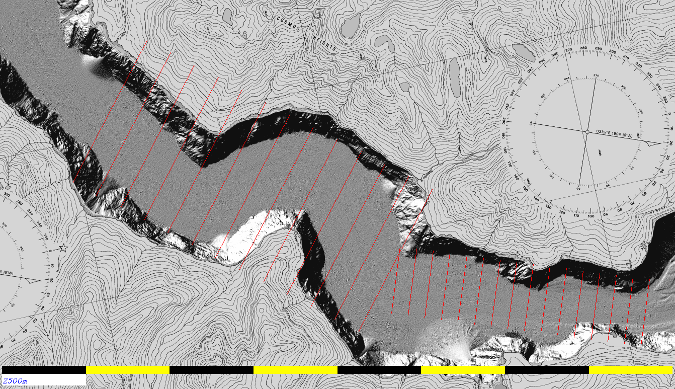
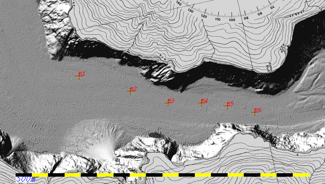
Downstream of the Orford River Fan.

The image shows the 2008 coverage (as it is the most extensive). As can be seen the channel system dies out about 3 miles north of the Orford River fan).

The only channel that is active since 2008 is the eastern channel (bottom in this rotated projection). The channels to the west, which were interpreted as active in the 1980's based on the Prior et al. sidescan surveys, appear to be no longer utilized.
2008 topo
Change over 6 freshets 2008-2014:

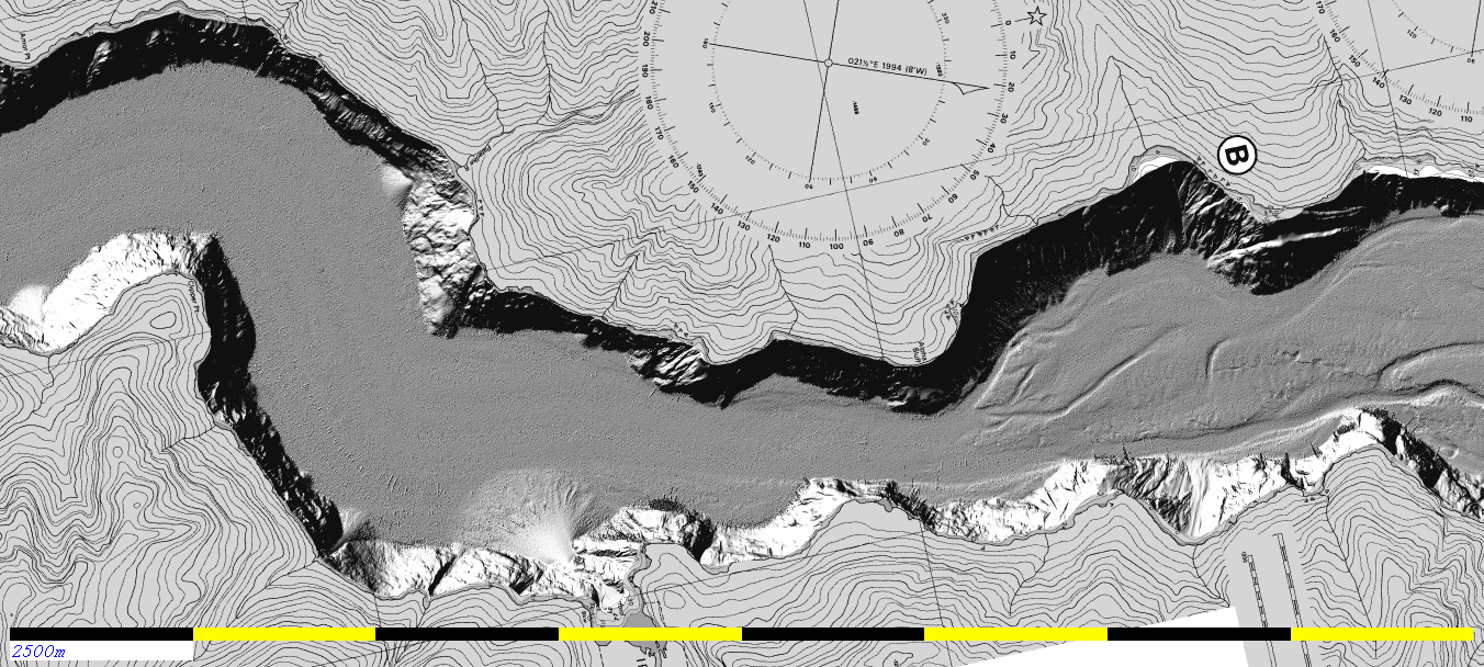
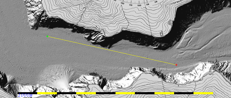
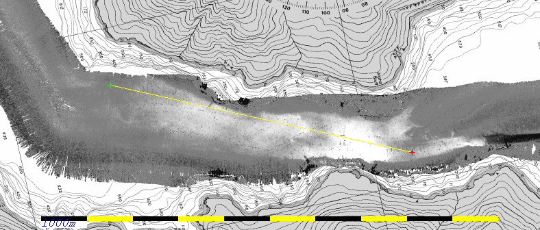
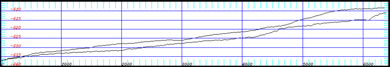
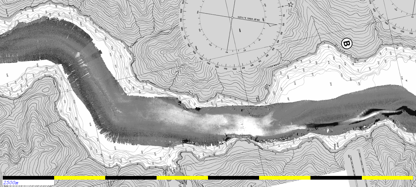
Greyscale for this and plots below is from <= -4m (erosion, black) to >= +4m (deposition, white).

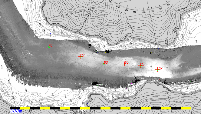
As can be seen, downstream of the last defined channel, the deposition has covered the fjord floor nearly uniformly from wall to wall.
The deposition however is not a uniformly thinning drape as one moves down the fjord. There are clear thickening and thinning patches.

Also note that the fill appears to slightly back up the abandoned channel system to the west (top in this rotated figure). This could be evidence of overbank flow moving there, or deposition from the channelized flow that spread extremely rapidly once it lost the channel wall constraints.

Note there are some artefacts on the southernmost (left edge in this rotated view) difference map. When operating in Very Deep Mode, single swath is used and the outermost sectors have differing frequencies. The port outermost sector is the lowest frequency and appears to penetrate at least an extra ~ 30cm deeper into the soft sediment of the fjord floor than the Deep Mode outer sectors (which, as dual, alternate between frequencies).
changes 2014-2008
Change over the first three freshets: 2008-2010

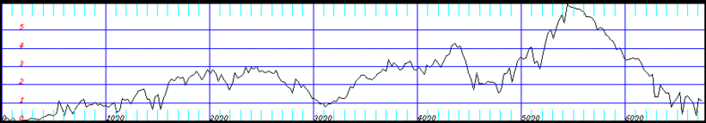
As can be seen, during the first three freshets, while clear changes on the channelized section are apparent, almost no discernible difference is apparent on the proximal lobe just downstream of the last channel relief.

This suggests that no significant flows exited the channel mouth over those three active years. This would imply that there is significant year-to-year variability in the flows that make it all the way to the lobe.
diff1 2010-2008
Change over the second three freshets: 2010-2014

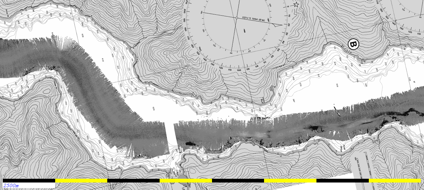
As can be seen, unlike the previous three year epoch,  in this case there is clearly deposition beyond the channel mouth. The discernible extent of that deposition is restricted to the width of the 2010 transit swath.
But the accretion pattern appears to be almost identical to that seen from the 6 freshet difference, suggesting that almost all the lobe accretion has occurred in the last three years.
2014-2010 diff1

Potential Coring Targets for Vector Operations in late June.

The intriguing question then is, now that we know the time constraint on the lobate deposit, can we discern the type and number of events that have occurred?.

The suggested coring strategy would be to put in ~ 6 piston cores located down fjord from the most proximal depocentre (just downstream of the last channel relief) each progressively more distal.

Does this accretion reflect 1, or more events?. How does that (do those) event(s) vary from proximal to distal?.

transect sun
showing the 2008 morphology along the extracted difference transect.
transect diff
2014-2008 difference map (black <= -4m, white >= +4m)
showing location of extracted section.
profile transect difference
extracted cross-section of difference between 2008 and 2014.
profile depth sections
extracted depth profiles from 2008 and 2014
along (almost) the same section.


As can be seen from the extracted profile, a peak of +6m of accretion has occurred. Downstream the thickness of the net accretion declines, but there are notable undulations. By looking at the depth profile along that section from 2008, it is apparent that the downstream variations in thickness, in part, reflect undulations in the lower surface.  The upper 2014 surface, however, shows similar wavelength undulations too, illustrating that subsequent flows do not just smooth the underlying relief..

Potential Multibeam Mapping and Coring:

As the Vector will be equipped with the EM710 0.5x1.0 system and the 3.5 kHz subbottom, should there be the opportunity, there are two requested survey projects:

Better defining the current lobe surface and shallow subsurface:

At these depths, the seafloor is so close to flat, that small sector boundary steps and slight refraction issues can bias the bathymetry. Beyond the main lobe identified, there is a suggestion that a much thinner, more distal lobe finger runs out down the axis of the fjord. Its definition, however  is limited by the fact that all the survey lines are run along the axis of the fjord thus any biases follow the fjord axis. I would really like to see a series of very closely spaced lines collected transverse to the fjord axis to minimize the bathymetric biases and derived 3.5 kHz cross sections across the lobe.

The following figures shows a series of transverse sections I would like to propose.

sections diff
800m spacing sections on the more distal, potential lobe. 500m spacing sections on the proximal lobe.

sections sun
same lines plotted over the bathymetric surface.

The section coordinates are listed here:
Note that these coordinates define parallel lines, the exact start and finish of the line should be defined by the edge of the channel floor, not the line ends.

The lines should be collected with the EM710 in the following modes:
vessel speed - slow (~ 6 knots).
Data need only be collected when the ponded fjord floor is being mapped. The vessel should try to get steady on line before the floor is crossed to avoid excessive yaw stabilization.

Core Site Locations on Lobe:
I would suggest ~ 6 piston core sites on the lobe running radially out from the channel mouth spaced according to the down-flow variations in the apparent lobe thickness.


core sites
core sites over the difference map
core sun
core sites over the terrain.

The hope is that core sites B1, B3 and B5 might penetrate the recent deposition. Sites B2, B4 and B6 are into the thicker deposits and most likely won't fully penetrate the deposit.

The specific core locations are listed in this file:

Seeing if there is any knickpoint progression  from 14th to 26th June:

The second survey agenda is merely to run up the length of the channel using a narrow restricted swath to best identify the in-channel knickpoint features.
The details of that proposed survey is described here.


page generated by JEHC, , June  2014