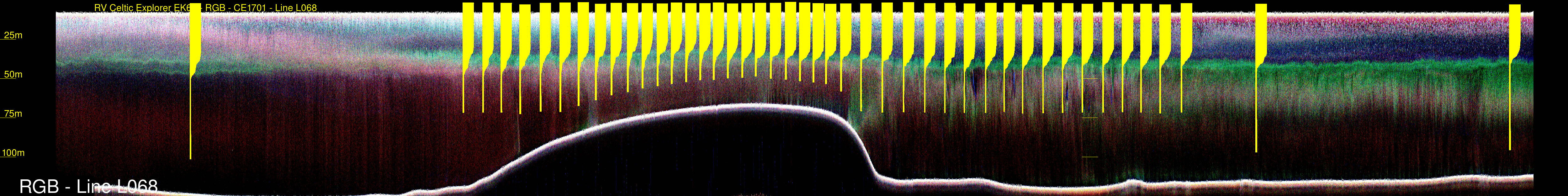
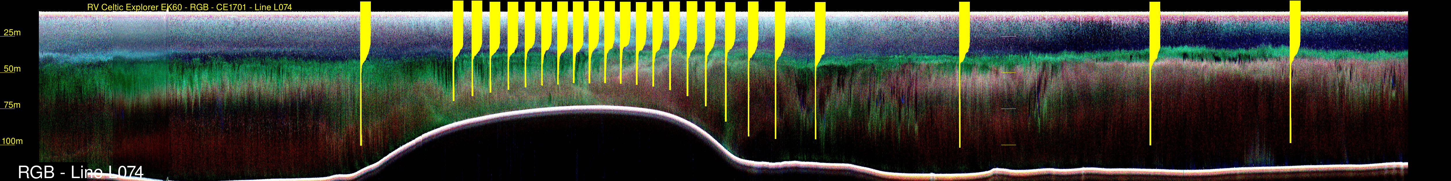
direct comparison - EK60 multi-frequency scattering section v. continuous MVP profiling
| back to: Report Index |
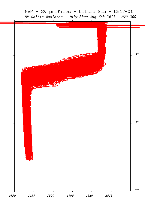
MVP
Sound Speed Data RV Celtic Explorer Cruise CE17-01 Chief Scientist: Kevin Sheehan, MI July 22nd to August 6th 2017 |
John E. Hughes Clarke Anand Hiroji Jose Cordero Ros Center for Coastal and Ocean Mapping University of New Hampshire |
 |
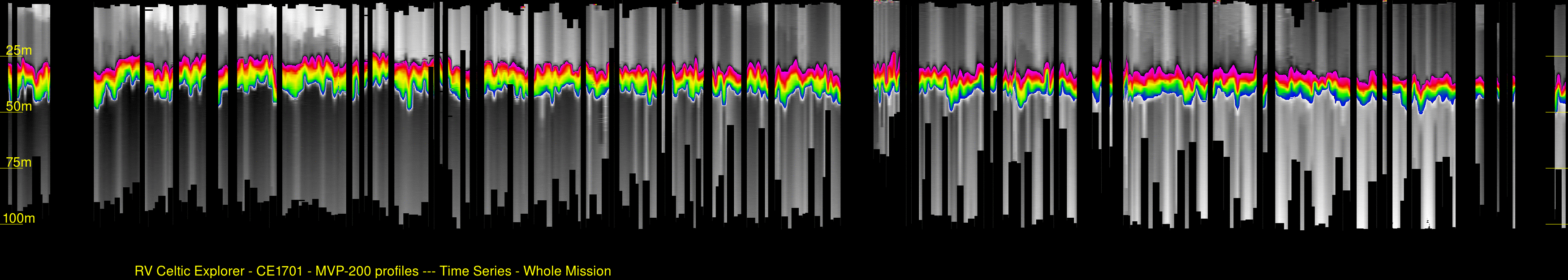 Time Series of SV structure The thermocline is represented by the colour range (1494.75 to 1511 m/s) greyscales above and below represent very different local ranges (lower: 1491.8 to 1494.75 m/s --- upper: 1511 to 1513.7 m/s) |
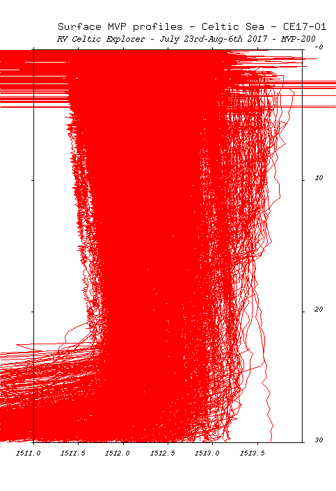 |
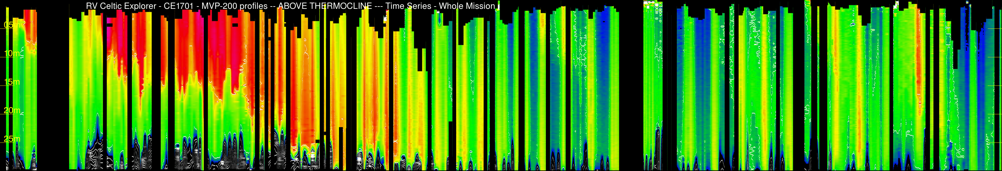 Time Series of upper layer thermal structure The colour range goes from : 1512 to 1514 m/s contours at 1 m/s intervals |
| This plot emphasized the
variability in the average temperature, and amount of weak
stratification in the surface mixed layer. As mentioned
above, the initial calm period promoted the development of a
shallow secondary thermocline. This was destroyed by the
first gale. To place the MVP variability in
context, the plots below illustrate the day-night
cyclicity seen in the EK60 tri-frequency imaging over the
identical time period.
|
|
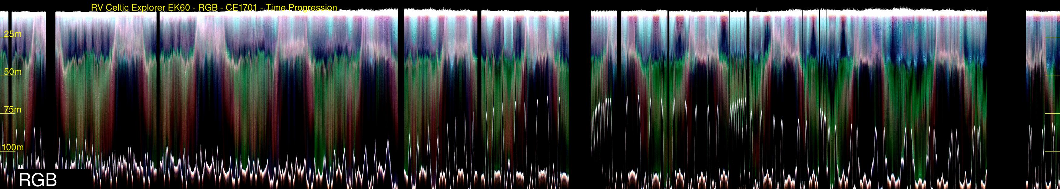 EK60 - RGB image of the same time period |
|