Navigation
Track
|
Vessel
- Sonar - Ancillary Instrumentation
|
|
CSL
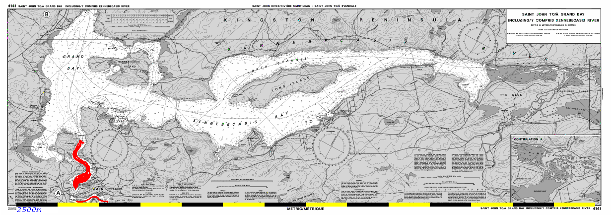
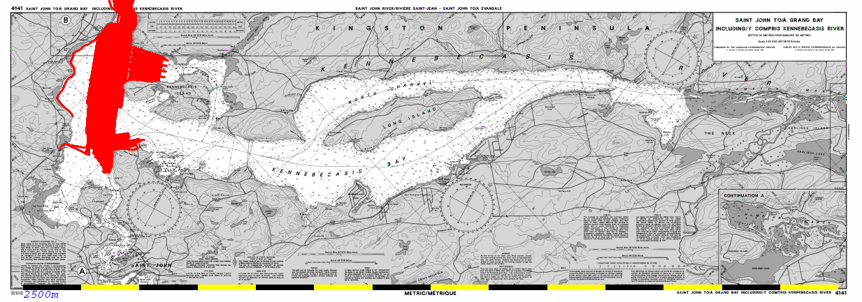
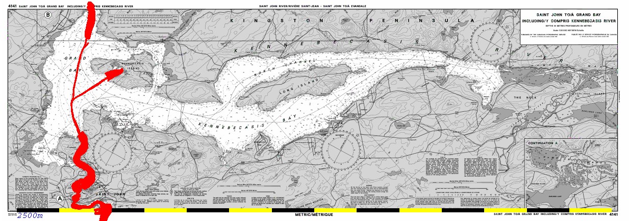
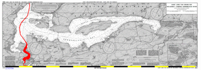
Plover June 1996: As part of a transit down the Saint John
River in 1996, the CSL Plover, with an EM3000 paused aboved the
Reversing Falls, waiting for the slack water period.
- Sonar : EM3000
- Positioning : DGPS - Coastguard Corrections
- Motion : POS/MV 310
- Sound Speed Data - unlikely to have measured one.
- Vertical Datum : Environment Canada Indiantown
Gauge..
|
 |
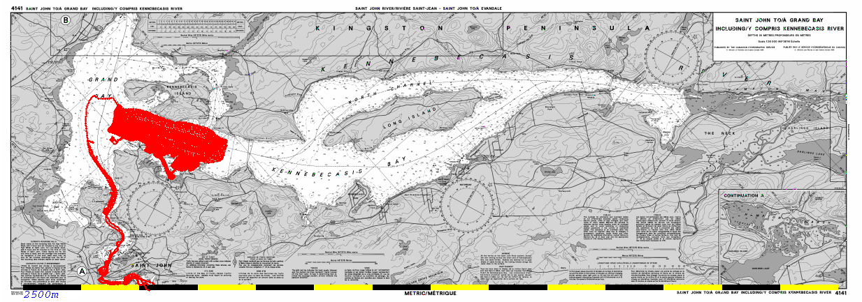
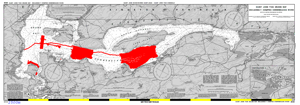
CSL
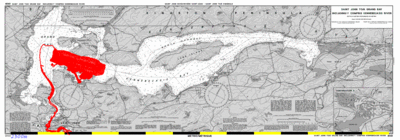
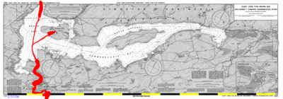
Plover May 2000: As
part of Hydrocamp 2000, about a week of EM3000 data was acquired of the
western Kennebecasis, based out of the RKYC.
- Sonar : EM3000
- Positioning : DGPS - a mix of Coastguard Corrections and
UNBSJ rooftop base station
- Motion : POS/MV 310
- Sound Speed Data - twice daily SVP's.
- Vertical Datum : local gauge installed at RKYC (unreliable)
and - Indiantown Gauge..
|
 |
CSL
Heron April 2002: As part of the first trials of the CSL Heron
in April 2002, the
- Sonar : EM3000
- Positioning : DGPS - Coastguard Corrections
- Motion : Seatex Seapath 200 (?) - with MRU6 backup
- Sound Speed Data - twice daily SVP's.
- Vertical Datum : Environment Canada Indiantown Gauge.
|
 |
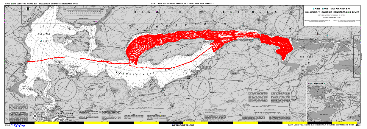
CSL
Heron Nov. 2002: At the end of the season, two days were used
to expand the coverage of the Kennebecasis.
- Sonar : EM3000
- Positioning : DGPS - Coastguard Corrections? or Racal
Landstar
- Motion : MRU6 with speed aiding
- Sound Speed Data - twice daily SVP's.
- Vertical Datum : Manual tidestaff readings at Saint
John Marina and Environment Canada Indiantown Gauge.
|
 |
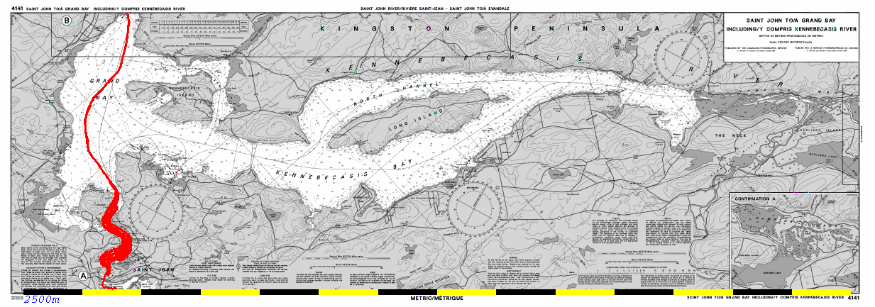
CSL
Heron May 2003: Hydrocamp 2003 took place in Grand Bay and the
Westfield Channel, based out of the Saint John Marina.
- Sonar : EM3000
- Positioning : DGPS - Coastguard Corrections (or
Racal Landstar?)
- Motion : MRU6 with speed aiding
- Sound Speed Data - twice daily SVP's.
- Vertical Datum : Automated tidegauge at Saint John
Marina and Environment Canada Indiantown Gauge.
|
 |
CSL
Heron Sept. 2004: At the end of the field season, the Heron was
used for GGE3353 undergraduate training and undertook an extra 2 days
of mapping in the Kennebecasis.
- Sonar : EM3000
- Positioning : DGPS - Coastguard Corrections or
CNav?
- Motion : Coda Octopus F180 with backup of MRU6 with speed
aidingAll_Kenn.Combo.sun_315
- Sound Speed Data - twice daily SVP's.
- Vertical Datum : Environment Canada Indiantown Gauge.
|
 |
CSL
Heron May-June 2005: In May, inital tests prior to Hydrocamp
2005 off Deer Island were undertaken (with a bad motino sensor). After
the camp the vessel returned prior to deployment to Quebec City (where
she was subsequently sunk).
- Sonar : EM3000
- Positioning : CNav
- Motion : May - MRU6 only (no speed aiding , June Coda
Octopus F180
- Sound Speed Data - twice daily SVP's.
- Vertical Datum : Environment Canada Indiantown Gauge.
|
 |
CSL
Heron Nov. 2008: As part of a break in the oceanographic tidal
cycle program in Saint John harbour, the Heron was used to resurvey
the entire gorge upstream of the Reversing Falls.
- Sonar : EM3002
- Positioning : CNav
- Motion : M Coda Octopus F185
- Sound Speed Data - multiple SVP's.
- Vertical Datum : Environment Canada Indiantown Gauge.
|
 |
CSL
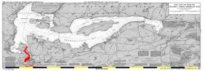
Plover Oct. 2009: While waiting out a storm , the Plover, based
off the CCGS Mattherw, came above the falls at UNB request to resurvey
the erosional flutes in the Westfield channel.
- Sonar : EM3002
- Positioning : Fugro OmniStar
- Motion : POS/NV 320 v.4
- Sound Speed Data - twice daily SVP's.
- Vertical Datum : Environment Canada Indiantown Gauge.
|
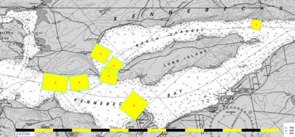
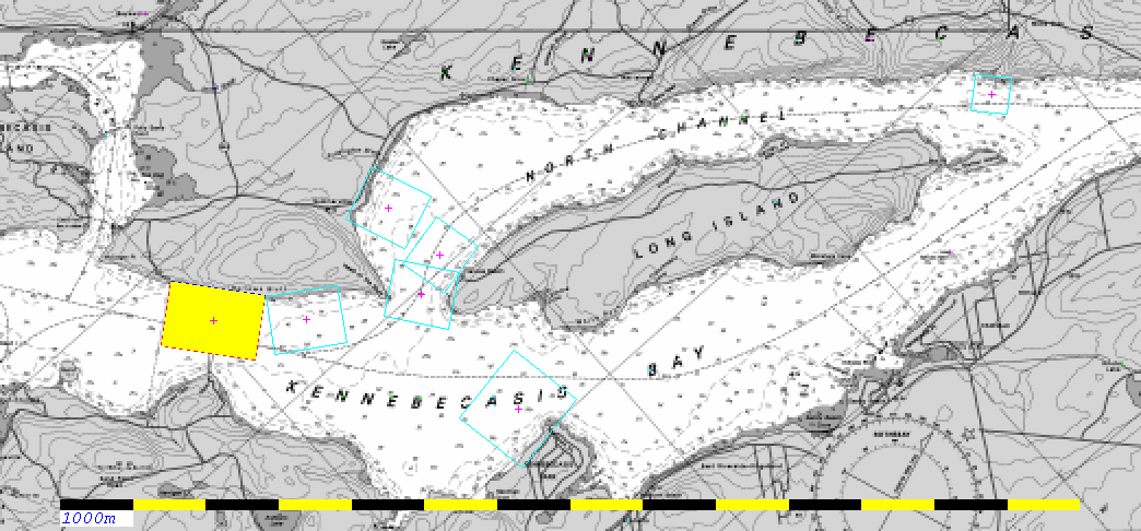
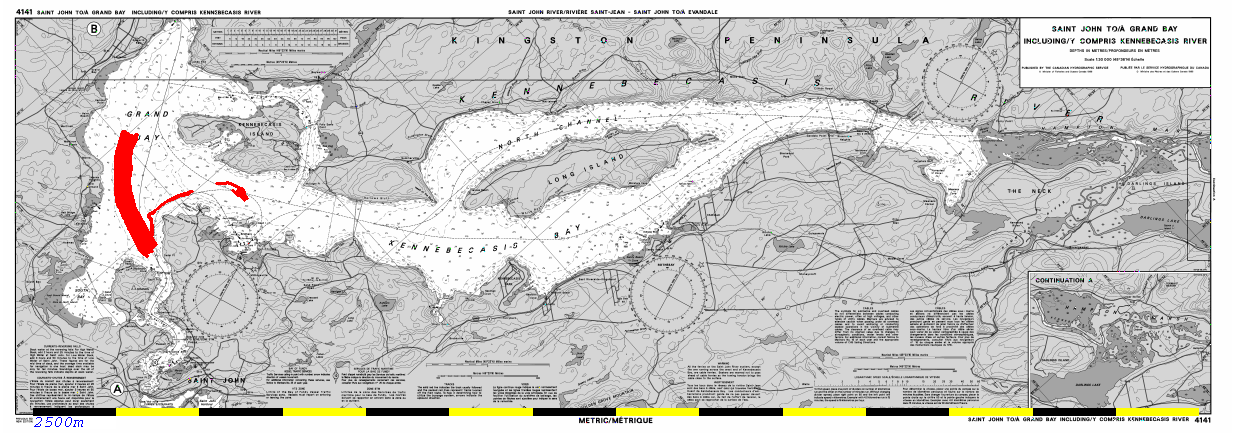
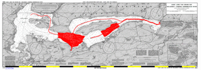
 You
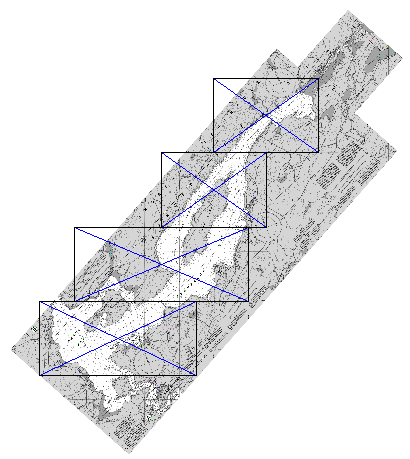
need to design a series of mapsheets to cover the whole fjord.
Something like the image here:
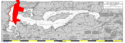
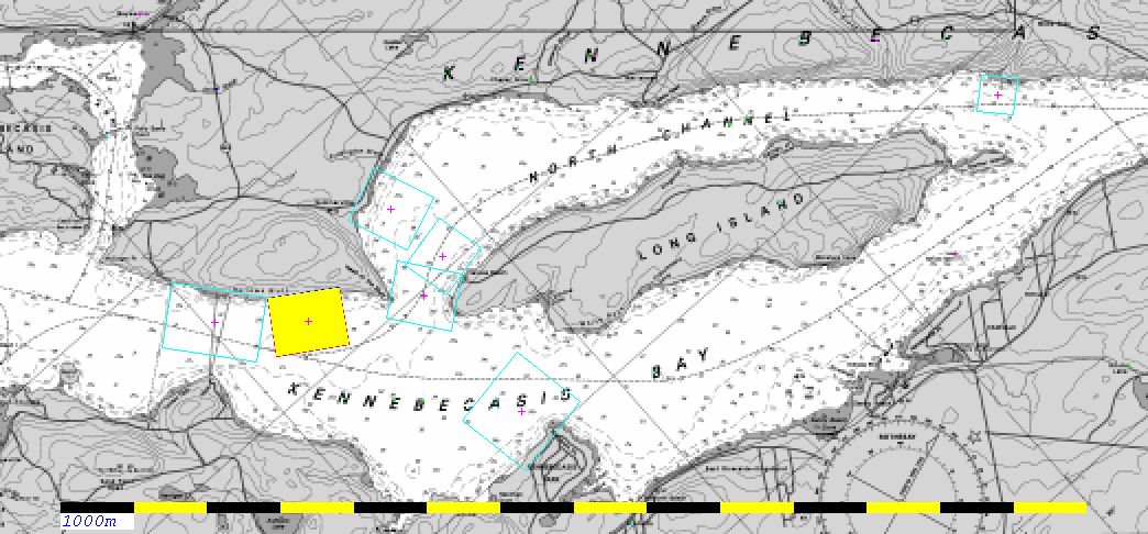
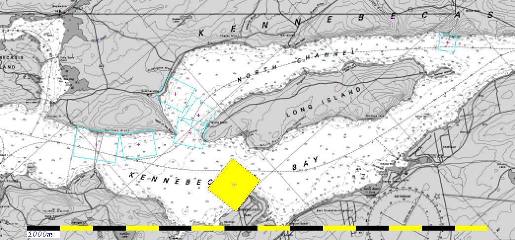
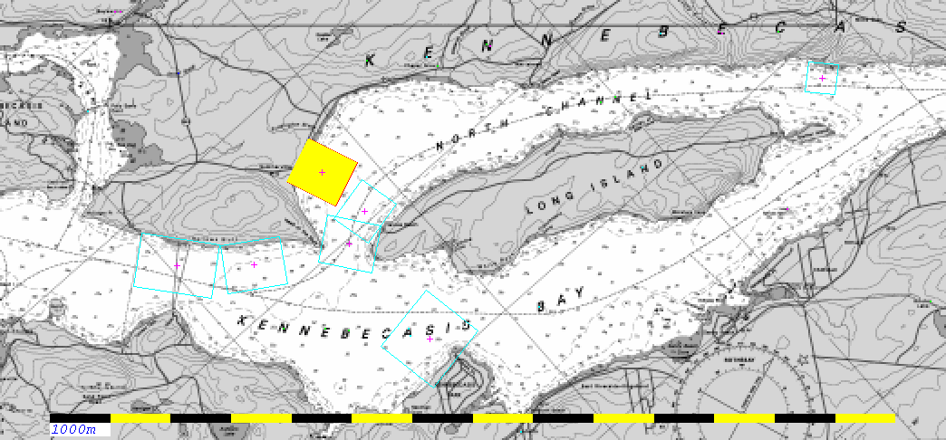
You
need to design a series of mapsheets to cover the whole fjord.
Something like the image here: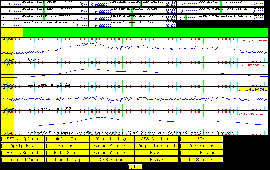 You
can then see the effect in swathed. Look at the list window and you
will see that the "Hv. (lpf)" field is non zero. You can plot this out
in the Time Series window (figure to left - derived by pressing the
"Heave" button and adjusting the vertical scale of each plot using the
up and down arrow keys).
You
can then see the effect in swathed. Look at the list window and you
will see that the "Hv. (lpf)" field is non zero. You can plot this out
in the Time Series window (figure to left - derived by pressing the
"Heave" button and adjusting the vertical scale of each plot using the
up and down arrow keys).