John E. Hughes Clarke
and John Winistok
Ocean Mapping Group, Dept.
Geodesy and Geomatics Engineering
University of New Brunswick, CANADA
506-453-4568 (phone), 506-453-4943 (fax), jhc@omg.unb.ca
Overview
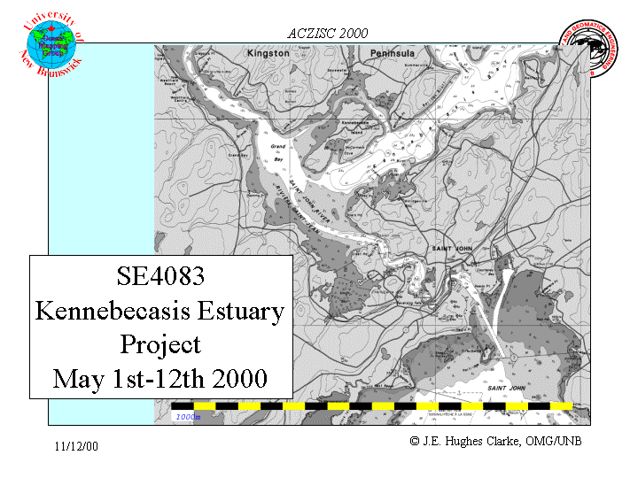
Over the summer and autumn of 2000, an oceanographic investigation
of the exchange of fresh and salt water was conducted over the sill that
separates the Kennebecasis fjord-estuary from the St. John River outflow
and the tidal influx of salt water through the Reversing Falls. Four components
of the survey were conducted:
Area of Interest
|
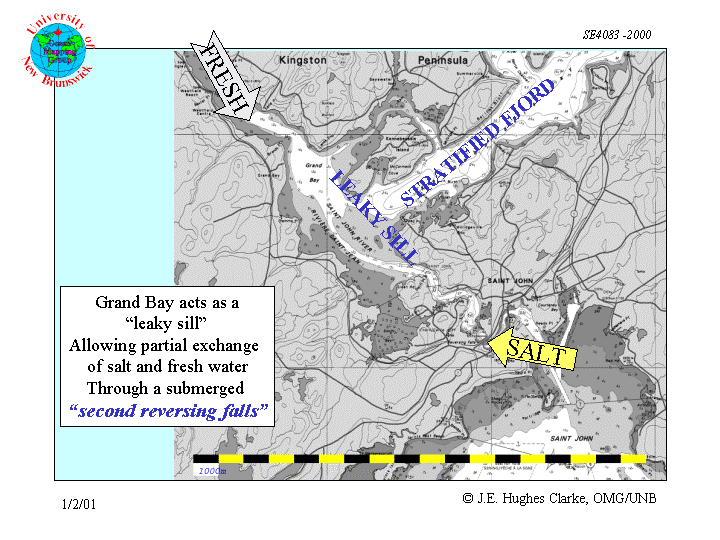
The area of interest is the sill that separates Grand Bay from the Kennebecasis Basin. The aim of the surveys were to investigate the exchange and mixing of salt and fresh water over that sill. | |
Oceanographic Framework of the Lower St. John River and the Kennebecasis Estuary
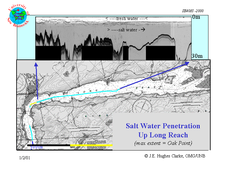 |
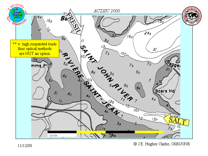
Salt water penetration up the St. John River extends to Oak Point.
At this location, the river shoalohn River extends to Oak Point.
At this location, the river shoals to less than 10m for several miles and
thus there is no further opportunity for the salt wedge to penetrate. The
St. John river drains central New Brunswick and Northern Maine with an
average discharge of ~35,000 c.f.s. with significantly higher peaks discharges
(240,000 c.f.s) during the spring freshet. The fresh water outflow
forms a stable 5-10m layer over the top of the salt water wedge.
The fresh water flow through the Kennebecasis, in contrast is minimal (the discharge of the Hampton River is a tiny fraction of the St. John). Nevertheless a similar stable 5-10m layer of fresh water overlies a salt plug that fills the remainder of the basin (with a maximum depth of 62m, although mean depths are ~30-40m). |
Previous work...
The survey of the Reversing Falls
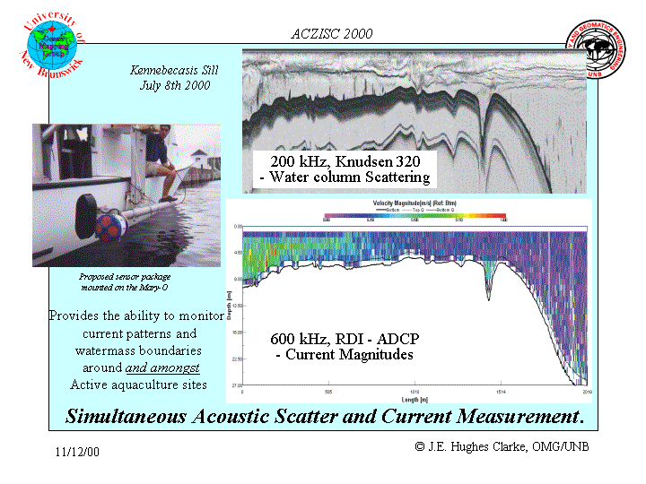
Instrumentation
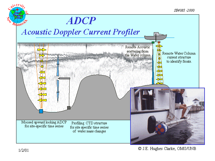 |
much more details on the ADCP surveys, including animation.... |
 |
 |
In order to ground truth and quantify the acoustic imagery, repetitive temperature and salinity profiles were taken using an autonomous, bottom mounted profiler. |
Bathymetric Surface Creation
To better establish the physical constraints imposed by the sill topography
in this area, a new bathymetric survey was done, combining multibeam data
collected in a survey from May 2000
with single beam data collected in June. A by-product of both these surveys
was the mapping of the surficial backscatter strength in the area. The
backscatter data can be used as an indicator of surficial sediment type.
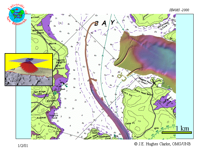
EM3000 multibeam bathymetry |
KEL 320BP single beam bathymetry |
combined and interpolated bathymetric surface |
EM3000 300 kHz backscatter image |
KEL 200 kHz sidescan backscatter |
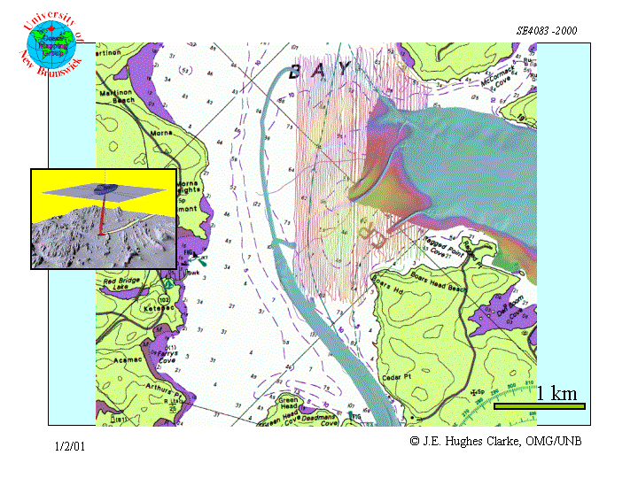
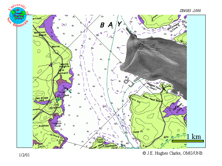
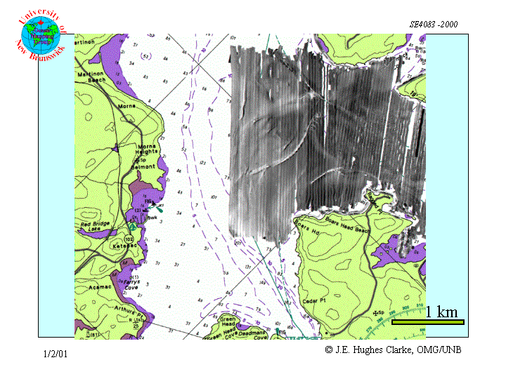
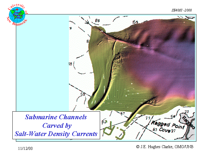
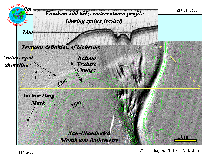
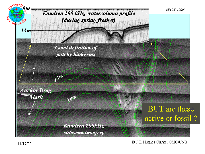
Sill-top bathymetric and sidescan survey results
Two major erosional channels were discovered in the May multibeam survey.
The June surveys was able to extrapolate the extent of these channels and
establish that there were several, previously unreported, erosional corridors
across the top of the sill. Because the sill top depth is close to the
average level of the halocline in the area, these channels represent sites
of enhanced exchange of the lower salt water layer.
 |
 |
 |
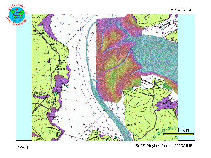
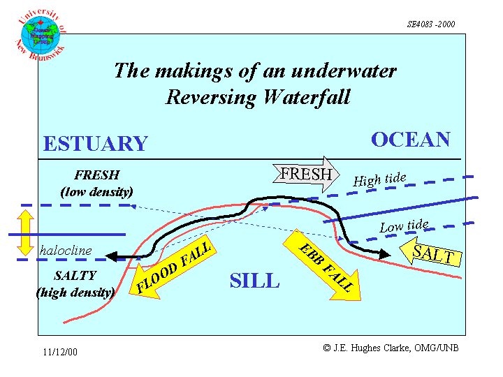
Initial Conclusions
As notes in previous literature (New 1960, Trites, 1060) the sill acts
to constrain the exchange of salt water between Grand Bay and the Kennebecasis.
New results indicate that this exchange is actually focussed within shallow
channels within which flow-intensification and enhanced turbulence have
been imaged. A second "Reversing Falls" takes place twice a day (under
periods of low river discharge) at the interface between the salt and fresh
water.
 |
 |
References
Neu, H.A.es
Neu, H.A., 1960, Hydrographic survey of Saint John harbour, NB.: National Research Council of Canada, Mechanical Engineering Report MH-97.
Trites,R.W., 1960, An oceanographical and biological reconnaissance of Kennebecasis Bay and the Saint John River Estuary: Journal of Fisheries Research Board of Canda, v.17, p.377-408.
still under construction....